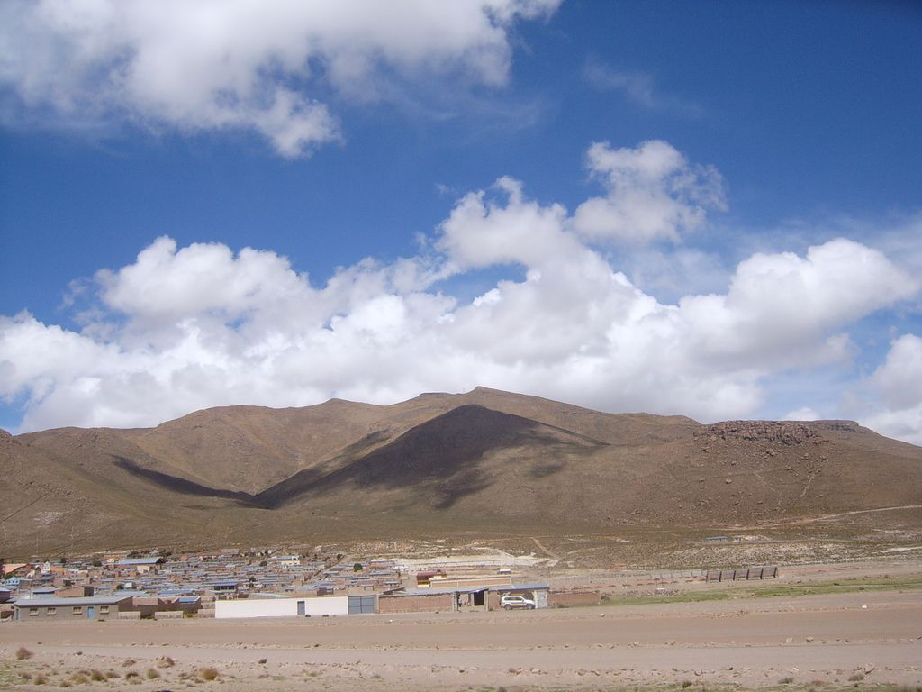
Pacha Qullu (Aymara pacha world; time, qullu mountain, Hispanicized spellings Pacha Kkollu, Pacha Kollu, also Pacha Kkollu Quimsa Misa) or Kimsa Misa (Aymara kimsa three, misa offering also spelled Quimsa Misa) is a 4,702-metre-high (15,427 ft) mountain in the Andes of Bolivia. It is located in the Oruro Department, Litoral Province, Huachacalla Municipality, west of Huachacalla (Wachaqalla). Pacha Qullu lies northwest of Inka Qhamachu. The plain at 18°42′44.86″S 68°34′25.21″W northwest of Pacha Qullu is named Kimsa Misa Pampa (Quimsa Misa Pampa).
The mountain is a volcano. While the date of the last eruption is not known, the degree of erosion suggests an age of about 8.3 million years. Originally the mountain was about 89 metres (292 ft) higher and had a volume of 37.4 cubic kilometres (9.0 cu mi). Pacha Qullu is a Pliocene age volcano. Its slopes range 11–16°, formed by lava flows and pyroclastic material. Erosion has carved radial gullies into its flanks, at whose ends alluvial fans have formed. The volcano has suffered a sector collapse, resulting in the formation of a 2.4 kilometres (1.5 mi) wide and 4.7-kilometre-long (2.9 mi) breach.
Temperatures in the closely located city of Oruro range 4–12 °C (39–54 °F), and precipitation is 400–100 millimetres (15.7–3.9 in). The area is very windy. This climate has led to a xerophytic vegetation, including shrubs and tussock grass.
We use GPS information embedded into the photo when it is available.
3D mountains overlay
Adjust mountain panorama to perfectly match your photos because recorded by camera photo position might be imprecise.
Move tool
Rotate tool
Zoom
More customization
Choose which peak labels should make into the final photo and what photo title should be.
Next
Photo Location
Satellitte
Flat map
Relief map
Latitude
Longitude
Altitude
OR
Latitude
°'''
Longitude
°'''
Apply
Register Peak
Peak Name
Latitude
Longitude
Altitude
Register
Teleport
PeakVisor
This 3D model of Sagarmatha National Park in Nepal was made using the PeakVisor app topographic data. The mobile app features higher precision models worldwide, more topographic details, and works offline. Download PeakVisor maps today.
Download OBJ model
PeakVisor
The download should start shortly. If you find it useful please consider supporting the PeakVisor app.
PeakVisor for iOS and Android
Be a superhero of outdoor navigation with state-of-the-art 3D maps and mountain identification in the palm of your hand!