Available for connected Garmin and Suunto accounts.
Scan the QR code and open PeakVisor on your phone
Nusha Hill map
Nusha Hill
S
Add photo
5 m
Elevation
Elevation is the altitude of a place above sea level.
Proportional Prominence0
About
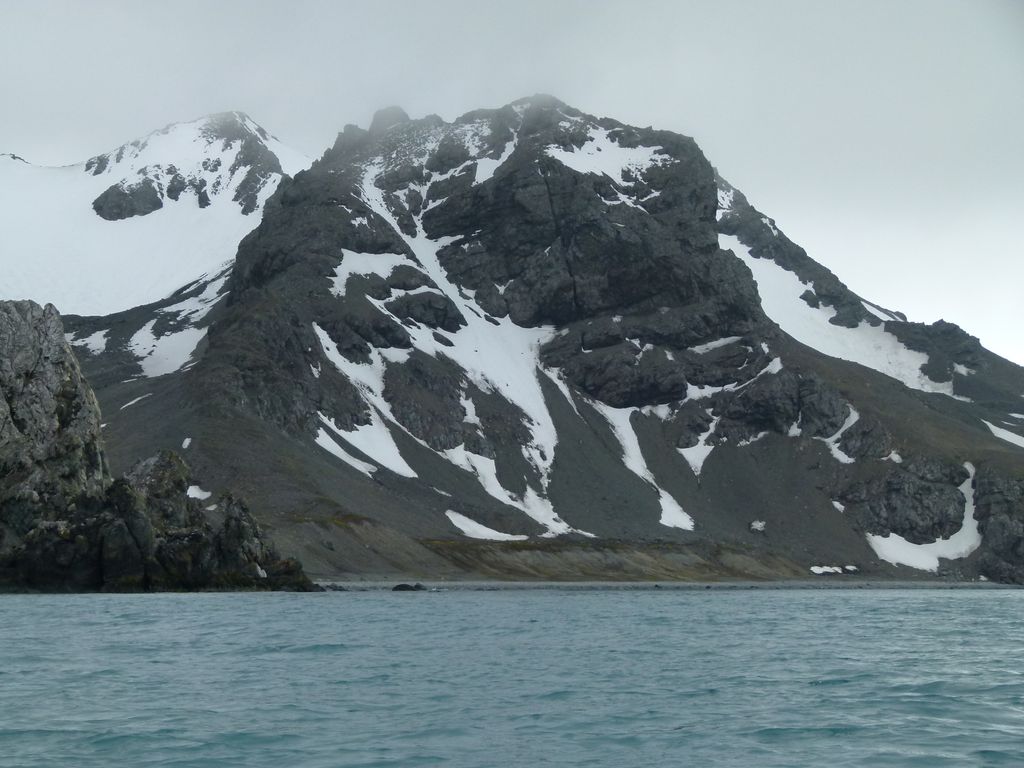
Nusha Hill (Bulgarian: Нушин хълм, ‘Nushin Halm’ \'nu-shin 'h&lm\) is the rocky hill rising to 251 m in southern Hurd Peninsula on Livingston Island in the South Shetland Islands, Antarctica. It has precipitous east, south and west slopes, and is linked to Doc Peak (301 m) to the north by a col of elevation 220 m. Nusha Hill surmounts a rock glacier to the west and southwest, False Bay to the east and its sub-embayment Glaciar Rocoso Cove to the south-southwest. The adjacent area, subject to geological and glaciological field work, is accessible by sea or by an overland route running from Hurd Ice Cap along the South Bay coast facing Sally Rocks and via a saddle of elevation 122 m situated 800 m west by south of the hill.
The feature is named after Nusha Ivanova (b. 1986), participant in the 2002/03 and subsequent Bulgarian Antarctic campaigns (the first Bulgarian high school student involved).
We use GPS information embedded into the photo when it is available.
3D mountains overlay
Adjust mountain panorama to perfectly match your photos because recorded by camera photo position might be imprecise.
Move tool
Rotate tool
Zoom
More customization
Choose which peak labels should make into the final photo and what photo title should be.
Next
Photo Location
Satellitte
Flat map
Relief map
Latitude
Longitude
Altitude
OR
Latitude
°'''
Longitude
°'''
Apply
Register Peak
Peak Name
Latitude
Longitude
Altitude
Register
Teleport
PeakVisor
This 3D model of Sagarmatha National Park in Nepal was made using the PeakVisor app topographic data. The mobile app features higher precision models worldwide, more topographic details, and works offline. Download PeakVisor maps today.
Download OBJ model
PeakVisor
The download should start shortly. If you find it useful please consider supporting the PeakVisor app.
PeakVisor for iOS and Android
Be a superhero of outdoor navigation with state-of-the-art 3D maps and mountain identification in the palm of your hand!