Available for connected Garmin and Suunto accounts.
Scan the QR code and open PeakVisor on your phone
Хесперидес map
Хесперидес
L
Add photo
62 m
Elevation
Elevation is the altitude of a place above sea level.
About
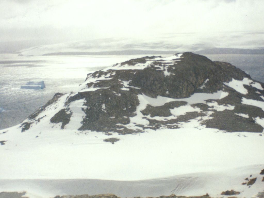
Hesperides Hill (Halm Hesperides \'h&lm he-spe-'ri-des\) is a ridge linked by a saddle of elevation 52 m with the northern slopes of Atlantic Club Ridge on Hurd Peninsula, eastern Livingston Island in the South Shetland Islands, Antarctica. The hill surmounts the South Bay coast north of Johnsons Dock to the southwest, and Bulgarian Beach to the northeast and is bounded to the southwest by Sea Lion Glacier. The ridge extends 420 m in south-southeast to north-northwest direction and is 250 m wide and narrowing towards north-northwest. Hesperides Hill has two heights, 94 and 63 m, the latter surmounting Hespérides Point. The hill is snow-free in summer months and is named from the adjacent Hespérides Point.
Show more
Sun and Moon
Mon
Tue
Wed
Thu
Fri
Sat
Sun
May 2022
Date and time
00:00
06:00
12:00
18:00
Today
--
--
Sunrise
--
Sunset
--
Moonrise
--
Moonset
Phase
🌔 Waxing Gibbous
The perfect light time for beautiful photos:
--
Sunrise
--
Sunset
PeakVisor app
Get the app on your smartphone
New Panorama Tools
Trace location on the map
Measure distances
All the instruments are available in the context menu as well.
We use GPS information embedded into the photo when it is available.
3D mountains overlay
Adjust mountain panorama to perfectly match your photos because recorded by camera photo position might be imprecise.
Move tool
Rotate tool
Zoom
More customization
Choose which peak labels should make into the final photo and what photo title should be.
Next
Photo Location
Satellitte
Flat map
Relief map
Latitude
Longitude
Altitude
OR
Latitude
°'''
Longitude
°'''
Apply
Register Peak
Peak Name
Latitude
Longitude
Altitude
Register
Teleport
PeakVisor
This 3D model of Sagarmatha National Park in Nepal was made using the PeakVisor app topographic data. The mobile app features higher precision models worldwide, more topographic details, and works offline. Download PeakVisor maps today.
Download OBJ model
PeakVisor
The download should start shortly. If you find it useful please consider supporting the PeakVisor app.
PeakVisor for iOS and Android
Be a superhero of outdoor navigation with state-of-the-art 3D maps and mountain identification in the palm of your hand!