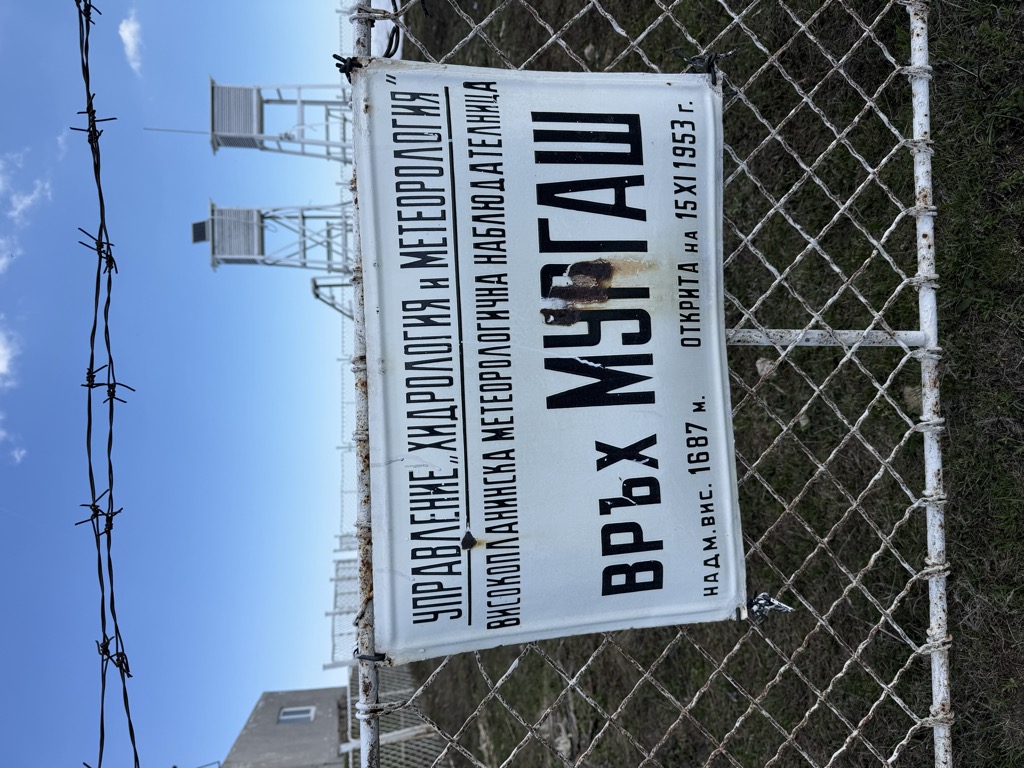
Murgash is a peak in Bulgaria, in the Balkan Mountains mountain range. The peak is located in the East part of Murgash massive, with an altitude of 1,687 m (5,535 ft) above sea level.
The peak consists of Paleozoic sediment and has a dome-shaped structure with steep slopes. Out of the summit of the peak stream two rivers – Baltuiska reka and Eleshnica river. The peak is an object of both international and national tourism. The Murgash touristic hut is located southwest of the peak with an altitude of 1490 meters.
The Eleshnishki monastery is located near the west foot of the Murgash peak.
In 1953, on Murgash peak a meteorological station was built and is still active.
There's a trail leading to the summit.
The nearest mountain hut is H. Murgash located 1 751m/5 745ft SW of the summit.
By elevation Murgash is
# 98 out of 536 in Sofia # 28 out of 87 in Sofia-City
By prominence Murgash is
# 2 out of 536 in Sofia # 2 out of 87 in Sofia-City # 14 out of 4517 in Bulgaria # 9 out of 3579 in the Bulgarian Ranges
We use GPS information embedded into the photo when it is available.
3D mountains overlay
Adjust mountain panorama to perfectly match your photos because recorded by camera photo position might be imprecise.
Move tool
Rotate tool
Zoom
More customization
Choose which peak labels should make into the final photo and what photo title should be.
Next
Photo Location
Satellitte
Flat map
Relief map
Latitude
Longitude
Altitude
OR
Latitude
°'''
Longitude
°'''
Apply
Register Peak
Peak Name
Latitude
Longitude
Altitude
Register
Teleport
PeakVisor
This 3D model of Sagarmatha National Park in Nepal was made using the PeakVisor app topographic data. The mobile app features higher precision models worldwide, more topographic details, and works offline. Download PeakVisor maps today.
Download OBJ model
PeakVisor
The download should start shortly. If you find it useful please consider supporting the PeakVisor app.
PeakVisor for iOS and Android
Be a superhero of outdoor navigation with state-of-the-art 3D maps and mountain identification in the palm of your hand!