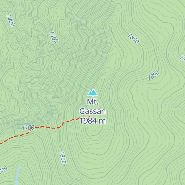
Mount Gassan (月山, Gassan) is the highest of the Three Mountains of Dewa and a stratovolcano in the ancient province of Dewa (modern-day Yamagata prefecture). The Gassan Shrine stands at the mountain's summit, 1,984 metres (6,509 ft) above sea level.
It has a long hike from its trailhead and usually requires about 4-5 hours to hike it. Visitors should be aware of the weather and not try to hike it during windy or days with heavy rain. Also note that the trail is not paved and in some parts requires use of hands to clear certain parts of the trail.
Due to heavy winter snowfall, the mountain and shrine are inaccessible for long periods of the year; however, skiing is possible on the mountain from April to mid-summer.
The mountain is interesting in that it contains elements of both shield volcanoes as well as stratovolcanoes, although it is classified as a stratovolcano.
There's a trail leading to the summit.
The nearest mountain hut is Gassan Chojo Goya located 147m/481ft S of the summit.
By elevation Mt. Gassan is
# 11 out of 233 in Yamagata Prefecture # 1 out of 6 in Higashitagawa # 1 out of 40 in Nishimurayama
By prominence Mt. Gassan is
# 23 out of 10903 in the Japanese Mountains # 2 out of 233 in Yamagata Prefecture # 23 out of 11291 in Japan # 1 out of 6 in Higashitagawa # 1 out of 40 in Nishimurayama
We use GPS information embedded into the photo when it is available.
3D mountains overlay
Adjust mountain panorama to perfectly match your photos because recorded by camera photo position might be imprecise.
Move tool
Rotate tool
Zoom
More customization
Choose which peak labels should make into the final photo and what photo title should be.
Next
Photo Location
Satellitte
Flat map
Relief map
Latitude
Longitude
Altitude
OR
Latitude
°'''
Longitude
°'''
Apply
Register Peak
Peak Name
Latitude
Longitude
Altitude
Register
Teleport
PeakVisor
This 3D model of Sagarmatha National Park in Nepal was made using the PeakVisor app topographic data. The mobile app features higher precision models worldwide, more topographic details, and works offline. Download PeakVisor maps today.
Download OBJ model
PeakVisor
The download should start shortly. If you find it useful please consider supporting the PeakVisor app.
PeakVisor for iOS and Android
Be a superhero of outdoor navigation with state-of-the-art 3D maps and mountain identification in the palm of your hand!


.jpg)