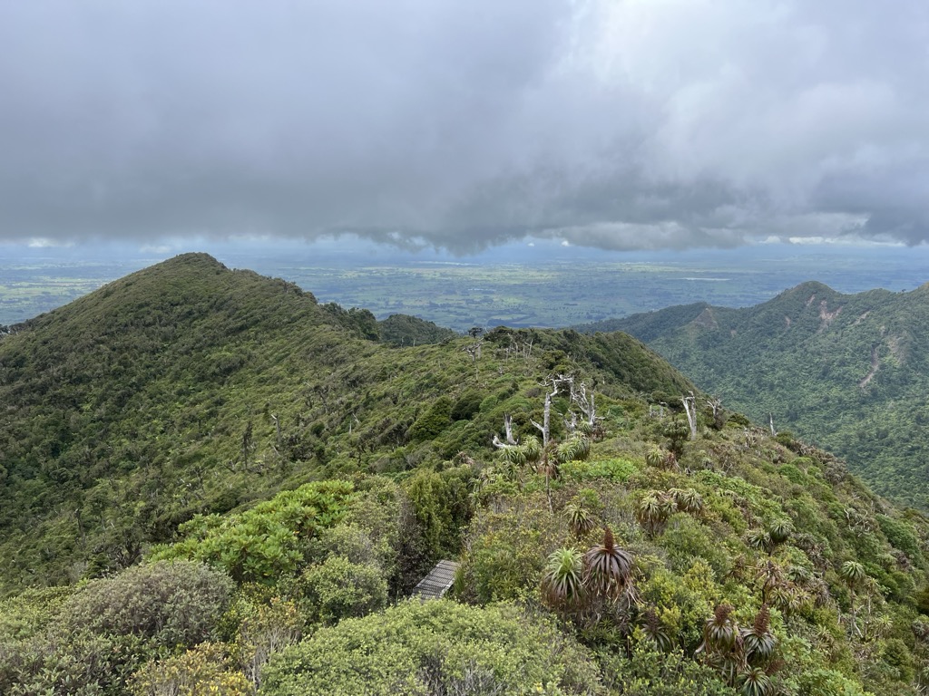
Mount Pirongia is an extinct stratovolcano located in the Waikato region of New Zealand's North Island. It rises to 959 m (3,146 ft) and is the highest peak around the Waikato plains. Pirongia's many peaks are basaltic cones created by successive volcanic eruptions between the late Pliocene and early Pleistocene, about 2.5 million years ago. In the adjacent picture, the characteristic profile of the mountain can be seen, along with a prominent accessory cone to the right (on the northern flank).
There's a trail leading to the summit. Pirongia is one of the 28 peaks along the multi-day Te Araroa - North Island / Te Ika-a-Māui.
The nearest mountain hut is Pahautea Hut located 500m/1 639ft W of the summit.
By elevation Pirongia is
# 1 out of 13 in Mount Pirongia Forest Park # 54 out of 723 in Waikato # 2 out of 62 in Otorohanga District
By prominence Pirongia is
# 1 out of 13 in Mount Pirongia Forest Park # 2 out of 723 in Waikato # 1 out of 62 in Otorohanga District # 5 out of 2137 in the Kaweka Range
We use GPS information embedded into the photo when it is available.
3D mountains overlay
Adjust mountain panorama to perfectly match your photos because recorded by camera photo position might be imprecise.
Move tool
Rotate tool
Zoom
More customization
Choose which peak labels should make into the final photo and what photo title should be.
Next
Photo Location
Satellitte
Flat map
Relief map
Latitude
Longitude
Altitude
OR
Latitude
°'''
Longitude
°'''
Apply
Register Peak
Peak Name
Latitude
Longitude
Altitude
Register
Teleport
PeakVisor
This 3D model of Sagarmatha National Park in Nepal was made using the PeakVisor app topographic data. The mobile app features higher precision models worldwide, more topographic details, and works offline. Download PeakVisor maps today.
Download OBJ model
PeakVisor
The download should start shortly. If you find it useful please consider supporting the PeakVisor app.
PeakVisor for iOS and Android
Be a superhero of outdoor navigation with state-of-the-art 3D maps and mountain identification in the palm of your hand!