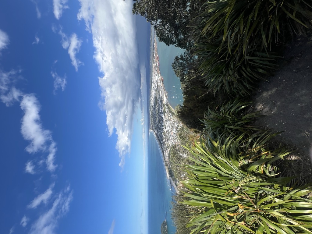
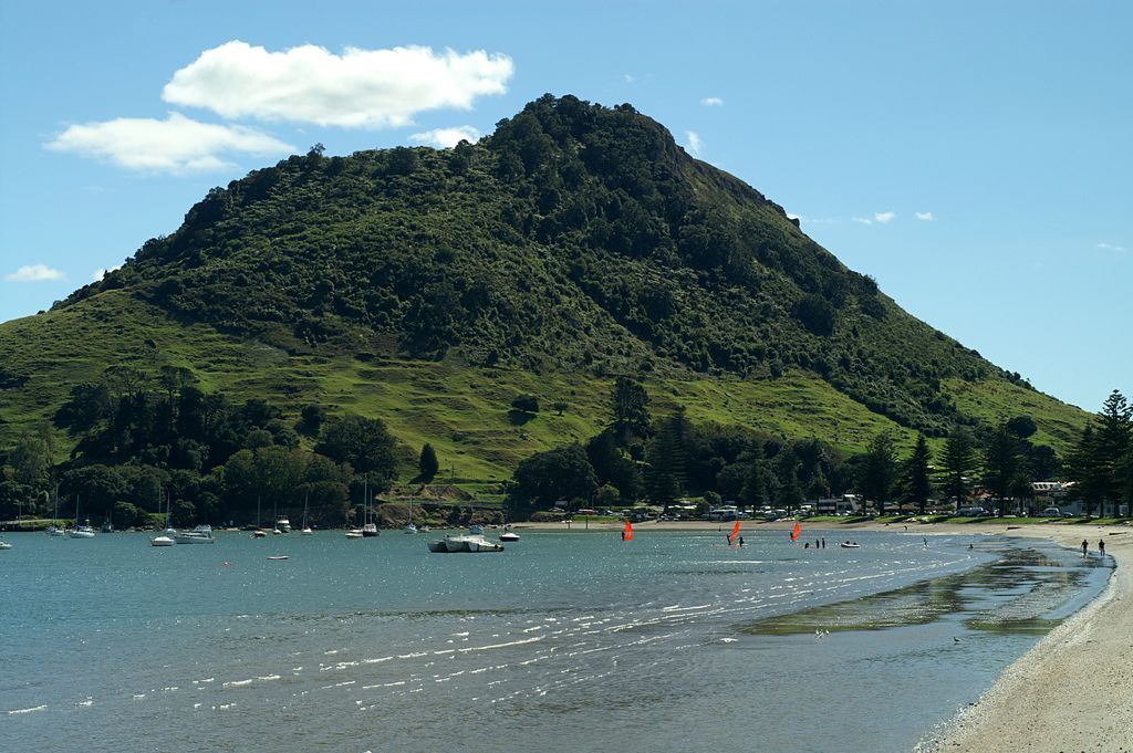
Mount Maunganui, or Mauao, known to locals as The Mount, is a 232 metre (760 foot) volcanic dome at the end of a peninsula in the Tauranga suburb of Mount Maunganui in New Zealand, beside the eastern entrance to the city's harbour.
Local Māori consider Mauao to be tapu (sacred), and it plays an important role in their mythology. They own the mountain and manage it jointly with Tauranga City Council.
Mauao is open to the public and is popular for scenic walks, jogging, parasailing and hang gliding. In recent years, fires and storm damage have required replanting and track repairs.
There's a trail leading to the summit.
By elevation Mount Maunganui is
# 1 out of 1 in Mauao # 1 out of 5 in Tauranga City
By prominence Mount Maunganui is
# 1 out of 1 in Mauao # 68 out of 473 in Bay of Plenty # 1 out of 5 in Tauranga City
We use GPS information embedded into the photo when it is available.
3D mountains overlay
Adjust mountain panorama to perfectly match your photos because recorded by camera photo position might be imprecise.
Move tool
Rotate tool
Zoom
More customization
Choose which peak labels should make into the final photo and what photo title should be.
Next
Photo Location
Satellitte
Flat map
Relief map
Latitude
Longitude
Altitude
OR
Latitude
°'''
Longitude
°'''
Apply
Register Peak
Peak Name
Latitude
Longitude
Altitude
Register
Teleport
PeakVisor
This 3D model of Sagarmatha National Park in Nepal was made using the PeakVisor app topographic data. The mobile app features higher precision models worldwide, more topographic details, and works offline. Download PeakVisor maps today.
Download OBJ model
PeakVisor
The download should start shortly. If you find it useful please consider supporting the PeakVisor app.
PeakVisor for iOS and Android
Be a superhero of outdoor navigation with state-of-the-art 3D maps and mountain identification in the palm of your hand!


.jpg)
.jpg)


