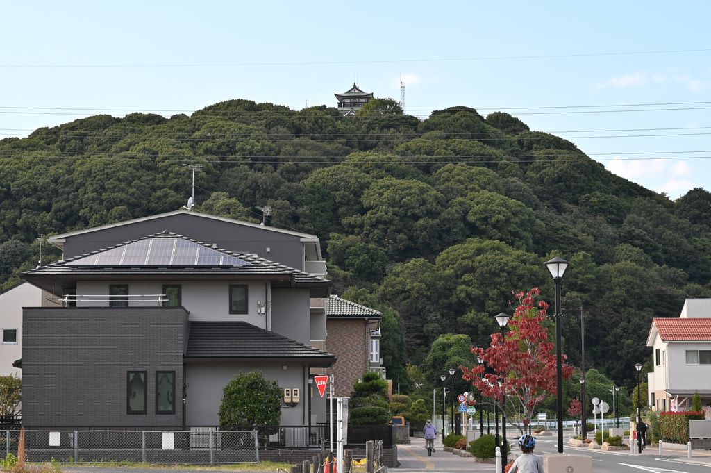
Mount Komaki (小牧山, Komakiyama) is an 86 m-high (282 ft) mountain located in the city of Komaki, Aichi Prefecture, Japan. At one point, the mountain was topped with the original Komakiyama Castle, built by Oda Nobunaga. Its base stretches for nearly 600 m (1,969 ft) from east to west, and 400 m (1,312 ft) from north to south, covering an area of approximately 21 ha (52 acres). The mountain is now a historical park, containing various castle ruins, including water wells and stone walls, in addition to artifacts dating further back. Though known for the sakura trees, the northern part of the mountain is home to many Machilus thunbergii trees. This is the only spot in the surrounding area where these trees occur naturally. The reproduction of Komakiyama Castle was built in 1967 and houses the Komaki City Historical Museum.
We use GPS information embedded into the photo when it is available.
3D mountains overlay
Adjust mountain panorama to perfectly match your photos because recorded by camera photo position might be imprecise.
Move tool
Rotate tool
Zoom
More customization
Choose which peak labels should make into the final photo and what photo title should be.
Next
Photo Location
Satellitte
Flat map
Relief map
Latitude
Longitude
Altitude
OR
Latitude
°'''
Longitude
°'''
Apply
Register Peak
Peak Name
Latitude
Longitude
Altitude
Register
Teleport
PeakVisor
This 3D model of Sagarmatha National Park in Nepal was made using the PeakVisor app topographic data. The mobile app features higher precision models worldwide, more topographic details, and works offline. Download PeakVisor maps today.
Download OBJ model
PeakVisor
The download should start shortly. If you find it useful please consider supporting the PeakVisor app.
PeakVisor for iOS and Android
Be a superhero of outdoor navigation with state-of-the-art 3D maps and mountain identification in the palm of your hand!