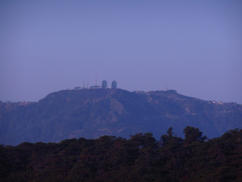
Mount Cabuyao (alternatively spelled as Mount Kabuyao) is a mountain in the Philippines located in the municipality of Tuba in the province of Benguet. Its summit, rising to more than 2,000 metres (6,600 ft) above sea level, overlooks the city of Baguio. It is commonly mistaken as Mount Santo Tomas, a taller mountain just beside it.
Due to its high elevation, several communications companies constructed relay stations and radars at the summit. A private observatory and AA radar station, once operated by the US Armed Forces stationed in the country, is also located here. A water catchment area was constructed to supply water to the City of Baguio and nearby towns. A small community of farmers live at the top of the mountain. A town hall and a school was built for them by the local government.
We use GPS information embedded into the photo when it is available.
3D mountains overlay
Adjust mountain panorama to perfectly match your photos because recorded by camera photo position might be imprecise.
Move tool
Rotate tool
Zoom
More customization
Choose which peak labels should make into the final photo and what photo title should be.
Next
Photo Location
Satellitte
Flat map
Relief map
Latitude
Longitude
Altitude
OR
Latitude
°'''
Longitude
°'''
Apply
Register Peak
Peak Name
Latitude
Longitude
Altitude
Register
Teleport
PeakVisor
This 3D model of Sagarmatha National Park in Nepal was made using the PeakVisor app topographic data. The mobile app features higher precision models worldwide, more topographic details, and works offline. Download PeakVisor maps today.
Download OBJ model
PeakVisor
The download should start shortly. If you find it useful please consider supporting the PeakVisor app.
PeakVisor for iOS and Android
Be a superhero of outdoor navigation with state-of-the-art 3D maps and mountain identification in the palm of your hand!