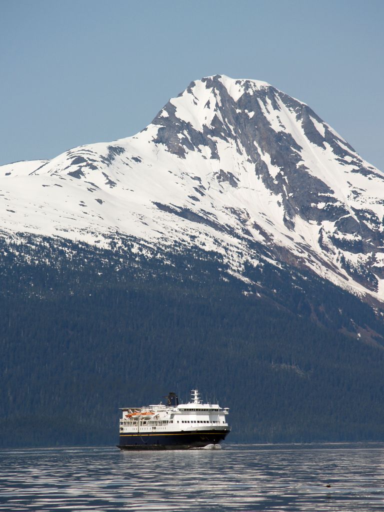
Mount Golub is a prominent 4,194 ft (1,280 m) mountain summit located in the Chilkat Range of the Saint Elias Mountains, in the U.S. state of Alaska. This peak is situated 29 miles (47 km) northwest of Juneau, and 2 mi (3 km) west of Lynn Canal, on land managed by Tongass National Forest. Although modest in elevation, relief is significant since Mount Golub rises above tidewater in less than two miles. The mountain's name was officially adopted in 1972 by the U.S. Board on Geographic Names to commemorate Harvey Golub (1930–1971), member of the 1968 first ascent party. Other members of the party were Richard Folta, Delbert Carnes, and Keith Hart. Hart submitted the name for consideration following the September 4, 1971, untimely death of Harvey Golub who perished in the Alaska Airlines Flight 1866 disaster. That flight, which took all 111 lives aboard, crashed in a canyon approximately seven miles south of his namesake mountain.
We use GPS information embedded into the photo when it is available.
3D mountains overlay
Adjust mountain panorama to perfectly match your photos because recorded by camera photo position might be imprecise.
Move tool
Rotate tool
Zoom
More customization
Choose which peak labels should make into the final photo and what photo title should be.
Next
Photo Location
Satellitte
Flat map
Relief map
Latitude
Longitude
Altitude
OR
Latitude
°'''
Longitude
°'''
Apply
Register Peak
Peak Name
Latitude
Longitude
Altitude
Register
Teleport
PeakVisor
This 3D model of Sagarmatha National Park in Nepal was made using the PeakVisor app topographic data. The mobile app features higher precision models worldwide, more topographic details, and works offline. Download PeakVisor maps today.
Download OBJ model
PeakVisor
The download should start shortly. If you find it useful please consider supporting the PeakVisor app.
PeakVisor for iOS and Android
Be a superhero of outdoor navigation with state-of-the-art 3D maps and mountain identification in the palm of your hand!