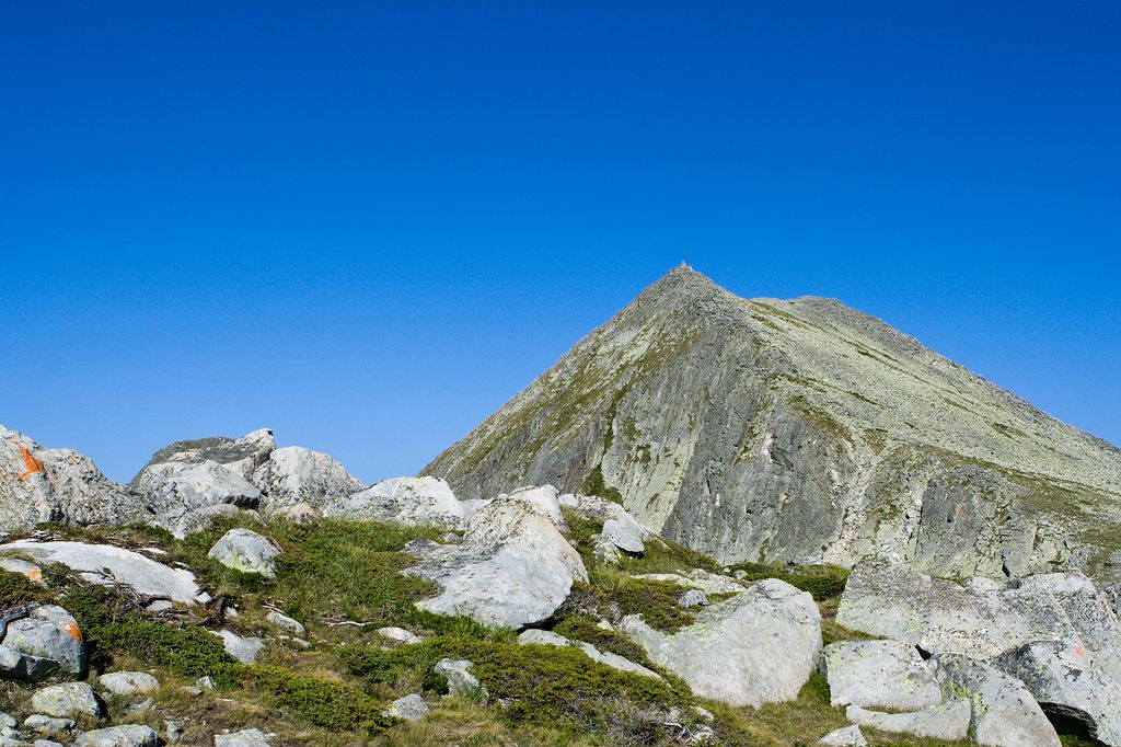
Momin Dvor (Bulgarian: Момин двор [ˈmɔmin dvɔr]) is a 2,723 m high peak in the Pirin mountain range, south-western Bulgaria. It is located in the northern part of Pirin on its main ridge between the summits of Kralev Dvor (2,680 m) and Dzhengal (2,730 m). Momin Dvor is pyramid-shaped and was formed by glacial erosion from the three neighbouring cirques: Valyavishki, Popovski and Belemeto. It is built up of porphyry granite.
Three short ridges connect Momin Dvor with the neighbouring peaks. The western ridge links it with Valyavishki Chukar (2,664 m) and at the same time separates the cirques Valyavishki and Belemeto; the ridge is part of a hiking trail leading from Tevno Ezero shelter to Dzhengal Peak. Another ridge stems in south-eastern direction towards Kralev Dvor and forms part of the main trail between Tevno Ezero shelter and Bezbog refuge. To the north-east a more difficultly accessible ridge links Momin Dvor and Dzhengal, situated on the neighbouring Polezhan secondary ridge.
Its name means Maiden's courtyard in Bulgarian and was given to the peak because of the snow on its northern slopes that holds until late summer and appears as clean maiden's laundry hung out in her courtyard. According to local legends god Perun had a younger sister who lived near Samodivski Lakes and used to hang out her laundry on the terraces of Momin Dvor.
There's a trail leading to the summit.
The nearest mountain hut is Tevno Ezero Shelter located 731m/2 398ft WSW of the summit.
By elevation Momini Dvori is
# 24 out of 93 in Pirin National Park # 28 out of 451 in Blagoevgrad # 39 out of 4517 in Bulgaria # 39 out of 3579 in the Bulgarian Ranges
By prominence Momini Dvori is
# 17 out of 93 in Pirin National Park # 67 out of 451 in Blagoevgrad
We use GPS information embedded into the photo when it is available.
3D mountains overlay
Adjust mountain panorama to perfectly match your photos because recorded by camera photo position might be imprecise.
Move tool
Rotate tool
Zoom
More customization
Choose which peak labels should make into the final photo and what photo title should be.
Next
Photo Location
Satellitte
Flat map
Relief map
Latitude
Longitude
Altitude
OR
Latitude
°'''
Longitude
°'''
Apply
Register Peak
Peak Name
Latitude
Longitude
Altitude
Register
Teleport
PeakVisor
This 3D model of Sagarmatha National Park in Nepal was made using the PeakVisor app topographic data. The mobile app features higher precision models worldwide, more topographic details, and works offline. Download PeakVisor maps today.
Download OBJ model
PeakVisor
The download should start shortly. If you find it useful please consider supporting the PeakVisor app.
PeakVisor for iOS and Android
Be a superhero of outdoor navigation with state-of-the-art 3D maps and mountain identification in the palm of your hand!