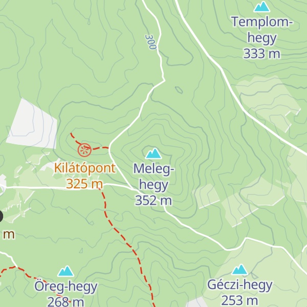
Velence Hills (Hungarian: Velencei-hegység) is a low mountain range in north-western Hungary, in the Central Transdanubian region. It lies to the north of Lake Velence, some 15 km to the east of city of Székesfehérvár. The Velence Hills are part of the Transdanubian Mountains. Village of Nadap lies in the central part of the hills and is the point of departure of excursions to the countryside. The highest point, Meleg-hegy ("Hot hill") (352 m) lies above the village.
There's a trail leading to the summit.
By elevation Meleg-hegy is
# 50 out of 218 in Fejér
By prominence Meleg-hegy is
# 85 out of 5035 in Hungary # 2 out of 218 in Fejér # 36 out of 1901 in Transdanubia
We use GPS information embedded into the photo when it is available.
3D mountains overlay
Adjust mountain panorama to perfectly match your photos because recorded by camera photo position might be imprecise.
Move tool
Rotate tool
Zoom
More customization
Choose which peak labels should make into the final photo and what photo title should be.
Next
Photo Location
Satellitte
Flat map
Relief map
Latitude
Longitude
Altitude
OR
Latitude
°'''
Longitude
°'''
Apply
Register Peak
Peak Name
Latitude
Longitude
Altitude
Register
Teleport
PeakVisor
This 3D model of Sagarmatha National Park in Nepal was made using the PeakVisor app topographic data. The mobile app features higher precision models worldwide, more topographic details, and works offline. Download PeakVisor maps today.
Download OBJ model
PeakVisor
The download should start shortly. If you find it useful please consider supporting the PeakVisor app.
PeakVisor for iOS and Android
Be a superhero of outdoor navigation with state-of-the-art 3D maps and mountain identification in the palm of your hand!