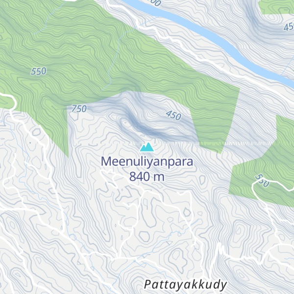
Meenuliyan Para is a prominent mountain peak located near Thodupuzha in the Idukki district of Kerala, India. Characterized by a massive rock formation that rises over 4000 feet, the mountain is named for the fish-scale appearance of its rocky surface. The peak hosts approximately two acres of evergreen forest at its summit.
Situated around 47 kilometers from Muvattupuzha and 51 kilometers from Thodupuzha, Meenuliyan Para is accessible only by a 3 kilometer pedestrian trail starting from Pattayakkudy in Vannappuram Panchayat. Clear weather offers expansive views of the surrounding landscape, including the Periyar region, Bhoothathankettu dam, and parts of Ernakulam and Thrissur districts.
We use GPS information embedded into the photo when it is available.
3D mountains overlay
Adjust mountain panorama to perfectly match your photos because recorded by camera photo position might be imprecise.
Move tool
Rotate tool
Zoom
More customization
Choose which peak labels should make into the final photo and what photo title should be.
Next
Photo Location
Satellitte
Flat map
Relief map
Latitude
Longitude
Altitude
OR
Latitude
°'''
Longitude
°'''
Apply
Register Peak
Peak Name
Latitude
Longitude
Altitude
Register
Teleport
PeakVisor
This 3D model of Sagarmatha National Park in Nepal was made using the PeakVisor app topographic data. The mobile app features higher precision models worldwide, more topographic details, and works offline. Download PeakVisor maps today.
Download OBJ model
PeakVisor
The download should start shortly. If you find it useful please consider supporting the PeakVisor app.
PeakVisor for iOS and Android
Be a superhero of outdoor navigation with state-of-the-art 3D maps and mountain identification in the palm of your hand!