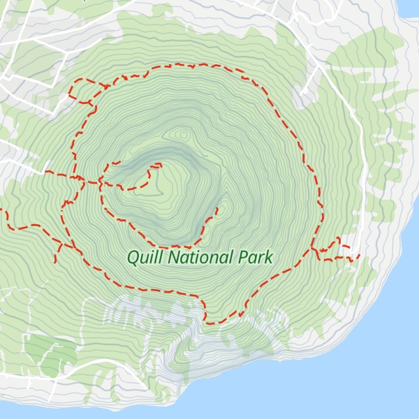
The Quill , also known as Mount Mazinga, is a stratovolcano located on the island of Sint Eustatius in the Caribbean Netherlands. The summit elevation is 601 m (1,972 ft) above sea level. It is also the second highest mountain in the Netherlands.
The name 'Quill' originates from the Dutch term kuil ([ˈkœyl]), meaning 'pit' or 'hole', which was used originally with reference to the volcanic crater. The Quill was designated as a national park by the government of the Netherlands Antilles in 1998. Quill/Boven National Park is administered by the Sint Eustatius National Parks Foundation, STENAPA, which maintains a number of trails for hikers.
The Quill formed between 22,000 and 32,000 years ago to the southeast of Sint Eustatius (Statia) in the West Indies. Pyroclastic flows during the initial eruption joined The Quill with what is now the rest of Sint Eustatius. The last known eruption, as determined by radiocarbon dating, occurred about 1,600 years ago.
By elevation Mazinga is
# 4 out of 90 in Caribbean Netherlands # 4 out of 544 in Netherlands # 2 out of 3 in Quill National Park
By prominence Mazinga is
# 15 out of 90 in Caribbean Netherlands # 58 out of 544 in Netherlands # 2 out of 3 in Quill National Park
We use GPS information embedded into the photo when it is available.
3D mountains overlay
Adjust mountain panorama to perfectly match your photos because recorded by camera photo position might be imprecise.
Move tool
Rotate tool
Zoom
More customization
Choose which peak labels should make into the final photo and what photo title should be.
Next
Photo Location
Satellitte
Flat map
Relief map
Latitude
Longitude
Altitude
OR
Latitude
°'''
Longitude
°'''
Apply
Register Peak
Peak Name
Latitude
Longitude
Altitude
Register
Teleport
PeakVisor
This 3D model of Sagarmatha National Park in Nepal was made using the PeakVisor app topographic data. The mobile app features higher precision models worldwide, more topographic details, and works offline. Download PeakVisor maps today.
Download OBJ model
PeakVisor
The download should start shortly. If you find it useful please consider supporting the PeakVisor app.
PeakVisor for iOS and Android
Be a superhero of outdoor navigation with state-of-the-art 3D maps and mountain identification in the palm of your hand!