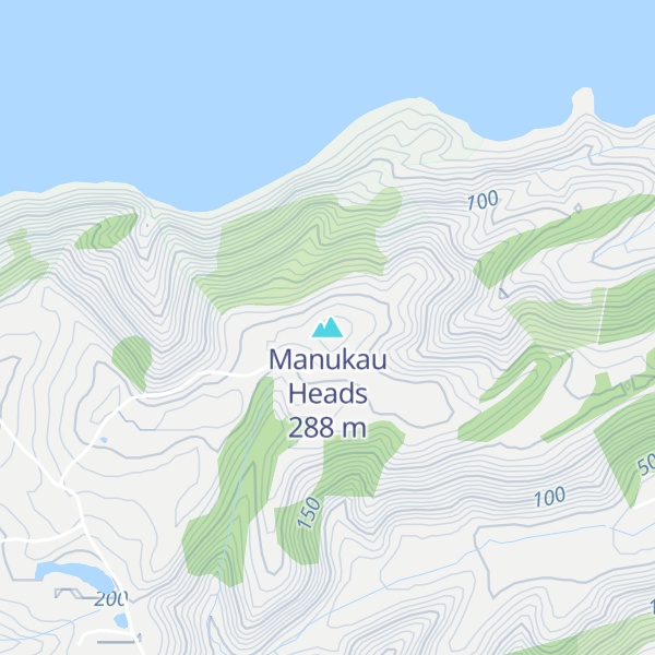
The Manukau Heads is the name given to the two promontories that form the entrance to the Manukau Harbour – one of the two harbours of Auckland in New Zealand. The southern head, at the northern tip of Āwhitu Peninsula, is simply termed "The South Head", whereas the northern head is named "Burnett Head" (the term North Head is used to indicate a promontory in the nearby Waitematā Harbour). Both heads are hilly areas of land that rise steeply from the water to over 240m within less than 400m of the shoreline.
We use GPS information embedded into the photo when it is available.
3D mountains overlay
Adjust mountain panorama to perfectly match your photos because recorded by camera photo position might be imprecise.
Move tool
Rotate tool
Zoom
More customization
Choose which peak labels should make into the final photo and what photo title should be.
Next
Photo Location
Satellitte
Flat map
Relief map
Latitude
Longitude
Altitude
OR
Latitude
°'''
Longitude
°'''
Apply
Register Peak
Peak Name
Latitude
Longitude
Altitude
Register
Teleport
PeakVisor
This 3D model of Sagarmatha National Park in Nepal was made using the PeakVisor app topographic data. The mobile app features higher precision models worldwide, more topographic details, and works offline. Download PeakVisor maps today.
Download OBJ model
PeakVisor
The download should start shortly. If you find it useful please consider supporting the PeakVisor app.
PeakVisor for iOS and Android
Be a superhero of outdoor navigation with state-of-the-art 3D maps and mountain identification in the palm of your hand!