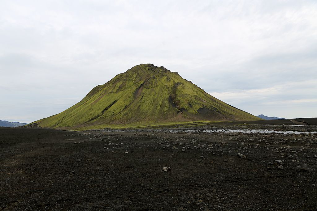
Mælifell (Icelandic pronunciation: [ˈmaiːlɪˌfɛtl̥] ) is a volcano located in Southern Iceland.
Mælifell stands 200 meters above its surroundings and it is a composite cone volcano formed by volcanic eruptions underneath the Myrdalsjökull glacier. Mælifell has surfaced ca 10,000 years ago as glaciers receded after the last ice age.
Apart from walking, Mount Mælifell is reachable only by a 4WD vehicle. It is on the southern Fjallabak road next to the glacier Mýrdalsjökull. The road is usually wet and sometimes completely flooded, making the volcano only accessible from July to the beginning of October.
By elevation Mælifell is
# 57 out of 257 in Katla UNESCO Global Geopark # 56 out of 151 in Rangárþing ytra
By prominence Mælifell is
# 25 out of 257 in Katla UNESCO Global Geopark # 19 out of 151 in Rangárþing ytra
We use GPS information embedded into the photo when it is available.
3D mountains overlay
Adjust mountain panorama to perfectly match your photos because recorded by camera photo position might be imprecise.
Move tool
Rotate tool
Zoom
More customization
Choose which peak labels should make into the final photo and what photo title should be.
Next
Photo Location
Satellitte
Flat map
Relief map
Latitude
Longitude
Altitude
OR
Latitude
°'''
Longitude
°'''
Apply
Register Peak
Peak Name
Latitude
Longitude
Altitude
Register
Teleport
PeakVisor
This 3D model of Sagarmatha National Park in Nepal was made using the PeakVisor app topographic data. The mobile app features higher precision models worldwide, more topographic details, and works offline. Download PeakVisor maps today.
Download OBJ model
PeakVisor
The download should start shortly. If you find it useful please consider supporting the PeakVisor app.
PeakVisor for iOS and Android
Be a superhero of outdoor navigation with state-of-the-art 3D maps and mountain identification in the palm of your hand!