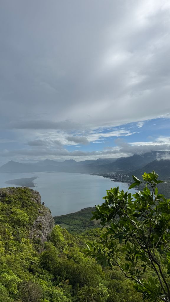
Le Morne Brabant [lə mɔʁn bʁa.bɑ̃] is a peninsula at the extreme southwestern tip of the Indian Ocean island of Mauritius. On it is a basaltic monolith of the same name 556 metres (1,824 ft) high. It's summit covers an area of over 12 hectares (30 acres). There are many caves and overhangs on the steep slopes. It is largely surrounded by a lagoon and is a well known tourist attraction. It is also a refuge for two rare plants, the Mandrinette and the Boucle d'Oreille. The peninsula of Le Morne benefits from a micro-climate. The mountain is named after the Dutch East India Company ship Brabant that ran aground here on 29 December 1783.
UNESCO added Morne Brabant Mountain to the World Heritage List in 2008.
By elevation Le Morne Brabant is
# 14 out of 21 in Black River # 41 out of 143 in Mauritius
By prominence Le Morne Brabant is
# 2 out of 21 in Black River # 2 out of 143 in Mauritius
We use GPS information embedded into the photo when it is available.
3D mountains overlay
Adjust mountain panorama to perfectly match your photos because recorded by camera photo position might be imprecise.
Move tool
Rotate tool
Zoom
More customization
Choose which peak labels should make into the final photo and what photo title should be.
Next
Photo Location
Satellitte
Flat map
Relief map
Latitude
Longitude
Altitude
OR
Latitude
°'''
Longitude
°'''
Apply
Register Peak
Peak Name
Latitude
Longitude
Altitude
Register
Teleport
PeakVisor
This 3D model of Sagarmatha National Park in Nepal was made using the PeakVisor app topographic data. The mobile app features higher precision models worldwide, more topographic details, and works offline. Download PeakVisor maps today.
Download OBJ model
PeakVisor
The download should start shortly. If you find it useful please consider supporting the PeakVisor app.
PeakVisor for iOS and Android
Be a superhero of outdoor navigation with state-of-the-art 3D maps and mountain identification in the palm of your hand!


.jpg)


