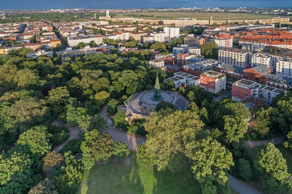
The Kreuzberg is a hill in the Kreuzberg locality of Berlin, Germany, in former West Berlin. It rises about 66 m (217 ft) above the sea level. It was named by King Frederick William III of Prussia after the Iron Cross which crowns the top of the Prussian National Monument for the Liberation Wars, designed by Karl Friedrich Schinkel, on its inauguration on 30 March 1821. On 27 September 1921 the borough assembly of the VIth borough of Berlin decided to name the borough after the hill. The borough was subsequently downgraded to a locality in 2001.
There's a trail leading to the summit.
The nearest mountain hut is Affenhütte located 806m/2 643ft NNW of the summit.
We use GPS information embedded into the photo when it is available.
3D mountains overlay
Adjust mountain panorama to perfectly match your photos because recorded by camera photo position might be imprecise.
Move tool
Rotate tool
Zoom
More customization
Choose which peak labels should make into the final photo and what photo title should be.
Next
Photo Location
Satellitte
Flat map
Relief map
Latitude
Longitude
Altitude
OR
Latitude
°'''
Longitude
°'''
Apply
Register Peak
Peak Name
Latitude
Longitude
Altitude
Register
Teleport
PeakVisor
This 3D model of Sagarmatha National Park in Nepal was made using the PeakVisor app topographic data. The mobile app features higher precision models worldwide, more topographic details, and works offline. Download PeakVisor maps today.
Download OBJ model
PeakVisor
The download should start shortly. If you find it useful please consider supporting the PeakVisor app.
PeakVisor for iOS and Android
Be a superhero of outdoor navigation with state-of-the-art 3D maps and mountain identification in the palm of your hand!


.jpg)
.jpg)