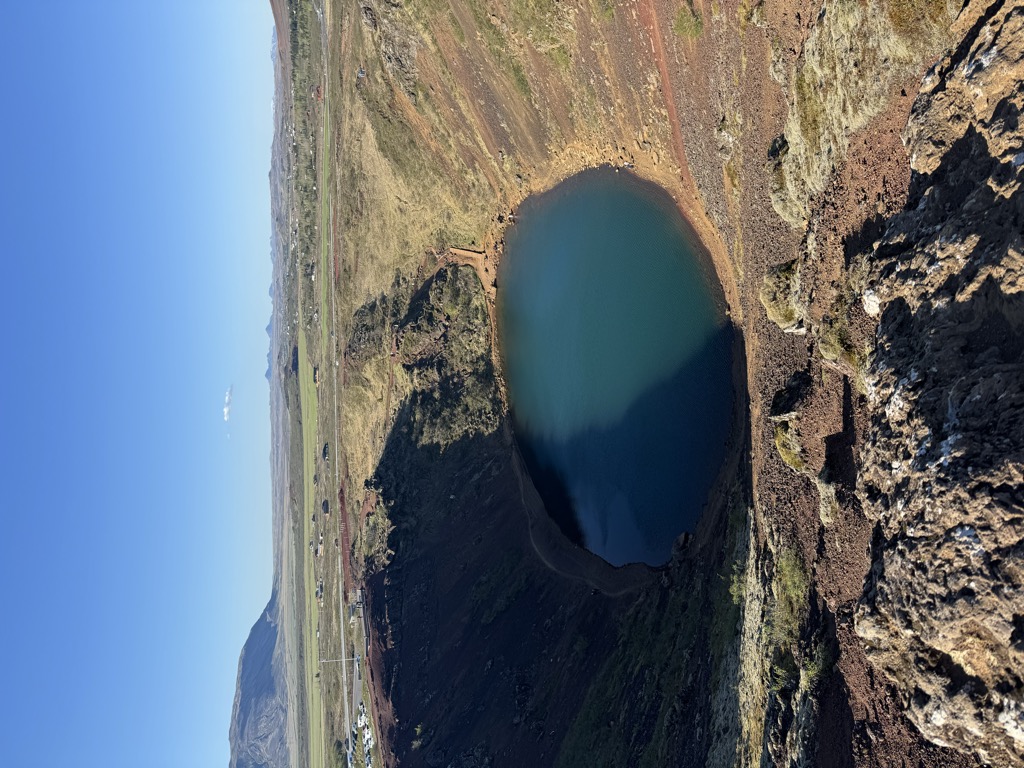
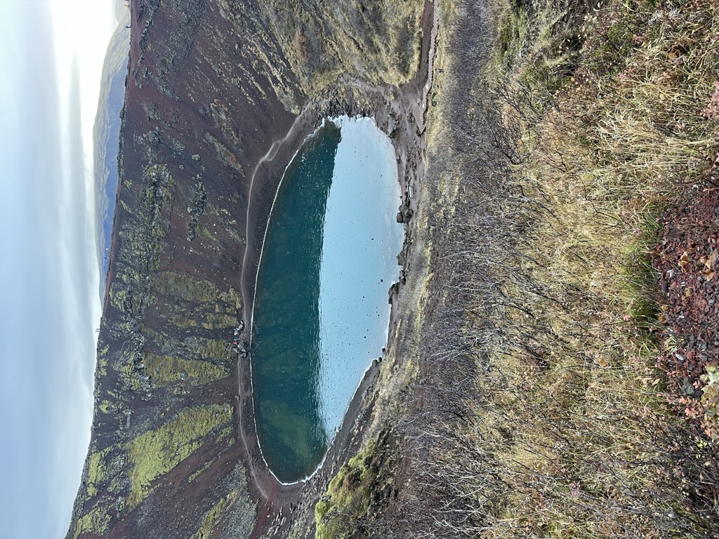
Kerið (Icelandic pronunciation: [ˈcʰɛːrɪθ]; also Kerith or Kerid) is a volcanic crater lake located in the Grímsnes area in south Iceland, along the Golden Circle. It is one of several crater lakes in the area, known as Iceland's Western Volcanic Zone, which includes the Reykjanes peninsula and the Langjökull Glacier, created as the land moved over a localized hotspot, but it is the one that has the most visually recognizable caldera still intact. The caldera, like the other volcanic rock in the area, is composed of a red (rather than black) volcanic rock. The caldera itself is approximately 55 m (180 ft) deep, 170 m (560 ft) wide, and 270 m (890 ft) across. Kerið's caldera is one of the three most recognizable volcanic craters at an age of approximately 6,500 years. It is only half as old as most of the surrounding volcanic features. The other two are Seyðishólar and Kerhóll.
While most of the crater is steep-walled with little vegetation, one wall is sloped more gently and blanketed with a deep moss, and can be descended fairly easily. The lake itself is fairly shallow (7–14 metres, depending on rainfall and other factors), but due to minerals from the soil, is an opaque and strikingly vivid aquamarine.
Land owners charge an entrance fee to see the crater of 600 ISK (as of June 2024).
We use GPS information embedded into the photo when it is available.
3D mountains overlay
Adjust mountain panorama to perfectly match your photos because recorded by camera photo position might be imprecise.
Move tool
Rotate tool
Zoom
More customization
Choose which peak labels should make into the final photo and what photo title should be.
Next
Photo Location
Satellitte
Flat map
Relief map
Latitude
Longitude
Altitude
OR
Latitude
°'''
Longitude
°'''
Apply
Register Peak
Peak Name
Latitude
Longitude
Altitude
Register
Teleport
PeakVisor
This 3D model of Sagarmatha National Park in Nepal was made using the PeakVisor app topographic data. The mobile app features higher precision models worldwide, more topographic details, and works offline. Download PeakVisor maps today.
Download OBJ model
PeakVisor
The download should start shortly. If you find it useful please consider supporting the PeakVisor app.
PeakVisor for iOS and Android
Be a superhero of outdoor navigation with state-of-the-art 3D maps and mountain identification in the palm of your hand!