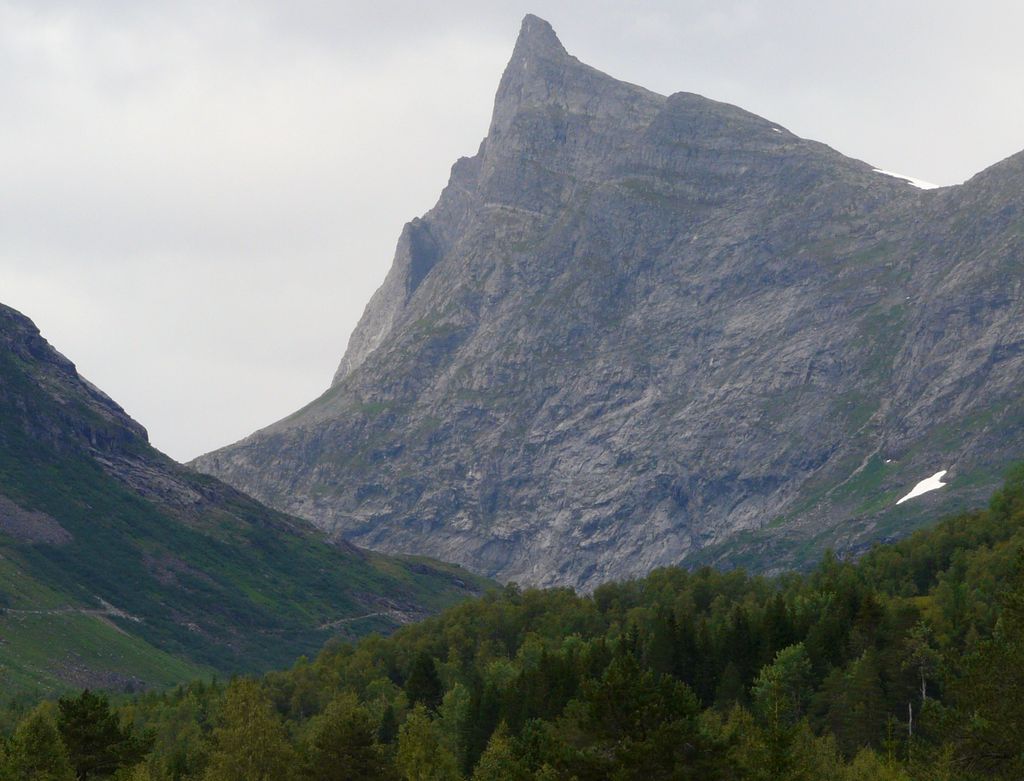
Hornindalsrokken is a 1,529-metre (5,016 ft) tall mountain in Møre og Romsdal county, Norway. It is located on the border of two municipalities: Stranda Municipality and Volda Municipality. The mountain is sometimes also called Honndalsrokken or sometimes just Rokken or Rokkjen.
The mountain is located about 14 kilometres (8.7 mi) northeast of the village of Grodås and lake Hornindalsvatnet. It is also located about 11 kilometres (6.8 mi) west of the village of Hellesylt in Stranda Municipality. It also lies about 6 kilometres (3.7 mi) southeast of the village of Leira in Volda Municipality. The mountain Kvitegga is 3 kilometres (1.9 mi) to the northeast on the Ørsta/Stranda municipal border.
The easiest ways to climb the mountain are from the Sæterdalen valley in Hornindal Municipality or from the Kjellstaddalen valley in Stranda Municipality. A popular viewpoint of the summit is from the Honndøla bridge which was built in 1810. The bridge lies near Norwegian County Road 60 in Indre Hornindal. North of the mountain lies the lake Tyssevatnet which is the innermost lake in the Hjørundfjorden area.
We use GPS information embedded into the photo when it is available.
3D mountains overlay
Adjust mountain panorama to perfectly match your photos because recorded by camera photo position might be imprecise.
Move tool
Rotate tool
Zoom
More customization
Choose which peak labels should make into the final photo and what photo title should be.
Next
Photo Location
Satellitte
Flat map
Relief map
Latitude
Longitude
Altitude
OR
Latitude
°'''
Longitude
°'''
Apply
Register Peak
Peak Name
Latitude
Longitude
Altitude
Register
Teleport
PeakVisor
This 3D model of Sagarmatha National Park in Nepal was made using the PeakVisor app topographic data. The mobile app features higher precision models worldwide, more topographic details, and works offline. Download PeakVisor maps today.
Download OBJ model
PeakVisor
The download should start shortly. If you find it useful please consider supporting the PeakVisor app.
PeakVisor for iOS and Android
Be a superhero of outdoor navigation with state-of-the-art 3D maps and mountain identification in the palm of your hand!