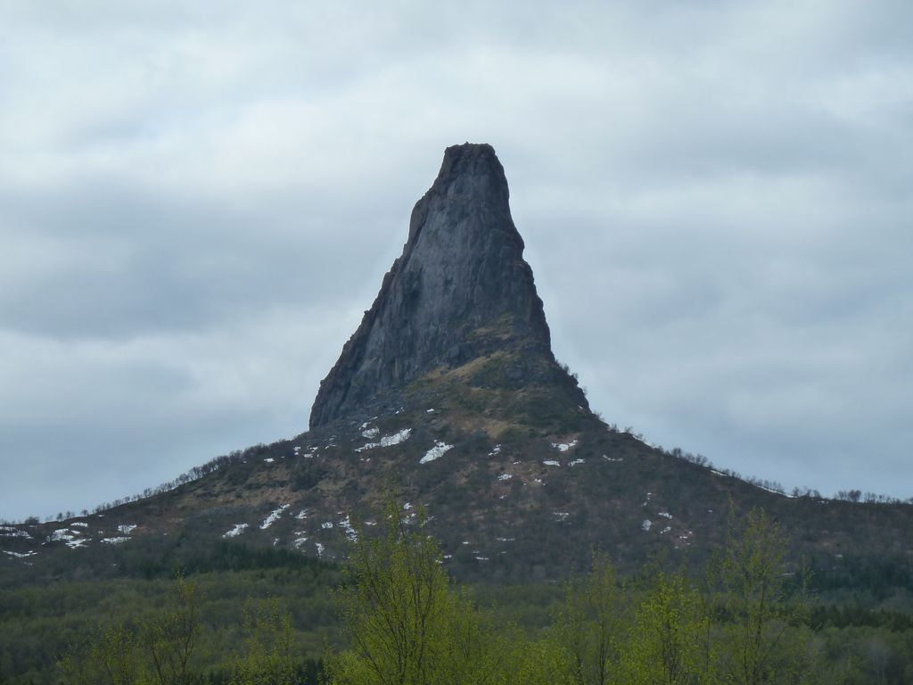
Hamarøyskaftet is a mountain in Hamarøy Municipality in Nordland county, Norway. The 612-metre (2,008 ft) mountain is a characteristic landmark of the region. It is located about 10 kilometres (6.2 mi) west of the villages of Oppeid and Presteid and about 7 kilometres (4.3 mi) north of the village of Skutvika. The mountain was first ascended by Martin Hoff Ekroll in 1885.
The normal route to the peak is described as technically easy, with some exposed parts.
In 1998, Hamarøyskaftet was featured on a Norwegian postage stamp (NK 1333 with a value of 5.50 kr).
We use GPS information embedded into the photo when it is available.
3D mountains overlay
Adjust mountain panorama to perfectly match your photos because recorded by camera photo position might be imprecise.
Move tool
Rotate tool
Zoom
More customization
Choose which peak labels should make into the final photo and what photo title should be.
Next
Photo Location
Satellitte
Flat map
Relief map
Latitude
Longitude
Altitude
OR
Latitude
°'''
Longitude
°'''
Apply
Register Peak
Peak Name
Latitude
Longitude
Altitude
Register
Teleport
PeakVisor
This 3D model of Sagarmatha National Park in Nepal was made using the PeakVisor app topographic data. The mobile app features higher precision models worldwide, more topographic details, and works offline. Download PeakVisor maps today.
Download OBJ model
PeakVisor
The download should start shortly. If you find it useful please consider supporting the PeakVisor app.
PeakVisor for iOS and Android
Be a superhero of outdoor navigation with state-of-the-art 3D maps and mountain identification in the palm of your hand!