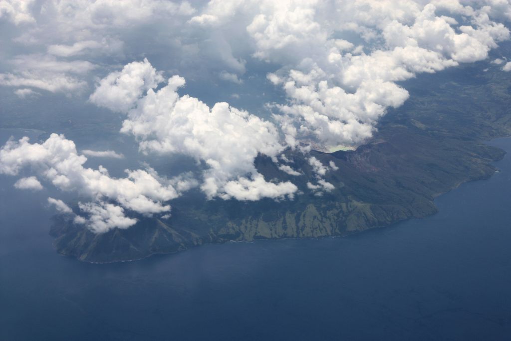
Mount Sirung (Indonesian: Gunung Sirung) is an active volcano complex volcano located on Pantar Island in the Alor archipelago of the eastern Indonesian province of Nusa Tenggara Timor. The crater rim can be reached by an easy hike from the village of Kakamauta. Inside the crater is a large sulphurous crater lake and several active steam vents. The last major eruption occurred 1970, and regular gas and clastic eruptions have occurred since 2004. A small eruption beginning May 12, 2012 triggered an evacuation of an area within a 1.5 km radius of the caldera.
We use GPS information embedded into the photo when it is available.
3D mountains overlay
Adjust mountain panorama to perfectly match your photos because recorded by camera photo position might be imprecise.
Move tool
Rotate tool
Zoom
More customization
Choose which peak labels should make into the final photo and what photo title should be.
Next
Photo Location
Satellitte
Flat map
Relief map
Latitude
Longitude
Altitude
OR
Latitude
°'''
Longitude
°'''
Apply
Register Peak
Peak Name
Latitude
Longitude
Altitude
Register
Teleport
PeakVisor
This 3D model of Sagarmatha National Park in Nepal was made using the PeakVisor app topographic data. The mobile app features higher precision models worldwide, more topographic details, and works offline. Download PeakVisor maps today.
Download OBJ model
PeakVisor
The download should start shortly. If you find it useful please consider supporting the PeakVisor app.
PeakVisor for iOS and Android
Be a superhero of outdoor navigation with state-of-the-art 3D maps and mountain identification in the palm of your hand!