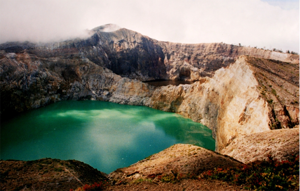
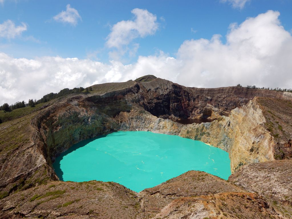
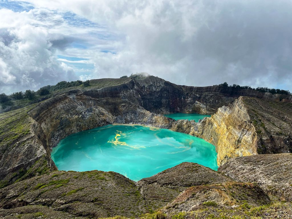
Kelimutu (pronounced [kəliˈmutu]) is a volcano close to the small town of Moni in central Flores island in Indonesia. It is around 50 km (31 mi) to the east of Ende, Indonesia, the capital of Ende regency in East Nusa Tenggara province. It has three volcanic crater lakes that differ in color.
The science of the Kelimutu lakes is relatively well-known, and the changes in color and temperature are concluded to be related to volcanic activity and the resulting fluid flux at vents at the bottom of the lakes. The Lake colors periodically change due to adjustments in the oxidation-reduction status of the fluid of each lake, and also considering the abundance of different major elements, such as iron and manganese. Oxidation-reduction status depends on the balance of volcanic gas input and rainfall rate, and is thought to be mediated by the groundwater system in the volcano itself. The colors in the lakes change independently from each other, as each has its own unique connectivity to the underlying volcano's activity. Between January and November 2016, the colors of the craters changed six times. Although it is widely believed that the changes are unpredictable, it is more accurate to say that the lack of any regular monitoring of the volcanic system precludes scientists from having the data necessary to drive widely available predictive models.
We use GPS information embedded into the photo when it is available.
3D mountains overlay
Adjust mountain panorama to perfectly match your photos because recorded by camera photo position might be imprecise.
Move tool
Rotate tool
Zoom
More customization
Choose which peak labels should make into the final photo and what photo title should be.
Next
Photo Location
Satellitte
Flat map
Relief map
Latitude
Longitude
Altitude
OR
Latitude
°'''
Longitude
°'''
Apply
Register Peak
Peak Name
Latitude
Longitude
Altitude
Register
Teleport
PeakVisor
This 3D model of Sagarmatha National Park in Nepal was made using the PeakVisor app topographic data. The mobile app features higher precision models worldwide, more topographic details, and works offline. Download PeakVisor maps today.
Download OBJ model
PeakVisor
The download should start shortly. If you find it useful please consider supporting the PeakVisor app.
PeakVisor for iOS and Android
Be a superhero of outdoor navigation with state-of-the-art 3D maps and mountain identification in the palm of your hand!