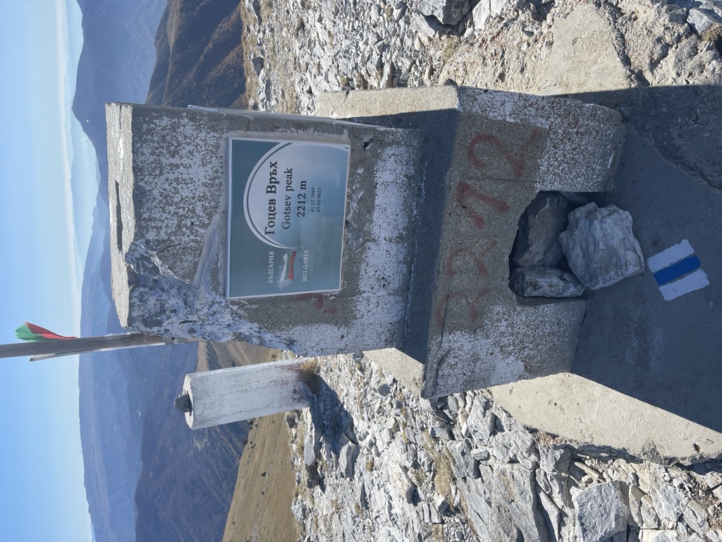
Slavyanka (Bulgarian: Славянка, "Slavic woman") or Orvilos (Greek: Όρβηλος), formerly known as Alibotush (from Turkish Alibotuş) and Kitka Planina (Китка планина), is a mountain located on the border of southwestern Bulgaria and northernmost Greece, located south of the Pirin Mountains and connected with it by the Paril Saddle. The highest peak of Slavyanka is Gotsev Vrah at 2,212 m, while other notable peaks include Golyam Tsarev Vrah (2,186 m), Malak Tsarev Vrah (2,087 m), Shabran (2,196 m) and Salyuva Dzhamiya (2,027 m). The Bulgarian section of the mountain is part of the Ali Botush Reserve.
The massif is dome-shaped and has very steep ridges. Slavyanka has a pronounced karst character and thus features over 30 caves, attracting many speleologists. The climate has a considerable Mediterranean influence, with precipitation being at its highest in the autumn and winter and at its lowest in the summer, and the average temperatures being higher than in the rest of the country at this height. The average annual temperature in the lowest part of the mountain is almost 14°C and about 6 °C in the highest part.
Slavyanka has a rich flora, with more than 1,700 vascular plants, including 20 Bulgarian endemic species and five that can be found nowhere else in the country. The low part of the mountain is rich in European Black Pine, while the Bosnian Pine grows at over 1,800 m above sea level, making Slavyanka the place with the highest concentration of the species in the Balkans. The fauna is represented not only by typical species for Bulgaria such as the deer, Wild Boar, hare, fox and badger, but also by characteristically Mediterranean animals like the jackal, the rare European Cat Snake, several species of tortoises and lizards, etc. There have been found 44 species of terrestrial gastropods in the Bulgarian part of the Alibotush Mountains. Twenty-four species of these terrestrial gastropods have Mediterranean type of distribution.
There's a trail leading to the summit.
By elevation Gotsev Peak / Tsolias is
# 20 out of 566 in Macedonia - Thrace # 1 out of 48 in Serres Regional Unit
By prominence Gotsev Peak / Tsolias is
# 3 out of 451 in Blagoevgrad # 8 out of 4517 in Bulgaria # 52 out of 4199 in Greece # 10 out of 566 in Macedonia - Thrace # 3 out of 48 in Serres Regional Unit
Show more
Sun and Moon
Mon
Tue
Wed
Thu
Fri
Sat
Sun
May 2022
Date and time
00:00
06:00
12:00
18:00
Today
--
--
Sunrise
--
Sunset
--
Moonrise
--
Moonset
Phase
🌔 Waxing Gibbous
The perfect light time for beautiful photos:
--
Sunrise
--
Sunset
Check out a downloadable 3D model of Gotsev Peak / Tsolias area. A higher resolution model can be found in the PeakVisor mobile app.
Do you have photos of Gotsev Peak / Tsolias or know something about it? Please let us know!
We use GPS information embedded into the photo when it is available.
3D mountains overlay
Adjust mountain panorama to perfectly match your photos because recorded by camera photo position might be imprecise.
Move tool
Rotate tool
Zoom
More customization
Choose which peak labels should make into the final photo and what photo title should be.
Next
Photo Location
Satellitte
Flat map
Relief map
Latitude
Longitude
Altitude
OR
Latitude
°'''
Longitude
°'''
Apply
Register Peak
Peak Name
Latitude
Longitude
Altitude
Register
Teleport
PeakVisor
This 3D model of Sagarmatha National Park in Nepal was made using the PeakVisor app topographic data. The mobile app features higher precision models worldwide, more topographic details, and works offline. Download PeakVisor maps today.
Download OBJ model
PeakVisor
The download should start shortly. If you find it useful please consider supporting the PeakVisor app.
PeakVisor for iOS and Android
Be a superhero of outdoor navigation with state-of-the-art 3D maps and mountain identification in the palm of your hand!