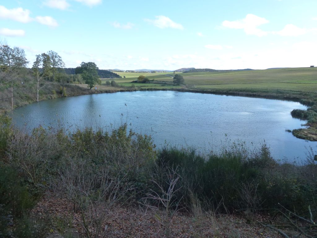
The Eichholzmaar is one of the smaller maars in the Volcanic Eifel and lies on the Landstraße between Steffeln and Duppach. It has a diameter of c. 120 metres. Its greatest depth is 3 metres.
The circular shape of the bowl of the maar can still be easily seen. It lies exactly on a geological fault line, which runs from northwest to southeast.
At the beginning of the 20th century the maar was drained in order to create meadows. From late summer 2007 to spring 2008 a renaturalisation was carried out and the lake restored with an area of c. 1,1 hectares. In only a few years the maar has become a refuge for rare water birds and reptiles.
Two natural mineral springs in the immediate vicinity of the maar are accessible on foot. About 300 metres upstream in a westerly direction from the Eichholzmaar is the mineral spring known as the Steffelner Dress (50.272306°N 6.560166°E / 50.272306; 6.560166 (mineral spring)). Around
270 metres downstream in an easterly direction from the Eichholzmaar is the mineral spring of Aueler Dress (50.271907°N 6.571413°E / 50.271907; 6.571413 (mineral spring)).
Detailed scientific research of the Eichholzmaar has been carried out by the universities of Jena and Frankfurt.
For visitors to the maar between April and October, there is the option of joining one of the regular guided tours by the local branch of the Eifel Club.
We use GPS information embedded into the photo when it is available.
3D mountains overlay
Adjust mountain panorama to perfectly match your photos because recorded by camera photo position might be imprecise.
Move tool
Rotate tool
Zoom
More customization
Choose which peak labels should make into the final photo and what photo title should be.
Next
Photo Location
Satellitte
Flat map
Relief map
Latitude
Longitude
Altitude
OR
Latitude
°'''
Longitude
°'''
Apply
Register Peak
Peak Name
Latitude
Longitude
Altitude
Register
Teleport
PeakVisor
This 3D model of Sagarmatha National Park in Nepal was made using the PeakVisor app topographic data. The mobile app features higher precision models worldwide, more topographic details, and works offline. Download PeakVisor maps today.
Download OBJ model
PeakVisor
The download should start shortly. If you find it useful please consider supporting the PeakVisor app.
PeakVisor for iOS and Android
Be a superhero of outdoor navigation with state-of-the-art 3D maps and mountain identification in the palm of your hand!