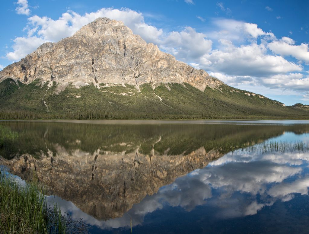
Dillon Mountain is a prominent 4,820-foot (1,469 meter) mountain summit located in the Philip Smith Mountains of the Brooks Range, in the U.S. state of Alaska. The peak is situated 93 miles north of the Arctic Circle near milepost 207 on the Dalton Highway, and 200 mi (322 km) north-northwest of Fairbanks, where the Bettles and Dietrich Rivers merge to form Middle Fork Koyukuk River. Sukakpak Mountain rises 3 mi (5 km) to the southwest, and Dietrich Camp of the Trans-Alaska Pipeline lies 3 mi (5 km) to the northwest. The peak was named after John Thomas Dillon (1947-1987), a geologist with the Alaska Division of Geological and Geophysical Surveys who mapped the geology of the southern Brooks Range mineral belt. He died tragically with his father, Stephen Patrick Dillon, in an airplane crash in the Brooks Range while returning home from field work in July 1987. The name was officially adopted in 1990 by the U.S. Board on Geographic Names. This landmark is notable for its massive west face composed of Skajit limestone rising nearly 3,400 feet (1,035 m) above the surrounding valley.
We use GPS information embedded into the photo when it is available.
3D mountains overlay
Adjust mountain panorama to perfectly match your photos because recorded by camera photo position might be imprecise.
Move tool
Rotate tool
Zoom
More customization
Choose which peak labels should make into the final photo and what photo title should be.
Next
Photo Location
Satellitte
Flat map
Relief map
Latitude
Longitude
Altitude
OR
Latitude
°'''
Longitude
°'''
Apply
Register Peak
Peak Name
Latitude
Longitude
Altitude
Register
Teleport
PeakVisor
This 3D model of Sagarmatha National Park in Nepal was made using the PeakVisor app topographic data. The mobile app features higher precision models worldwide, more topographic details, and works offline. Download PeakVisor maps today.
Download OBJ model
PeakVisor
The download should start shortly. If you find it useful please consider supporting the PeakVisor app.
PeakVisor for iOS and Android
Be a superhero of outdoor navigation with state-of-the-art 3D maps and mountain identification in the palm of your hand!