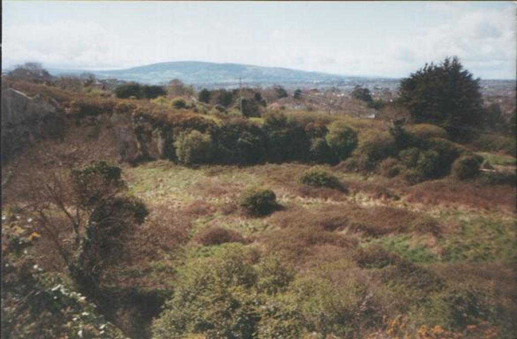
Dalkey Hill (Irish: Cnoc Dheilginse) is the northernmost of the two hills which form the southern boundary of Dublin Bay (the other being Killiney Hill). Dalkey Hill is 140 metres high and has views over the surrounding areas : Dublin to the northwest; the Irish Sea and the mountains of Wales (on a clear day) to the east and southeast; and Bray Head and the Wicklow Mountains to the south.
Dalkey Hill and Killiney Hill are both part of Killiney Hill Park, a small public park overlooking the villages of Dalkey to the north and Killiney to the west. The park is crossed by a number of walking tracks, and with views from all directions, is a used by walkers and hikers from the surrounding areas.
Extensive quarrying of Dalkey Hill in the 19th century has resulted in the existence of Dalkey Quarry, which is now a rock-climbing location.
We use GPS information embedded into the photo when it is available.
3D mountains overlay
Adjust mountain panorama to perfectly match your photos because recorded by camera photo position might be imprecise.
Move tool
Rotate tool
Zoom
More customization
Choose which peak labels should make into the final photo and what photo title should be.
Next
Photo Location
Satellitte
Flat map
Relief map
Latitude
Longitude
Altitude
OR
Latitude
°'''
Longitude
°'''
Apply
Register Peak
Peak Name
Latitude
Longitude
Altitude
Register
Teleport
PeakVisor
This 3D model of Sagarmatha National Park in Nepal was made using the PeakVisor app topographic data. The mobile app features higher precision models worldwide, more topographic details, and works offline. Download PeakVisor maps today.
Download OBJ model
PeakVisor
The download should start shortly. If you find it useful please consider supporting the PeakVisor app.
PeakVisor for iOS and Android
Be a superhero of outdoor navigation with state-of-the-art 3D maps and mountain identification in the palm of your hand!