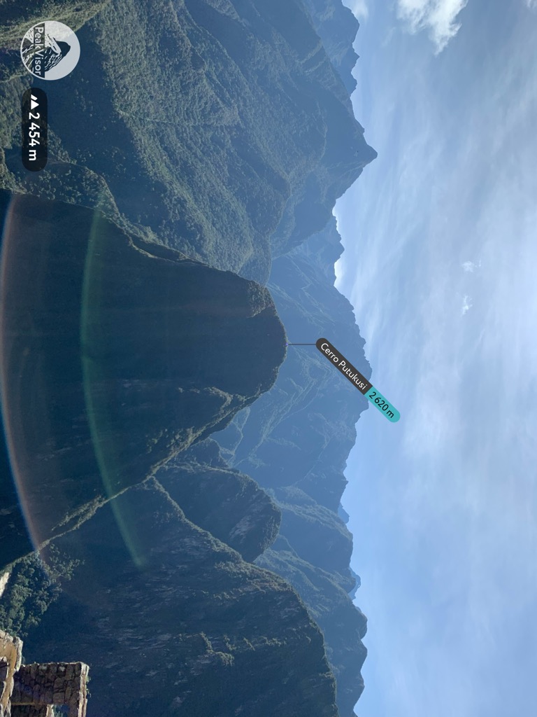
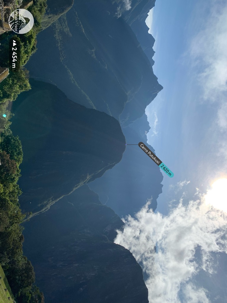
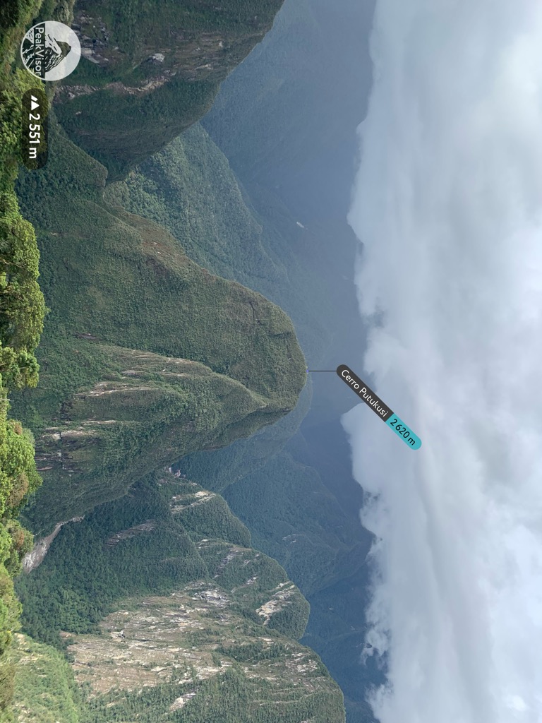
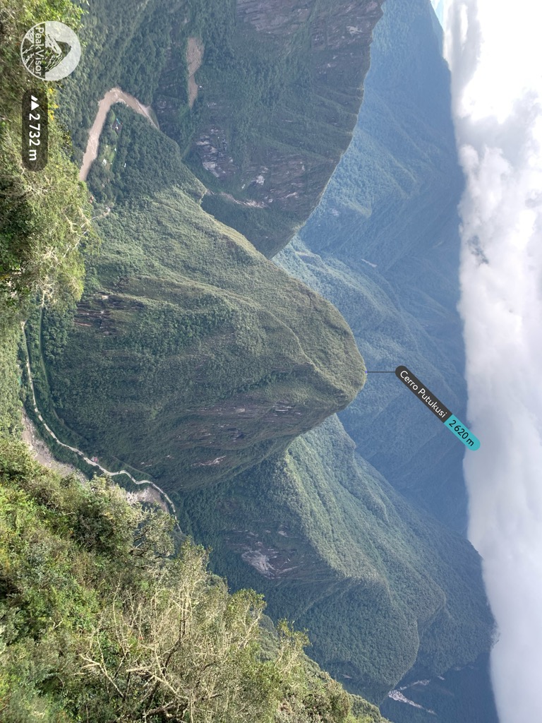
Putucusi (possibly from Quechua phutu bud, -q a suffix, k'usi a cucurbit species, a small zucchini or Cucurbita pepo, "budding zucchini (or Cucurbita pepo)") is a round-shaped mountain located on the opposite side (northeast) of the Urubamba River to Machu Picchu in the Cusco Region of Peru. Reaching approximately 2,560 metres (8,400 ft) above sea level at its peak, the mountain offers epic views of Machu Picchu and the surrounding Urubamba River valley.
"Putu Cusi" has been described by Quechua-speaking guides as "Happy Mountain". According to Glosbe Glosbe online Quechua-English dictionary, "Kusi" means "happy", and "Putuq" translates to "trapezoid". As the feature could be seen as a trapezoidal mountain that would align with this translation. It is important to recognize that Quechua has several dialects.
Putucusi, Machu Picchu ("old peak" in Quechua) and Huayna Picchu ("young peak") are considered apus or holy mountains by the local Quechua people.
There's a hiking trail (T2) leading to the summit.
By elevation Cerro Putukusi is
# 94 out of 94 in Urubamba # 17 out of 17 in Machupicchu Historical Sanctuary
By prominence Cerro Putukusi is
# 14 out of 94 in Urubamba # 5 out of 17 in Machupicchu Historical Sanctuary
We use GPS information embedded into the photo when it is available.
3D mountains overlay
Adjust mountain panorama to perfectly match your photos because recorded by camera photo position might be imprecise.
Move tool
Rotate tool
Zoom
More customization
Choose which peak labels should make into the final photo and what photo title should be.
Next
Photo Location
Satellitte
Flat map
Relief map
Latitude
Longitude
Altitude
OR
Latitude
°'''
Longitude
°'''
Apply
Register Peak
Peak Name
Latitude
Longitude
Altitude
Register
Teleport
PeakVisor
This 3D model of Sagarmatha National Park in Nepal was made using the PeakVisor app topographic data. The mobile app features higher precision models worldwide, more topographic details, and works offline. Download PeakVisor maps today.
Download OBJ model
PeakVisor
The download should start shortly. If you find it useful please consider supporting the PeakVisor app.
PeakVisor for iOS and Android
Be a superhero of outdoor navigation with state-of-the-art 3D maps and mountain identification in the palm of your hand!


.jpg)


