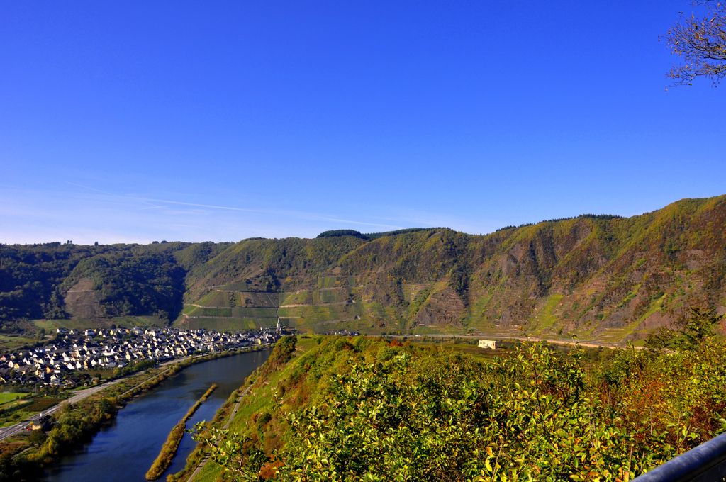
The Calmont, also called the Calmond, between Bremm and Ediger-Eller in the county of Cochem-Zell in the German state of Rhineland-Palatinate, is a steep hill on the heights above the Moselle river to a height of 380.6 m above sea level (NHN). It lies within the Moselle wine region and is home to the vineyards of Bremmer Calmont and Ellerer Calmont which, with gradients of up to over 65º, are among the steepest vineyards in the world.
There's a trail leading to the summit. Calmont is one of the 71 peaks along the multi-day Wanderwege NWS Eifel.
The nearest mountain hut is Feuerwehrhütte located 582m/1 910ft ESE of the summit.
We use GPS information embedded into the photo when it is available.
3D mountains overlay
Adjust mountain panorama to perfectly match your photos because recorded by camera photo position might be imprecise.
Move tool
Rotate tool
Zoom
More customization
Choose which peak labels should make into the final photo and what photo title should be.
Next
Photo Location
Satellitte
Flat map
Relief map
Latitude
Longitude
Altitude
OR
Latitude
°'''
Longitude
°'''
Apply
Register Peak
Peak Name
Latitude
Longitude
Altitude
Register
Teleport
PeakVisor
This 3D model of Sagarmatha National Park in Nepal was made using the PeakVisor app topographic data. The mobile app features higher precision models worldwide, more topographic details, and works offline. Download PeakVisor maps today.
Download OBJ model
PeakVisor
The download should start shortly. If you find it useful please consider supporting the PeakVisor app.
PeakVisor for iOS and Android
Be a superhero of outdoor navigation with state-of-the-art 3D maps and mountain identification in the palm of your hand!