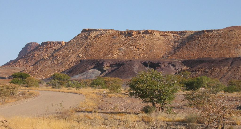
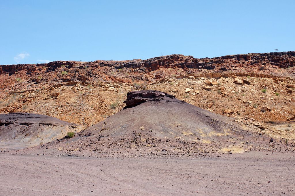
The Burnt Mountain (Afrikaans: Verbrande Berg) is a hill with a solidified lava flow at the foot of a 12-kilometre-long volcanic ridge in Damaraland in northern Namibia. The 80-million-year-old stream of lava was formed by thermal and compression metamorphism and its red, brown, cream and purple colours creates a striking contrast at dusk with the surrounding 200-million-year-old beige rocks of Karoo slate.
Burnt Mountain rises above the surrounding area by about 200 metres and is not far from the Organ Pipes on the D3254 road and about 10 kilometres southeast of Twyfelfontein.
Since 15 September 1956, the Burnt Mountain has been a National Monument of Namibia.
We use GPS information embedded into the photo when it is available.
3D mountains overlay
Adjust mountain panorama to perfectly match your photos because recorded by camera photo position might be imprecise.
Move tool
Rotate tool
Zoom
More customization
Choose which peak labels should make into the final photo and what photo title should be.
Next
Photo Location
Satellitte
Flat map
Relief map
Latitude
Longitude
Altitude
OR
Latitude
°'''
Longitude
°'''
Apply
Register Peak
Peak Name
Latitude
Longitude
Altitude
Register
Teleport
PeakVisor
This 3D model of Sagarmatha National Park in Nepal was made using the PeakVisor app topographic data. The mobile app features higher precision models worldwide, more topographic details, and works offline. Download PeakVisor maps today.
Download OBJ model
PeakVisor
The download should start shortly. If you find it useful please consider supporting the PeakVisor app.
PeakVisor for iOS and Android
Be a superhero of outdoor navigation with state-of-the-art 3D maps and mountain identification in the palm of your hand!