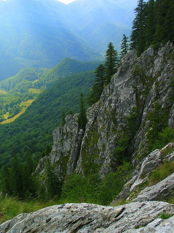
Bihor Mountains (Romanian: Munții Bihorului, Hungarian: Bihar-hegység) is a mountain range in western Romania. It is part of the Apuseni Mountains, which are part of the Carpathian Mountains.
The massif has a length of 25 kilometres (16 mi) from the northwest to the southeast and a width of 14 kilometres (8.7 mi). It is located east of the town Ștei, Bihor County and north of the town of Brad, Hunedoara County.
The highest peak is Cucurbăta Mare, with an elevation of 1,849 metres (6,066 ft); this also the highest peak of the Apuseni Mountains. Other high peaks are Buteasa (1,790 m), Cârligatele (1,694 m), Piatra Grăitoare (1,658 m), and Bohodei (1,654 m).
The Vlădeasa Massif is a volcanic range extension of the Bihor Mountains to the north, reaching a maximum height of 1,836 metres (6,024 ft).
By elevation Bihor is
# 25 out of 219 in Bihor # 68 out of 859 in the Apuseni Mountains
We use GPS information embedded into the photo when it is available.
3D mountains overlay
Adjust mountain panorama to perfectly match your photos because recorded by camera photo position might be imprecise.
Move tool
Rotate tool
Zoom
More customization
Choose which peak labels should make into the final photo and what photo title should be.
Next
Photo Location
Satellitte
Flat map
Relief map
Latitude
Longitude
Altitude
OR
Latitude
°'''
Longitude
°'''
Apply
Register Peak
Peak Name
Latitude
Longitude
Altitude
Register
Teleport
PeakVisor
This 3D model of Sagarmatha National Park in Nepal was made using the PeakVisor app topographic data. The mobile app features higher precision models worldwide, more topographic details, and works offline. Download PeakVisor maps today.
Download OBJ model
PeakVisor
The download should start shortly. If you find it useful please consider supporting the PeakVisor app.
PeakVisor for iOS and Android
Be a superhero of outdoor navigation with state-of-the-art 3D maps and mountain identification in the palm of your hand!