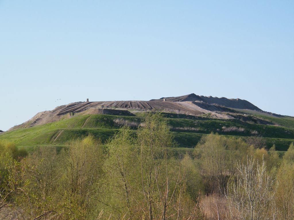
The Arkenberge is a hill in the Berlin municipality of Blankenfelde in the borough of Pankow. The name was originally given to a natural hill ridge on the site, and the nearby settlement of Arkenberge was named after that chain of little hills. In 1984 a rubble heap for building waste was established east of this settlement. In January 2015, it was determined that the top of this tip had reached a height of 120.7 m above sea level (NHN). Since then it has been ranked as the highest point in the state of Berlin, superseding the Teufelsberg. However, the highest natural point in Berlin is the Großer Müggelberg (114.7 m above sea level (NHN)).
We use GPS information embedded into the photo when it is available.
3D mountains overlay
Adjust mountain panorama to perfectly match your photos because recorded by camera photo position might be imprecise.
Move tool
Rotate tool
Zoom
More customization
Choose which peak labels should make into the final photo and what photo title should be.
Next
Photo Location
Satellitte
Flat map
Relief map
Latitude
Longitude
Altitude
OR
Latitude
°'''
Longitude
°'''
Apply
Register Peak
Peak Name
Latitude
Longitude
Altitude
Register
Teleport
PeakVisor
This 3D model of Sagarmatha National Park in Nepal was made using the PeakVisor app topographic data. The mobile app features higher precision models worldwide, more topographic details, and works offline. Download PeakVisor maps today.
Download OBJ model
PeakVisor
The download should start shortly. If you find it useful please consider supporting the PeakVisor app.
PeakVisor for iOS and Android
Be a superhero of outdoor navigation with state-of-the-art 3D maps and mountain identification in the palm of your hand!