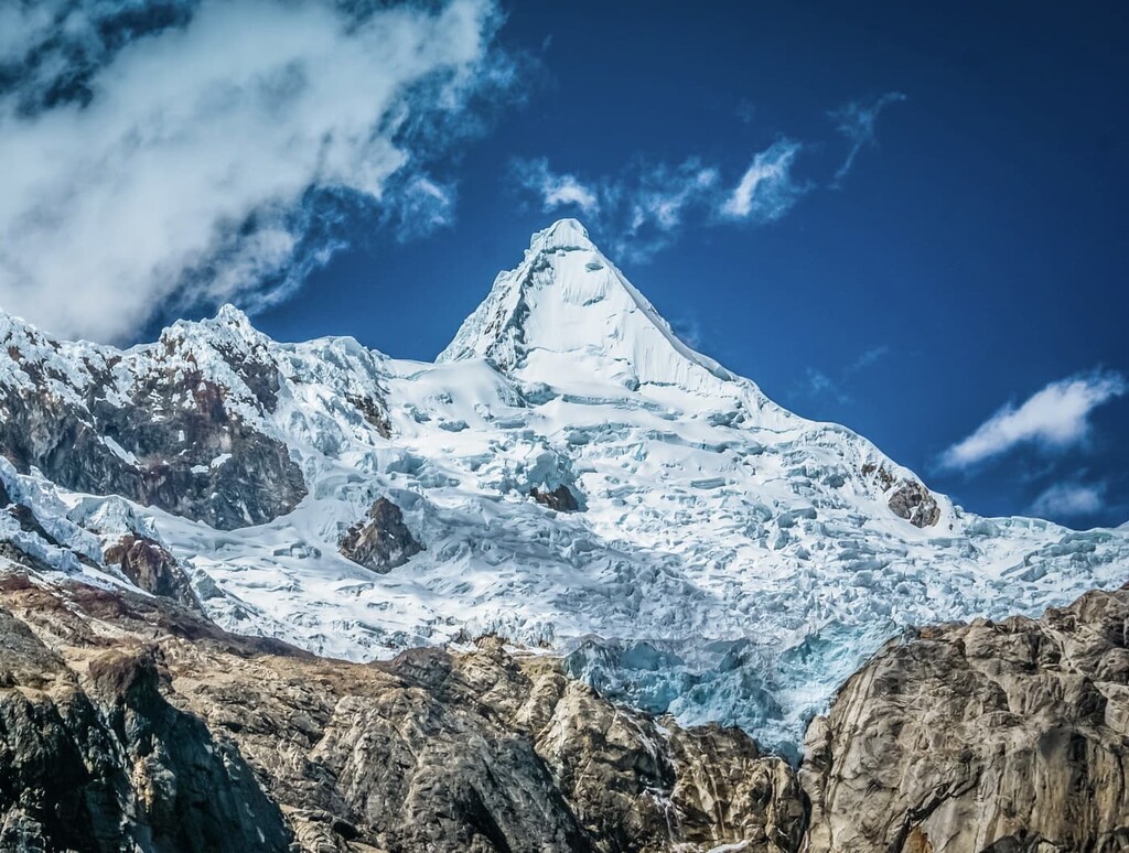
Alpamayo (possibly from Quechua allpa earth, mayu river, "earth river") or Shuyturaju (possibly from Ancash Quechua huytu, shuytu oblong, slim and long, Quechua rahu snow, ice, mountain covered in snow) is one of the most conspicuous peaks in the Cordillera Blanca of the Peruvian Andes. Alpamayo Creek originates northwest of it.
The Alpamayo lies next to the slightly higher Quitaraju.
In July 1966, the German magazine "Alpinismus", published a photo of Alpamayo taken by American photographer Leigh Ortenburger accompanied by an article on a survey among mountaineering experts, who chose Alpamayo as "The Most Beautiful Mountain in the World".
By elevation Alpamayo is
# 27 out of 1334 in Ancash # 9 out of 95 in Huaylas # 52 out of 21468 in Peru # 23 out of 122 in Huascarán National Park # 69 out of 39148 in the Andes (Bolivia, Peru, Ecuador, Colombia, Venezuela)
By prominence Alpamayo is
# 49 out of 1334 in Ancash # 10 out of 95 in Huaylas # 29 out of 122 in Huascarán National Park
We use GPS information embedded into the photo when it is available.
3D mountains overlay
Adjust mountain panorama to perfectly match your photos because recorded by camera photo position might be imprecise.
Move tool
Rotate tool
Zoom
More customization
Choose which peak labels should make into the final photo and what photo title should be.
Next
Photo Location
Satellitte
Flat map
Relief map
Latitude
Longitude
Altitude
OR
Latitude
°'''
Longitude
°'''
Apply
Register Peak
Peak Name
Latitude
Longitude
Altitude
Register
Teleport
PeakVisor
This 3D model of Sagarmatha National Park in Nepal was made using the PeakVisor app topographic data. The mobile app features higher precision models worldwide, more topographic details, and works offline. Download PeakVisor maps today.
Download OBJ model
PeakVisor
The download should start shortly. If you find it useful please consider supporting the PeakVisor app.
PeakVisor for iOS and Android
Be a superhero of outdoor navigation with state-of-the-art 3D maps and mountain identification in the palm of your hand!