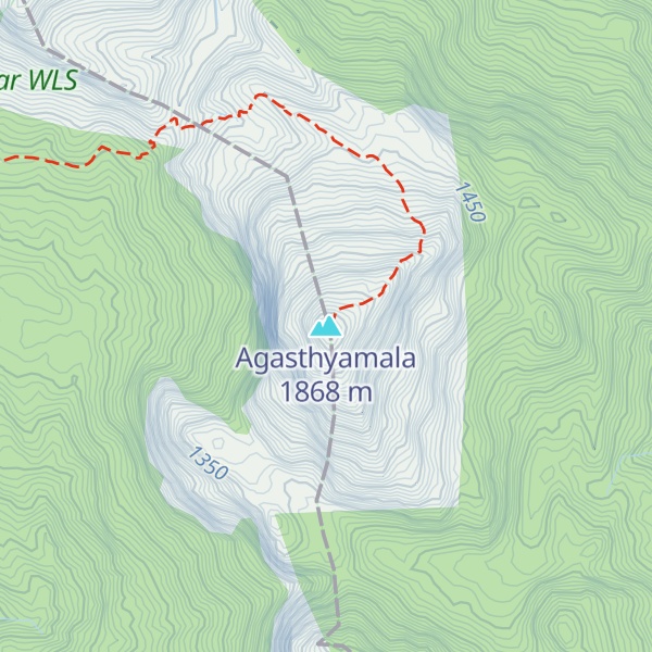
Agastya Mala (or Agasthyamalai or Agastyarkoodam) is one of the peaks in the Western Ghats of Thiruvananthapuram District of Kerala, near to the border of Tamilnadu, India. This peak is a part of the Agasthyamala Biosphere Reserve which lies on the border between the Indian states of Tamil Nadu, Tirunelveli district and Kerala, Thiruvananthapuram district. The perennial Thamirabarani River originates from the eastern side of the range and flows into the Tirunelveli district of Tamil Nadu. It is 1,868-metres (6,129 ft) tall.
Agastyaarkoodam is a pilgrimage centre for devotees of the Hindu sage Agastya, who is considered to be one of the seven rishis (Saptarishi) of Hindu Puranas. In Tamil traditions, Agastya is considered as the father of the Tamil language and the compiler of the first Tamil grammar called Agattiyam or Akattiyam. There is a small stone statue of Agathiyar at the top of the peak and the devotees can offer pujas.
Agasthyamala Biosphere Reserve is among 20 new sites added by UNESCO to its World Network of Biosphere Reserves in March 2016. The International Co-ordinating Council added the new sites during a two-day meeting on 19 March 2016 in Lima, bringing the total number of biosphere reserves to 669 sites in 120 countries, including 16 transboundary sites. The biosphere reserve includes close to 300 rare bird species and more than 200 medicinal plants endemic to this region.
There's a hiking trail (T1) called Athirumala Agasthyarkoodam trail leading to the summit.
By elevation Agasthyamala is
# 1 out of 8 in Nedumangad # 1 out of 5 in Neyyattinkara # 84 out of 845 in Kerala # 1 out of 34 in Ambasamudram # 1 out of 2 in Neyyar WLS
By prominence Agasthyamala is
# 1 out of 8 in Nedumangad # 1 out of 5 in Neyyattinkara # 3 out of 845 in Kerala # 44 out of 13857 in India # 1 out of 34 in Ambasamudram # 1 out of 2 in Neyyar WLS # 2 out of 1381 in Tamil Nadu # 2 out of 1042 in the Cardamom Mountains
We use GPS information embedded into the photo when it is available.
3D mountains overlay
Adjust mountain panorama to perfectly match your photos because recorded by camera photo position might be imprecise.
Move tool
Rotate tool
Zoom
More customization
Choose which peak labels should make into the final photo and what photo title should be.
Next
Photo Location
Satellitte
Flat map
Relief map
Latitude
Longitude
Altitude
OR
Latitude
°'''
Longitude
°'''
Apply
Register Peak
Peak Name
Latitude
Longitude
Altitude
Register
Teleport
PeakVisor
This 3D model of Sagarmatha National Park in Nepal was made using the PeakVisor app topographic data. The mobile app features higher precision models worldwide, more topographic details, and works offline. Download PeakVisor maps today.
Download OBJ model
PeakVisor
The download should start shortly. If you find it useful please consider supporting the PeakVisor app.
PeakVisor for iOS and Android
Be a superhero of outdoor navigation with state-of-the-art 3D maps and mountain identification in the palm of your hand!