
Scan the QR code and open PeakVisor on your phone
White Ranch Park has 1 named peak. The highest is Ralston Buttes at 2,362 m.
White Ranch Park is located just outside of Golden, Colorado, and is one of 27 parks that make up the Jefferson County Open Space Parks system. The county is the fourth most populous county in the state and includes several of the western suburbs of Denver. Despite its proximity to a large metropolitan area, most of the county is mountainous and consequently most of the open Space Parks are in the mountains, primarily in the foothills of the Rockies. The Open Space system encompasses about 56,000 acres, which contain 244 miles of hiking trails and contribute significantly to the county’s recreation infrastructure. A dedicated sales tax ensures funding for creation of the parks, their maintenance and for creation of new trails. Admission to the parks is free for all visitors and the parks are very popular, especially on weekends. Facilities, including restrooms, parking lots, picnic areas and trails are exceptionally clean and well-maintained.
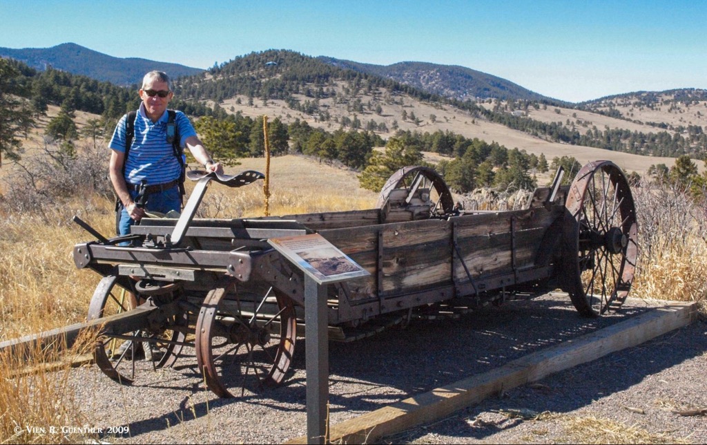
White Ranch Park is the largest of all the parks, consisting of 3,953 acres (actually a lot more, but those areas are closed for resource and wildlife management) and 22 miles of trails. I have hiked all of them – many times. After all, I lived in Jefferson County for many years, only 12 miles from the park’s nearest trailhead. This is one of only two parks in the system that allows walk-in camping. It also has two entrance roadways, three parking lots and three trailheads. The park was originally owned by the Paul White family who operated this land from 1913 until 1974 as a cattle ranch. After Paul White’s death in 1969, his widow, Anne Lee White, initiated a purchase-gift agreement for the land with Jefferson County Open Space. To commemorate the park's earlier life, there is an open-air museum near one of the parking lots that has an array of various historic farm implements and information kiosks. There are also still a few historic farm buildings on the property. This is not just a great place for hiking but is also informational for all visitors.
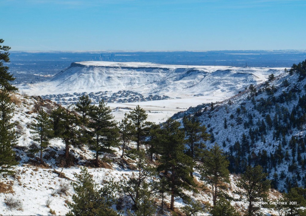
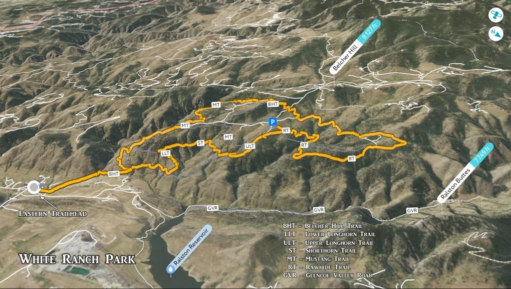
White Ranch Park has only one named mountain, Ralston Buttes, which by default is both the highest and most prominent at 7,749 feet. Elevations in the park range from 6,060 feet at Ralston Creek to approximately 7,900 feet. Yes, you read that correctly – while Ralston Buttes is the highest named mountain, this is the highest elevation in the park reached by a trail. The park’s terrain starts out flat at its eastern boundary but immediately rises steeply across undulating hills and ravines. This makes for an interesting variety of trails, most of which are rugged, though in the higher parts of the park, the terrain is somewhat gentler resulting in easier trails. The main access for most people is on the east side trailhead, from which only one trail starts, the first mile of which runs on an easement through private property. This trailhead is easily reached from Golden in about 5 minutes.
The other two trailheads are on the western end of the park, about a 10-mile drive from Golden. There are two parking lots on the Belcher Hill Road, both within park limits. Both these lots are at elevations around 7,500 feet. These lots are not as large as the main eastern lot since most park visitors will want to start closer to home. But, due to the immense size of the park, and the long distances required to hike to the most remote ends of the park, these lots make a better staging point for those who want to hike on these higher trails without first having to overcome 1,500 feet of elevation gain. My wife and I have hiked mostly from the base, although we have made some hikes by starting at the upper lots. If you are planning to camp in White Ranch Park, you would most likely want to start here, considering that you can't drive to your campsite and have to carry your gear in. It is less than two miles to either campground on mostly forgiving trails.
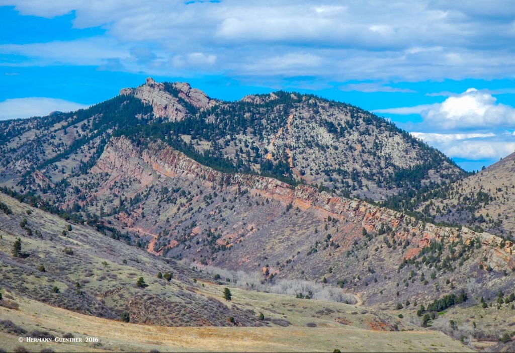
Before I get into actual hiking trails, I need to call attention to what is probably the most striking feature of White Ranch Park – and you are not allowed to go there. This is a sensitive area set aside for protection of bear and raptor habitat and can only be accessed by special permit. This has undoubtedly incensed countless climbers who look at those massive cliffs just waiting to be climbed. For climbers and non-climbers alike, the Ralston Buttes are perhaps the most spectacular terrain features in the entire park, but climbing them would not be in our personal interests – we come here to go hiking. And we get to look at the cliffs from many parts of the park and marvel at their dominance of the landscape.
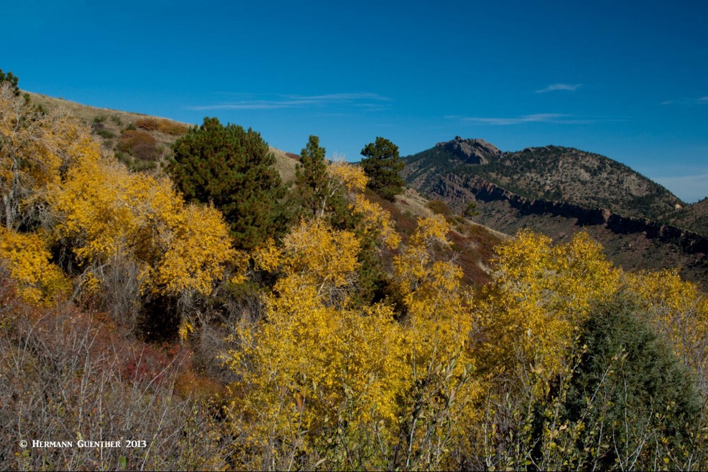
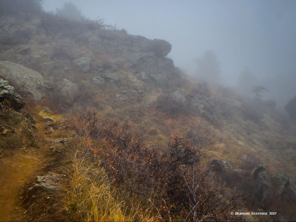
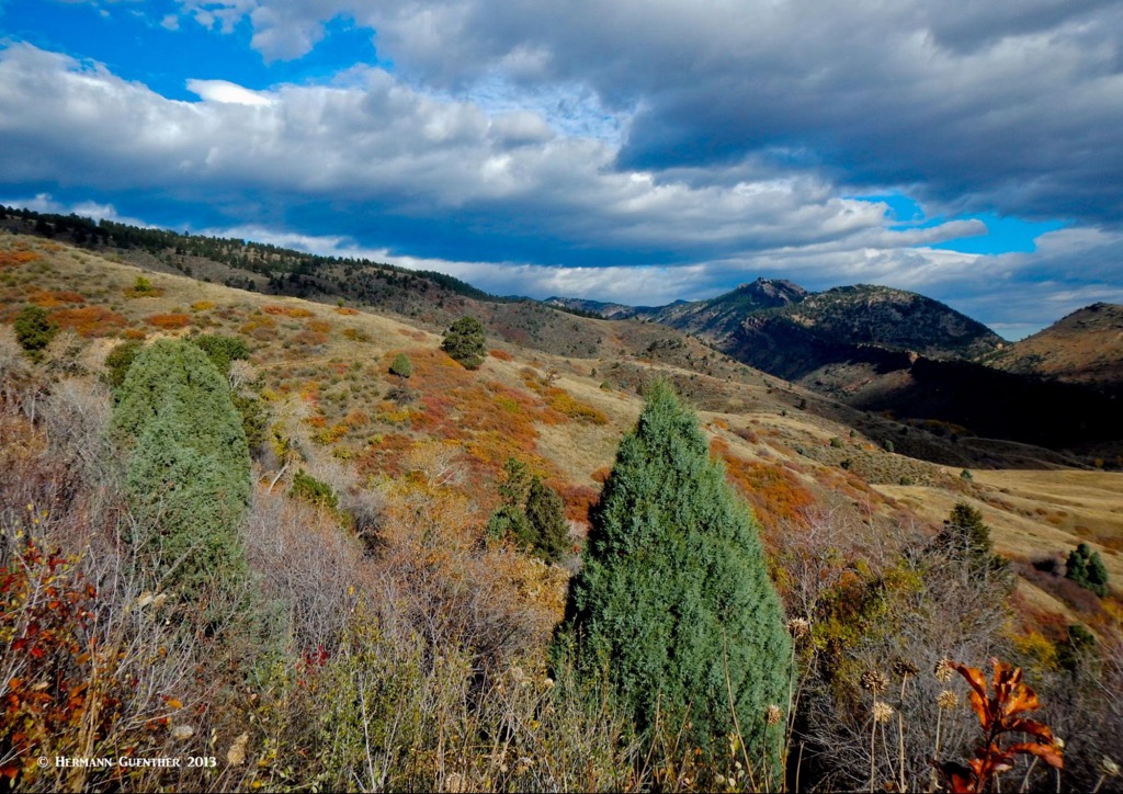
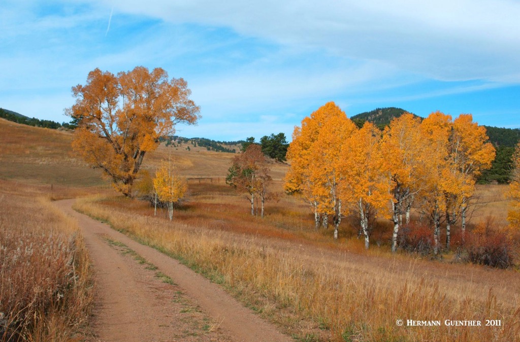
There are so many trails in White Ranch Park that you will most likely never get bored hiking here. I never have. For one thing, you can hike here year-round without needing any special equipment or skills. But in winter or early spring, spikes can be very handy when icing conditions occur, which is common. Spring and autumn are also delightful here, as wildflowers spring up and fall colors paint the landscape. Summer is great for those who like to hike in warm or hot conditions although some cooler days do happen frequently, even in summer. Most of the trails offer fine views to the east, toward the Great Plains, the urban areas and downtown Denver. However, views to the high mountains to the west are sparse since they are blocked by higher foothills terrain. But fear not, this park is a beautiful place that is always pleasing to the eye. With the exception of one segment of one trail, which is for bikers only, all trails are considered “shared-use” for hikers, equestrians and bikers alike.
When starting your hike at this trailhead, you will have only one trail option – for the first mile. The Belcher Hill Trail starts here, and as you hike up you will find a number of trail junctions (nine in all, including the one at the top) all the way to the highest elevation in the park. Taking any of these trails will in turn take you to other junctions thus affording you a wide range of choices. The Belcher Hill Trail will take you to the top, but not to Belcher Hill, which is not even within the park. The first two junctions are the Whippletree Trail and the Longhorn Trail. The latter has two further junctions with the Shorthorn Trail, which is one of the lesser used trails and one of my favorites. I have hiked this one at times when I never saw another person on it, especially in the winter when there is snow and ice.
If you want to continue on the Belcher Hill Trail, you will find that it is one of the more widely used trails. Mountain bikers love it because it climbs steeply and relentlessly to the top in under four miles. The terrain along large sections of this trail is very rocky with loose rubble making it almost unpleasant to walk on. I guess that’s what the bikers like. To add to the misery, most of the trail has a southwesterly exposure and affords almost no shade. It can be brutal in the afternoon sun. But since so many other trails intersect it, you will in all probability hike some parts of the Belcher Hill Trail. One of my favorite routes to the top is to leave this trail at its junction with the Mustang Trail, 2.3 miles from the bottom; then follow that delightful two-mile trail to the top. It first contours around an open hillside with fine views after which it descends slightly into a deep gully, which it follows to the top. You will see less hikers and far less bikers on this trail. Once on top, you will have many options for going back down. I have done them all.
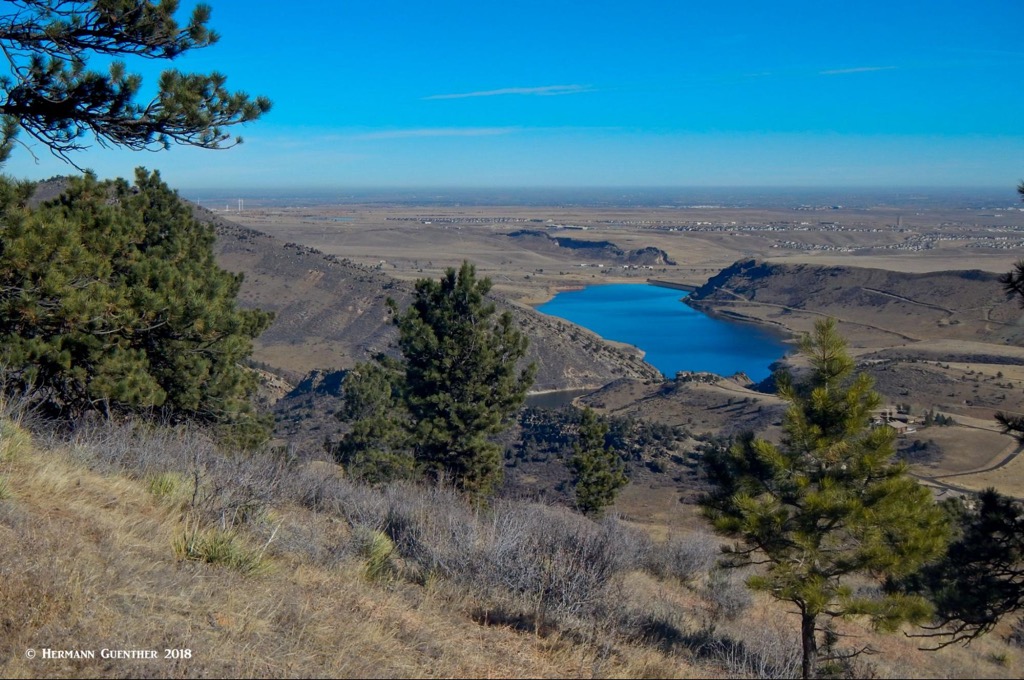
As I said before, starting at the east trailhead you will have no choice but to follow the Belcher Hill Trail for at least one mile. But an option I particularly enjoy is to continue up as far as the junction with the Longhorn Trail and follow that to its junction with the Shorthorn Trail. The latter then contours for over a mile along a huge basin almost resembling an amphitheater. This pleasant trail is largely in the trees but with openings to the east that afford great views. Except for periodic ups and downs, the trail mostly maintains a constant elevation until it reaches its second junction with the Longhorn Trail. The view down to the Ralston Reservoir and to the Great Plains beyond is wonderful.
Once you have re-joined the Longhorn Trail, you will start climbing into the higher reaches of the park where you have many options to extend your hike. You will also soon have a chance to keep your hike shorter and return to the beginning by deviating from the Longhorn Trail onto the Maverick Trail which, in about a mile, will intersect the Belcher Hill Trail (yes, that one again), that you can take back down; doing this, you will have created a nice loop hike for yourself. I have done that on a few occasions, when, upon reaching the Longhorn-Maverick junction, I found that it was extremely windy and not a pleasant prospect to continue higher. So I used this option, thus staying mostly below the open area, while still turning this into a fairly easy 7-mile hike.
I mentioned earlier that there are two trailheads at the western end of the park. That is true, but functionally, I will treat them as one since they are only three tenths of a mile apart and one can be reached from the other. The more westerly upper one is close to the high point in the park and is therefore very handy for those wanting to make an attractive 4.5-mile loop by first climbing the short distance to the top of the Belcher Hill Trail and then following it downhill to its junction with the Mustang Trail, which is then followed back to its upper terminus. The final mile is uphill all the way to the top, from where it is then just a short downhill back to the parking lot. The loop can of course be done in the reverse direction. This is a nice way to experience the solitude of the Mustang Trail without having to make the long climb up from the eastern trailhead. Partway down from the top on either trail are junctions with the Sawmill Trail, which passes through the Sawmill Campground, resulting in a much shorter loop. At the lower end of the Mustang Trail is a bench where you can sit and enjoy the distant view toward the Ralston Buttes (see photo below).
White Ranch Park is huge and attempting to reach the farthest points in the park from the eastern trailhead can be a daunting undertaking for some hikers who are not prepared for such a lengthy excursion with lots of elevation gain. For those hikers, I strongly recommend parking at the lower of the two western trailheads. This is where the open-air museum is located; there is also a large picnic ground here, which includes a group picnic shelter as well as rest rooms. This is also where the longest trail in the park begins and ends – the 5-mile loop of the Rawhide Trail. Despite its length, this marvelous trail has a total elevation gain of only 860 feet. More than two miles of this trail have been relocated in recent years after a heavy rain event in September of 2013 caused significant damage due to flooding and erosion. It was several years until the trail had been reopened. I recommend doing this hike in the anti-clockwise direction; this will prevent you having to make the biggest and steepest uphill segment at the end of your hike.
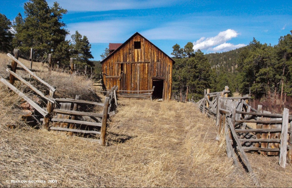
The Rawhide Loop will also present you with opportunities to see other characteristics of the park. In addition to passing right through the open-air farm museum, the trail also passes the Sourdough Springs Campground, the second one in the park, which you can explore while hiking. It also passes two benches with a view where you can sit and rest or enjoy a snack. For about half the length, this trail is in the trees, which give you shelter from the sun on hot days and from the wind on blustery days. The trail also passes close to an old barn that is still in decent shape (as of the last time we hiked there) but no longer functional. It is surrounded on three sides by hilly, open meadows. We have hiked to it although you would have to go off-trail to visit it (which may not technically be allowed). The stretch of the trail from the campground back to the trailhead, just under two miles, is more of a wide gravel road, since park vehicles have to use it to service the campground.
If you desire a slightly longer loop hike from the western trailheads, a variation of the one just described will give you a round trip of 7.5 miles and about 1,322 feet of total elevation gain. This one will take you through both campgrounds in the park and will let you finish the last two miles on a somewhat downward slope. Just follow the Rawhide Trail as before, but shortly before the end of that loop, make a right turn on the Belcher Hill Trail (its upper end). The trail rises up to the upper trailhead, crosses the road and then climbs gently to the high point in the park, where there is a bench. From here, go down the Mustang Trail for just over a half mile and then go left on the Sawmill Trail, which goes through the Sawmill Campground as before and the continues until it crosses the Belcher Hill Trail after which it meanders across a meadow to end at the lower parking area where this exciting loop hike ends.
Finally, it is entirely possible to hike all of the lower trails on the eastern side of the park from these western trailheads. But all of those combinations will require that you have to make a long uphill slog to get back to your car. Why would you want to do that? Probably to show how tough you are. I suggest if you want to do any combination of upper and lower trails, start at the eastern trailhead. I have done all the trails in the park from the eastern trailhead (but not all in one go, mind you; I would have no idea how many miles you would have to hike to accomplish that), making hikes as long as 16 miles. Days like that are behind me now! See below one of my GPS tracks uploaded to the 3-D view in the PeakVisor app. This was a perimeter hike of 16 miles that I have done a number of times.
Keeping in mind that White Ranch Park is at the very edge of a metropolitan area of two million people, it is likely to be a busy place, especially during fine weather and on weekends and holidays. But for those who have the benefits of retirement, going there on weekdays is the best ticket. On certain winter days, I have often arrived at the eastern trailhead in the morning and saw no other cars parked there, although hikers and bikers certainly arrived later on. On such hikes, I was sometimes by myself for miles before encountering another person. But I was a local resident. Visitors from other places will need tourist amenities, and those are abundant in metro Denver. We will now visit a couple of nearby towns that offer plenty of charm, atmosphere and places to stay and eat. And shop.
There is no town closer to White Ranch Park than the exciting and historic place called Golden. This historic town is the seat of Jefferson County and has an interesting and colorful history. Situated on Clear Creek at the foot of the Front Range, Golden was founded during the Pike’s Peak Gold Rush on June 16, 1859. The town is home to the excellent Colorado School of Mines which offers programs in engineering and science. If one wants to become a mining engineer, this would not be a bad place to undertake your studies. The famous western showman, William F. Cody (better known as Buffalo Bill) is buried on nearby Lookout Mountain. The Coors Brewery, located in the Clear Creek Valley between North Table Mountain and South Table Mountain, is the largest single-site brewery in the world. Visitors must take a tour – and sample some of the goods as well.
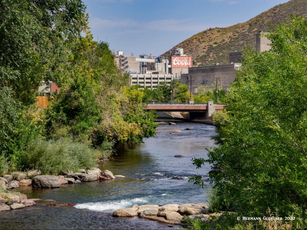
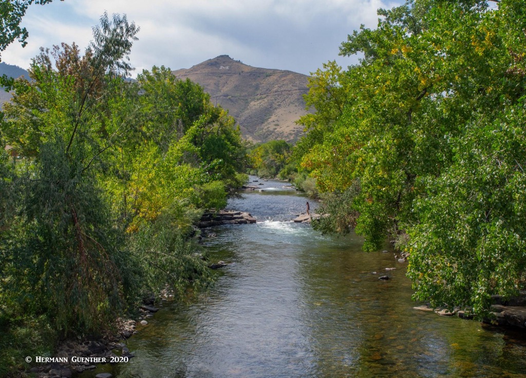
The historic center of Golden is a charming place to spend a couple of hours. Its setting at the foot of South Table Mountain, with Lookout Mountain on the opposite side of downtown, is one of the finest in the entire Front Range, just minutes from downtown Denver. Walk along the waterfront park developed around the sparkling Clear Creek and you will be transported to another world that seems far from the bustling metropolis of which it is a part. And appropriately, the American Mountaineering Center is located here. Its museum is the first and only one in the nation dedicated to mountaineering history. The town has no shortage of places to eat and drink, but accommodations are somewhat limited (and a bit high-end) in the center of town although there are many more options nearby.
What visitor to Colorado hasn’t heard of Boulder? Whether it relates to hiking, climbing, education or high-tech industry, Boulder is “where it’s happening.” The center of this exciting city is only 18 miles and a 25-minute drive from the east trailhead of White Ranch Park. Granted, Boulder has its own mecca of hiking venues, in most cases second to none in the greater Denver and Front Range area. Yet even people from that upscale place might want to hike in White Ranch Park. Even more likely, people who regularly hike in the park often find excuses to take a detour to Boulder before going home in other towns nearby. It’s just that kind of place. With its grand scenic setting and wide variety of places to eat and stay, this place is simply a pleasure to visit even if you are not hiking. Boulder is the home to the main campus of the University of Colorado, and is notable for many science and high-tech institutions. It has garnered top rankings in terms of health, well-being and quality of life, which may correlate with the high cost of living. If you have what it takes, you cannot possibly go wrong visiting or even living in this town.


The highest peak in White Ranch Park is Ralston Buttes, at 2,362 m.
Notable peaks in White Ranch Park include Ralston Buttes.


