Scan the QR code and open PeakVisor on your phone
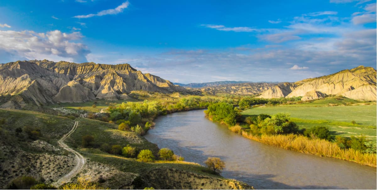
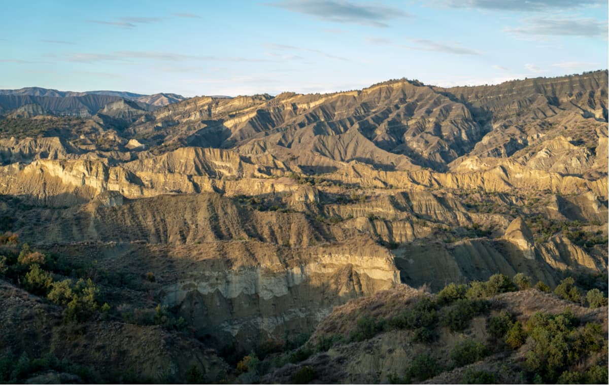
The Vashlovani National Park lies in the eastern part of Georgia in the sunny lands of the Kakheti Region, almost next to the Azerbaijani border. It includes several types of natural zones: steppe, forest-steppe, semi-desert, and deciduous forests. The park features steep sedimentary rocks (badland), plain plateaus and even karst caves. The height of the area varies from 100 to 800 meters above sea level.
The Vashlovani Park is not the usual sight of Caucasian snow-white mountains or alpine meadows. It is a unique area which resembles a wild prairie or savannah. Beautiful protected lands of the park give an impression you are on safari to Africa! The Vashlovani is a kind of a cauldron which was formed amidst the growing mountains and began to abide very different laws from those typical for the rest of Kakheti. This park has an awesome blend of pristine nature, lavish forests, deserts, volcanoes and ridges than turn it into a fantastic island in Georgia.
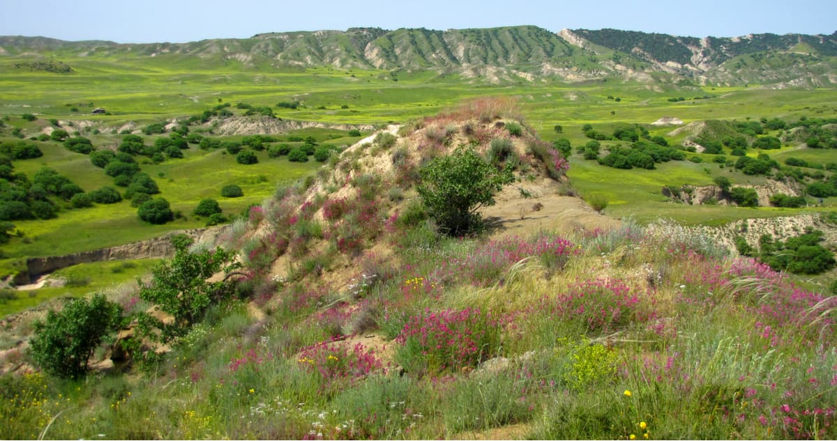
Within the park, there are found deciduous forests, forest-steppe, steppe and a semi-desert. According to scientific and research data, there are at least 660 species of plants in the protected area, 40 of which grow mainly in the Caucasus. The prevailing tree types are pistachio, juniper, cherry, maple, pear, fig and pomegranate. Here one can find buckthorn, jasmine, barberry, and honeysuckle.
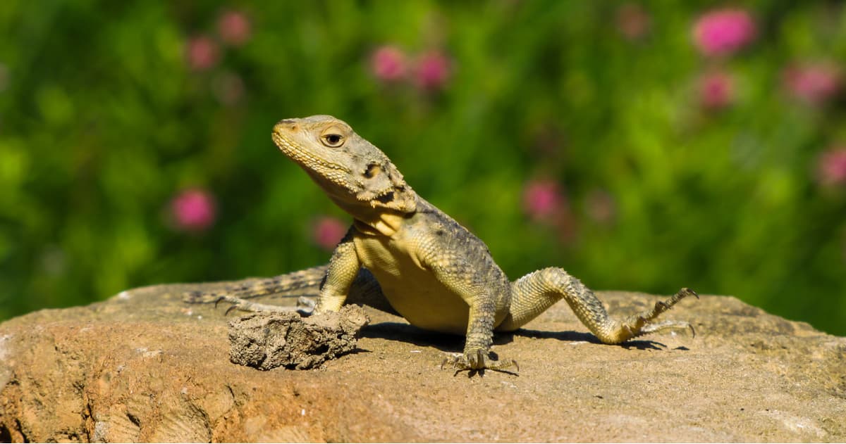
As to the animal world, there are 80 species of birds, 18 species of reptiles and amphibians, and 17 species of mammals. The most common animals are hares, badgers, foxes, hedgehogs, martens, and ferrets. It is also possible to meet bigger animals such as wolves, jackals, hyenas, brown bears, wild boars, lynxes and wild cats.
The Vashlovani Park is characterized by a hot, arid climate, which is facilitated by the complete absence of freshwater reservoirs and minimal annual precipitation as well as largely due to the influence of the Shirak steppe located within its limits. In summer, it is very hot and the temperature keeps at the level of +40C (+104F) and more. Winters are harsh and the temperature often drops to -25C (-13F). The best time to visit the Vashlovani Park is in spring and autumn.
The Eagle Gorge (Artsivis Kheoba) is a kind of a two-in-one offer. On the one hand, you will see a limestone rocky canyon and on the other, there is an extensive forest area with the fortress Hornabudzhi in the middle of it. The fortress dates back to the 5th century. Those white limestone cliffs rising over the lush greenery provide excellent photos, you can also spot vultures flying over the terrain. There are special observation decks for that. More than sixty bird species live here including the nesting rare species of black stork, vultures, Colchis pheasants and other birds. In general, the Eagle Gorge is an ideal place for bird watching.
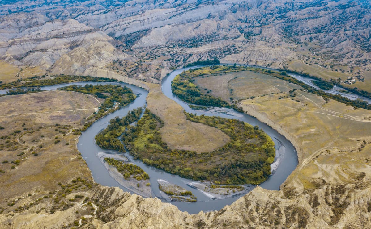
The Kaklis Kure (the Oreshnikovy Bay on the Alazani River) is a vegetation-rich forest zone on the peninsula formed by the Alazani River. The total area is over 200 hectares. This is the only place where wild walnut grows naturally on the territory of Georgia. Also, there are the only specimens of giant ash, oak and elm trees in the country.
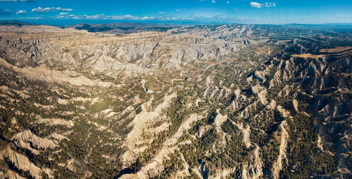
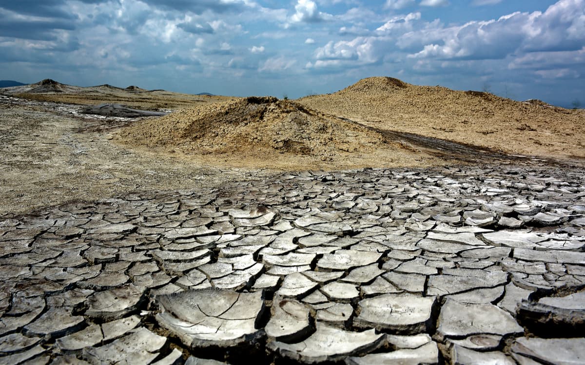
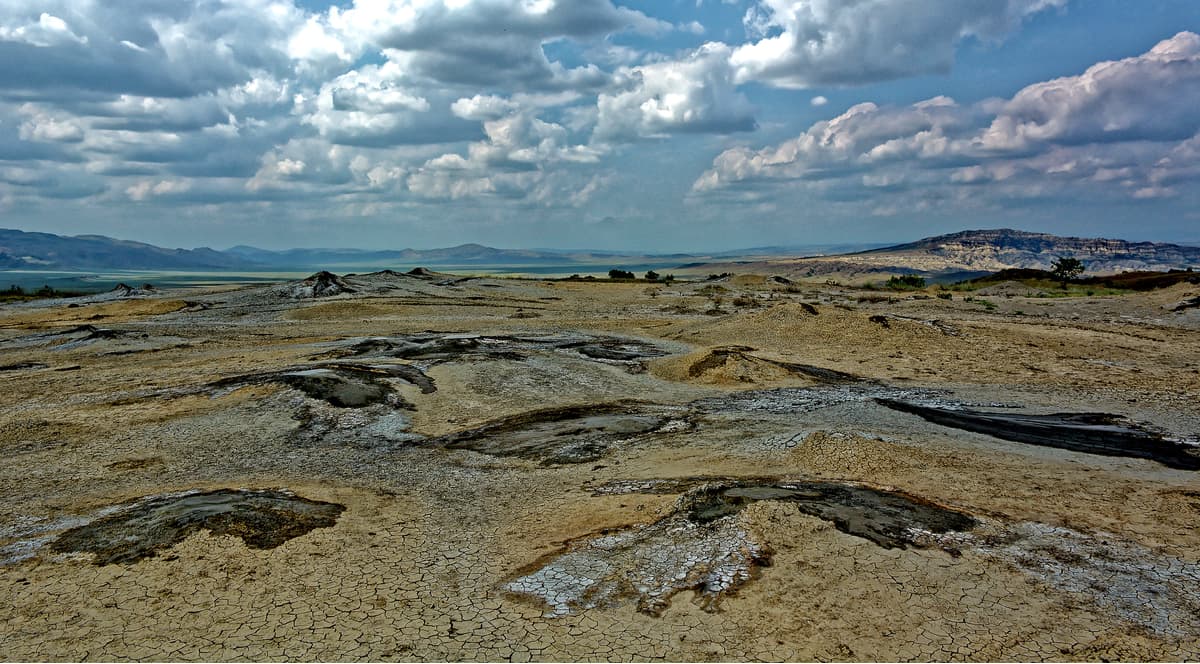
The Takhti-Tepa volcanoes are a miracle that teleports you to another planet. The nature around is unusual, there are a lot of big stones covered with grass and deep ravines mixed with plains. It is an astounding creation of nature, which amazes with its scale. Here, at an altitude of 620 meters above sea level, near Mount Dali, among the cracked land appear springs of different sizes with grey-blue bubbling clay, their height varies from 20 cm to 1.5 m. The diameter of the largest of the volcanoes is 3-4 m. At the tops of these hills, there are round mud craters boiling and bubbling continuously. Blue clay, oil and gas are ejected to the surface from the very depths of the earth. The mud erupted by volcanoes has healing properties.
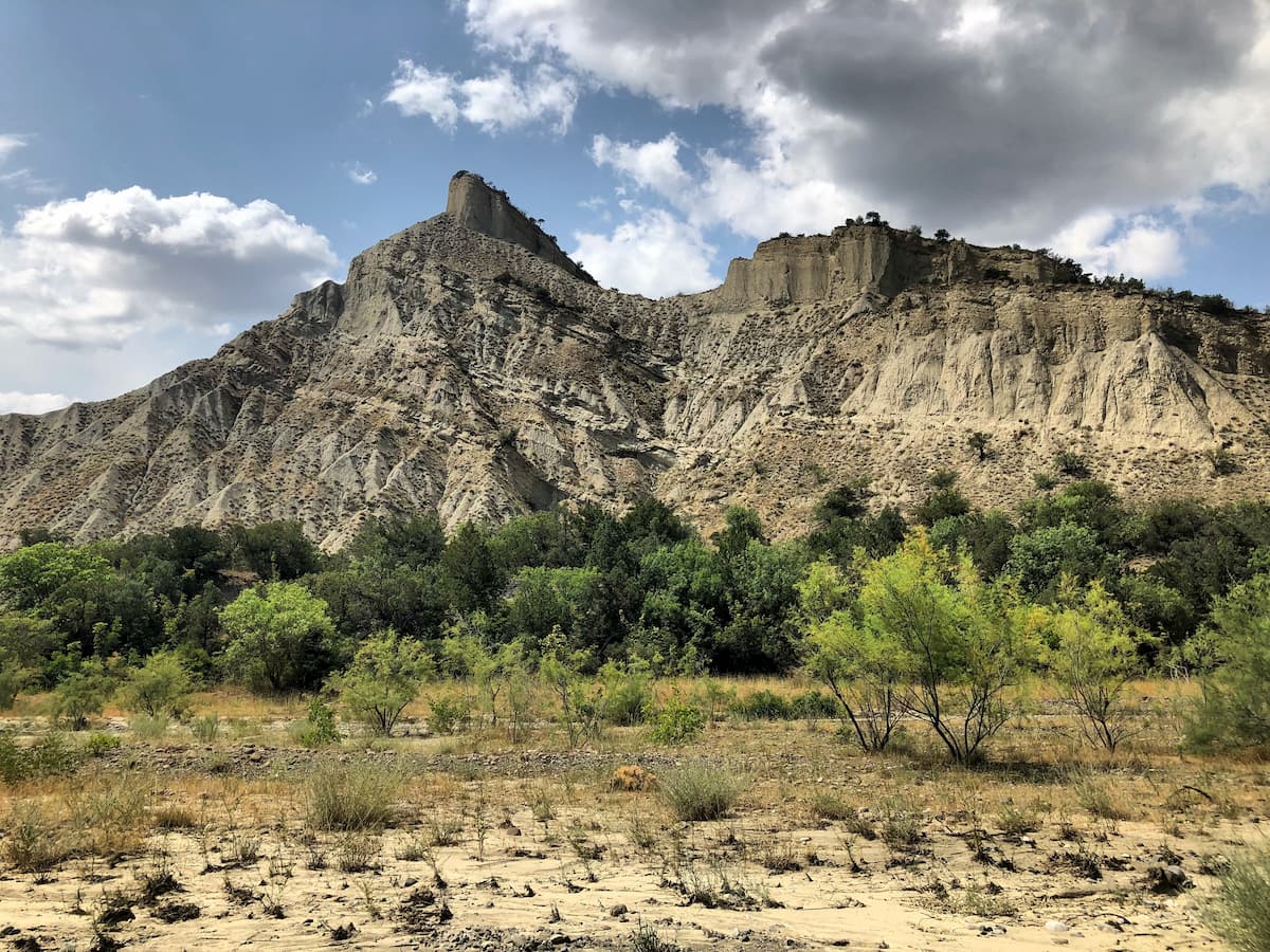
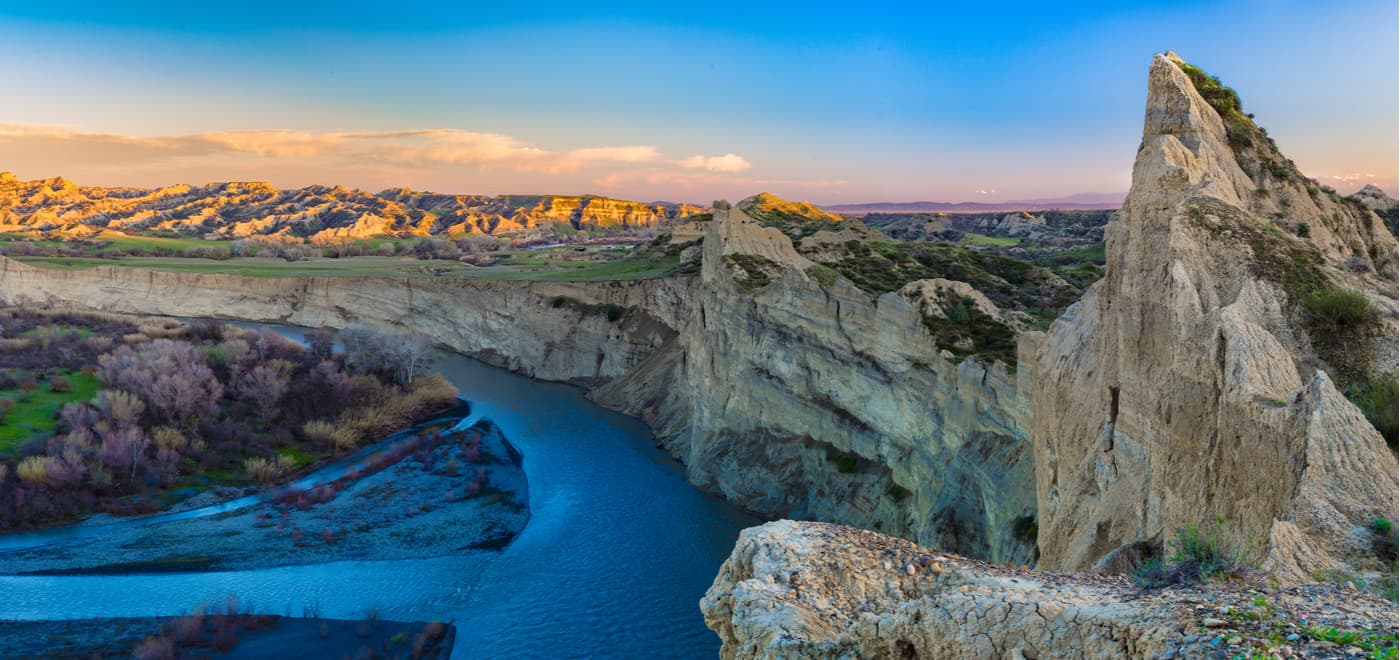
The Alesilebi (aka The Pointed Rocks) is the Vashlovani's signature card. When you get here, it is hard to understand what country you are in Mexico, Africa, or maybe even the lunar or primitive Earth landscape. The clay walls of these cliffs are rising high up to 59-70 m. They look as if chiselled by the wind which gives them quite bizarre unusual shapes. The stone massifs are huge, with steep slopes, ridges and chasms between them, you can see black vultures are soaring above them. These ridges are called Pantishira and Datviskhevi. They have old caves which used to be of great importance in old military actions, as these caves were perfect watch spots for the coming enemy troops in the old days. As a natural barrier, they contribute to the protection of the area as well.
There is a good observation deck hanging over an abyss. It is called Usakhelo or Nameless. From this place begins the difficult descent to the very bottom of the basin (about 8 kilometres) of Mizhnis Kure. In the case of high humidity, this road can become almost impassable even for the strongest SUVs. This fact should be taken into account before you embark on your journey down. Getting here, too, is not so easy either, make sure you have a good SUV and an experienced driver.
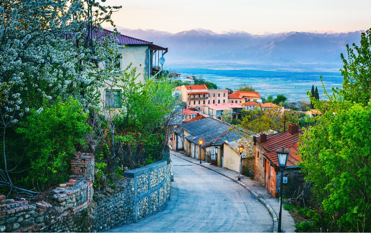
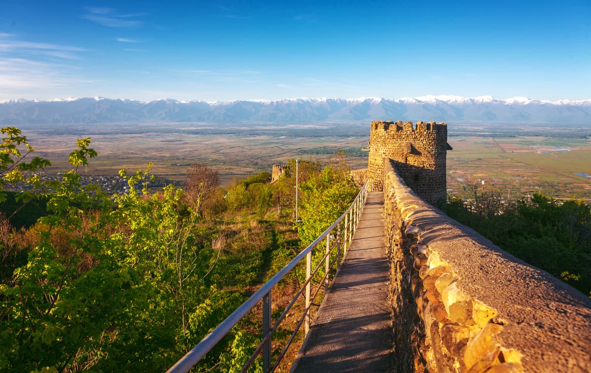
The fortress city of Hornabudzhi, also sometimes called the Fortress of Queen Tamara, is an ancient fortress in eastern Georgia. It is located about three kilometres north of the town of Dedoplis-Tskaro in the Kakhetia region. The ruined walls of the fortress rise on the majestic Tsiv-Gombori Range. It was probably erected originally at the end of the 1st millennium BC. At that time, it served as the only fortification controlling the valleys of the Iori and Alazani rivers. The name Hornabudzhi translates from the Persian language as a sunny mountain.
The ancient fortress changed many hands, it was ruled by some of the greatest rulers of different ages. The upper point of the fortress, which rises on the northern slope of the rock, offers stunning panoramic views of the eastern Kavkasioni and Alazani Valley.
The Tezbiteli Temple was erected on the limestone rock of St. Ilya (St. Elias) in the 6th century at an altitude of 45 meters. After the October Revolution (in 1917 in Russia, when the tzars were killed and the Soviets came to power) it was destroyed and restored to its former glory only almost 100 years later, at the beginning of the 21st century. From the top, one can see landscapes of the Shirak and Tariban valleys, Lake Kochebi, and the Kotsakhuri Range.
The ruins of the monastery on Black Mountain date back to the 4-5th centuries. You can see the Kavkasioni Range in clear weather from here. To date, almost nothing has preserved from it. Only the foundation and fragments of the floor have survived. It is 500 m from the highway to the ruins.
Hikers who go by themselves, not in an organized group, can choose one of the seven routes equipped with special markings. The administration of the park provides huts, bungalows, places for picnics and overnight stays in tents on campsites. Each trip starts and ends at the visitor centre.
During the warmer seasons, on the limestone cliffs, you can see an endemic white Kakhetian bell, this flower is really unpretentious to the conditions of growth. The gorge has observation sites for bird watching. You will have to walk up to the ruins of Hornabudzhi and Tezbiteli. The route is 7-8 km long and takes one day of leisurely walking.
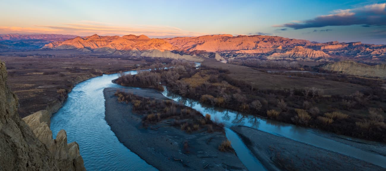
There is abundant relict vegetation of the Vashlovani Basin here. The narrow valley of Pantishira, also called the City of Swallows due to the huge concentration of swallow's nests, offers plenty of opportunities for birds of prey observation. There is the Bear Canyon (Datviskhevi) where you can see the petrified bones of dinosaurs and mammoths as well as traces of shells of sea molluscs which testify to the existence of an ancient sea on this territory. The route is 120 km long and providing you have a car, you will cover it in 1 day.
This is an area with about two dozen active volcanoes. It is divided into two zones – the one landscaped for tourists and the wild zone. The landscapes remind you of Mars, you will see the rampant bottom of the ancient ocean, cracked surface of mud layers, craters puffing and towering above the ground, dried up stream beds descending into the ravine. The area will not fail to fascinate and leave unforgettable impressions. The muds here have healing properties. The length of the route is 110 km, the duration is 1 day.
Visit the picturesque forest in the floodplain of the Alazani River where you can find giant elms, oaks, and ash trees. The way back lies through the villages of Kvemo-Kedi, Arkhiloskalo, and Zemo-Kedi. In April-May, all the area is covered with blooming peony fields. The length of the route is 150 km, the duration is 1 day.
The road runs through the valleys of Pantishira and Natlistskali, along the mountain ridge and up the forested slopes, gradually descending to the Alazan floodplain. On the way, there are many viewing platforms. The last stage is the Imeda Valley, the habitat of the Colchis pheasant. Walk here to the ruins of the old monastery. The route length is 220 km, the duration is 2 days.
The trip is designed for fishing enthusiasts. There are about 20 species of fish in the Alazani River including catfish, carp, barbel (Barbus), and Caucasian herring. It is allowed to fish with both fishing rods and nets. The maximum daily catch is 20 kg. The route length is 160 km and the duration is 2 days.
The route runs along the valley of Pantishira, through the rocky massifs of Alesilebi and captures different landscape zones of the Vashlovani. You can see a semi-desert and snow-capped mountain peaks at the same time. The route length is 200 km, the duration is 2 days.
Since the visits to the Vashlovani National Park require special registration and obtaining a permit, any visitor must check in the Administration Office located
5 Baratashvili Street, Dedoplistskaro. Georgia
Director of the Park: Merab Pirosmanishvili
email: mpirosmanishvili@apa.gov.ge
Facebook: VashlovaniProtected Areas
Follow S5 highway from Tbilisi to the east to get to Dedoplistskaro. The distance between the endpoints is 130km. Travel time is about 2 hours.
You can get to Dedoplistskaro from Tbilisi by public transport from Ortachala bus station or Isani metro station. The minibuses leave several times a day at an interval of about 60 minutes. You can check the schedule at the location.
Alternatively, you can travel from Batumi. A bus ride will take about 8-9 hours.
The visitor centre of the Vashlovani park is located at 5, Baratashvili Street, Dedoplistskaro. Tourists must register and obtain the permit. This is solely for the safety of the guests of Georgia. The centre provides all the necessary information about the park. You can also find the latest updates on the Vashlovani National Park official website. You can stay at the hotels in Dedoplistskaro or in the Vashlovani Nature Park itself, the bungalows and camping sites are equipped along all routes. The park's trails are marked and well-maintained.
There are plenty of one-day and multi-day guided tours, options for hiking and biking, and for those wishing to ride in the park on horseback there is a special service that provides rental horses.
Driving in the protected areas of the Vashlovani park is possible only by off-roadsters or SUVs. The rest of the park allows for driving in ordinary cars, but it is not recommended to do so as it may be difficult to overcome the dirt roads, especially in the rain. When going on a trip, you should bring enough food and water. There are no shops or cafes in the park, and few springs are scattered over a huge area.
It should be taken into account that mobile communication in the Vashlovani is unstable. If you decline the offer of an accompanying guide, you will be left to your own devices. During a trip or a hike, you should definitely take first aid toolkit.