
Scan the QR code and open PeakVisor on your phone
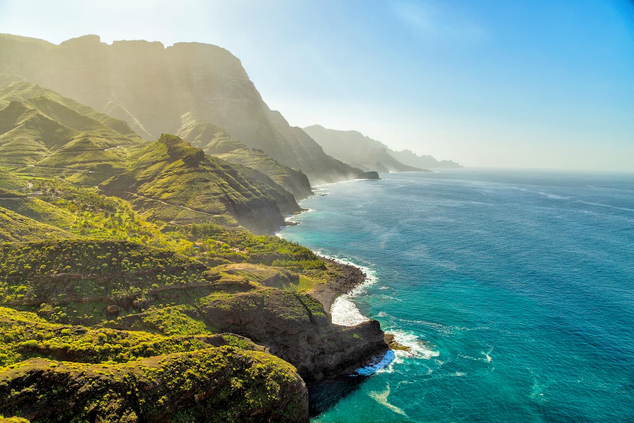
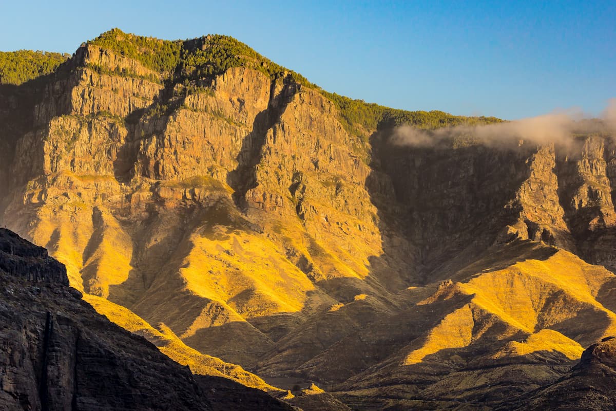
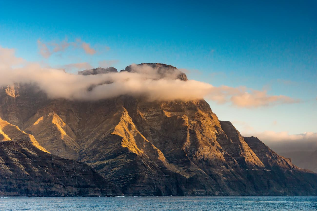
Tamadaba is a rock massif 1,444 m high located northwest on the island of Gran Canaria. The Natural Park appeared there in 1987, it is just a 90-minute drive or 60 km from the capital, Las Palmas de Gran Canaria. The Tamadaba Natural Park is one of the territories least altered by human hands on the island of Gran Canaria. This Unesco Biosphere Reserve covers 7,500 hectares from the summit to the coast at the western end of the island. Visitors can choose between the fabulous natural Canarian pine forests of the summits, the vertiginous cliffs of its almost inaccessible coast and the rich biodiversity of its ravines. Almost all of this area has quite fragile environmental systems. There is a special zone of protection for birds. This Park, located in the municipalities of Agaete, Artenara and San Nicolás, is adjacent to the Nublo Rural Park.
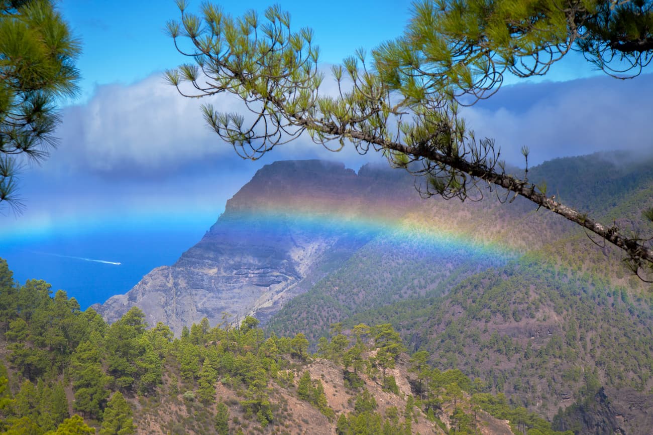
This massif is composed at its base by stacks of basaltic rocks from the first stage of formation of the island shield 14 million years ago. These rocks were overlapped with tuffs and photolytic, rhyolitic and trachytic flows that are hundreds of meters thick. It is interesting to see how all these layers get exposed on cliffs of more than a thousand meters above the sea. It is possible to see this wonder due to old giant landslides and the marine erosive effects happening over millions of years.
This area has great beauty given the existence of natural elements of notable geomorphological interest. You will see mind-boggling ravines, vast high plateaus and towering rock massifs.
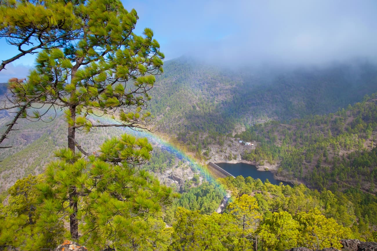
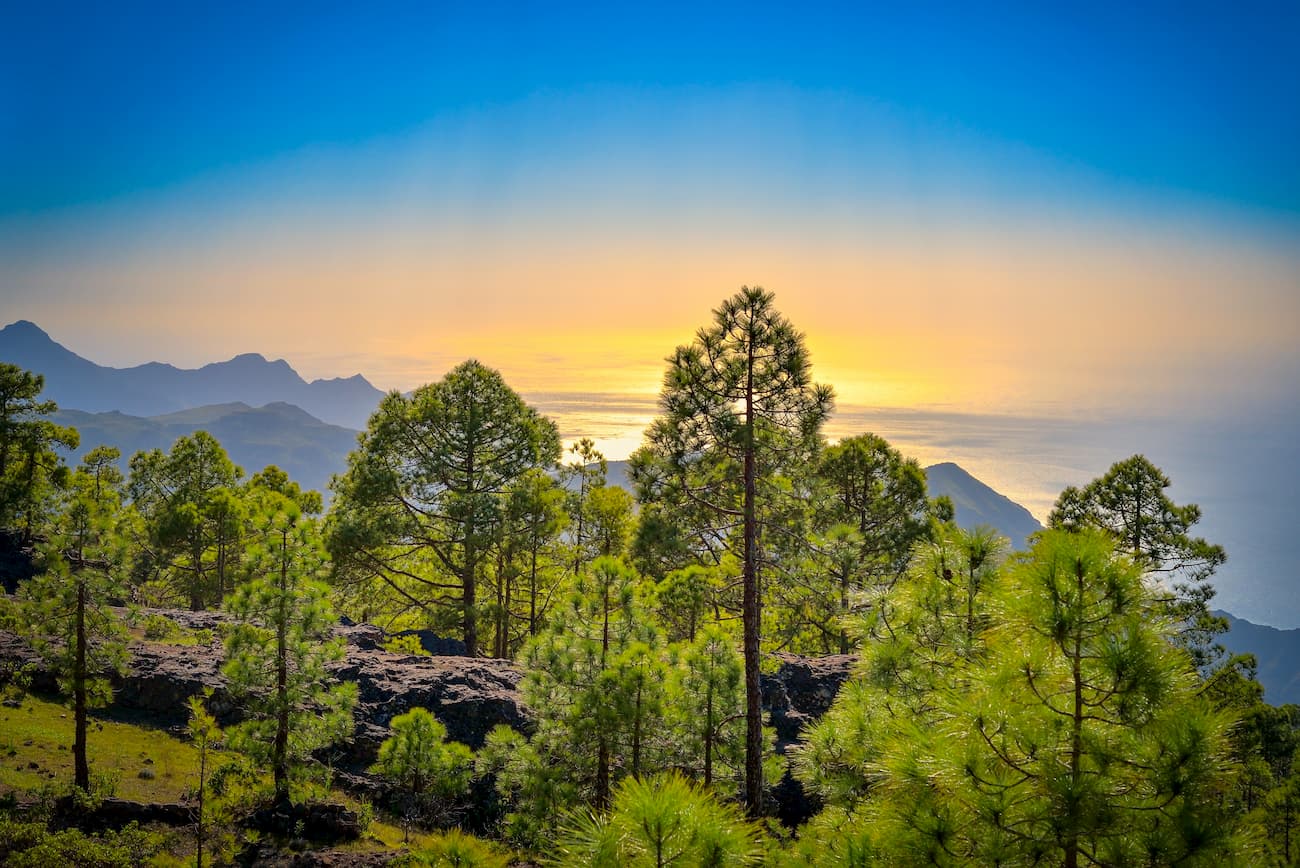
You will find one of the best-preserved natural pine forests on the island. It managed to survive due to notable effectiveness in hydrological systems, there are several artificial dams in its neighbourhood that ensure balanced precipitation and watering of vegetation. At the same time, there are other well-preserved biosystems, such as those of ravines, and the tabaibal-cardonal communities of low areas, in addition to the habitats of highlands.

Here live protected species and even some are exclusive to the place, this is especially seen in the Guayedra crags. In addition, certain endemic and protected bird species nest in the park's pine forests. From a cultural point of view, some isolated and semi-abandoned farmhouses stand out. The archaeological importance of areas such as El Risco and the Guayedra valley is of great importance as well.
These cliffs shelter numerous island endemisms, some of them in danger of extinction. The highest areas are covered by a mixed natural and regeneration pine forest, with areas of pine plantations and other foreign species, interspersed by heather and laurisilva relicts in the areas most exposed to the humid trade winds from the north. The vegetation is abundant, in addition to Canarian pine and heather we can find olivillos, escobones, yellow gorse, rockrose and thyme.
Due to the high altitude and open exposure, winter temperatures can be very cold, softening in summer, even thermal inversion can occur, reaching high values, exceeding 30ºC with the consequent threat of forest fire. Rainfall is important in winter, there come storms from the southwest, bringing over 1,000 mm rainfall per year. Please keep this in mind when planning your trip.
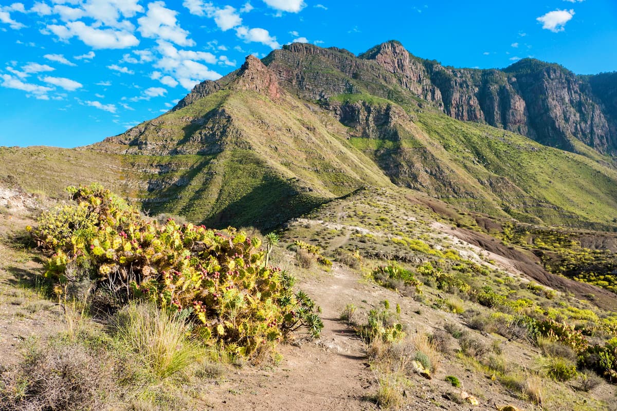
Visit the pine forest of Tamadaba. The Tamadaba Natural Park has an outstanding pine forest. The 2,000 hectares of the Tamadaba pine forest cover a large abrupt and rugged massif in the northwest of the island of Gran Canaria, with access from the towns of Agaete or Aldea de San Nicolás. Having been regenerated and repopulated in the 20th century, today it is one of the healthiest pine forests in the Canary Islands and a popular leisure destination in Gran Canaria.
The pines of Gran Canaria are of a peculiar species: the Canary pine, which is native to these islands. It is a tall, symmetrical tree, ashen green in colour and fire resistant. In its cool shade, we find fragrant plants and colourful flowers such as rockrose and wild thyme. In addition, their tops and trunks are home to numerous birds, such as the lively woodpeckers and the rare but charming blue finches of Gran Canaria.
Guayedra ravine and beach. Guayedra is a long ravine with a grove of Canarian palm trees that ends on a wild beach with black sand and callaos. This little frequented corner is only six kilometres from the town and the port of Agaete, in the northwest of Gran Canaria. The GC-200 road will take you directly to the ravine, 650 meters on the beach path.
From the splendid palm trees of its fine section to its surviving seedlings of the great forests of yesteryear, the flora of Guayedra is exceptional. Many endemic plants of Gran Canaria live here, such as the beautiful daisy of Guayedra. A circular path that connects with Agaete allows you to enjoy all this beauty.
Declared Natural Site for its valuable testimonies both geological, natural and landscape, this ravine has great importance, since it was the place chosen by Fernando Guanarteme, aboriginal king, to exile after his cooperation as a mediator between the Castilians and aborigines in the conquest of Gran Canaria. After the visit, you can enjoy and swim on the Guayedra beach, but please be careful with the current and the waves, which are very strong in this area. It can only be accessed by ATV and on foot.
This park is most well-known for his climbing opportunities, but it has a wide network of hiking trails, from the very simple ones where there is hardly any difference in elevation, to a low-medium level and the more advanced ones that descend its cliffs and slopes until reaching some sea level. Many of the trails are signposted.

We can make circuits through the pine forest or go down to the Agaete valley, the Dams of Lugarejos, El Hornillo, Tirma, Risco Faneque, continue to Artenara or reach La Aldea.
Some routes you can find in the park:
In the very heart of the Tamadaba Natural Park, you can find the main sport climbing area on the island. It is an ultimate heaven for climbing. Sprinkled generously in the ravines and forests there are around 400 routes with an abundance of medium levels and a maximum height of 40 meters that go up steep cliffs.
Basically, Tamadaba’s climb an elegant one but it requires strength and power in the fingers and to block. This is due to the prevailing grey basalt at every sector that is characteristic for little grasps and edges at many of them. Because of this reason, it is necessary to be strong and have good technique.

The park has a multitude of areas spread over different platforms and difficulty for all tastes, at this point it is interesting to explain that what we would call base camp, Los Llanos de la Mimbre, is reached from above by the road that connects El Pinar with the municipality of Artenara and that the different climbing areas are distributed on different levels descending the cliffs. It is a bit complicated if one does not know which area to access by which sectors. For those who want more information, contact the locals or buy one of the two climbing guides in the area available in different mountain shops on the island. Same if you want to practice canyoning, it is advisable to contact the locals or consult the available canyon guide.
All the routes offer good equipment, and despite the predominance of medium and high level routes, some can also be done by those people who have low level of climbing experience since excellent itineraries are constantly being created in sectors somewhat further away. It can be climbed all year round, except some limited sections in winter. In addition, there is an area where camping is allowed, once permission has been requested from the Cabildo de Gran Canaria Environment Area.
Camping area in Llanos de la Mimbre. One of the favourite nature activities of the residents of Gran Canaria is to meet in the shade of the pine forests of the Tamadaba Natural Park. Perhaps for this reason, one of the most complete and extensive camping and barbecue areas on the island is located in this pine forest located on the summits of the northwest of the island. With space for 400 people in huts or motorhomes, the Llanos de La Mimbre are an ideal point from which to explore this natural park.
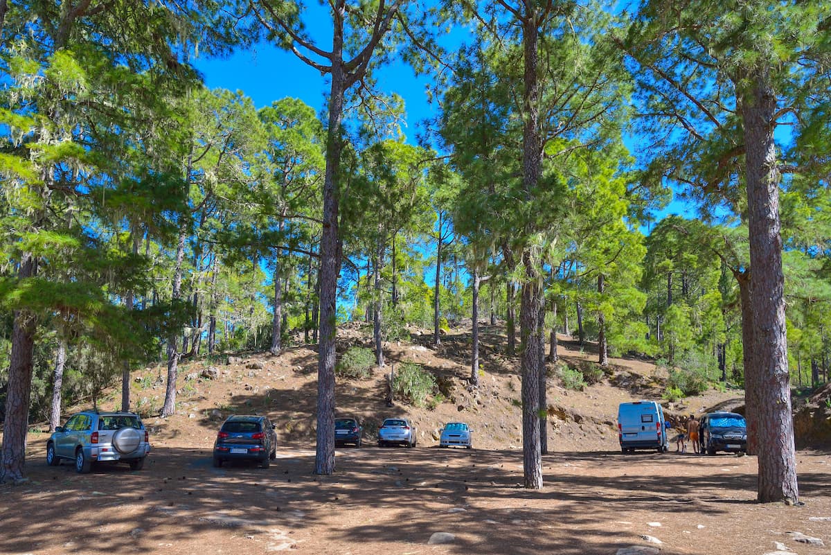
This camping and recreational area is located at the heart of the Tamadaba pine forest, next to GC-216 road which surrounds the La Bandera peak. Several interesting trails leave from the vicinity of the enclosure such as the one that goes up to the peak of La Bandera itself, or the classic 20-kilometer route of San Pedro, which offers impressive views of the coastal town of Agaete from above. You must reserve a place to stay overnight in the Llanos de la Mimbre.
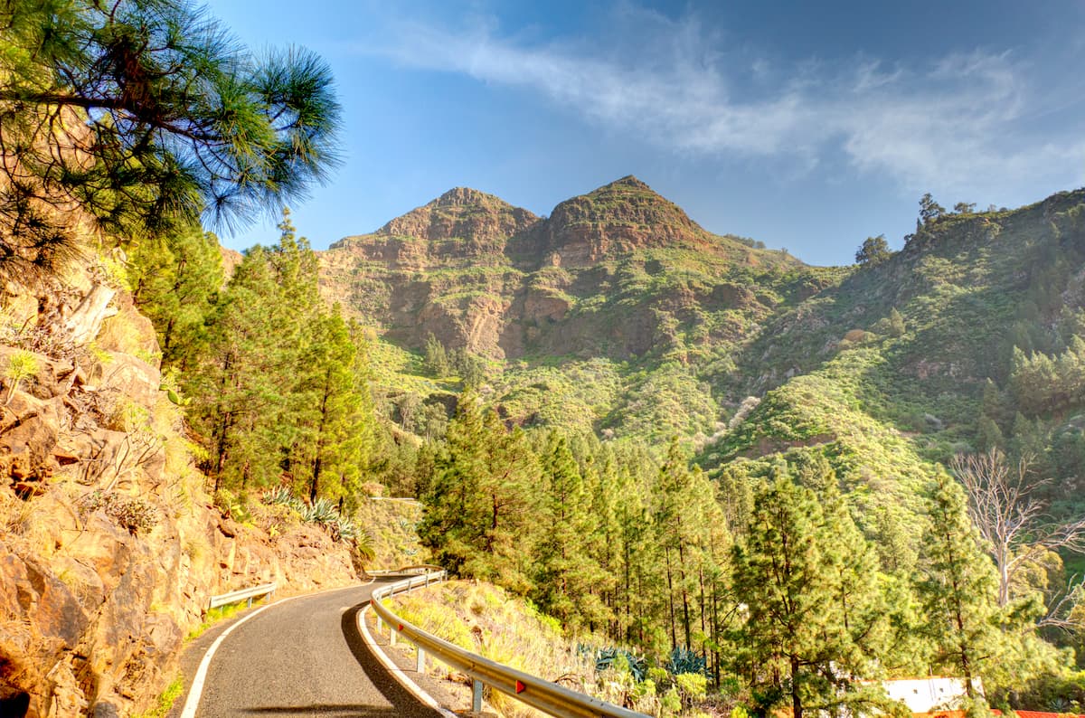
By car: When driving from inland, take GC-210 to the left side of Artenara. Get off and drive through GC-216, a one-way road which would take visitors around the middle and into the main viewing camp at the highlands of the majestic reserve.
If driving from the northern village of Agaete, take the winding mountainous road down GC-200 passing through Barranco Guayedra. It would directly lead to Mirador del Balcon. The breeze from the west coast and the beautiful hamlets and lush green ridges make every second of the drive enjoyable.
If you come from the south in La Aldea de San Nicolas, you can either drive up through GC-200 to the west for the cliff and ocean view or go through GC-210, then to GC-216 to the east, for more of the ravines and pine forest views.
By Bus: From the bus station at Las Palmas, take Bus No. 102 which would go through Platform 3, at Galdar, and then at Agaete. The buses leave every hour to take passengers to Valle Agaete. Once in the village, the stop at El Lomo is where hikers could start following the Camino trail to Tamadaba.
Located in the northwest of the island, Agaete preserves a traditional aspect and offers harmony and the beauty of a historic urban complex of white houses that sit on the slopes of its ravines. Enjoy the astounding views of the large houses with patios from the 19th century and the church of La Conception. A walk through the Flower Garden completes the visit.
Before leaving the town, you must go to one of the most interesting archaeological sites in Gran Canaria: the Maipés necropolis. You cannot leave Agaete without going down to the charming fishing village of Puerto de las Nieves. The image of its white and blue houses at the foot of a pebble beach will surprise you. This is probably the most popular place on the island to savour fresh fish right by the sea.

Artenara is the highest town in Gran Canaria. Surrounded by a rather rugged terrain that the writer Miguel de Unamuno called "petrified storm", it is an immense natural balcony that overlooks the World Biosphere Reserve of Gran Canaria. From Artenara, you have an unbeatable view of two famous symbols of Gran Canaria: the Roque Nublo and the Roque Bentayga, a spiritual centre for the aborigines. It is a summit town, really quiet, and where you can take a break from the most bustling areas of the coast.

Artenara invites you to explore it and delve into the lush nature of the Pinar de Tamadaba Natural Park. If you’re curious, you will be able to feel how they lived until not many decades ago in the typical cave houses of the area, many of them have been recently converted into rural accommodation. Or you can travel to the pre-European past in the Acusa archaeological site. In its architecture, its small houses stand out, sober and functional, without great artifacts but with the mixture of styles that the European conquerors contributed.
The town of La Aldea de San Nicolás is located west of the island. It is the least accessible area of Gran Canaria due to the distance from the rest of the island and the orography of the area. That is, the road has quite a few curves. It is true that the road from the north has recently been improved and now it’s faster to get there (about 1 hour by car from the capital and the same from Maspalomas.) That is why if you decide to visit this small town, we guarantee that you will teleport to an authentic haven of peace. In addition, in La Aldea de San Nicolás you can feel like a local Canary resident and discover that the town still retains its essence. Therefore, you will have no choice but to try the local food and take a bath on its uncrowded beaches.


