
Scan the QR code and open PeakVisor on your phone
Monumento Natural del Roque Nublo has 4 named peaks. The highest is Roque Nublo at 1,813 m. Other notable peaks include La Rana, El Fraile and Montaña del Aserrador.
Welcome to the Nublo Rural Park, one of the largest and most populated protected areas in the Canary Islands. It covers 26,307.4 hectares and it spreads over the municipalities of Artenara, Tejeda, San Nicolás, Mogán, San Bartolomé, San Mateo, Valleseco, and Moya.
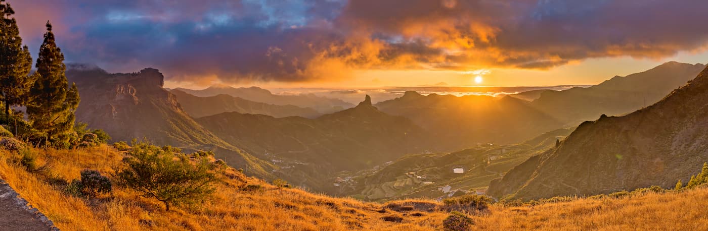
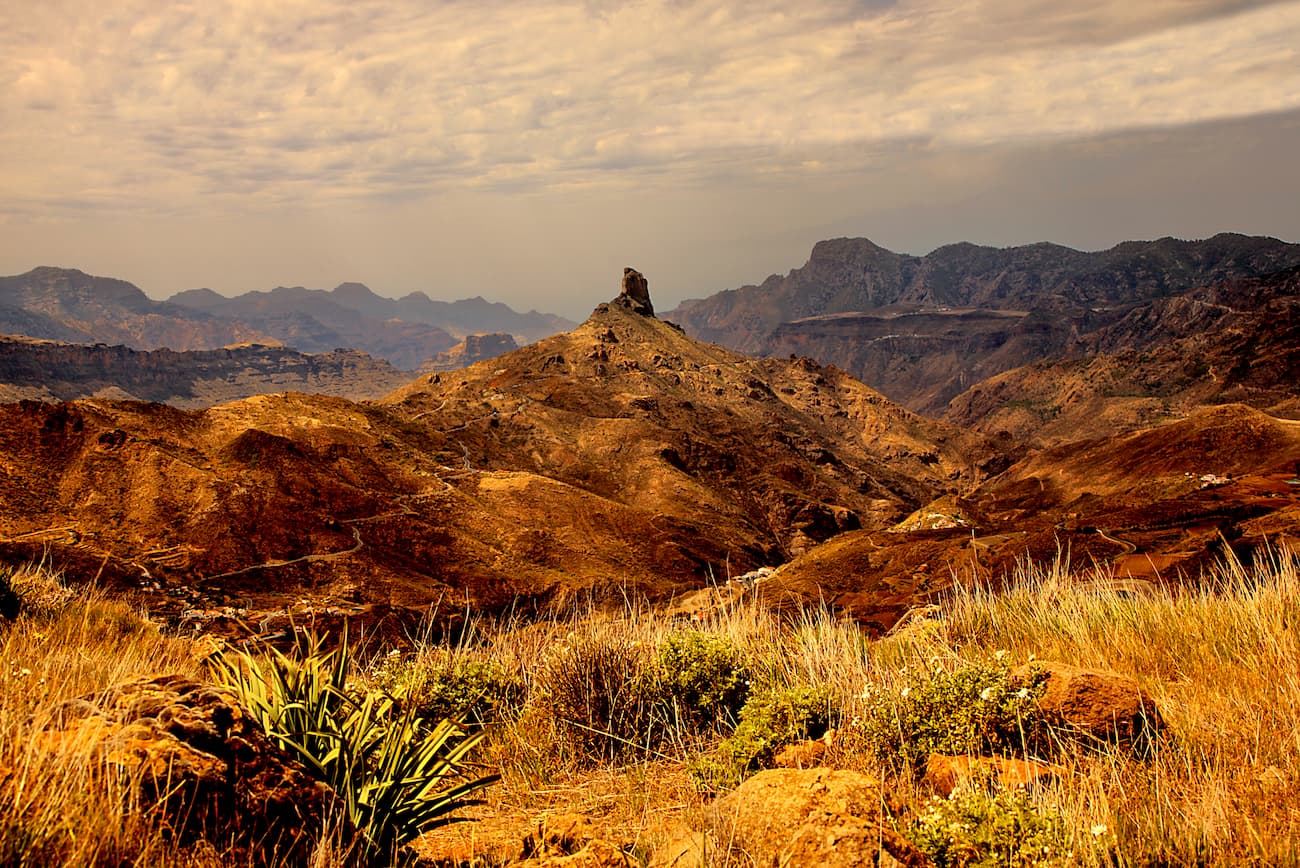
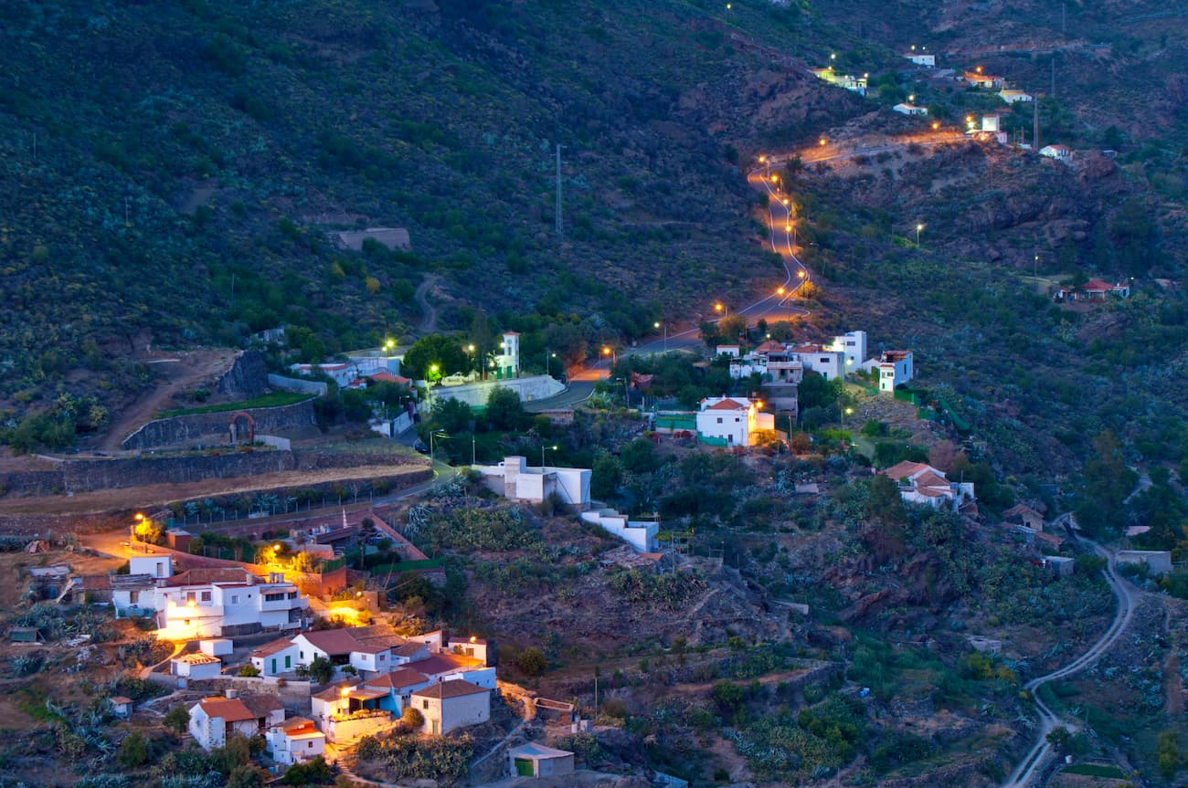
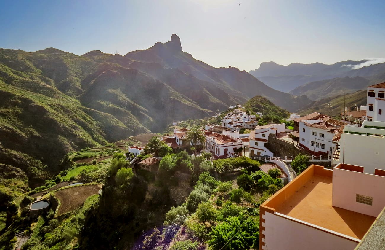
Being located in the western centre of the island, the Nublo is home to almost thirty urban settlements, and it comprises three well-defined units: The Caldera de Tejeda, the Sándara mountain and the southwest ravines with the Roque Nublo Natural Monument, the second highest peak on the island, standing out. Overall, the Nublo is one of the most emblematic areas of the island.
The landscape here is rugged and offers spectacular views. Three sectors have been considered points of geological interest, as in the case of the Caldera de Tejeda or Ayacata that has a pink matrix dotted with white crystals and conical dykes in the centre of the caldera.
This area has been intensively used since it's inhabited by 4,410 residents in various settlements who practice raising traditional livestock and agriculture. Despite this, it's in an excellent state of conservation and preserves natural habitats in good condition.
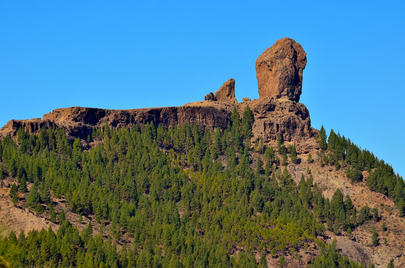
As mentioned before, within this Rural Park we can find the Roque Nublo Natural Monument which is one of the most mind-blowing natural spaces on the island. It's located in the geographic centre of the island, in a very steep area in the municipality of Tejeda. Being of volcanic origin, the rock rises 80 meters above its base and 1,813 meters above sea level. The Roque Nublo is actually one of the largest rocks in the world and it was used as an aboriginal place of worship in ancient times. By the way, when you climb this mighty rock, pay attention to the small quirky rock in the shape of a frog next to the Roque itself.
This park was declared a Natural Area on June 19, 1987 and on December 19, 1994 it was declared a Rural Park, thus entering the list of Natural Areas of the Canary Islands. The park sector that delimits the Inagua integral nature reserve is considered an area of ecological importance.
The justification for the National Park proposal was given essentially for two reasons: the beauty of its landscapes, its geomorphological formations and its high endemic biodiversity. Speaking of the latter, here live the tabaibal-cardonal communities, characteristic formations of the lower areas of the Canary Islands, it is a type of vegetation representative of the national territory not yet present in any other highland national park such as the Nublo.
In addition to these two basic criteria, the Park proposal aims to provide enclaves of other plant formations such as thermophilic forests, dry southern pine forests and the humid ones of Tamadaba, as well as providing high-value landscape enclaves and areas without people living nearby or intensive farming.
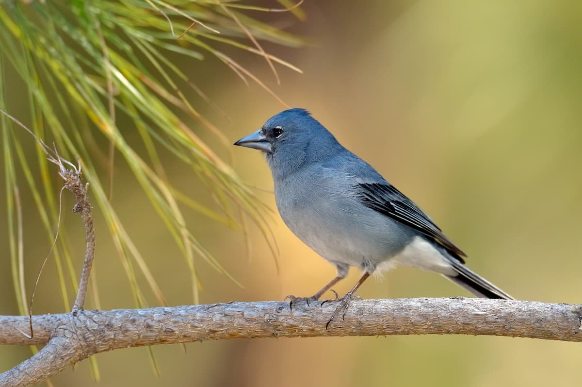
The flora of the Canary Islands is a fantastic anomaly worldwide, preserved thanks to the geographic isolation and the protection of its territory. Within this park, we can find 308 types of plants and fungi, 51 of them only live naturally in the Canary Islands, and one is only found in this park. In addition, its orography, which extends from summit to the coast, is home to a huge variety of habitats.
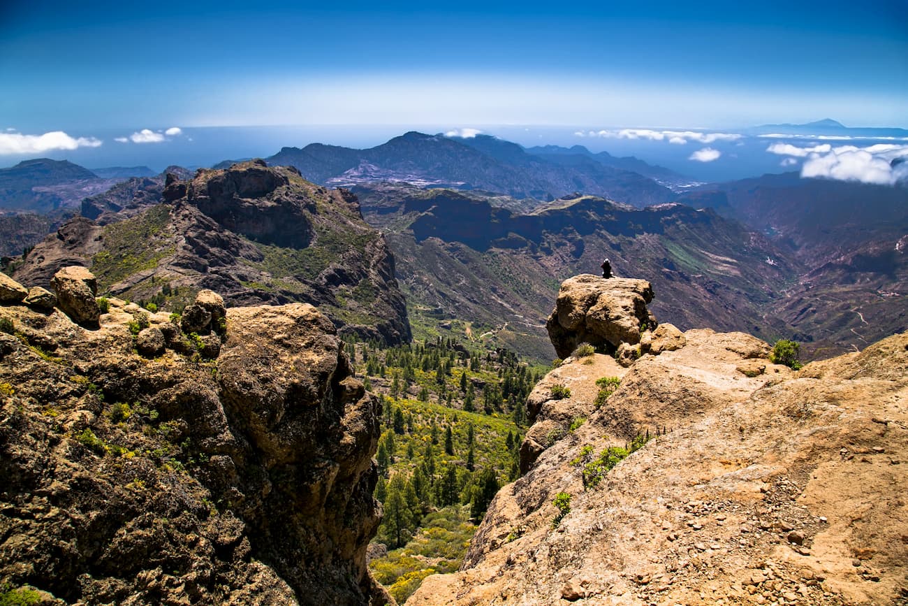
Near Pico de las Nieves (1,949 m), the highest point in the park and on the island, we find Canarian pine forests with a refreshing shade. Going down the ravines, you will see willow trees in the riverbed and tapestries of plants clinging to the rock on the cliffs. We can also spot some specimens of native seedlings and palm trees. And further down, in the warmer area of the park, you will find yourself surrounded by thickets of desert plants such as tabaibas and cardones. In short, this is indeed a miniature botanical continent.
Let’s review the reasons why the Nublo Rural Park has been declared a protected area:
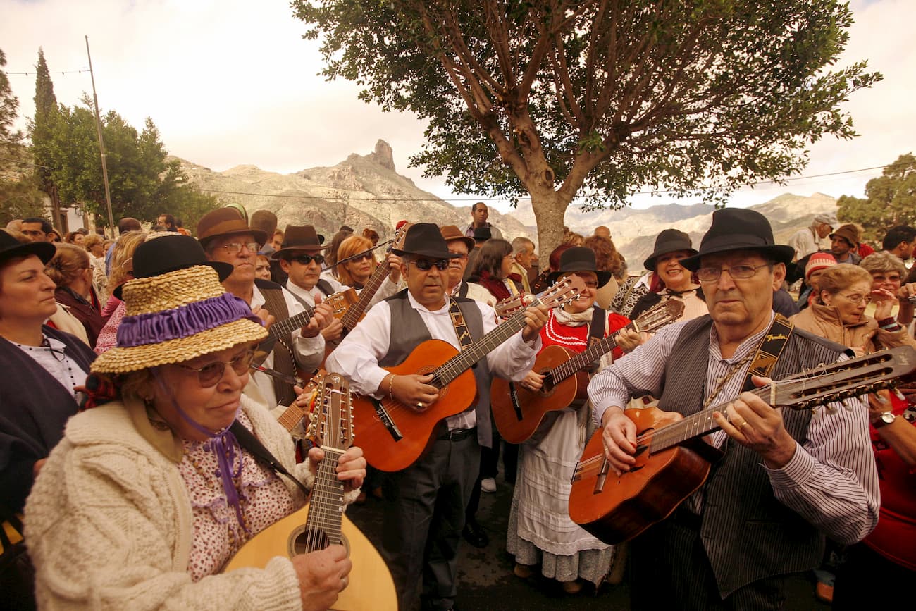
The Park is also home to a wide spectrum of cultural, archaeological, ethnographic and artistic resources, which includes museums, religious and civil architecture, folklore and gastronomy, among others.
Archaeology: The following complexes are found within the Park area: Chira complex, Riscos de Chapín complex, Nublo-Chirimique complex, Sierra del Bentayga complex, Mesa del Junquillo complex, Andén de Tasarte-Toscón complex, Barranco de Tajuy, Artenara complex, Mesa de Acusa complex, San Nicolás complex, Tocodomán complex, Tasartico complex, Tasarte complex, Inagua complex and deposits in the municipality of Mogán.
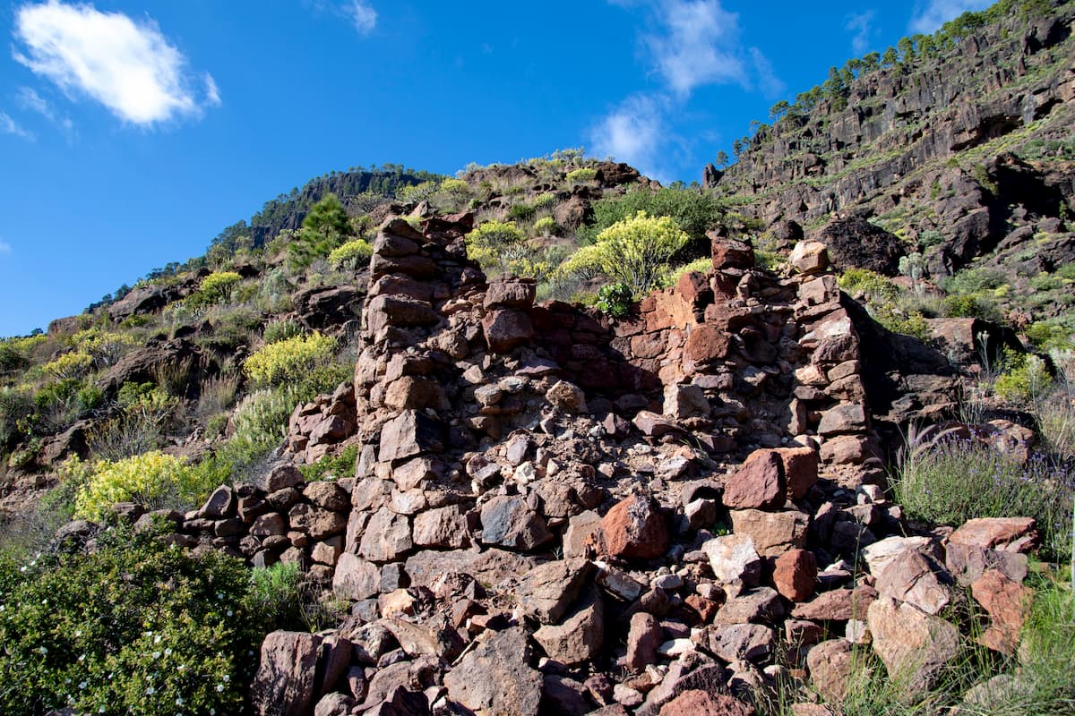
Assets of Cultural Interest: All of the assets of cultural Interest in the Park are archaeological in nature, located mainly in the municipality of Mogán, except for the one located in the Sierra del Bentayga (Tejeda). These are: Castillete de Tabaibales, Cogolla de Veneguera, Cuevas del Caserón, Lomo de las Camellitas, Los Panasocos (Lomo de las Ventosillas, Lomo de los Tabaibales, Lomo del Castillete), Montaña de los Secos, Roque Bentayga (Cuevas del Rey, Roque Narices.)
Historical-Artistic: The Tejeda Museum, the Tejeda Parador, the Church of Nuestra Señora del Socorro and the Sanctuary of the Virgen de la Cuevita.
Ethnography: The ethnographic heritage includes both movable and immovable property and cultural manifestations of the folklore traditions. Among the former, the most important are Las Eras, the traditional water catchment works, conduction and storage of water, the mills that are part of the cereal heritage of this space, the charcoal pits, the ovens and artisan products.
Roque Bentayga visitor centre:
The Roque Bentayga Visitor Centre is the best place to plan and begin a visit to the Parque Rural del Nublo. The staff of this modern museum can recommend the best options to enjoy the largest natural area in Gran Canaria. In addition, its modern and elegant facilities reveal the interesting natural and human history that surrounds the Roque Bentayga, a rock supported by an almost pyramidal mountain and considered sacred by the ancient Canaries.
The visitor centre is located on GC-671 road, near the town of Tejeda, in the centre of the island. After parking, the visitor can enjoy the viewpoint of the centre and its impressive view of the Caldera de Tejeda and Roque Nublo. Once inside, we can enjoy a very interesting circuit of exhibitions, panels and an eight-minute video with general information about the area. When leaving, a short path ascends towards the Roque Bentayga and passes through the almogarén, a sacred place of reunion where the ancient canaries used to celebrate their religious rites.
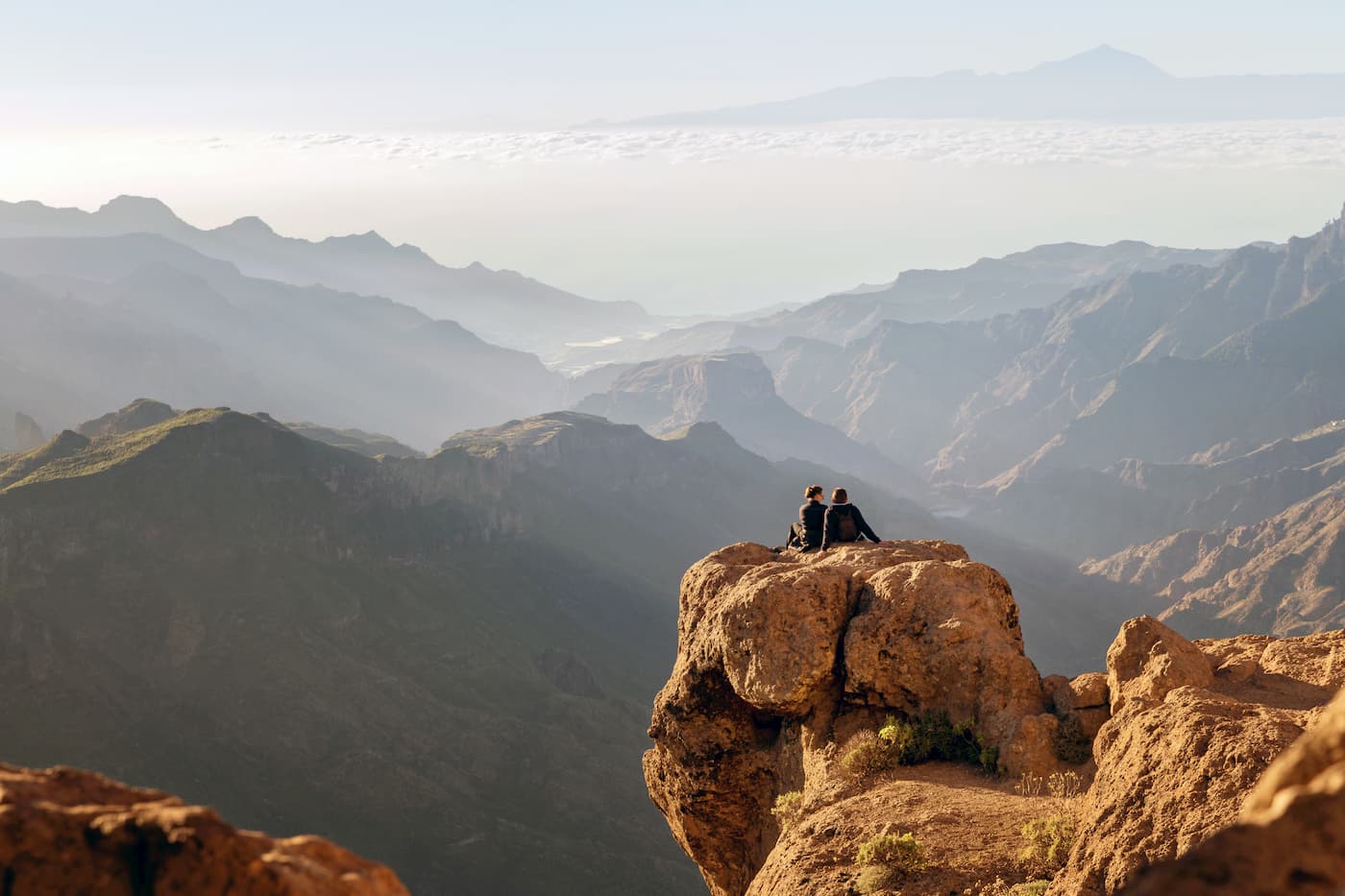
Roque Nublo is a prismatic monolith of volcanic origin of about 80 meters high, created naturally by erosion of the surrounding material and located on the roof and centre of the island of Gran Canaria. The Neolithic tribes that inhabited the island more than 500 years ago considered the mountain that supports this mace-shaped rock a sacred place. For the current residents of the island, it's an emblem of Gran Canaria and a nook where you can see gorgeous romantic sunsets over the wooded and cool peaks of the island.
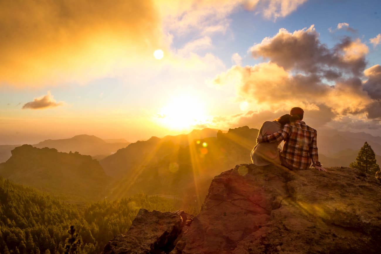
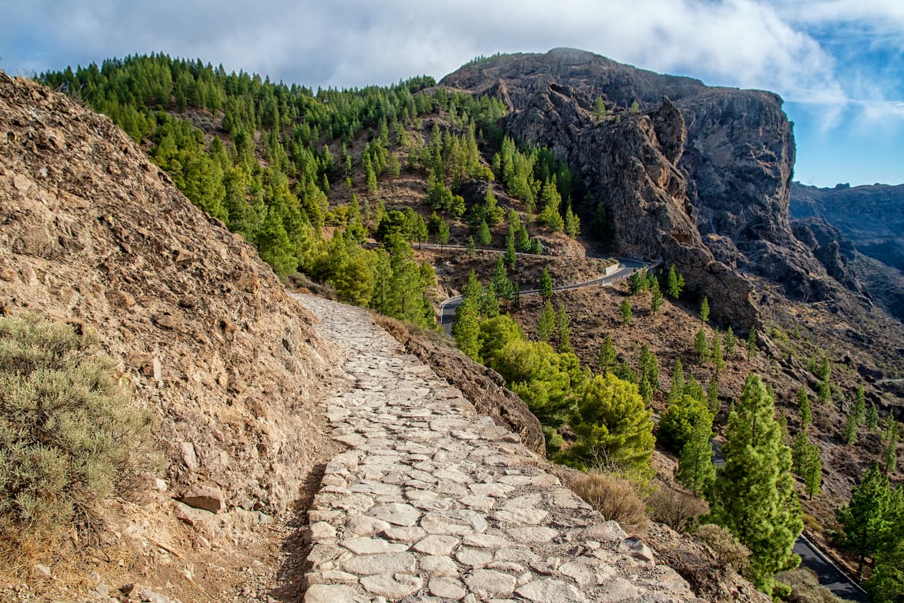
It can be accessed by a short but steep path at the base of the Roque, at an altitude of 1,750 meters, that starts from GC-600 road and connects El Nublo with its two small satellite rocks with whimsical shapes: El Fraile and La Rana. The ascent in the afternoon ensures excellent sunsets over the sea of clouds, with Tenerife and the Atlantic Ocean in the background.
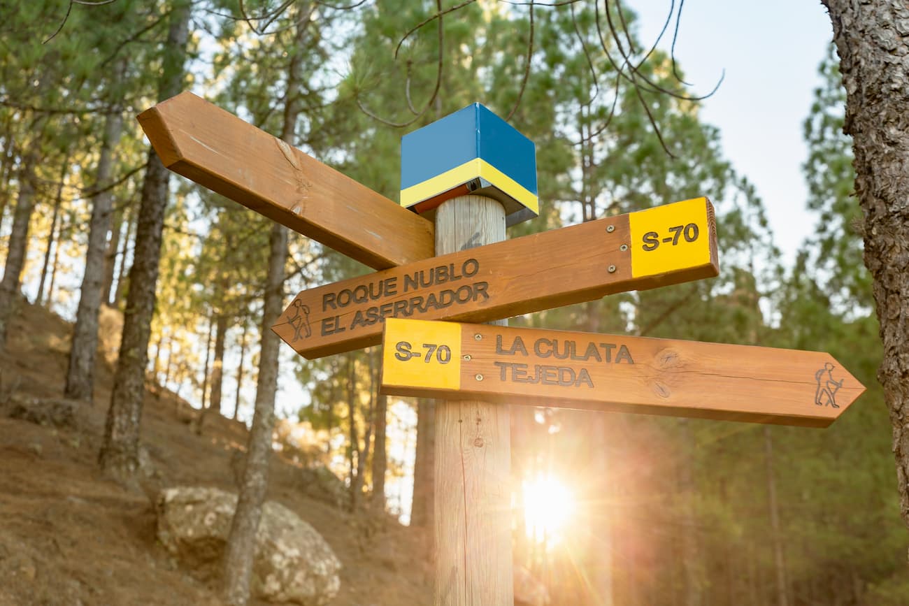
The 26,000 hectares of the Parque Rural del Nublo in Gran Canaria, are crossed by trails of all lengths, angles and difficulties. The star of all of them is the ascent to Roque Nublo itself. However, other important milestones can be reached at the stroke of a boot, such as the highest point of the island, the peak of Las Nieves ( 1,949 m) located 3.7 kilometres from the excellent camping area of Los Llanos de la Pez, in the mountainous centre of the island.
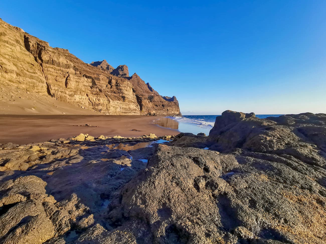
Another popular trail, but of moderate difficulty and length (12 kilometres a round trip), is the one that starts from the little town of Tasartico, descends between bushes of lush tabaibas and cardones and reaches the virgin beach of the Güigüí, on the west coast of the island. Another path of similar length joins the peaks of the Cruz de Tejeda and the Cruz de María by the edge of a mountain range that separates north and south slopes, and where the trade winds usually blow, dragging the clouds at the height of the walker.
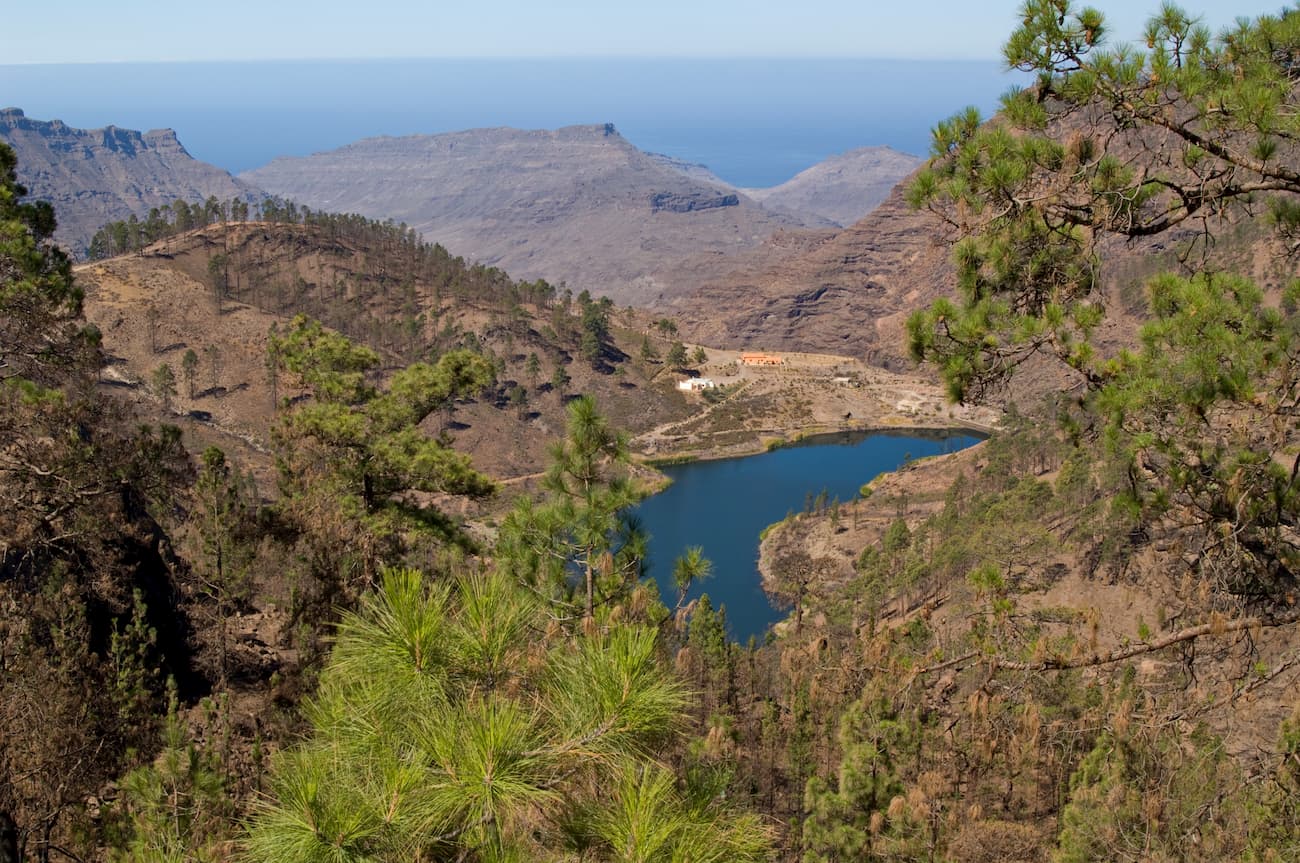
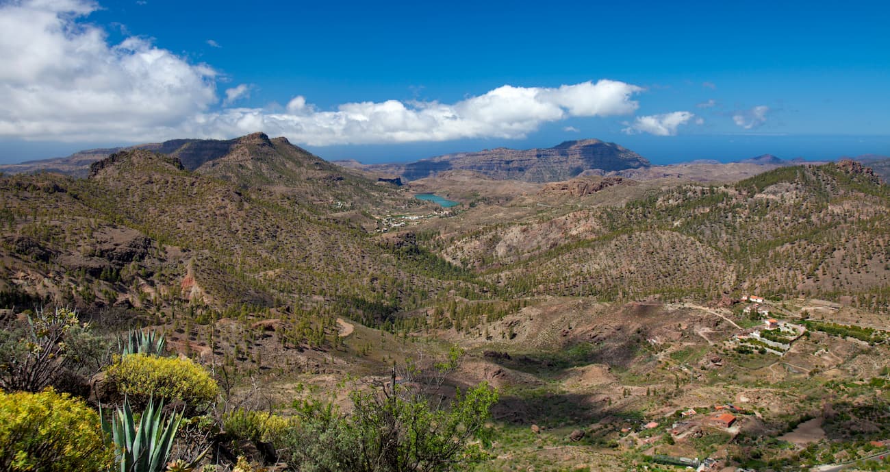
It could be said that Gran Canaria is an island of reservoirs and that some of the best landscapes on the island are associated with the artificial lakes. Hence, one of the most popular visits within the Parque Rural del Nublo is a walking route that passes through three of the largest dams on the island, overcoming impressive ravines and groves of palm and pine trees that present to the visitor landscapes typical of the best nature calendar.
This 15-kilometer, low-difficulty circular route passes through the Chira, Soria and Cueva de las Chicas dams, two of which are included in the Nublo Rural Park at the headwaters of individual ravines in the south of the island. The starting point is Chira's own retaining wall and one of the most beautiful stops is the Caidero de Soria waterfall. The excursion should be postponed if it has rained heavily the previous weeks or if the weather forecast announces precipitation.
Roque Nublo is one of the most recommended and oldest climbing areas in Gran Canaria. This is where it all began and where sport climbers and mountaineers tested their strength long ago.
Roque Nublo is easily accessible and offers more than 10 different routes with different degrees of difficulty for the ascent. Beginning and advanced climbers alike will find a suitable trail on this mountain. Even free climbers can let off steam in the heights. Climbers of all levels are rewarded with a sporting adventure in Gran Canaria and a fantastic view of the surroundings (Teide included). As Roque Nublo is located in the center of the island, the view from the flank of the summit reaches far beyond the great island landscape formed by volcanoes.
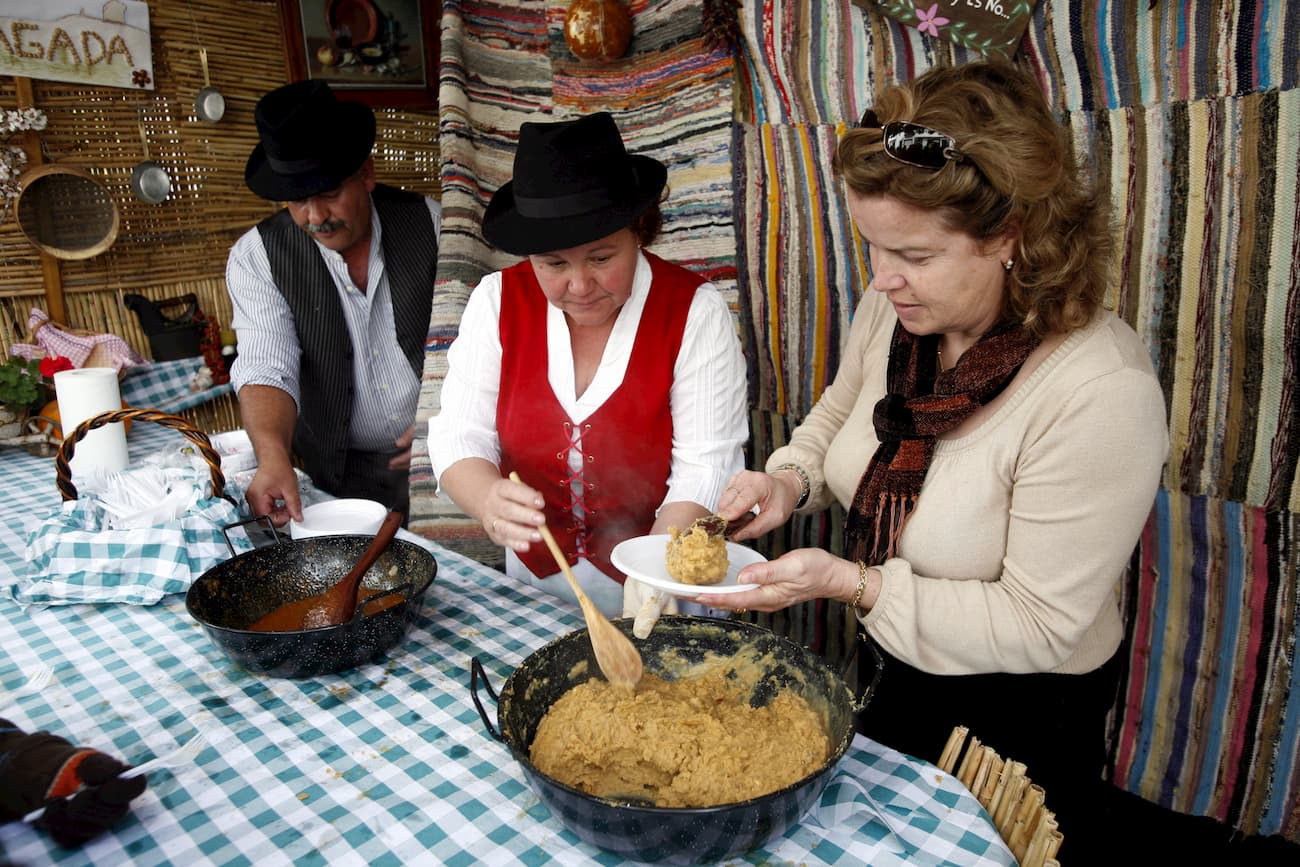
The few settlements of the Parque Rural del Nublo in Gran Canaria, still treasure fascinating traditions and provide delicious products. The first stop on a route of traditions is the town of Tejeda in the centre of the island where local almonds are used in its famous marzipan and bienmesabe. In its Centre of Medicinal Plants, you can learn ancient health tricks and in its daily market, buy sweets and seasonal fruits.
The next stop is the western town of Artenara, where they make fantastic stew with millet and local potatoes, and where one of the last transhumant sheep herds produces milk for excellent cheese.
In two towns near Artenara, unique trades survive: in the cave houses of Acusa,
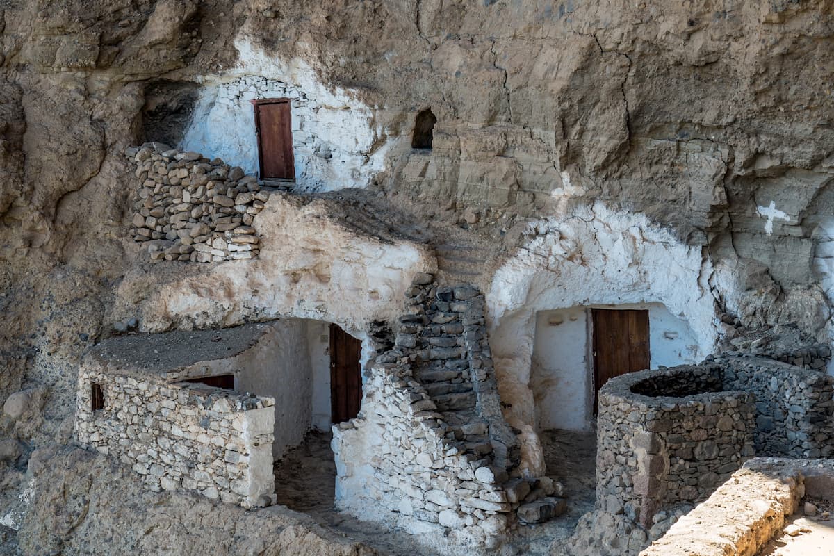
brooms are made with palm leaves and in the Locero de Lugarejos Centre pottery is made in the pre-Hispanic style: without a wheel and without an oven.
Los Llanos de la Pez: It is one of the most emblematic and traditional recreational and camping areas on the island since it was created in the 1970s. It is located on a plain at 1600 m. a.s.l. in the centre of the island and about 38 km from the capital (1-hour trip within the Nublo Rural Park)
It is surrounded by a repopulated pine forest. The project began in the 1950s and has grown so dense today that it requires selective felling and thinning to favour the development of the most vigorous specimens.
Both the camping area and the recreational area are part of a crossroads and trails of the island network, which can connect us with emblematic places such as Roque Nublo, Ayacata, La Culata, Cruz de Tejeda, Pico de las Nieves, San Mateo and San Bartolomé de Tirajana.
Due to the high altitude, the temperatures are extreme, cold in winter and even snowing on occasions, and in summer thermal inversion can take place, exceeding 30ºC, with the consequent danger of fire. The thermal oscillation between day and night is also very noticeable and can vary by more than 20ºC. Rainfall is important in winter, especially if the storms come from southwest. Precipitation can reach values of more than 1,000 mm per year. As the park lies downwind, it is sheltered from the trade winds, although sometimes the sea of clouds exceeds the relief, producing abundant fog.
By car: The main access road to Roque Nublo and the park is GC-60 which passes through Tejeda and leads to other places such as San Bartolomé de Tirajana or Las Palmas de Gran Canaria, connecting in this case with other successive roads.
Also, from Las Palmas towards Tejeda, take GC-150 road towards Roque Nublo.
By bus: To get to Roque Nublo by bus from Las Palmas, you can take line 303 in the Parque de las Ranas that will take you to La Vega de San Mateo. From the central station, you can take line 305 that will leave you in La Culata where you’ll need to walk to the starting point of the trail that will take you to the foothills of the volcanic rock colossus.
From the south, take line 18 that goes from Maspalomas to Ayacata in a journey of just over an hour to later walk to the starting point of the trail called La Degollada de La Goleta.


The highest peak in Monumento Natural del Roque Nublo is Roque Nublo, at 1,813 m.
Notable peaks in Monumento Natural del Roque Nublo include Roque Nublo, La Rana, El Fraile and Montaña del Aserrador.


