Scan the QR code and open PeakVisor on your phone
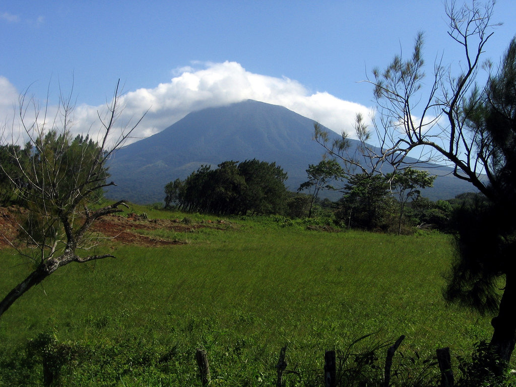
Located in the northwestern region of Costa Rica lies the Rincón de la Vieja Volcano National Park. The park spans 55 square miles and was established back in 2015. The geography of the park is centered around numerous volcanoes including Rincon de la Vieja, Santa Maria volcanoes, and Cerro Von Seebach. There are 5 named mountains in Rincón de la Vieja Volcano National Park. The highest and the most prominent mountain is Volcán Santa María that stands at 6,214 feet with 4,360 feet of prominence.
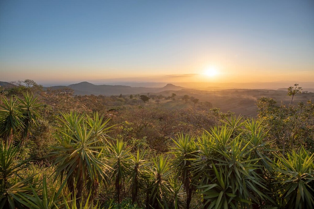
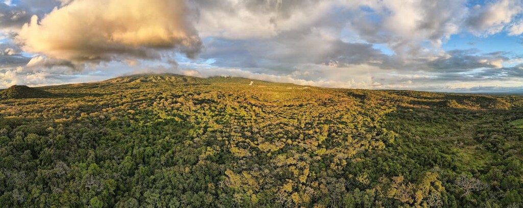
The park is characterized by its rolling grassy hills and vibrant flowers intermixes with lush cloud forests. The Pacific Ocean can be seen to the west from the higher elevations in the park as well as the Guanacaste Province. Despite not having lush forests across the entire park, Rincón de la Vieja Volcano National Park is home to a variety of wildlife. Within the park lie over 300 species of birds along with monkeys, jaguar, kinkajous, coati, agouti, and armadillo. Emerald toucanets inhabit the forest full of orchids, laurel trees, and Guanacaste trees.
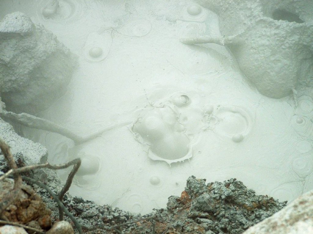
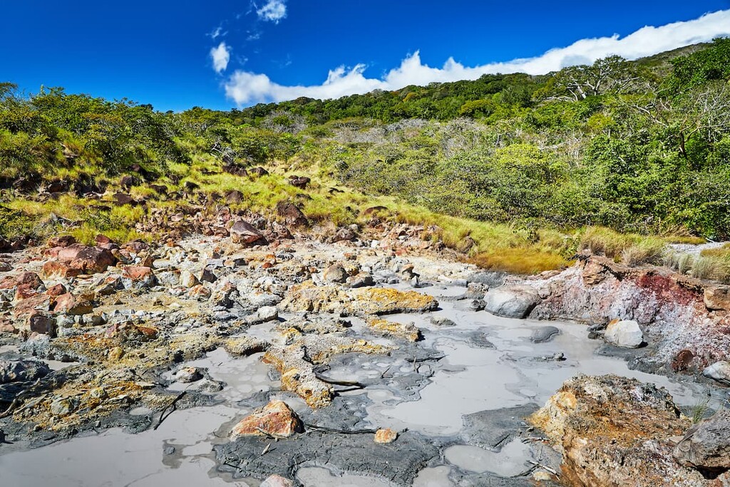
The Rincón de la Vieja Volcano National Park is known for its hot springs, streams, waterfalls, and even its boiling mud pits. The eastern side of the park receives over 200 inches of annual rainfall, offering more lush scenery than the western region. Streams that run throughout the park often lead to swimming holes connected by the various hiking trails. At a glance it may not appear that the volcano is active but the bubbling pools of mud along the trails remind visitors of the power of the region. Besides numerous hiking trails throughout the park, visitors can also visit the Rio Negro Hot Springs for a relaxing activity. Here lie nearly a dozen man made pools all heated by the volcanic activity beneath the surface.
Las Pailas Circular Trail: This two-mile loop trail takes visitors past many viewpoints within the park. Also known as the Boiling Mud Pots Trail, hikers can see this strange phenomenon throughout the trail along with views of the main volcano, along with seasonal waterfalls during the rainy season. A short hike that winds through some of the key features of the park.

La Cangreja Waterfall: As one of the most popular hikes in the park, this six-mile out and back trail leads to “the blue lagoon”. After climbing through the forest and crossing a few small streams, hikers are greeted by the massive waterfall tumbling down into the bright blue waters. While swimming is not permitted in this region of the park, the views alone are worth the effort of climbing to the waterfall.
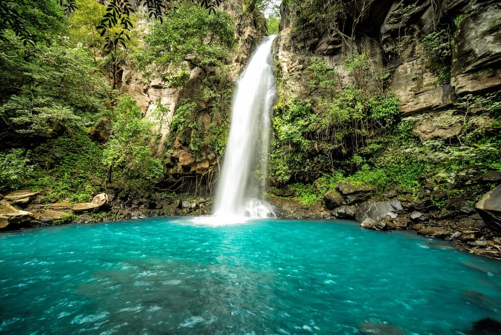
Victoria Waterfall: This stunning waterfall stands 115 high as it drops into the canyon below. Once there, hikers have the opportunity to swim within the clear waters at the base after hiking through the forest with viewpoints of the volcanoes along the way. Other popular waterfalls to hike include Las Chorreras Waterfall and La Oropendola Rio Negro Waterfall.
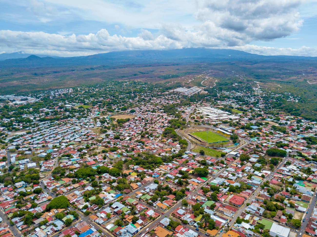
The nearest city to Rincón de la Vieja Volcano National Park is Liberia, located in the Guanacaste Province. With a population of around 56,000, Liberia is the hub for the northwestern region of Costa Rica. The vibrant town is often passed through on the way to coastal cities and beaches such as Playa del Coco, Playa Hermosa, and the Papagayo Peninsula. Due to its location at the foothills of the volcanoes of the region, Liberia is drier than much of Costa Rica though it still receives a wet season from May to October.
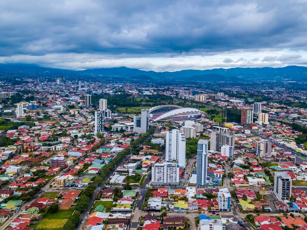
The largest city in the country is San Jose, which also happens to be the capitol. The metro population of the area is estimated to be 2.1 million people. The central location of the city allows for travelers to have easy access to all regions of the country. San Jose is known for being one of the safest major cities in Latin America and its focus on sustainability. Typical food throughout Costa Rica, and within San Jose, consists of gallo pinto, a mixture of beans and rice. From the capitol city, tourists have access to all of the major regions and National Parks that Costa Rica has to offer.