Get PeakVisor App
Sign In
Search by GPS coordinates
- Latitude
- ° ' ''
- Longitude
- ° ' ''
- Units of Length

Yes
Cancel
❤ Wishlist ×
Choose
Delete
Pok Fu Lam Country Park is a compact nature reserve overlooking the administrative and financial center of the Hong Kong Special Administrative Region of China. There are 4 named peaks in the park, the highest of which is Victoria Peak (552 m/ 1,811 ft).
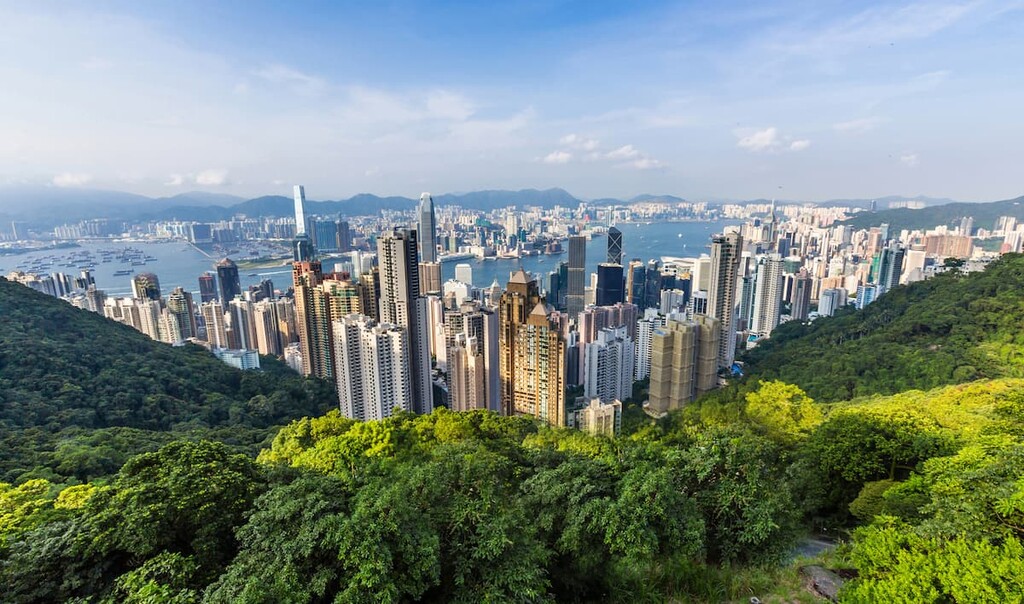
With an area of only 270 hectares (667 acres), Pok Fu Lam Country Park encompasses the Central & Western District and Southern District on Hong Kong Island in China.
The northern and eastern sides of the park are flanked by prime real estate at Mid-Levels and the Peak, respectively. To the west is its namesake neighborhood of Pok Fu Lam and to the south is Aberdeen.
Even though the lower slopes of Victoria Peak make up a substantial part of the park, the upper portion of the hill is excluded from the park as it had been developed for touristic and residential purposes long before the park’s designation in 1979.
Pok Fu Lam Reservoir is tucked away in a corner along the eastern border. The park is connected to Aberdeen Country Park to the south-east and the tiny Lung Fu Shan Country Park to the north-west.

Most of the park is part of the Ap Lei Chau Formation, which is named after an island off the Aberdeen area on southern Hong Kong Island.
The formation is characterized by strata of crystal-bearing fine ash vitric tuff with eutaxite, a type of banded volcanic rock. The eutaxite is folded into a wavy pattern with anticlines and synclines, forming some pronounced topographic features like High West and Mount Kellett.
The area between Victoria Peak and Pok Fu Lam display a sequence of eutaxite alternating with fine ash tuff. The tuffs and minor sediments close to The Peak have undergone thermal metamorphism.

The park is one of the best forested areas in Hong Kong with a diverse mixture of both native and introduced tree species. The most common native species include Hong Kong gordonia (Polyspora axillaris) and Chekiang machilus (Machilus chekiangensis).
Introduced species such as Taiwan acacia (Acacia confusa), slash pine (Pinus elliottii) and Brisbane box (Lophostemon confertus) also thrive in the park. The most recognized trees are probably the huge India-rubber trees (Ficus elastica) with their aerial roots and shiny leaves.
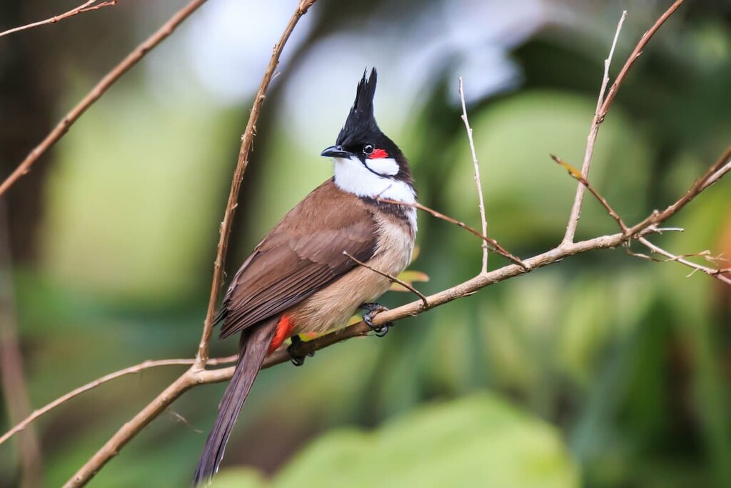
The woodlands, shrublands, and streams, as well as the park’s reservoir, provide ideal habitat for both terrestrial and wetland birds. Among the sixty or so bird species found in the park, visitors have a good chance to see magpies, bulbuls, robins and black kites.
A few species of amphibians can be found close to the streams and the reservoir in the park, such as Hong Kong cascade frog, brown tree frog, Asian common toad and short-legged toad.
The park is also a sanctuary for a variety of mammals including red muntjac, Chinese porcupine, masked palm civet and Chinese leopard cat. Energetic Pallas's squirrels can often be spotted scurrying on the trees.
After Hong Kong was colonized by the British in 1841, the city’s population grew exponentially from 7,000 to 120,000 in the first two decades, but citizens still rely on wells and streams as the main sources of water supply. In an attempt to find an urgent solution to mounting water shortage, the government offered a reward of £1,000 to anyone who provided the solution.
The reward went to a clerk from the Royal Engineers, S.B. Rawling, who proposed building a reservoir in Pok Fu Lam Valley, which was above but not far away from the urban center.
Completed in 1893, Pok Fu Lam Reservoir was the first reservoir built in Hong Kong. In addition to the reservoir, there is a gauge basin and four masonry bridges built in Italianate Renaissance style.
The Former Watchman's Cottage, which has been converted to the Pok Fu Lam Management Centre, is a single-storey building with triangular pediments and white painted walls constructed in Neoclassical style, though its pitched tiled roof was built in traditional Chinese style.
With its small size and proximity to the city’s administrative and financial hub of Central, the park is easy to access and navigate. Within its boundaries are the first two sections of the Hong Kong Trail, a 50-km (31-mi) hiking route with eight sections that traverses Hong Kong Island from west to east.
The Peak Circle Walk is a 4-km (2.5-mi) loop, all paved and mostly flat, that starts and ends just outside the park on the top of Victoria Peak, an area which is more often simply known as The Peak. After getting a fill of the iconic views of one of the most photographed skylines in the world, take Lugard Road and admire Victoria Harbour some more from different angles.
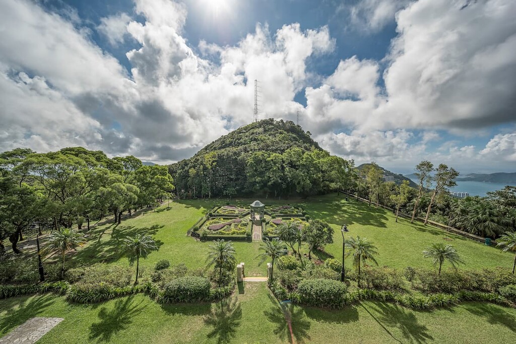
This part overlaps with the Pok Fu Lam Native Tree Walk, which features a wide range of sub-tropical species such as Chinese banyan, camphor tree, ivy tree and turn-in-the-wind.
A bit more than halfway through, Lugard Road turns into Harlech Road which leads back to the peak. From there you can make a 700-m (435-ft) detour to Mount High West Viewing Point for superb vistas of Lantau Island, Lamma Island, and of course, Victoria Harbour. It’s a great spot for watching the sunset.
The Peak to Pok Fu Lam hike is the first section of the Hong Kong Trail. It also starts at Lugard Road at The Peak, which is the same starting point as the first half of the Peak Circle Walk. At the end of the road, turn west and follow the trail through woodlands to the ending point at Pok Fu Lam Reservoir Road.
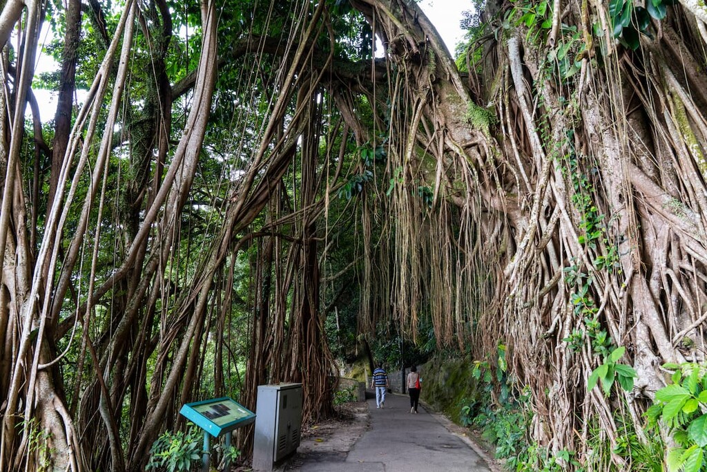
The trail lasts for about 7 km (4.3 mi), with several footpaths branching off to the reservoir toward the end. There is no public transport at the end of the route, so unless you are continuing onto Hong Kong Trail Section 2, head for the reservoir and exit at Pok Fu Lam Road.
If you want to combine a visit to the reservoir with the Peak Circular Walk, you can take Pok Fu Lam Reservoir Road all the way between the Peak and the reservoir. This road is a much shorter alternative without any backtracking. The whole route is known as the Peak Trail.
The Pok Fu Lam to Aberdeen walk is the second section of the Hong Kong Trail, starting at Pok Fu Lam Reservoir Road about 300 m (984 ft) east of the reservoir. It winds its way through the southern part of the park to end at Peel Rise at the border with Aberdeen Country Park.
The 4.5-km (2.8-mi) paved route has lots of shade and occasional views of southern Hong Kong Island and the East Lamma Channel beyond. From the end of the route, it is another 1.5 km (0.9 mi) to the urban area of Aberdeen. Hikers usually combine this section with Section 1 and/ or Section 3 (in Aberdeen Country Park) of the Hong Kong Trail.
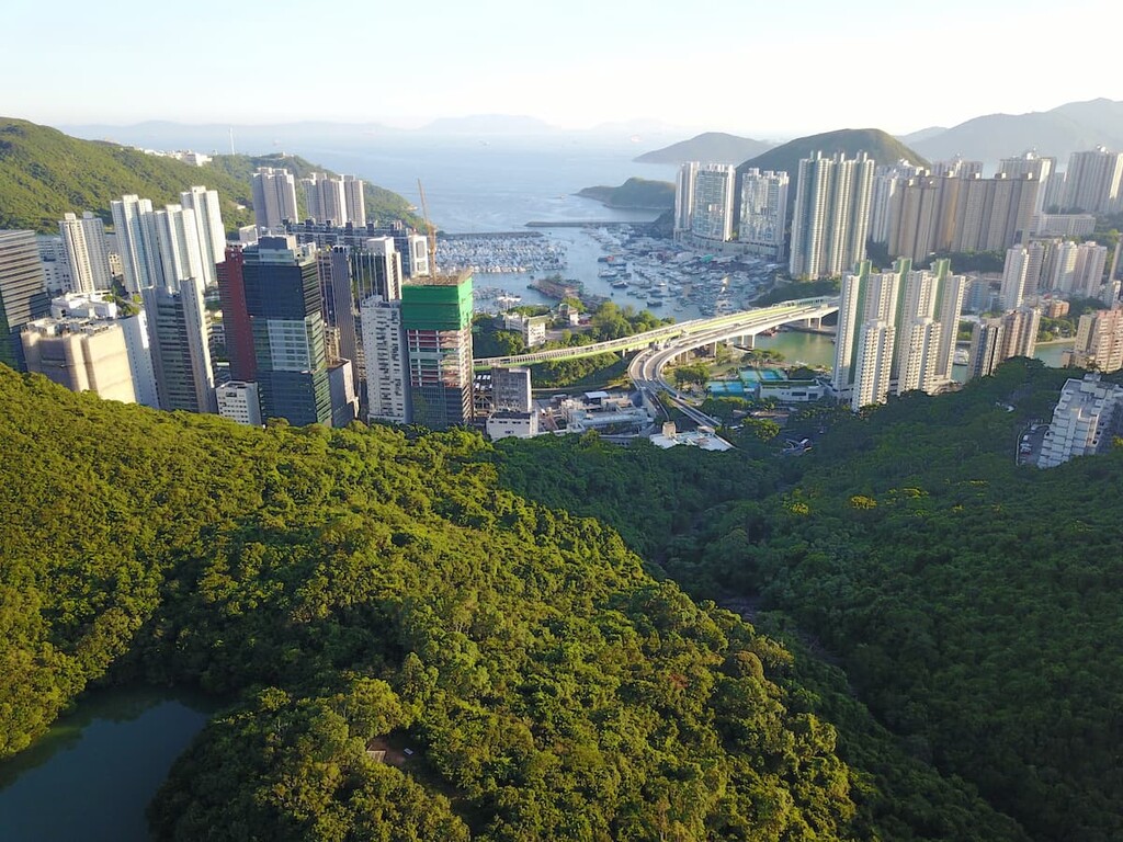
The park can be reached from the following neighborhoods, all of which are worth exploring in their own right.
Situated on western Hong Kong Island next to Telegraph Bay, Pok Fu Lam is a predominantly residential neighborhood that preserves some important pieces of the city’s pre-colonial and early colonial history. Pok Fu Lam Village, which was founded in the seventeenth century, is a living museum with a current population of around 3,000 people.
As the only Indigenous village remaining on Hong Kong Island, the haphazard tin-roofed huts of the village contrast dramatically with the upscale high-rise apartments in the neighborhood.
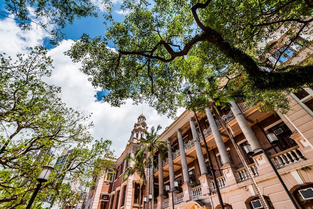
There are many colonial monuments of significant historic value from the late nineteenth to early twentieth centuries, such as Béthanie Chapel and the oldest buildings at the University of Hong Kong.
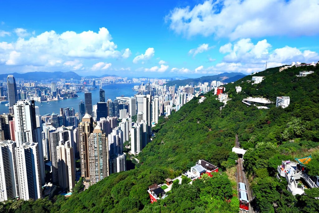
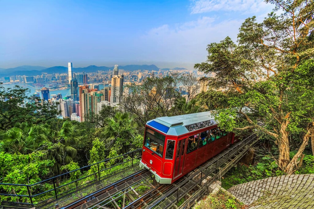
Undisputedly the top attraction in the territory, The Peak is thronged with tourists day and night. Towering over the skyscraper-studded financial center between the sparkling sea and rolling hills, this is the best place to marvel at Hong Kong’s world-famous cityscape. To many people, the sight from The Peak is the defining image of Hong Kong.
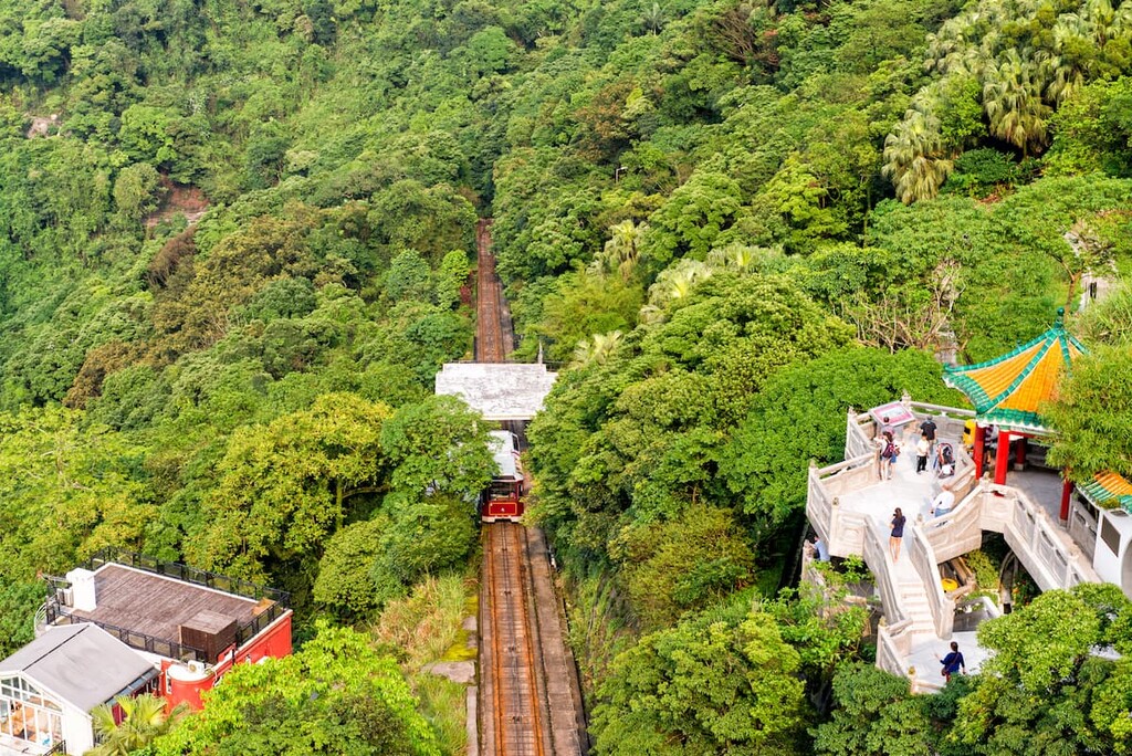
There are tourist facilities at The Peak such as a shopping mall, a wax museum and a garden. You can get there by bus, minibus or the scenic and historic Peak Tram from Central.
Because of its unparalleled vistas, the neighborhood has been the most exclusive residential area in the city since early colonial times. In 2018, a residential plot at 37 Barker Road was sold at a world record-breaking price of about US$37,800 per square foot.
With a strong tradition as a fishing community, the Aberdeen neighborhood in southern Hong Kong Island is famous for its fishing boats mooring in the typhoon shelter, the biggest wholesale fish market in Hong Kong, and the ornate Jumbo Kingdom floating restaurants (now closed). Its most well-known landmark, however, is probably Hong Kong’s local theme park, Ocean Park.
Aberdeen is one of the very few places in Hong Kong where the traditional sampan boat is still used as a means of commuting. You can hop on one for a short ride to the island of Ap Lei Chau at a mere cost of HK$2.50 (US$0.30).

Explore Pok Fu Lam Country Park with the PeakVisor 3D Map and identify its summits.


