
Scan the QR code and open PeakVisor on your phone
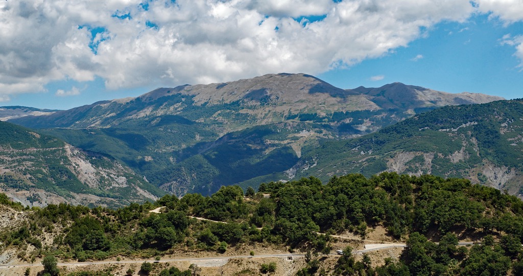
Mali me Gropa-Bizë-Martanesh Nature Park area lies in the heart of Albania and celebrated for its dramatic mountain landscapes and diverse ecosystems. There are 33 named mountains in Mali me Gropa-Bizë-Martanesh Nature Park. Maja e Kaptinës (1,857m / 6,093ft) is the highest point. The most prominent mountain is Maja e Micekut te Shemerise (1,818 m / 5,965 ft).
The Mali me Gropa-Bizë-Martanesh Nature Park was designated a protected area in 2007. It is classified as a "natural park" (IUCN IV) and is located near Dajti National Park and Qafeshtama National Park to the northwest.
The park covers 26,043.34 ha (64,345 acres), making it the second-largest protected landscape in Albania. Located in central Albania, it has an altitude range of 800 to 1,870 m (2,625 to 6,135 ft). Its proximity to the capital of Tirana makes it ideal for tourism, both local and international.
The protected area lies within the districts of Mat, Tirana, and Bulqiza, including the communes of Shengjergj, Xiber, and Martanesh. The park’s roads are mostly unpaved or deteriorated asphalt. The main road connects Mali me Gropa to the meadows of Bizë.
The Mali me Gropa-Bize-Martanesh massif is made mostly of thick, fractured limestone and flysch.
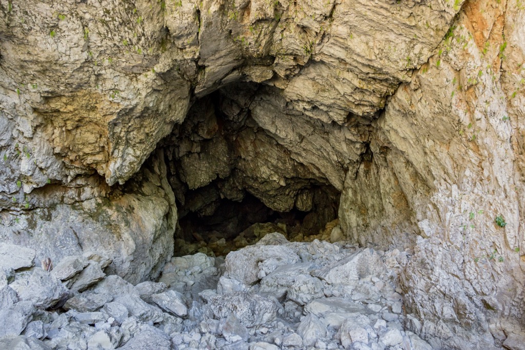
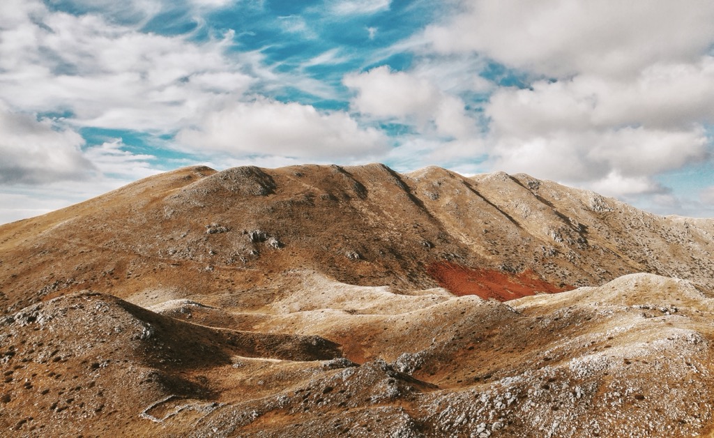
The massif is home to many unique karst formations. The "Mountain with Holes" (Mali me Gropa, the park’s namesake) is one of Albania's most classic examples of a karst landscape. The massif's powerful uplift deepened the karst features, leaving behind surface formations that resemble beehives. These geological features contribute to its unusual hydrology, with water systems often disappearing underground and reemerging as springs.
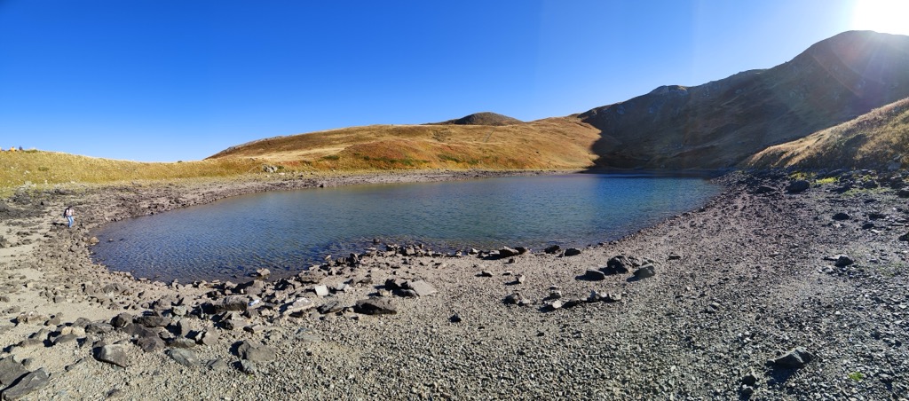
The region also exhibits evidence of ancient glacial activity, with U-shaped valleys, glacial lakes, and moraines visible in certain areas.
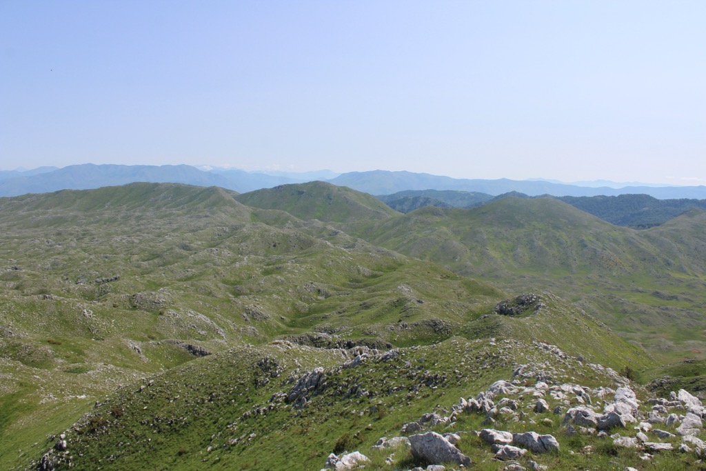
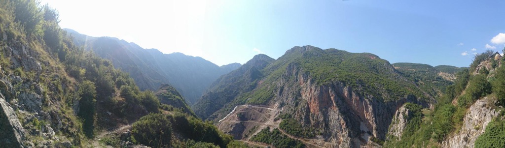
This area is a protected landscape by the International Union for Conservation of Nature (IUCN) and is recognized as an Important Plant Area by Plantlife. The vegetation is divided into zones: the coniferous zone is dominated by black pine and European beech, and the alpine zone features grasses, mosses, and rare flowers. The coniferous zone belongs to the Dinaric alpine mixed forests ecoregion and features forests covering 68% of the area, with a mix of coniferous and deciduous trees. Meanwhile, the alpine zone is home to vast alpine grasslands such as the Bizë meadows.
The area is home to 209 species of vertebrates, including 44 mammals, 130 birds, 23 reptiles, and 12 amphibians. It also hosts 450 vascular plant species, which comprise 12% of Albania's total flora. The area functions as an important habitat and corridor for bear, wolf, and roe deer, and it is home to 10 natural habitats, ten important plant species, nine endemic species, and 1 IUCN Red List species.
Alpine meadows feature grasses like Festuca bosniaca and flowers such as Thymus cherlerioides. The region is also notable for its endemic plants, such as Carex markgrafii and Stachys albanica.
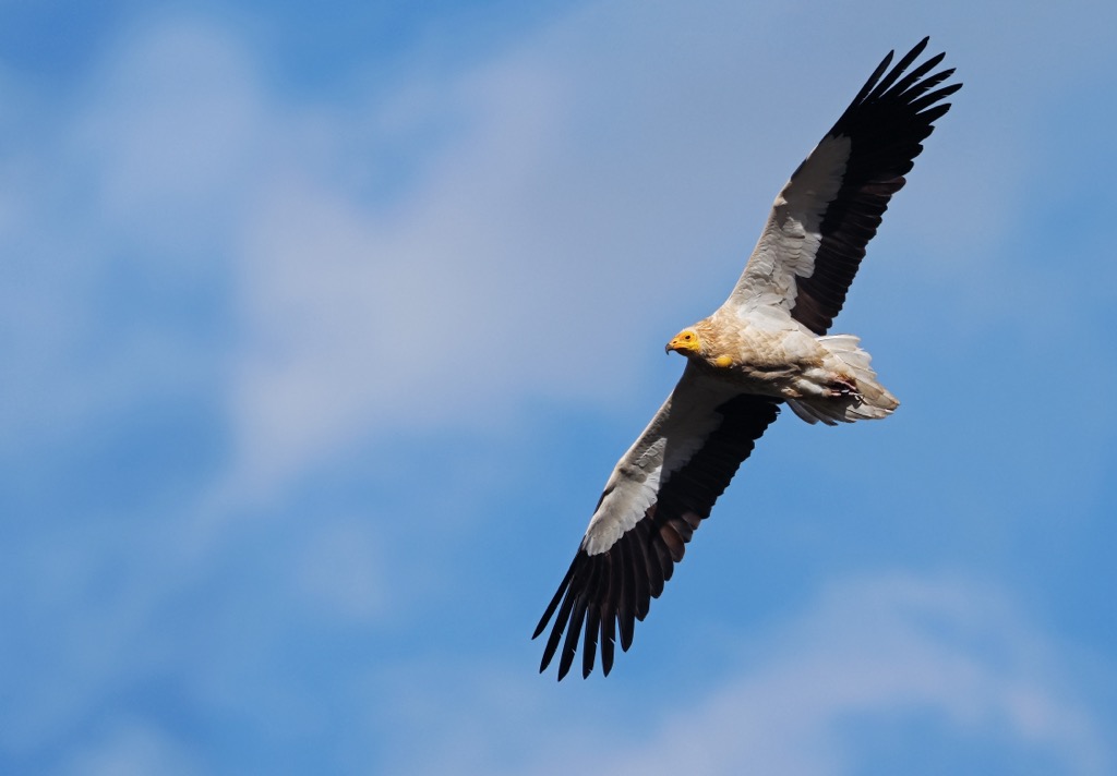
Forested areas are home to species like the brown bear, grey wolf, lynx, red fox, roe deer, wild boar, red squirrel, and European otter. Bird species such as the golden eagle, sparrowhawk, and Egyptian vulture are also common, as are various reptiles and amphibians, including the alpine newt and European pond turtle.
The Mali me Gropa-Bizë-Martanesh region has a history dating back to antiquity, with archaeological evidence suggesting it was inhabited by the ancient Illyrians, the ancestors of modern Albanians. The nearby mining resources, particularly iron, have likely been exploited since ancient times. During the Roman era, Mali me Gropa became part of the Roman Empire, and saw the establishment of road networks and increased trade.
In the medieval period, Mali me Gropa experienced the rise of feudalism and the establishment of fortified villages. Martanesh became a significant hub during the Middle Ages due to its strategic position and access to resources. Under the Ottoman Empire, which ruled the area from the late 15th century until the early 20th century, the region saw the Islamic influences introduced to the cultural fabric Albania, while many remote villages near Mali me Gropa retained their former pagan and Christian traditions.
The 20th century saw heavily industrialized mining in Martanesh, though the collapse of communism in the early 1990s led to the decline of these state-run operations. Today, the region is embracing its natural and cultural heritage, with a growing focus on ecotourism.
Mali me Gropa is a unique karst landscape, among the largest in Europe. Its name comes from the numerous karst pits scattered across the mountain's surface, formed during the Ice Age. The hike's highest point is Mcek Peak, at 1,847 m (6,063 ft).
The hike begins at 900 m (2,953 ft) near the Shen Meri (St. Meri) village. After gaining 700 m (2,297 ft) of elevation, it reaches an old shepherd's hut. From here, the trail continues another 300 m (984 ft) to the summit. The total elevation gain is 950 m (2,953 ft) over 12 km (7.5 mi) of trail. The hike takes around five hours.
This scenic 22 km (14.51 mi) loop offers an elevation gain and loss of more than 1,000 m (3,281 ft), making it a challenging hike. However, it’s for those looking to experience the region's natural beauty.. Along the way, the route summits Marku Peak at 1,738 m (5,702 ft) and Kauri Peak at 1,735 m (5,692 ft). The loop offers a mix of open meadows, forested paths, and rocky sections.
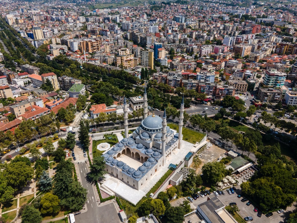
As Albania's vibrant capital and largest city, Tirana boasts a population of around 520,000. The city's historical tapestry, dating back to Ottoman times, adds layers of complexity and culture. Notably, Tirana is celebrated for its colorful buildings, bustling streets, and a blend of Ottoman, Italian, and communist-era architecture. Skanderbeg Square, the heart of the city, is a must-visit.
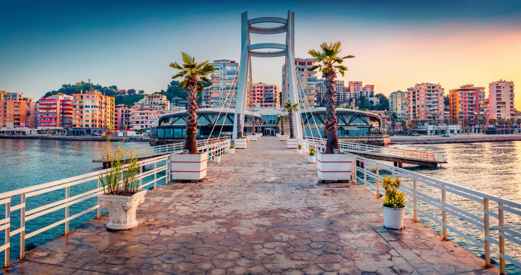
Albania's second-largest city, Durrës, is home to approximately 300,000 residents and is situated on the coast of the Adriatic Sea. With roots tracing back to ancient times, Durrës is one of Europe's oldest cities, steeped in a rich cultural heritage. Originally known as Dyrachion from an Illyrian settlement, it has witnessed various civilizations, including Greeks, Romans, Byzantines, and Slavs. Among other monuments, a Roman amphitheater and Venetian tower still stand today.
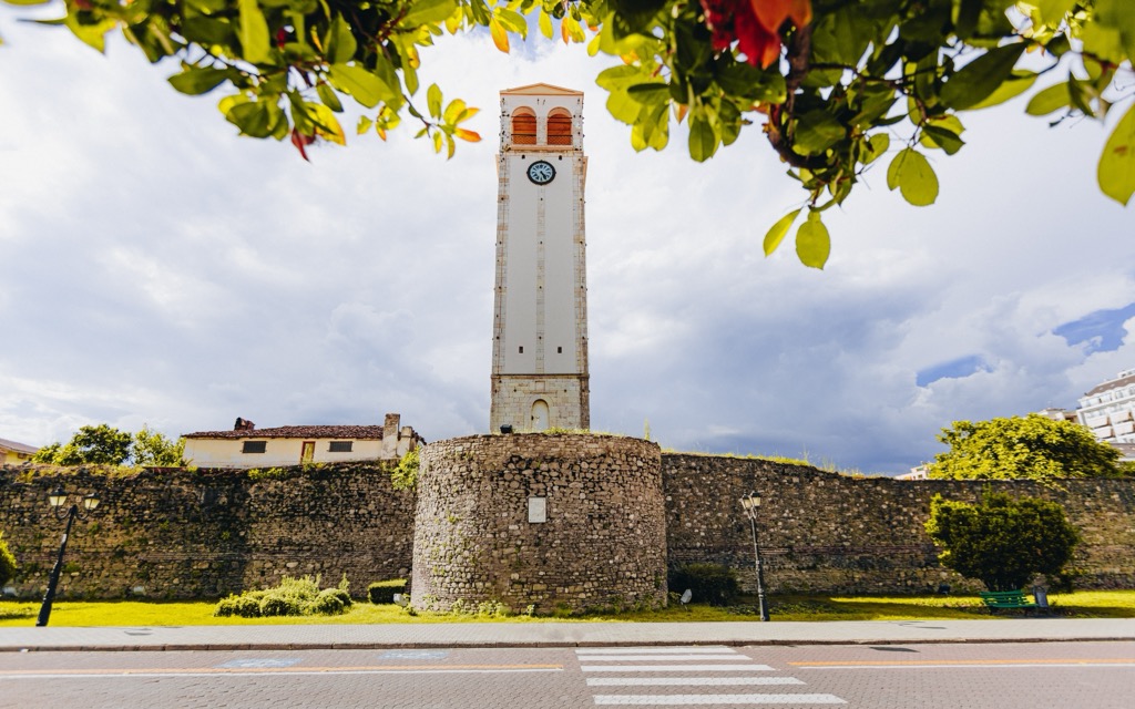
Elbasan has a population of about 141,000, and a long history dating back to antiquity. Elbasan was founded by Thracians and later became part of Illyria. In 1478, Elbasan became part of the Ottoman Empire and remained so until 1912, when Italy occupied it during World War I. Moreover, Elbasan has always been a crossroads due to its location on a major trade route through central Europe. One notable monument is Saint Prokopius’s church, which dates to the sixteenth century.


.jpg)