Scan the QR code and open PeakVisor on your phone
If you want to enjoy a beautiful view over Tirana, Albania, this green mountain peak is a must-see, also known as Tirana’s terrace. There are 48 named mountains in Dajti Mountain National Park. Maja e Micekut te Shemerise (1,818 m/ 5,964 ft) is the highest point. The most prominent mountain is Mali i Dajtit (1,613 m/ 5,291 ft).
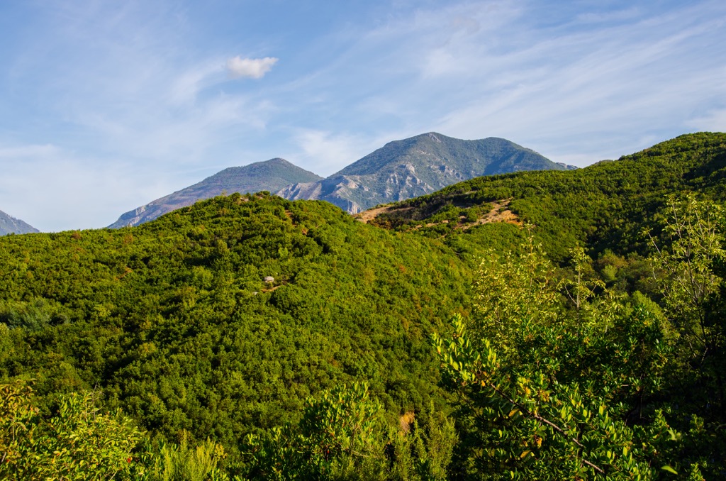
Dajti Mountain is a mountain in central Albania, located 26 km (16 mi) from Tirana, with 3 types of forests, made of trees and shrubs, herbaceous plants, wild greens, and other wild plants, which cover about 80% of the territory.
Mount Dajti was declared a National Park by the decision of the Council of Ministers of Albania. Today has an area of about 3,300 ha (8,154 ar), with the prospect that it will be expanded up to about 11,000 ha (27,181 ar).
The mountain was first protected in 1961, and its protected territory expanded gradually. Dajti National Park is one of the 12 national parks that Albania boasts with, part of Tirana District. The area is governed between the Albanian Agency of Protected Areas (AKZM) and Tirana Municipality Parks and Recreation Agency (APR).

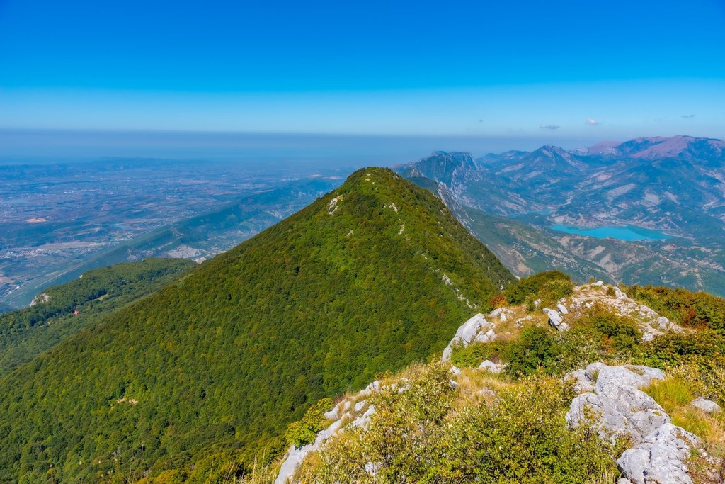
The mountain is part of the Kruja Range, a long line of mountains stretching from Shkodra to the south of Tirana. Deep river valleys cut the chain. Dajti is surrounded by the mountains of Tirana and Maja e Priskës. It has a western branch known as Lana. In the north of Dajti is Maja e Tujanit (1,524 m/ 5,000 ft), making this mountain a double peak.
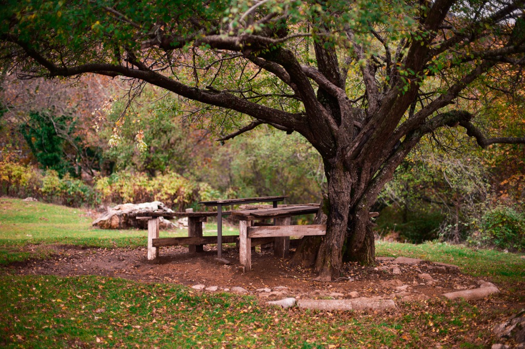
Dajti Mountain is often referred to as the "lung of Tirana," giving you a view that extends all over the city. Dajti National Park offers an exciting journey into Albania's natural world. This park is a great place for family outings and picnics, providing lots of interesting and natural activities. Young children can enjoy the playgrounds while teens can enjoy nature.
The Shtamë Pass is in the northwest, the protected area of Kraste-Verjon is to the west, and Mali me Gropa-Bizë-Martanesh Park is in the east. The topography at the park is like no other in the region. With such varied terrain, the diversity of ecosystems and biodiversity is abundant.
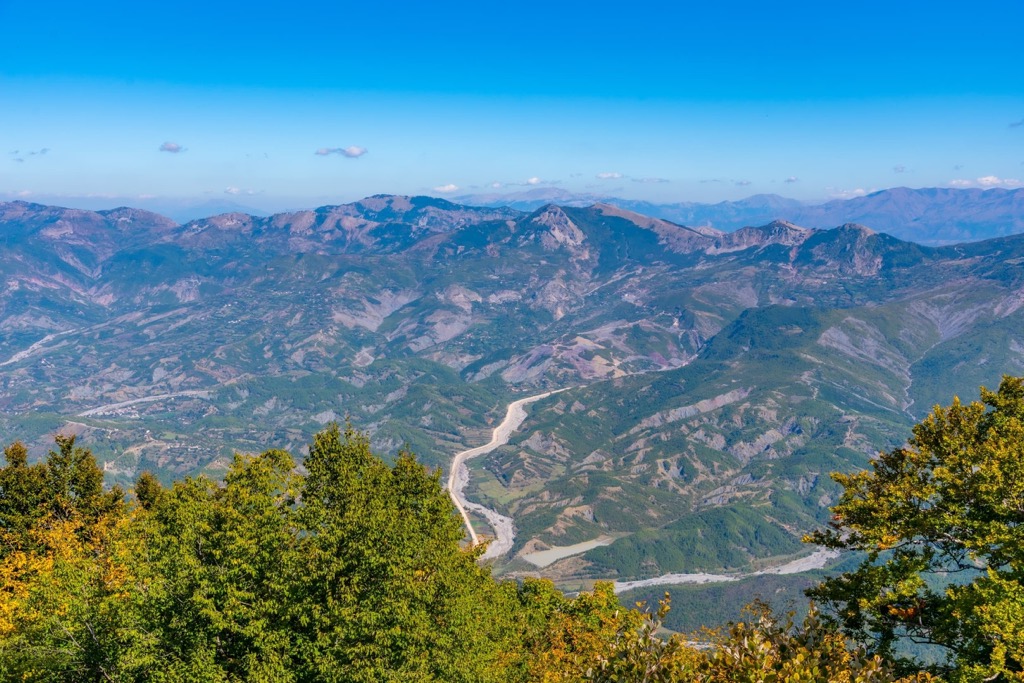
Dajti Mountain National Park is one of the oldest national parks in Albania. It's a popular destination and is close in proximity to the Adriatic Sea. This park has over 330 sq. km (205 sq. mi) of rolling hills and diverse landscapes, including deep gorges, high sheer rock faces, lakes, and rivers.
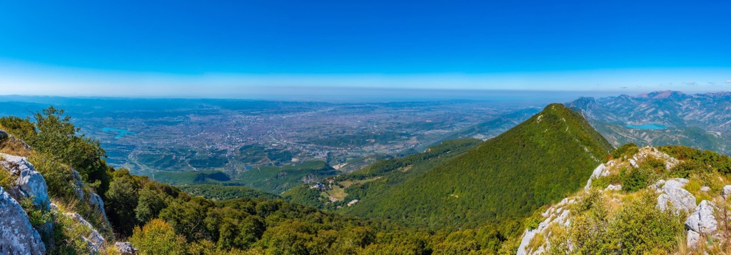
Mt. Dajti is a natural part of Tirana that towers over the capital and provides a beautiful view of its green mass above it. It sits at the eastern end of a large valley in central Albania.
IUCN has listed the park as "Category II," which is a type of ranking for plants in need of protection. Plantlife also recognizes it as an important area. In 2019, Dajti National Park opened TV and Radio towers in Fushe Dajt or the field below the peak. The newly opened tourist information center was built near its main entrance too, making the area even more urban.
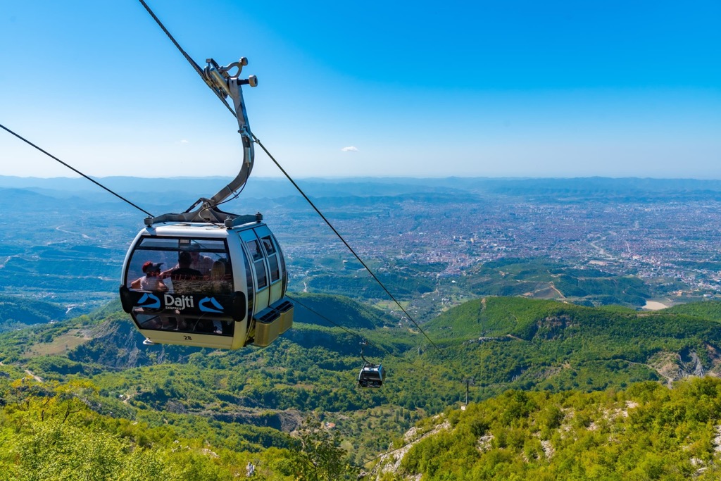
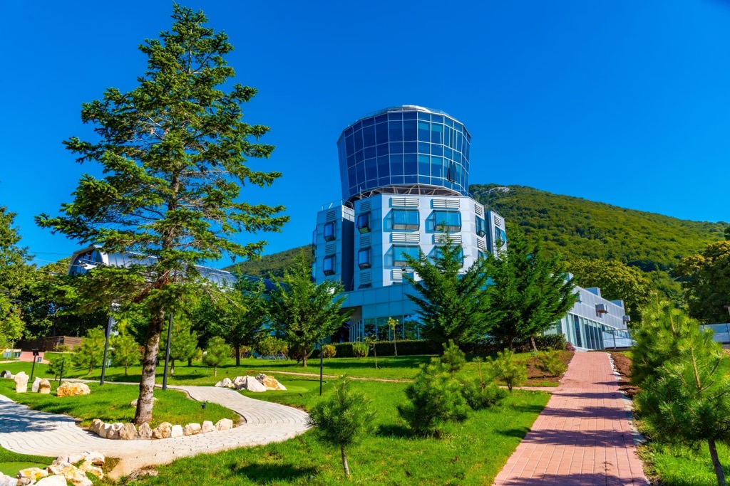
When visiting Tirana, you may see there isn't enough greenery and parks in the city. The famous Dajti Mountain is very near and offers a tropical sensation for anyone to enjoy. This picturesque mountain, Tirana's highest point, is just about a 15-minute cable car ride from the city.
The Dajti mountain is the best accessible mountain in the country, and many locals go there to get away from the city. A sky-high Austrian-made cable car, Dajti Express, takes 15 minutes to make the scenic trip (almost) to the top.
Up there, you can see a panorama of the city that takes in two rivers and provides a stunning view of Albania's capital. In addition to being known for the Dajti Cable Car and Adventure Park, the area is also known for its traditional restaurants, which follow a slow food tradition.
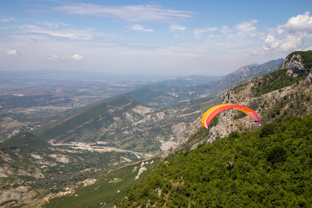
The park's sports values are endless. There are opportunities for hiking, mountaineering, and skiing at the park. It's known for its special natural values, including its climate, air quality, dense forest, and terrain. It can also be considered a perfect place to learn about fauna species and geological features.
The national park is well suited for single-day trips out of Tirana. Because of this, you can visit it in any season. It might be snowy in winter and should therefore be prepared for cold weather. The most popular season is summer and the month with most visitors falls in July.
Dajti mountain chain is a mountain line that reaches an elevation of 1,818 m/ 5,964 ft with Maja e Micekut te Shemerise. It includes Mali i Dajtit (1,613 m/ 5,291 ft), Priska or Maja Priskes (1,353 m / 4,438 ft) to the south and Maja e Tujanit (1,524 m/ 5,000 ft) in the center. When reaching the peaks, mountain climbers are able to see down onto Tirana and over the city.
The balcony of Tirana is named like this because it provides a panoramic view of the city. The reliefs here were formed through geological processes which took place over a large area and during a long formation period. Geologomorphology is an important part of the landscape in this area.
Dajti is a mountain that rises over 1,800 m (5,959 ft) high and has dramatic sides. Its west side is separated by a saddle and three other peaks rise to 1,600 m (5,249 ft) like Mali i Dajtit (1,613 m/ 5,291 ft). There are also some rock formations at the top of the mountain, which make for beautiful views.
The land around the borders of this nature preserve and inside of it is layered with stone, which is evidence that a lot has taken place over time. Most of the mountain is made out of limestone and karstified over time.
The geological base of the area is made up of sedimentary rocks called limestone. These are layers of Mesozoic-era sediments. Of course, apart from limestone, even metamorphic rocks like dolomite are to be seen. We can distinguish limestone and dolomite with a number of varieties that are visible in their relief.
Since these large blocks of rock were moving and being broken by geological activity, we have a lot of regions with porous rocks visible today. Dolomite layers were often exposed near the surface, which made it easier for shallow groundwater to penetrate them. This led us to a beneficial outcome or numerous water sources on the mountain.
Most mountain ranges formed during the Mesozoic era were formed through hectic geologic events that caused them to form different shapes, heights, and depths. This resulted in water penetration throughout the mountain and formed numerous areas with surface water flow.
The area contains many characteristic karst rock formations that are particularly well represented on the plain or slopes and include some remarkable swallow holes. This is why caves also formed. They are fascinating ecosystems to study and protect.
Numerous caves, holes, and other formations also mean numerous water sources. One of the country's best aquifers is just a few miles north of the Dajti mountain. Not only does it provide high-quality water to Tirana, but it makes the whole region even more potent with life.
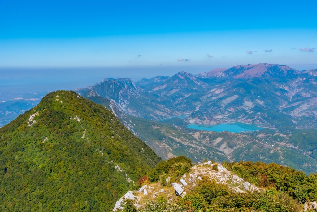
One of Tirana's main water sources, Lake Bovilla, is located northeast of the city and inside Dajti Mountain National Park. There are steep cliffs and a canyon on the other extremity of the park, while the Erzen River flows near the prehistoric Pellumbas Cave on its way to Skorana Gorge. One of the most well-known attractions near Shëngjergj is the Shëngjini Waterfalls.
Sub-terranean waters can only be found in rocks that are made up of dolomite and limestone here. Dolomite also does a great job at ensuring the creation of underground caves as well.
When you talk about climate, Dajti Mountain National Park, it’s basically a mixture of coastal and continental climates, with the summer being hot while the winter is harsher. These are the highest peaks in the park:
Dajti Mountain National Park has a highly diverse ecosystem. It is filled with plant life that thrives in its warm weather, making it one of the greenest and most beloved parks in Albania. This park has types of plants unique to each floor, with three different floors.
The Mediterranean shrub floor has shrubs with evergreen plants, and the gorse plant floor includes other types of evergreen plants like heather. The most extensive floor is the forest floor with oaks and beech. There are also types of oak trees on the oak floor exclusively. On the beech deck, you'll find a forest made up entirely of beech.
Dajti Forest is considered untouched by man and, as such, has great scientific and ecological values. The diverse plant life present there also serves to protect ancient habitats and food sources for animals.
There is a vast ecosystem in the ground where plants, trees, and animals all intertwine. Some bacteria decompose dead materials as well as fungi and animal life. Dying trees are significant for providing homes for birds, insects, and other wildlife.
Dajt Park has 8 different mammal species, in addition to 11 bird species. The park is very special because of its diversity. Animals that can be found here are bears, wolves, rabbits, hedgehogs, otters, bats (several types), and squirrels. The park is also inhabited by wild boar, Eurasian wolf, red fox, European hare, brown bear, squirrel, and European wildcat.
The types of birds in this list include eagles, woodpeckers, mountain partridge, 7 species of reptiles, and 4 amphibians. In the lower part of the mountains, there is a whole lot of natural scrubland and heath. They contain myrtle and fragaria as well as some oak shrubs and conifers.
There is also an oak forest above 600 - 1,000 m (1,968 - 3,280 ft) that gradually gives way to beech and maple forests at 1,000 m (3,280 ft). The top of the mountain is known as a rock face or meadow.
In recent years, forest fires burned down 10 ha (24 ar) of forests at the Priska or Maja Priskes (1,353 m / 4,438 ft) and partially Mali i Dajtit (1,613 m/ 5,291 ft) as well. Authorities were only able to extinguish the fires after days of work. The effects of forest fires are becoming more frequent and dangerous. Not only is anyone not being held accountable, but the number of forest fires has increased massively in recent years.
Many sites have been discovered recently with traces of settlements and fortifications from earlier periods inside Dajti Mountain National Park. These findings are important as they can provide insight into the people who lived in the past here.
The fortification found on top of Mali i Dajtit (1,613 m/ 5,291 ft) was built in prehistory and used since then, through antiquity and the medieval period, and in World War I and II. It was used as a refuge and military outpost. It shows us how people used to live both on the mountain and used it, all while living in the valley of Tirana.
Dajti mountain’s name might come from the Greek goddess Diktynna. Dajti is well-known for its ancient remains, some dating back 10,000 years ago. There have also been finds of fortifications from later periods in Dajti's history. All of this speaks in favor of this peak being named after the Greek goddess.
As a national park, parts of the mountain have been protected since 1961. The peak can also be reached through a narrow asphalted road, and once there, it branches off onto an area once the site of a summer camp and is now filled with many restaurants and radio/TV transmitters.
Since June 2005, the Austrian-built gondola lift has provided travelers a new opportunity to explore the mountain close to the capital. En route, travelers will discover beautiful views of Fusha e Dajtit and higher altitudes.
When visiting Dajti Mountain National Park, make sure to check these peaks out:
One of the most relaxing ways to ascend a mountain is by the Dajti Ekspres cable car. The car uses a patented Austrian design and will travel up to 4.7 km (3 mi) in just 15 minutes.
You'll be driving up Mount Dajti National Park and making the climb up to get a great view of the city of Tirana. You'll see dwellings that range from rural small houses and farms, to a lake, and plenty of greenery.
There are radio and television broadcasting systems on the summit and a military-restricted area. Walking here is only allowed for the military, and no visitors are accepted. Therefore, your cable car ride will take you to the peak, and you will not be able to hike to the true top.
If you want to explore the mountain without much hassle and away from the crowd, try Tujani. The tour begins at the top of Dajti and follows an old, well-trodden trail through the forest to a pass between Mali i Dajtit (1,613 m/ 5,291 ft) and Maja e Tujanit (1,524 m/ 5,000 ft).
You will be able to see everything from this breathtaking vantage point in the western lowlands. The trail leads you to Tujani peak, which is the highest point that can be reached by foot. From the summit, you can enjoy beautiful views of Lake Bovilla and its surrounding mountains.
If you want to do something special without having to leave the city, this day trip just for adventurous people is for you. Your hike will have amazing views and a chance to glimpse stunning stalactites and stalagmites.
This 2 km (1.2 mi) hike will lead us to the famous “Shpella e Zeze” or “The Black Cave of Pellumbas.” This is a safe hiking trail and it was inspected just last year in 2010 as well. Being able to take in the views from the Erzen River is a fantastic experience. The canyon walls drop off into the wildflowers and the expanse of mountain peaks around it.
This cave was among the earliest settlements to be found in the region. Tools dating back to the Neolithic era have been found inside, and more recent artifacts from the Bronze & Iron periods were also discovered.
Tirana is the nearest city to Dajti Mountain National Park, but make sure to visit other cities near it too:
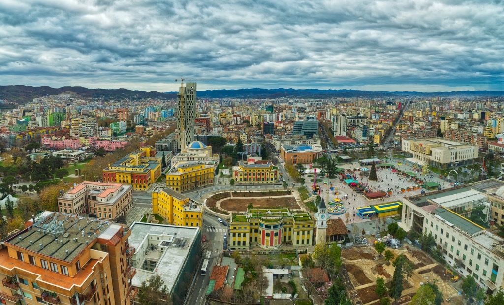
Tirana is the capital and largest city of Albania, and it has a population of about 500,000. The country's most important economic sectors are all based here: industry, trade, transport, communications, and tourism.
Tirana is a rapidly growing city with much diversity and culture. Much of the city's history dates back to Ottoman times and represents one of the more complicated corners of modern Albania. The architecture in this city is quite diverse and offers a lot of colorful options that set it apart from other metropolitan areas.
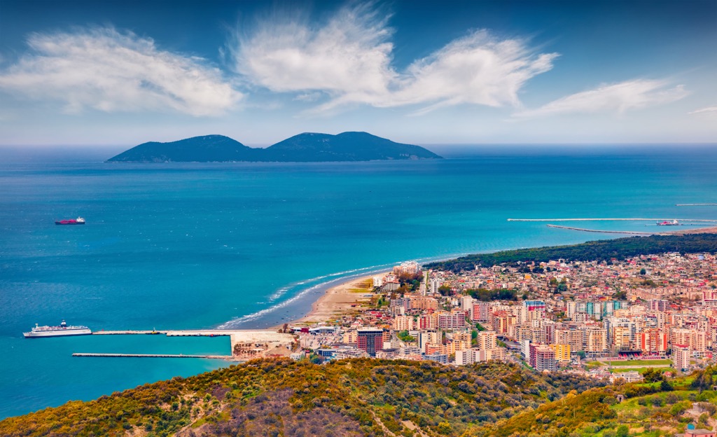
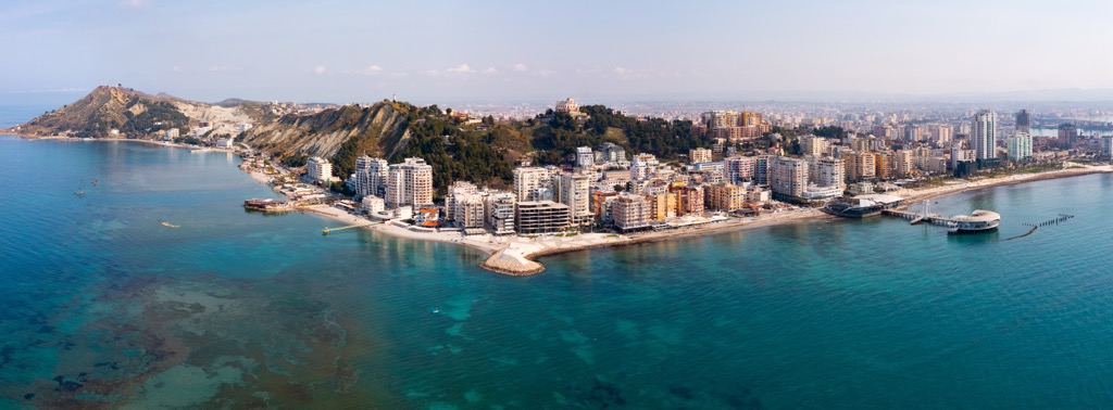
Durres is the second largest city in Albania, and it has a population of around 300,000. It is located on the west coast of the country.
Durres is one of the oldest European cities, with a rich cultural heritage. The city’s name comes from an Illyrian settlement called Dyrachion, which was inhabited by Dardanians who were known for their toughness and bravery.
It was inhabited by Illyrians and then later by Greeks, Romans, Byzantines, and Slavs before becoming part of the Ottoman Empire in 1478. It became part of Italy after World War I but was ceded back to Albania after World War II.
Vlore is a small city in Albania. It is the capital of the Vlora District and has a population of about 130,000 people. The Romans founded Vlore in the 1st century AD, and it was one of the most important cities of ancient Albania.
The city was inhabited by Greeks, Romans, Byzantines, and Turks. The city's name comes from the Latin word "vola," which means "to fly." Tourists from around Europe often visit its numerous beaches. In addition to this, Vlore has many historical sites such as churches, mosques, and monasteries that make it an attractive place for visitors to explore.