
Scan the QR code and open PeakVisor on your phone
Shtam Pass National Park has 3 named peaks. The highest is Maja e Liqenit at 1,717 m. Other notable peaks include Maja e Zithit and Maja e Kavanijës.
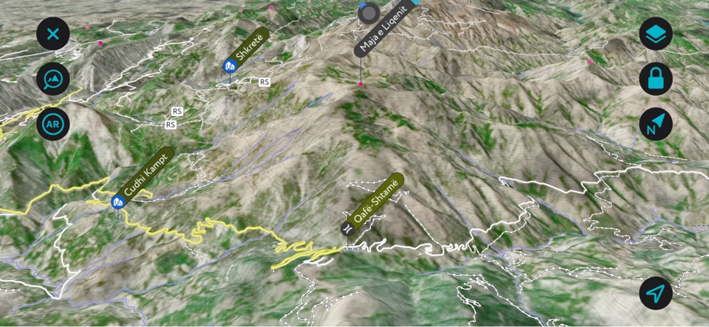
Shtamë Pass connects two regions of Albania and is protected as a nature park. Shtamë is a small refuge with dense black forests and freshwater springs. There are 3 named mountains in Shtamë Pass National Park; the highest and the most prominent is Maja e Liqenit (1,717 m / 5,633 ft).
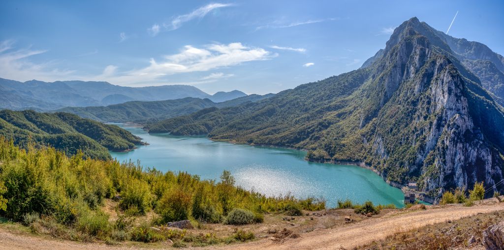
Shtamë Pass Nature Park, also known as Parku Natyror i Qafështamës in Albanian or Quefeshtames Nature Park, is situated on the northern edge of the Tirana mountain range. It covers an area of 6,864 ha (16.961 ar) and boasts a stunning landscape featuring pine forests, small lakes, and significant water sources. The Albanian government established the park in 1996 and later expanded into a nature park in 2022.
The pass is approximately 25 km (15.5 mi) northeast of Kruje, passing through the Culli municipality. Also known as the Qafë-Shtamë pass, it stands at an elevation of 1,230 m (4,035 ft) and is a vital link to the Mati Valley and north. The park's southern border connects with the Bovilla basin and shares ecological ties.
The park is south of the Skenderbeu mountain, nestled between Skenderbeu and Xibri mountains, ranging in elevation from 525 to 1,724 m (1,722 to 5,656 ft). It borders the Dajti National Park in the southeast and adjoins the Kraste-Verjon Protected Landscape in the southwest.
The small area showcases distinct structural, glacial, and erosive features. It’s in the central mountainous region of Albania, the mountain ranges surrounding Tirana, and primarily comprises siltstone-sandstone-marl and limestone-marl flysch.
Tectonic fractures and rapid Pliocene-Quaternary neotectonic activities have significantly influenced the range's morphological development, resulting in particularly sharp mountain peaks. The highest points rise steeply to the north, reaching Maja e Liqenit (1,717 m / 5,633 ft). It's important to note that Maja e Liqenit shouldn’t be confused with another peak by the same name in the Sharr region of Kosovo.
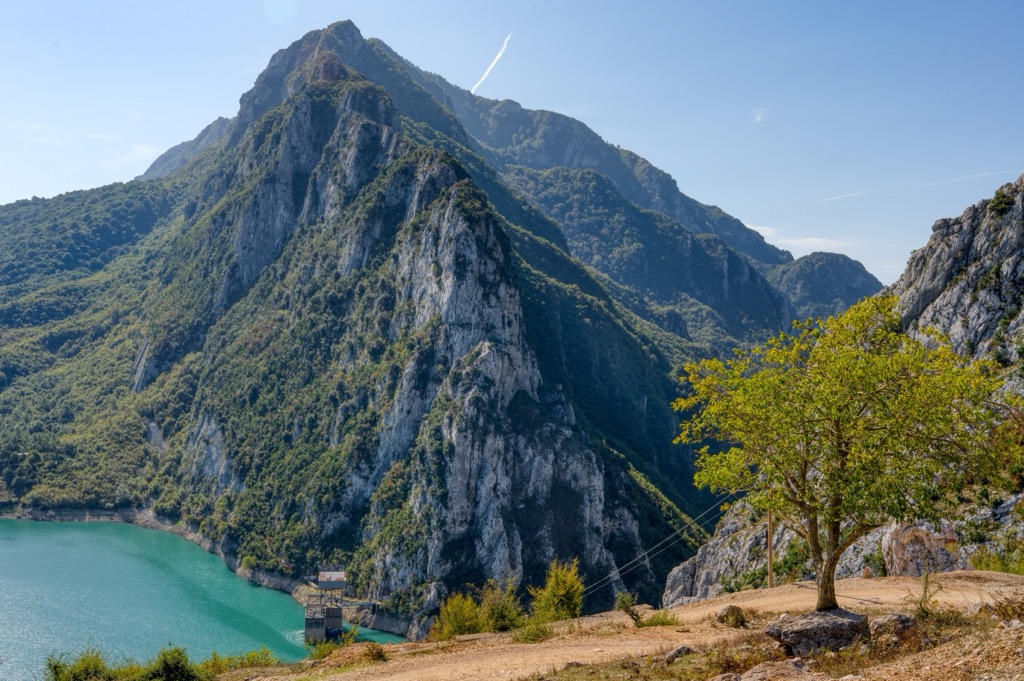
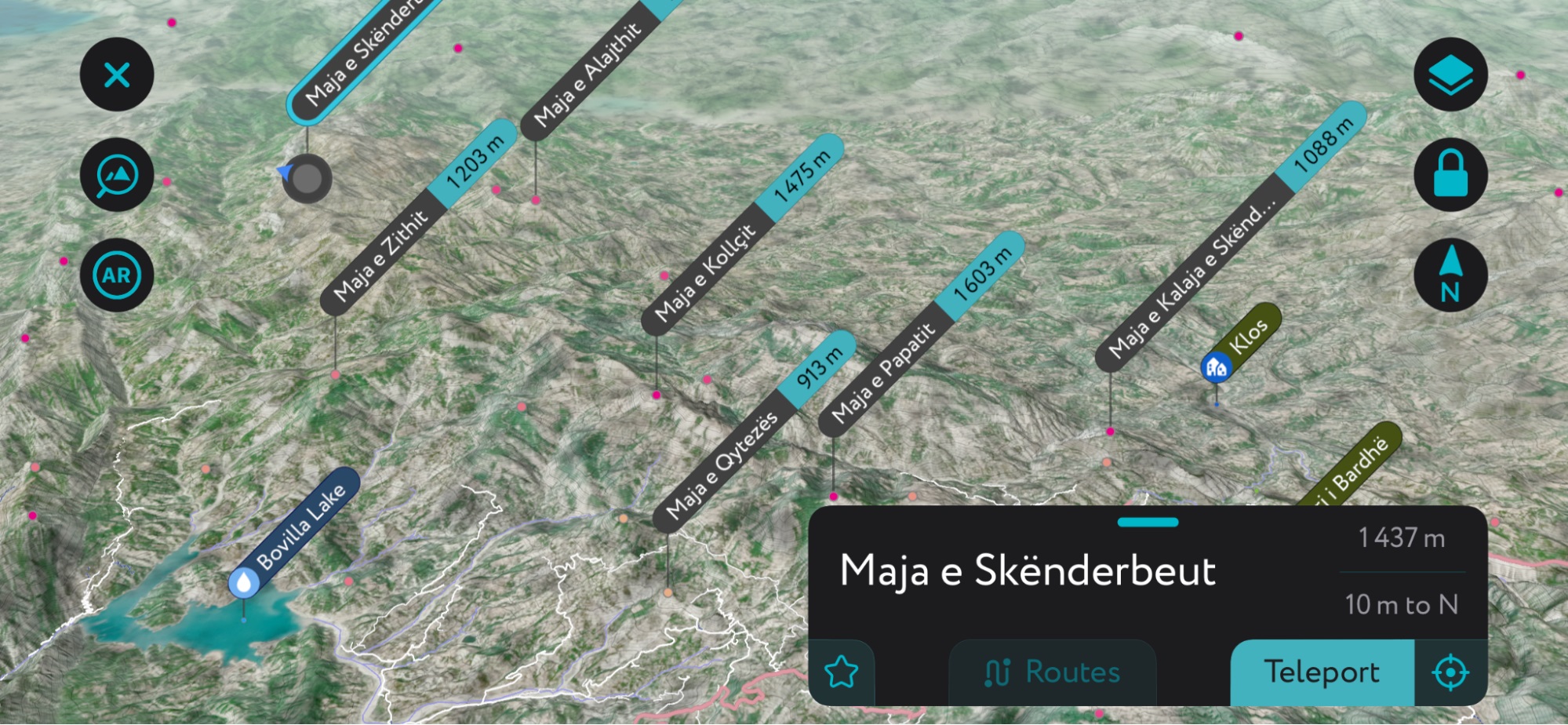
To the north of these peaks is Maja e Skënderbeut (1,437 m / 4,714 ft), which rises above the Mat Gorge and is composed of limestone.
The Zeza and Droja streams bisect the mountains. As these streams flow east to west, they've carved two steep and narrow gorges: Skalla e Vaja and Gryka e Zeza.
Notably, the springs in this area are famous for their healing properties, such as the Kroi of the 'Queen Mother,' located amidst the park's pine forest. The springs, particularly those in Shtamë, are recognized for their light and magnesium-rich water.

The park features diverse vegetation that changes with altitude. While the park's flora doesn't boast many species, it stands out for its rare grassland and scrub habitats. The park is home to several rare and endangered species.
Plants like makje or maquis shrubs cover lower elevations (up to 600 m or 1,968 ft). As altitude increases, plant cover transitions: the mid-zone (up to 1,000 m or 3,280 ft) has oak and maple, while the higher zone is dominated by black pine. Above the forest belt, natural pastures prevail, dominated by grasses, often mixed with juniper.
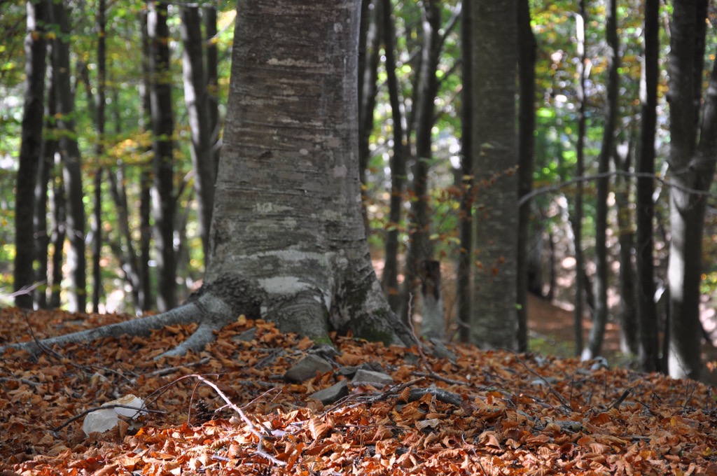
Mediterranean shrubs dominate the understory, including heather and euphorbia. The forest floor primarily consists of black pine (Pinus nigra) and beech (Fagus sylvatica). Boshtra (Forsythia europaea), an Albanian endemic, is common. The herbaceous vegetation mainly comprises grasses and plants of the rose family. The park also hosts medicinal plants such as sage, linden flower, and thyme.
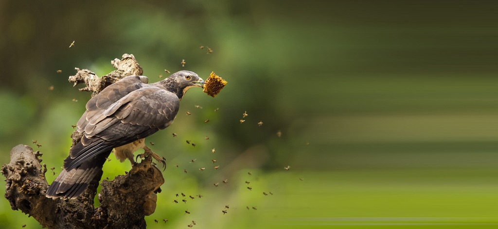
The park is home to various amphibians, reptiles, and birds, including owls, mountain eagles, honey buzzards, and mountain partridges. It’s also a core habitat for large mammals such as bears, wolves, foxes, and roe deer.
The primary water source in the Shtamë Pass Nature Park is known as "Kroi i Nenës Mbretëreshë" or "Source of the Queen Mother," recognized for its clean and healthy water. Legend has it that the Albanian Royal Family favored this water source.
King Zog, born in the Mat region, hailed from the eastern side of the pass and is believed to have built a recreational villa in this area. His mother, known as "Queen Mother," likely refers to Sadije Toptani or Geraldine Apponyis, which is why this spring is associated with the Albanian Royal Family.
The claims were supported by a laboratory from Vienna declaring it the best water in the country in 1932 through laboratory tests. Today, the water from this source is also collected and processed at a bottling plant located a bit further from the park entrance. The resulting bottled mineral water, branded as "Qafshtama," is distributed nationwide in Albania. A center specializing in the treatment of lung diseases also operates near the park.
Recently, the park has become a magnet for hiking enthusiasts. The park's status and area were changed from "national park," with an area of 2,000 ha (4,942 ar), to "natural park," with an area of 6,864 ha (16,963 ar), as of January 26, 2022.
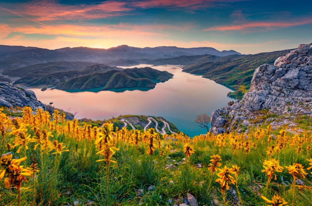
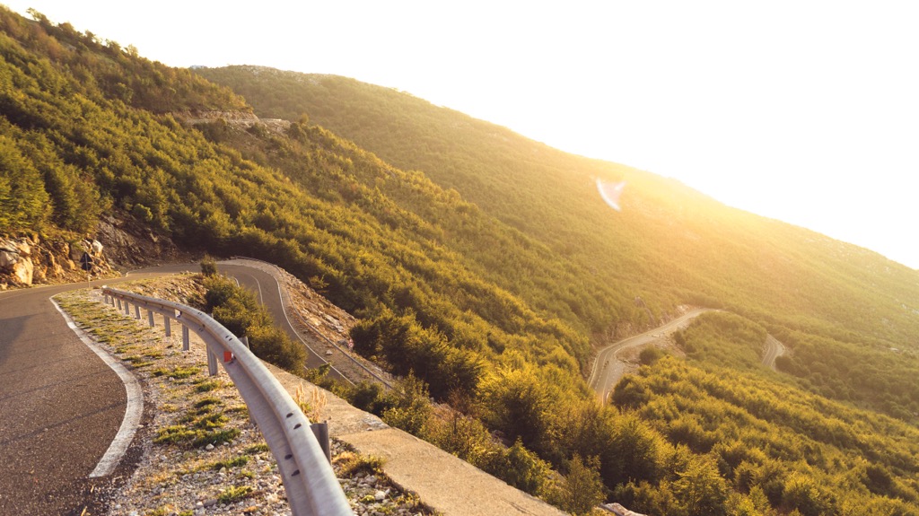
The hike from Kruje to Qafe Stama covers about 26 km (16 mi) through picturesque green valleys and forests. The trail starts on a narrow downhill asphalt road and passes villages and suburbs, offering glimpses of traditional Balkan village life. As the journey progresses, the road turns to dirt, winding uphill and unveiling a vast gorge with a flowing river.
The landscape offers beautiful vistas, especially in winter, with snow-capped peaks. The path showcases remnants of Albania's communist past, including tunnels, bunkers, and storage rooms. The entrance to the national park marks the end of the hike, featuring cabins, a hotel, and a water bottling facility.
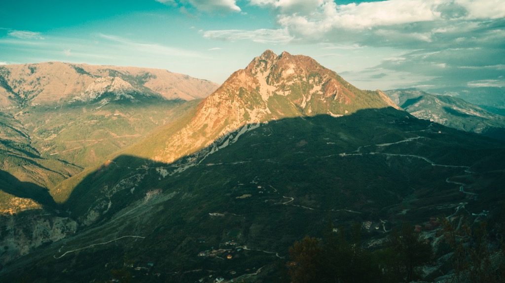
Embark on a snowshoe journey or summer hike towards the summit of Shtamë Pass Nature Park, ultimately reaching Maja e Liqenit (1,717 m / 5,633 ft). At the peak with antennae, you'll be rewarded with a vista that stretches to the Adriatic Sea.
The ascent traverses through a breathtaking forest of firs and beech trees and takes around 4 hours. Its difficulty is moderate, with an elevation change of approximately 500 m (1,640 ft).
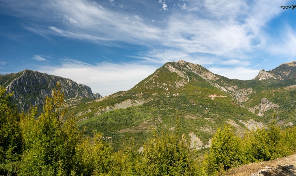
This hike covers a distance of 3.5 km (2 mi), with an elevation gain of 470 m (1,542 ft), leading you from Qafe Shtamë to the prominent Maja e Skënderbeut (1,437 m / 4,714 ft). This hike offers a panoramic view overlooking Dajti Mountain, the Adriatic Sea, Tirana, Burrel, and more.
Accessing the trailhead might pose a slight challenge, but the awe-inspiring vistas make it worthwhile. Choose between an ascent via a steep mule trail near the radio tower or a longer but equally rewarding hike along the mountain road.
These are the nearest cities to Shtamë Pass Nature Park:
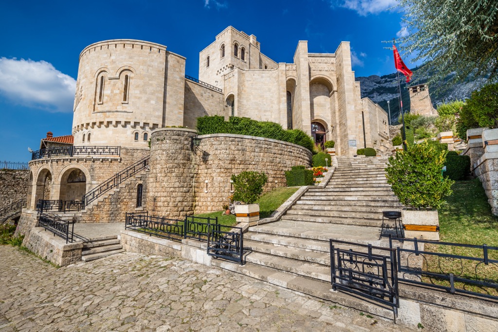
Kruje, located in northwestern Albania, is a historic and picturesque town that proudly symbolizes Albanian resistance against foreign invasions. Situated atop a rocky hill, Kruje overlooks stunning landscapes and offers breathtaking views of the surrounding countryside. Its population numbers around 59,000, making it a significant urban center for Albania.
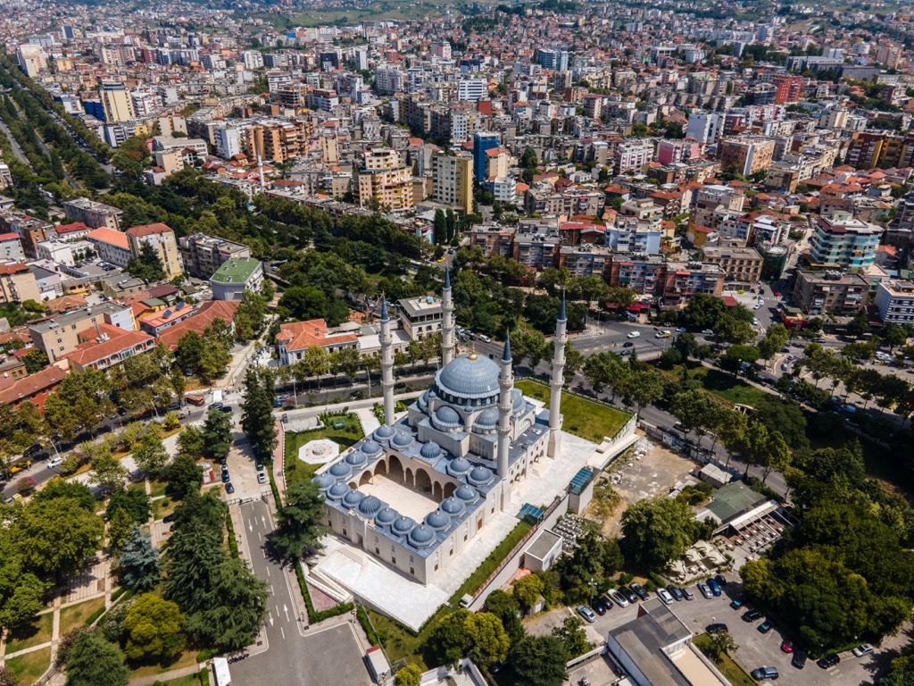
As Albania's vibrant capital and largest city, Tirana boasts a population of around 520,000. As a vital economic hub, it encompasses industry, trade, transport, communications, and tourism. The city's historical tapestry, dating back to Ottoman times, adds layers of complexity and culture. Tirana stands out with its diverse and colorful architecture, setting it apart from other metropolitan areas.
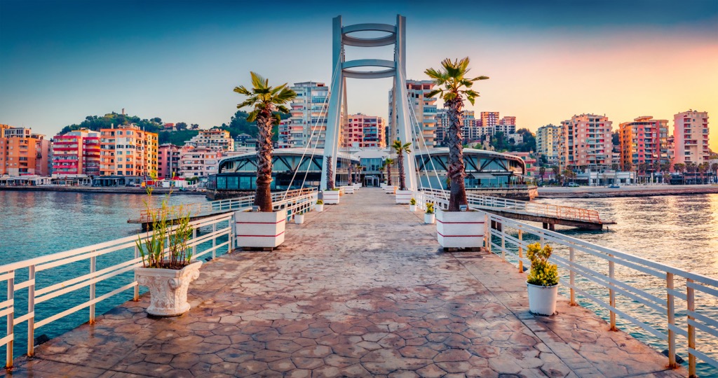
Albania's second-largest city, Durres, is home to approximately 300,000 residents and is situated on the coast of the Adriatic Sea. With roots tracing back to ancient times, Durres is one of Europe's oldest cities, steeped in a rich cultural heritage. Originally known as Dyrachion from an Illyrian settlement, it has witnessed various civilizations, including Greeks, Romans, Byzantines, and Slavs.


The highest peak in Shtam Pass National Park is Maja e Liqenit, at 1,717 m.
Notable peaks in Shtam Pass National Park include Maja e Liqenit, Maja e Zithit and Maja e Kavanijës.


