Scan the QR code and open PeakVisor on your phone
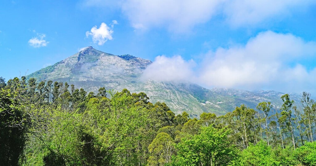
Located in northern Spain, lies Parque Natural de Ponga (Ponga Natural Park); a stunning outdoor recreation destination located within the Cantabrian Mountains. The park contains 195 named mountains. The tallest and most prominent peak is Peña de Ten standing at 2,142 m (7,027 ft) with 718 m (2,356 ft) of prominence.
Parque Natural de Ponga is situated in the northern region of Spain in the autonomous community of Asturias. The park spans 20533 ha (50,739 acres) across northern Spain. The Cantabrian Mountains run from west to east throughout the park.
The Cantabrian Mountains are located in the southern region of the park while the northern section consists of more rolling foothills. The Sella and Duero rivers run through the park. The western boundary is marked by the Ponga Ridge which separates the park from Parque Natural de Redes (Redes Natural Park).
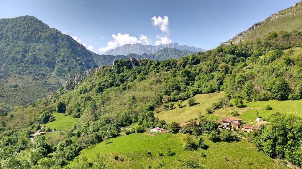
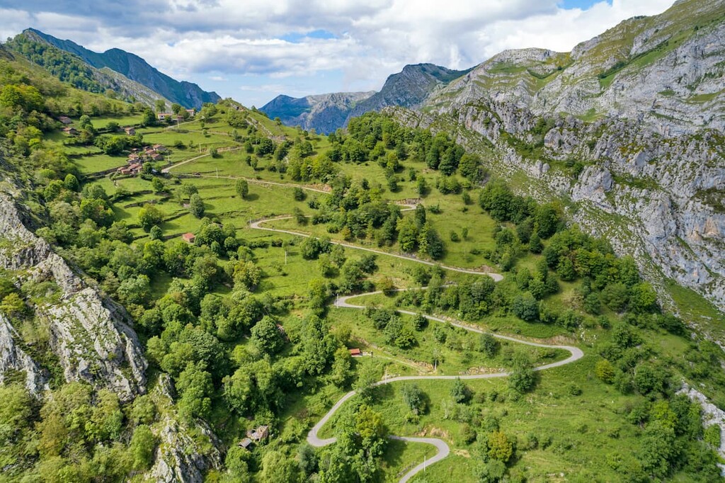
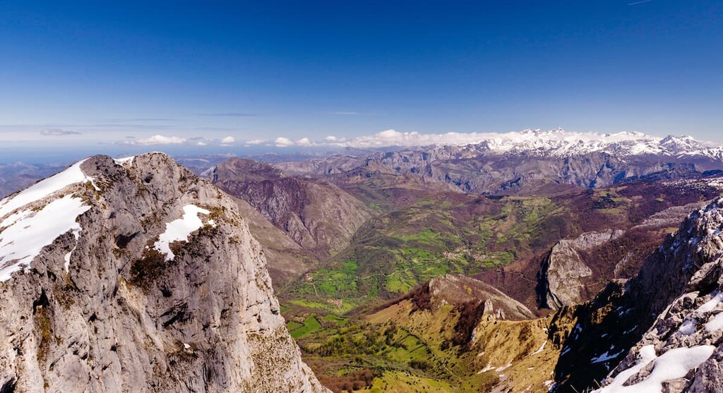
Many of the rivers in the park cut through the landscape via deep river valleys. The Cantabrian Mountains rise steeply from the river floor with the most notable valleys being the Ponga Gorge and Beyos Gorge. Lower elevations in the park are marked by their lush vegetation and predominantly beech forests.
Additionally, Parque Natural de Ponga is surrounded by other popular outdoor recreation areas. Directly west lies the Parque Natural de Redes (Redes Natural Park) and the Parque Nacional de Picos de Europa (Picos de Europa National Park) lies to the east and to the south.
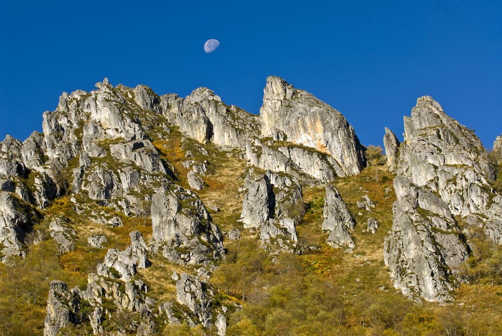
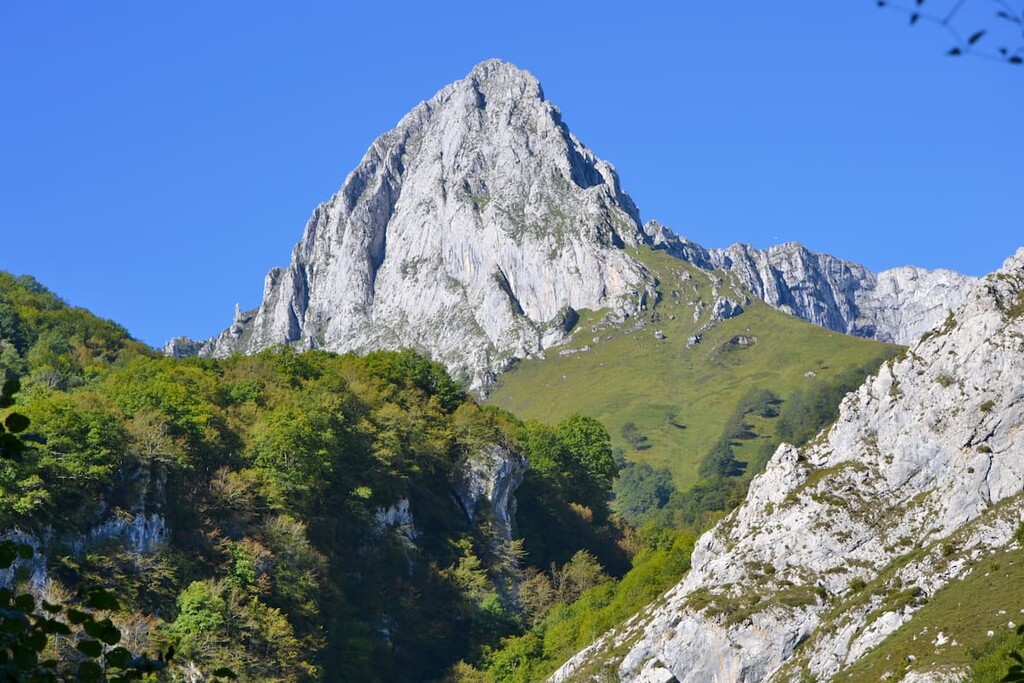
Similar to much of the mountains in Spain, the Cantabrian Mountains are limestone dating back to the Carboniferous and Paleozoic time periods. The range in the park runs parallel to the Atlantic Ocean that lies to the north.
The mountains in the park together form what is referred to as the Ponga Unit. This group of peaks are defined by their rugged faults, created from the folding of the rocks. Many of the faults in this group have folds that lie perpendicular to their peaks, given the rocks a unique composition.
The park’s limestone composition has left behind karst formations along with numerous caves throughout. Glacial formations, such as cirques and moraines are found throughout the park near the major peaks.
Major peaks within the park include Peña de Ten, Pileñes, Pierzo, and Tiatordos.
Though higher elevations in the park are marked by the rugged karst formations, the rest of the park is full of primarily beech forest. Other common trees include yes, oak, ash, maple, birch, and alder.
Together these forests cover approximately 37% of the park. Within the park lies the Peloño Partial Nature Reserve that works to protect the beech forest even further. Besides woodlands, the park is also home to vast meadows.
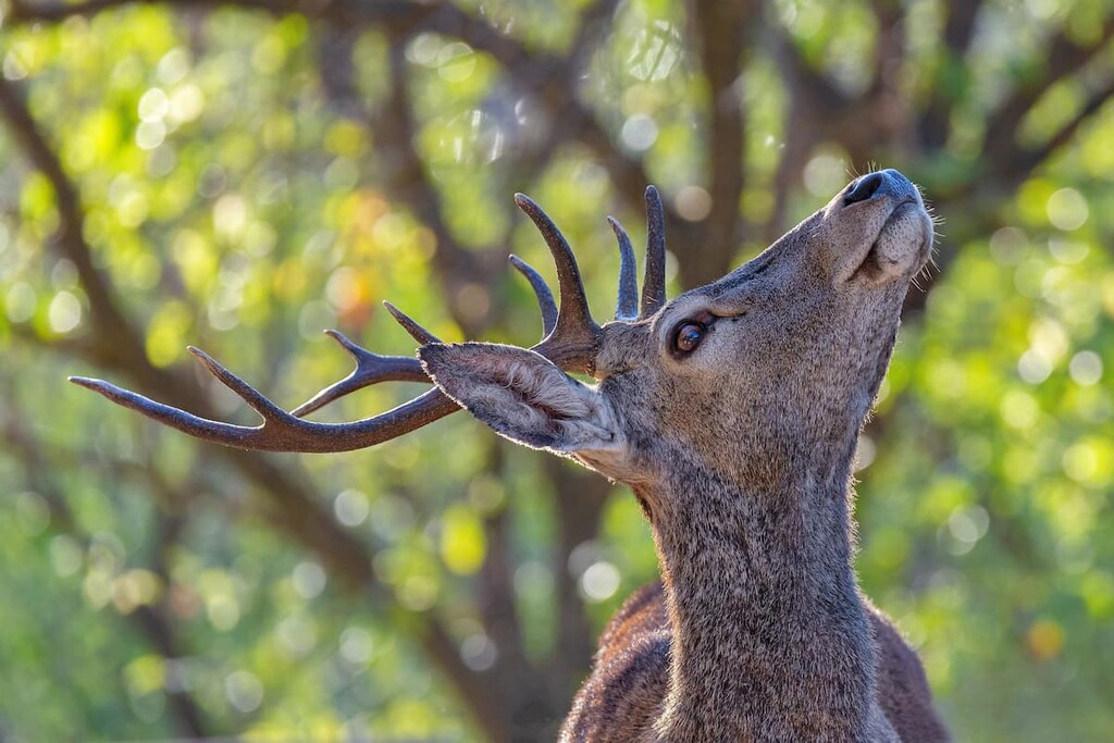
Because the park shares borders with other natural parks, wildlife is able to thrive with the vast amount of protected land. Animals in the park include brown bears, deer, muskrat, wild boar, roe deer, and a vast number of bird species.
Common bird species include the black woodpecker, Cantabrian capercaillie, golden eagle, Egyptian vulture, griffon vulture, and various other birds of prey.
Before the park, and those surrounding it, were ever established, the region was home to the Battle of Covadonga around 718 AD. Due to the significance of this battle, and the legend that Virgin Mary appeared, much of the land became protected.
The park first proposed at the same time as the Parque Natural de Redes in 1996. However, due to legislative differences, the only Redes park was established. The Paruqe Natural de Ponga was later established in 2003 and is part of the large network of parks which also share borders.
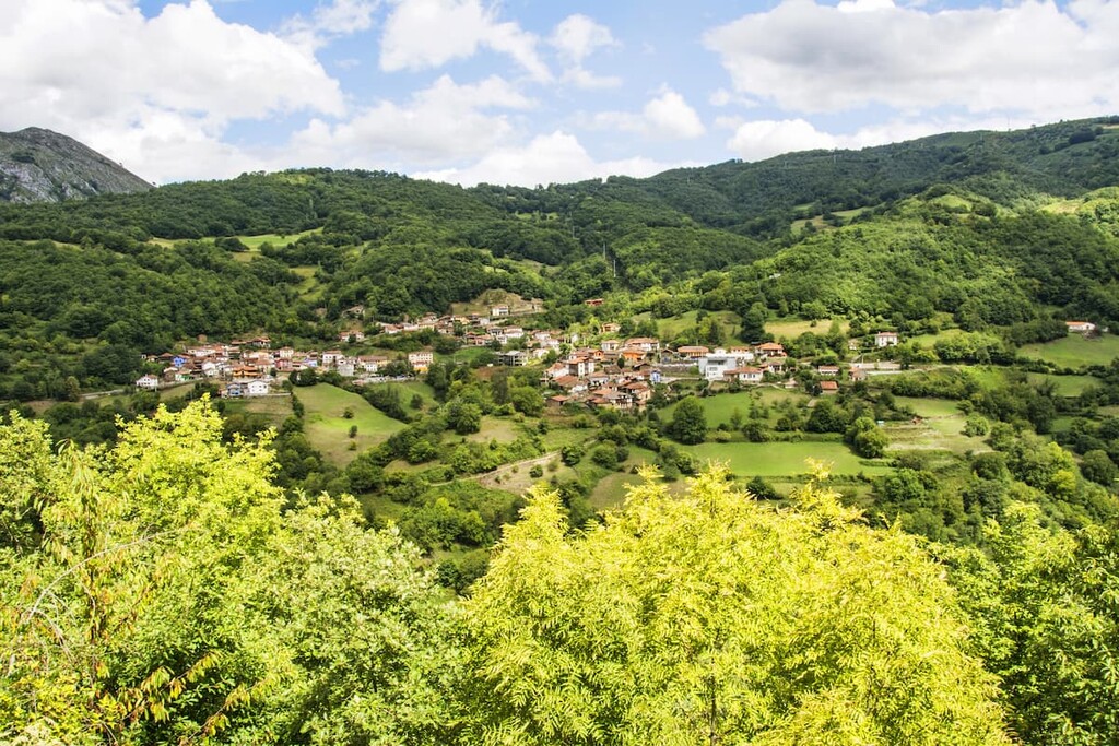
Today local communities utilize transhumance farming. This involves farmers moving livestock to higher elevation pastures during the summer months and down to lower elevations during the winter months. This is popular near the villages of Beleño, Abiegos, and Taranes.
Parque Natural de Ponga is home to numerous trails. Here are some of the top hiking areas to visit in the park:
This easy trail takes hikes up through the park to the plaza within the city of San Juan de Beleno. From the accessible town square, visitors have panoramic views of many of the major peaks in the park including Tiatordos.
The Peloño Forest trail winds steadily through this iconic preserve that lies within the park boundaries. Starting in Les Bedules, the trail travels through one of the best preserved beech forests in the entire region.
The route to the summit of Peña Salón is 4.4 km (2.7 miles) with 474 m (1,555 ft) elevation gain. This out and back trail starts near the city of Viego before steadily climbing up to the summit. From the top of the trail hikers have panoramic views of the nearby peaks and rolling beech forests.
Looking for a place to stay near Parque Natural de Ponga? Here are some of the best cities and villages to check out in the region:
Located to the northwest of the park lies the city of Oviedo. This city is the capital of Asturias and has a population of around 220,000. Oviedo is known for its rich architectural history, multiple buildings dating back to as early as 800 AD.
Many Spanish writers and artists have been inspired by this city and it is home to numerous cathedrals, museums, and theatres. Despite being slightly inland, the city has a temperate oceanic climate, perfect for visiting throughout the year.

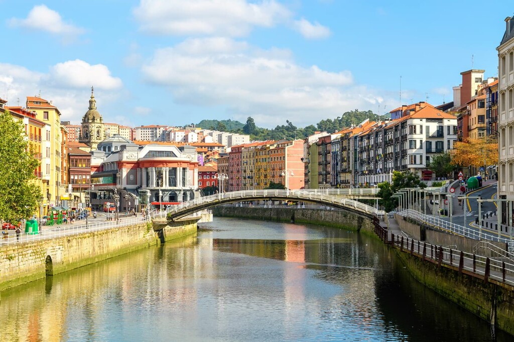
East of the park lies the city of Bilbao. With a metro population of over 1 million, the city is the largest in all of the Basque Country and northern Spain. Though the city is outside of the park, it is also home to two small mountain ranges that help give Bilbao its moderate climate.
Because Bilbao is the largest city in the region it acts as a cultural hub. Basque is spoken throughout the city and surrounding region and is home to its unique style of cuisine. The city also has over a dozen museums, many dedicated to Basque cultural and heritage.