Scan the QR code and open PeakVisor on your phone
Amid the vast Atacama Desert is Chile’s Pan de Azúcar National Park, a 438km2/169mi2 reserve established in 1985. The park has eight named mountains, the tallest of which is Cerro Morado at 803m/2,635ft, and the most prominent of which is Cerro Castillo, at a prominence of 271m/889ft.
The park is known for hosting a popular breeding ground for Humboldt penguins, as well as the small fishing town of Caleta that resides on its coast.
The Parque Nacional Pan de Azúcar is located on the coasts of both the Región de Atacama and the Región de Antofagasta, albeit with far more territory in Atacama, towards the south, than Antofagasta, in the north.
Specifically, the Atacama portion of the park resides in the Provincia de Chañaral, with Chañaral being its closest city, while the Antofagasta portion resides in the Provincia de Antofagasta. The commune of Taltal within the Provincia de Antofagasta comprises the entire northern portion.
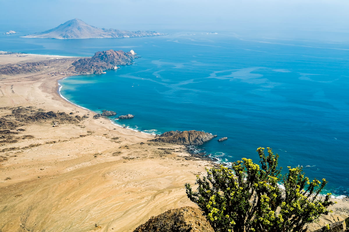
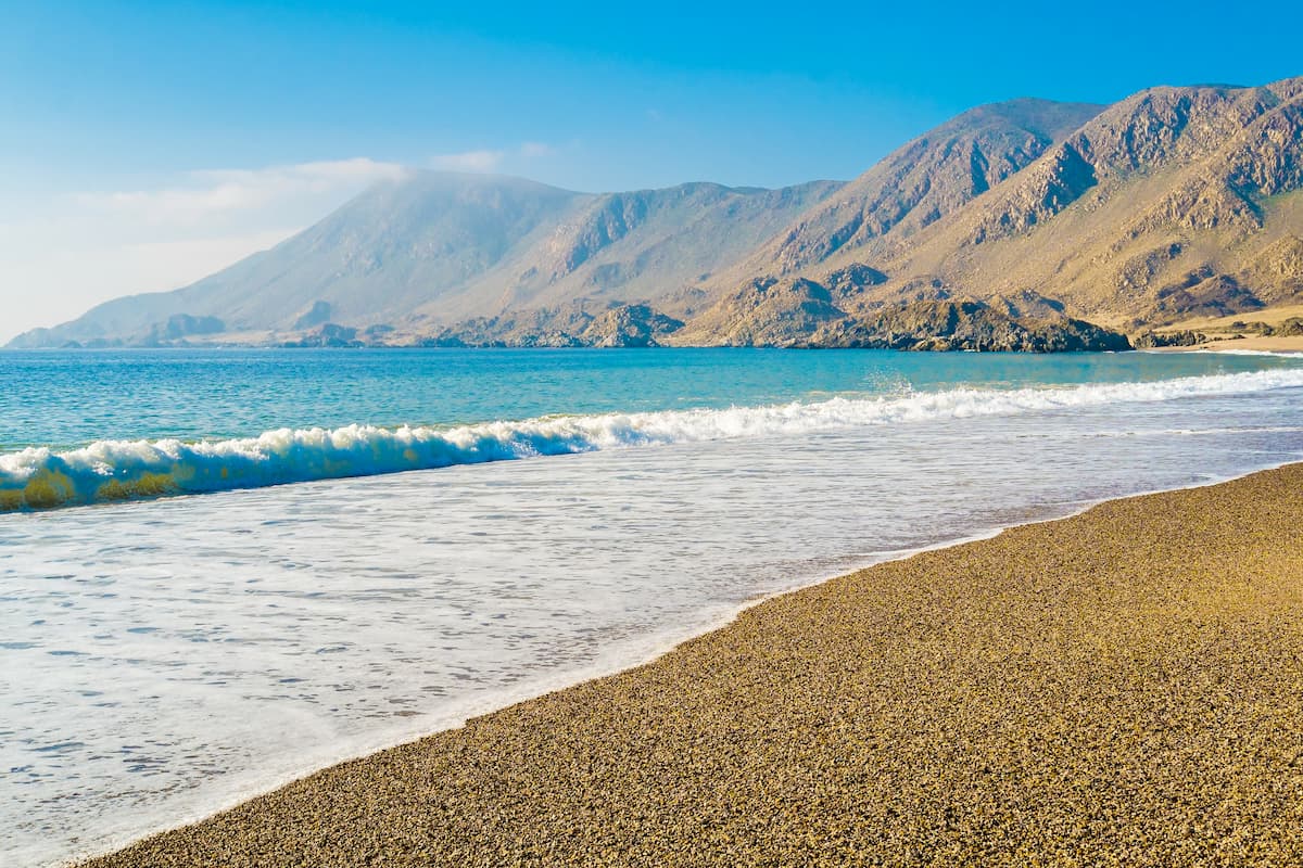
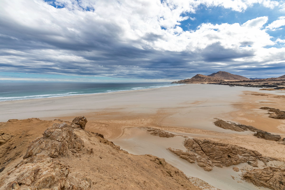
The Parque Nacional Pan de Azúcar rests on a vast coastal plain, standing in contrast to its more mountainous neighbors.
The Isla Pan de Azucar comprises the largest of a group of rock formations off the coast of the park, consisting of intensely metamorphosed sandstone and mudstone. These islands are affected by the Humboldt current, which, combined with their rocky crags, provide optimal nesting areas for Humboldt penguins.
There was once considerable volcanic activity in the area, as seen in the Las Chilcas Geological Site, but the volcanoes had eroded away after an active period in the Triassic era, leaving only exposed volcanic conglomerates.
Though mining activity has largely ceased now, the park once contained copper deposits, specifically around the town of Caleta. In the northern section, within Taltal, there were also once copper mining operations, but the discovery of potassium nitrate proved far more fruitful.
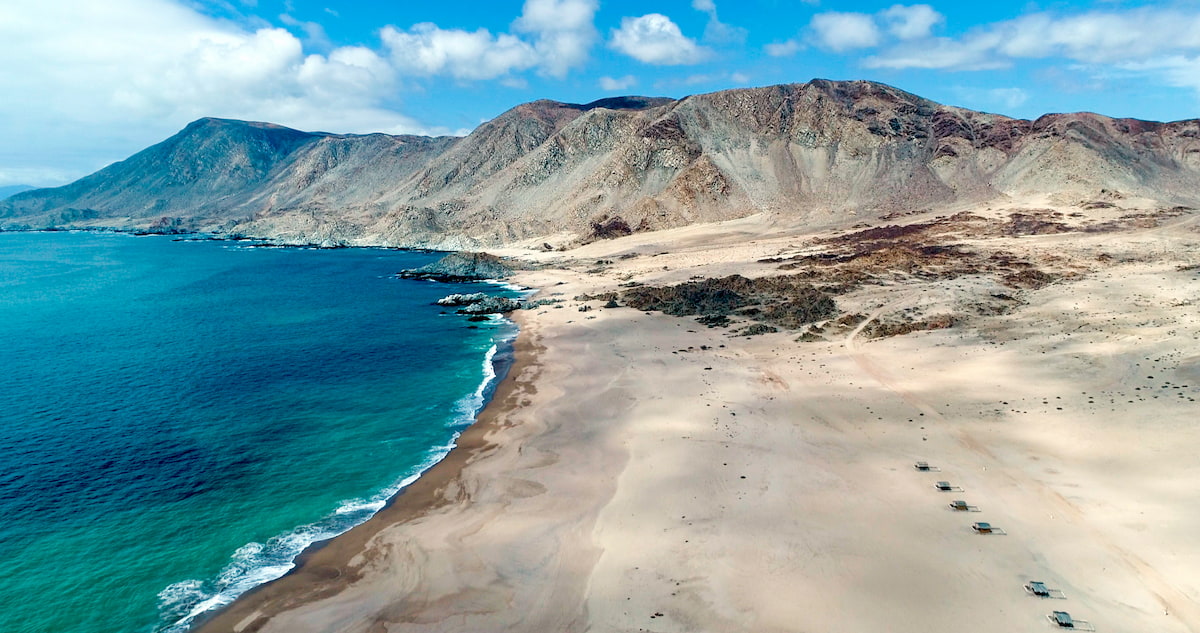
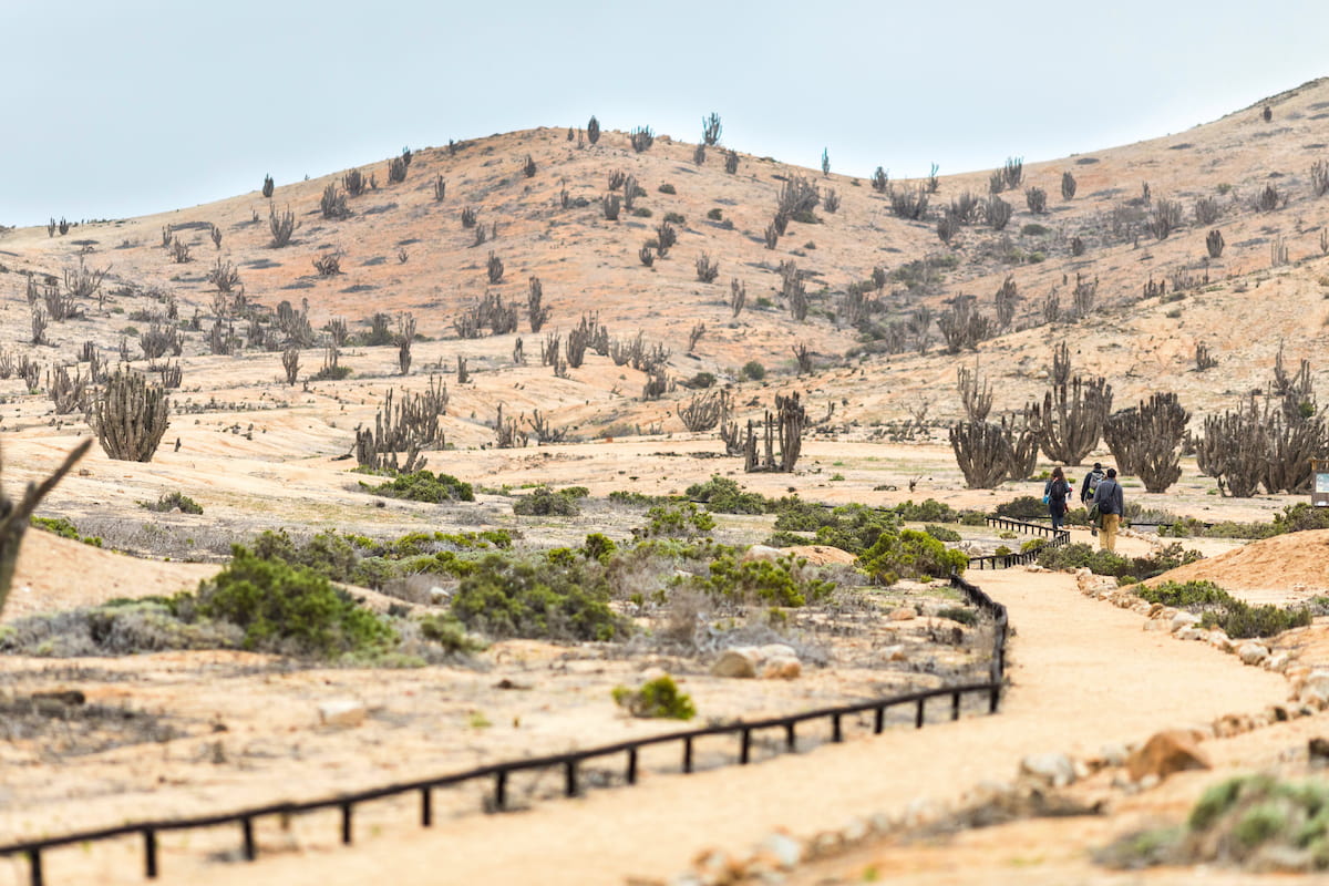
The coastal desert of Taltal and the dry desert of the interior are the two main ecosystems of the Parque Nacional Pan de Azúcar. Much like the rest of Atacama, the park is largely arid, but there is a diversity of flora supported by coastal mist, known as camanchaca.
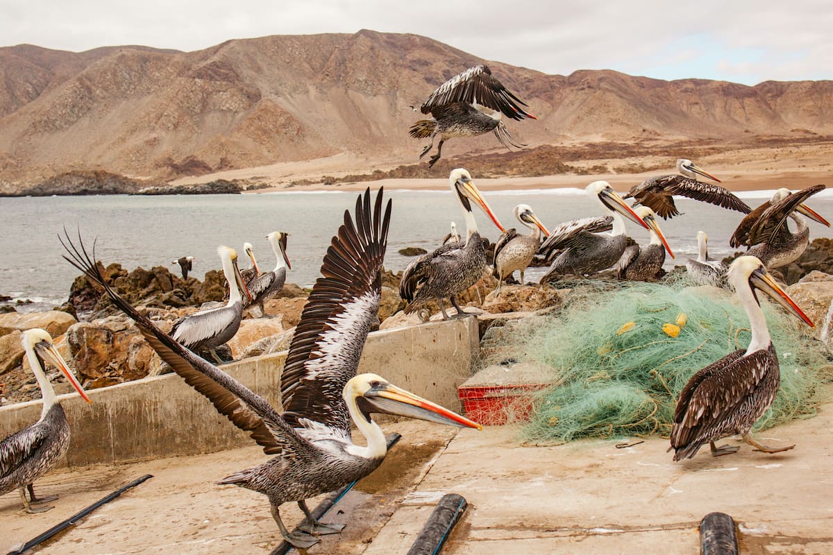
Plant species such as the chañar, cleome, or lechero thrive along the coast, whose unique colors and textures enliven the landscape. The coast is also home to marine otters, a rare weasel only found on the Pacific coasts of South America, as well as the South American sea lion and birds like plovers and pelicans.
The main attraction, however, is the Humboldt penguin, a vulnerable species native to Chile and Peru. They can occasionally be found breeding on the Isla Pan de Azúcar, a rock formation right off the border between Antofagasta and Atacama.
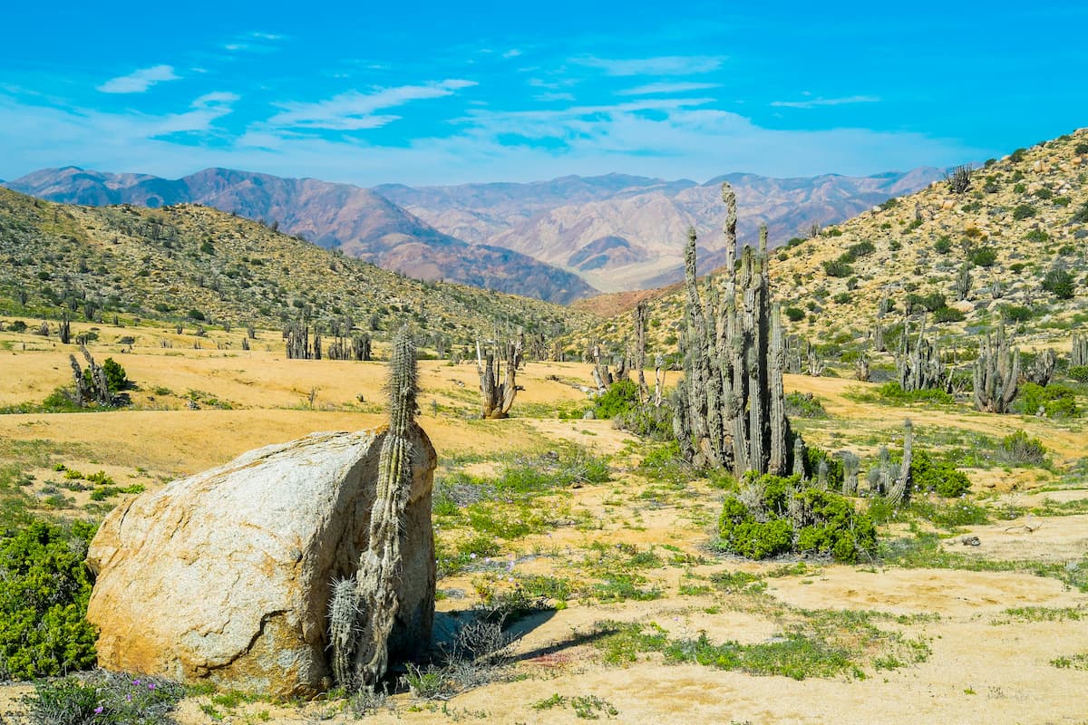
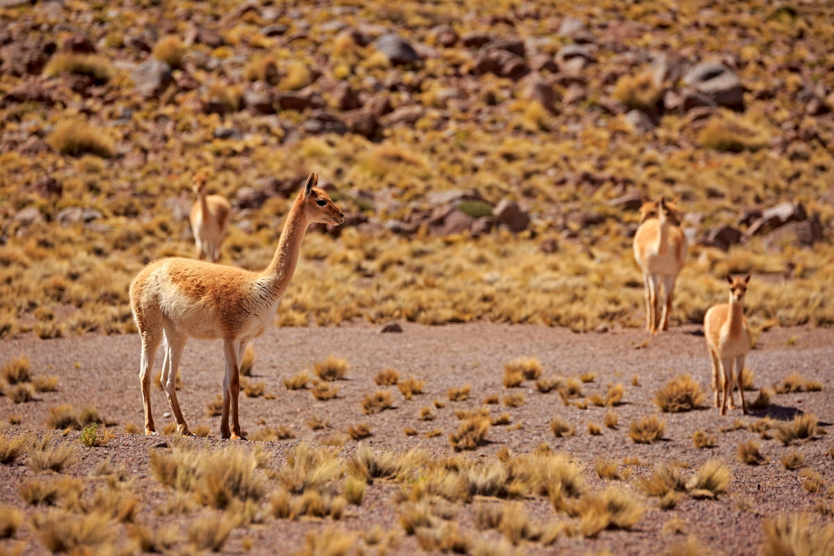
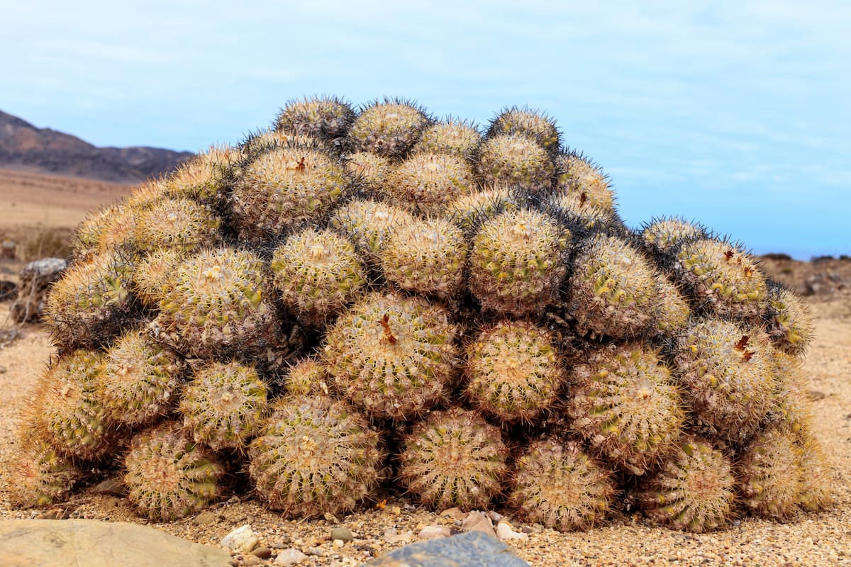
Inland, the desert boasts more than twenty species of cactus, mainly of the Copiapoa genus typical to the Atacama Desert. As for animals, guanacos, a llama-like species, are perhaps the most notable residents, alongside culpeo foxes, chilla foxes, and condors. A few species of lizards can also be found in the dryness of the desert.
The area in and around the Parque Nacional Pan de Azúcar has likely experienced human movement and settlement for quite some time, with some of the first evidence being of the Huentelauquén people. The Huentelauquéns were a prehispanic hunter-gatherer community who inhabited swaths of northern Chile.
Evidence has been found of mining activity carried about by the Huentelauquéns from around 12,000 years ago, deeming it the oldest known organized mine in the Americas. The Huentelauquens used the iron oxides they found as pigment for painting stones, instruments, clothing, and likely their own bodies as well.
It seems that the Huentelauquéns abandoned the area around 4,000 BC, though a couple thousand years later the mines were exploited again.
As the park is largely coastal, it is also likely to have been inhabited by the Chango people, who lived along the Atacama shores. The Changos were a fairly disparate community of families, who were either nomadic or sedentary, and who were typically independent of each other. The Chango culture is now considered extinct, due to Spanish conquest and integration. The Diaguitos peoples may have also populated the area at one point, especially inland.
Today, the Taltal area is mostly sustained by fishing and small mining operations. A similar history can be seen in Caleta Pan de Azúcar, whose copper mines were exploited in the late 1800s. Mining is not as important in those sites anymore, with Caleta now known for being a quaint, small fishing village popular among tourists.
The Parque Nacional Pan de Azúcar draws many people for its diverse and endemic flora and fauna, and its beautiful views of the Pacific. The park provides opportunities for camping, hiking, and biking, with twenty five camping sites, five rustic cabins, and numerous trails available.
This trail, of medium difficulty and lasting about two hours over 5km/3.1mi, runs through the desert, offering great opportunities to see the natural flora and fauna of the area. At the end of the trail is a spring, a great spot for observing Pan de Azúcar’s local birds.
Sendero Aguada Los Sapos begins at an altitude of 117m/384ft and ends at an altitude of 318m/1,043ft.
A low difficulty trail with little slope, the Sendero Costero Pan de Azúcar boasts opportunities to witness the full vibrancy of the coastal desert ecosystem. The trail takes around 2 hours for a total route of 1.5km/.9mi.
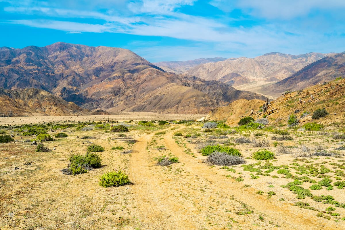
The Sendero Quedabra del Castillo leads right to the heart of the park, allowing for frequent sightings of the park’s endemic cacti and various desert animals, especially guanacos.
The altitude of the trail begins at 135m/443ft and ends at 305m/1,001ft, with the round trip of about 6km/3.7mi typically requiring about 2.5 hours to complete.
This medium difficulty trail provides different options for pedestrians and vehicles, with a 2.5km/1.5mi pedestrian route requiring around 2 hours and a vehicle route of around 7km/4.3mi. The path is great for observing cacti and shrubs, and often stumbles upon the occasional guanaco herd or fox.
The trail begins at 180m/590ft above sea level and ends with an altitude of 317m/1,040ft, at which point the stunning ocean view reveals itself.
The Sendero Las Lomitas also has different options for pedestrians/bikers and vehicles. By vehicle, one can go along the path for around 26km/16mi, although by bicycle or foot, the path lasts around 4km/2.5mi. The trek has little slope and is of low difficulty, beginning at an altitude of 750m/2,460ft and ending at an altitude of 820m/2,690ft.
This trail offers some of the best opportunities of witnessing the coastal hills and the coastal desert’s unique green vegetation, a result of the coastal fog that pours in from the Pacific. One may also catch a glimpse of guanacos, chilla foxes, or various bird species.
Outside of the main trails, the park offers many unique and extraordinary locations. The Isla Pan de Azúcar is the premiere spot in the area to witness Humboldt penguins, who enjoy nesting in its rocky slopes.
There is also the Aguada Quinchihue, a geological anomaly in the desert where the groundwater has risen to the surface, providing a watering hole that has been used throughout history by those traveling through the desert. While it often appears dry, seasonal groundwater fed by the snow of the Andes mountains occasionally replenishes it.
The historic site at the old port of Pan de Azúcar provides an interesting look into the region’s mining operations of the 1800s.
Lastly, there is the Las Chilcas Geological Site, a group of volcanic conglomerates created from violent volcanic eruptions in the Triassic Era. While the volcanoes are no longer there, the site is now home to exposed rocks formed from the volcanic deposits.
Though the area around the Parque Nacional Pan de Azúcar is sparsely populated, there are still a few options for day trips or lodging within a reasonable distance, and a number of small towns worth stopping by.
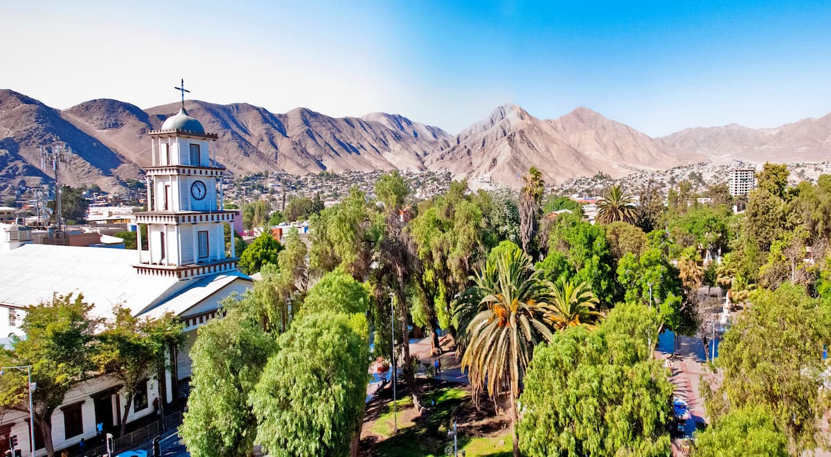
Chañaral, a small coastal city with only around 13,000 people, is the capital of the Chañaral Province and the closest city to the Parque Nacional Pan de Azúcar. The city is relatively untouched by tourism, often overlooked in favor of San Pedro de Atacama.
The contamination of the ocean from its copper mining industry prevents a potentially successful seaside resort industry, also hindering its popularity.
Nonetheless, its proximity to the park, colorful buildings, and lively daytime atmosphere deem it worth a visit.
About two hours south of Chañaral and thus, by extension, the park, Copiapó, a city of around 158,000 people in the aptly named Provincia de Copiapó, has a developing tourism sector propped by its growing downtown, many national and indigenous monuments, museums, parks, and casino.
Located fairly central to many of the Región de Atacama’s main attractions, Copiapó may be an ideal lodging option for those exploring the area, while also making for a great day trip for those interested in the Región de Atacama’s history.