Scan the QR code and open PeakVisor on your phone
Llica National Park (Parque Nacional Llica) is a mountainous protected area in western Bolivia that’s located next to the world’s largest salt flats. The area is home to 39 named mountains, the highest and the most prominent mountain of which is Cerro Sapajo at 5,190 m (17,028 ft) in elevation.
Llica National Park (Parque Nacional Llica) is located at the far western edge of Bolivia, in Daniel Campos Province (Provincia de Daniel Campos) within the department of Potosí (Departamento de Potosí). The park encompasses an area of about 972 km² (375 mi²).
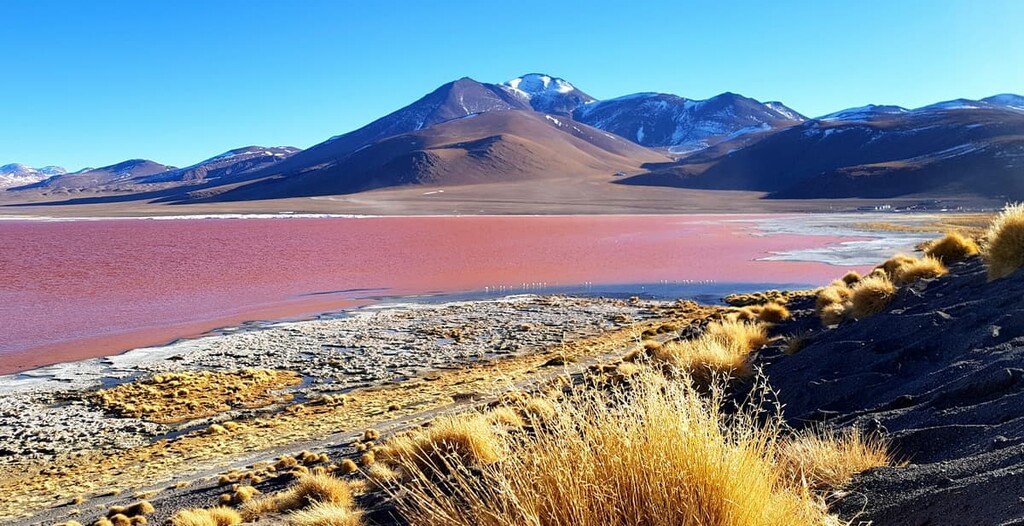
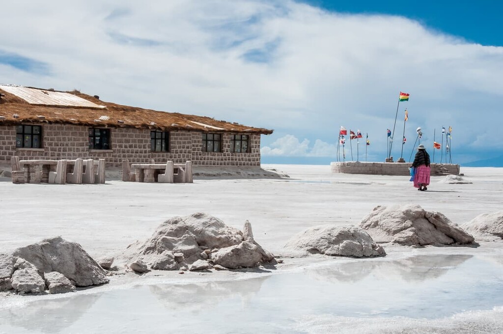
Llica National Park lies within a mountainous, volcanic area of the central Andes, within the Bolivian Cordillera Occidental. To the west, the park is bounded by the border with Chile. To the east, the park is boarded by the Salar de Uyuni, the world’s largest salt flat.
The Salar de Uyuni covers over 10,000 sq. km (3,900 sq. mi) of land, roughly the size of Puerto Rico. Average elevation varies less than a meter (3.3 ft) across the whole area, making this the flattest place on earth. The salar is so uniformly flat that it’s frequently used by satellites to calibrate their instruments.
While salt flats are the biggest tourist draw to the area, Llica National Park contains its own fascinating geological features, including volcanic mountains and craters. Elevations in the park range from 3,500 m to 5,190 m (11,500–17,000 ft) at the summit of Cerro Sapajo.
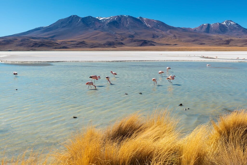
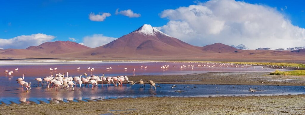
Outside of Llica National Park, the Salar de Uyuni is the most famous nearby hiking area. Hikers climb the extinct volcanic hills, often called islands, that rise from the salt flat. The volcanoes around its edges are also hiking destinations, most notably 5,432 m (17,820 ft) Tunupa.
The closest national park to Llica is Sajama National Park (Parque Nacional Sajama), which lies to the north along the Chilean border.
Llica National Park is located within the Andes, the world’s longest mountain range. Specifically, Llica National Park is part of the Cordillera Occidental, the volcanic western spine of the Bolivian Andes.
The park is part of a transition zone between the Cordillera Occidental and the Intersalar, a mountainous region between the large Uyuni and Coipasa salt flats. While there are no active volcanoes in the park, most of the terrain features have volcanic origins.
The Intersalar lies within the rain shadow between the Cordillera Occidental and the Cordillera Real to the east, so it's highly arid. The region only receives a few inches of rain a year. Some parts of the Atacama Desert, which is located to south of Llica National Park, have no record of ever receiving rainfall.
Plant and animal life varies with the climate at different elevations within Llica National Park. Between 3,550 m–4,100 m (11,600–13,450 ft), the park is part of the Puna ecoregion, with lower elevation areas containing smaller salt flats.
At higher elevations, the mountains are dominated by high Andean desert conditions. The highest mountains in the park are permanently snow-capped, with the snow line lying around 4,800 m (15,750 ft).
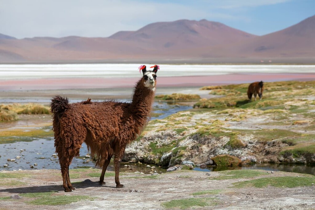
Some of the most important plants in the area are the massive Pasacana cactuses, which grow tall and thick enough in some areas to be called forests. They can grow up to 9 m (30 ft) tall. The most recognizable animal in the park is the vicuña, a wild relative of the lama.
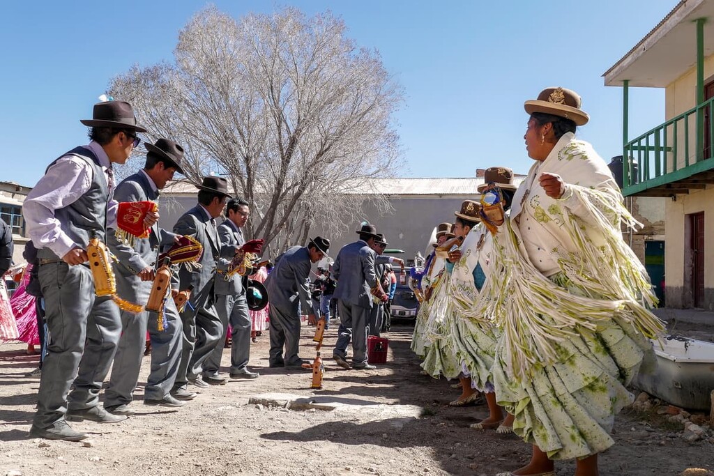
While Llica National Park was first established in 1990, people have lived in the area for thousands of years. The park is part of the traditional territory of the Aymara people.
The Aymara are an Indigenous group who live in high Andean and Altiplano areas of Peru, Bolivia, and Chile. There are about 2 million Aymara people across the region today. Over 85 percent of the population of Llica Municipality is Aymara and many speak Aymara as their first language.
While the Aymara are the Indigenous people of the region, the Inca conquered the area before the arrival of Spanish colonists in the 1500s. The small town of Llica, which is the capital of Daniel Campos Province, has likely been inhabited for over 500 years.
Cerro Sapajo can be climbed via a trail from Pella, a small town southwest of Llica. There are also routes to the top of Cerro Vilajake.
Many of the trailless peaks in Llica National Park can be climbed by walking overland with a good map and compass. There are no trees and everything is exposed, so navigation is relatively easy.
If you plan to hike in Llica National Park, the best choice is to hire a local guide from the town of Llica.
Looking for a place to stay near Llica National Park? Here are some of the best cities and towns to check out:
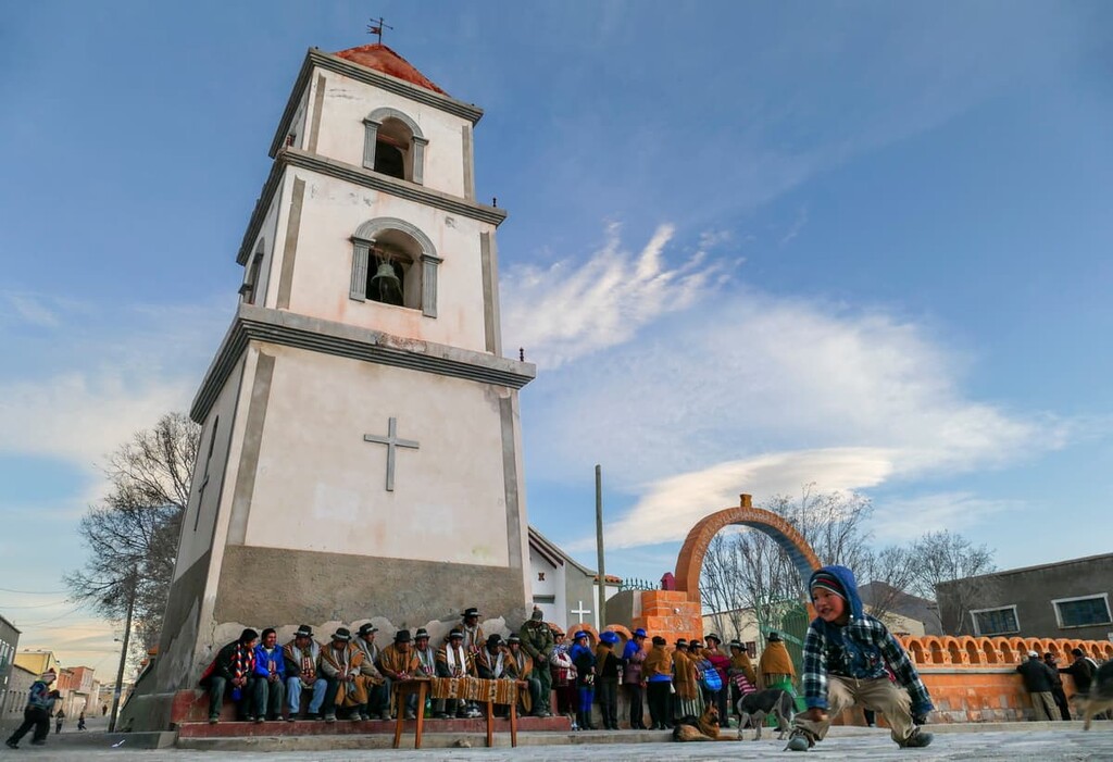
The town of Llica lies on the northeast border of the national park. It’s a small town of about 500 people and it is not a main tourist town, but there are several hotels and restaurants here. Llica is mentioned in a Spanish colonial document from 1571, so the town is at least several hundred years old, and probably much older.
The easiest way to get to Llica is to take a public bus from Uyuni, which crosses the salt flats.
If you’re coming to Llica National Park, you’ll likely be passing through Uyuni. Uyuni is a small city of about 30,000 people, but it’s a major transportation hub. Not only is the town a junction of four railway lines, it’s also the main jumping-off point for tours across the salt flats.
Uyuni has a “train graveyard” a few kilometers outside of town and a good street market, but other than that there’s little by way of dedicated tourist attractions to check out in town. Use it as a base to resupply for a hiking trip or find guides and information.
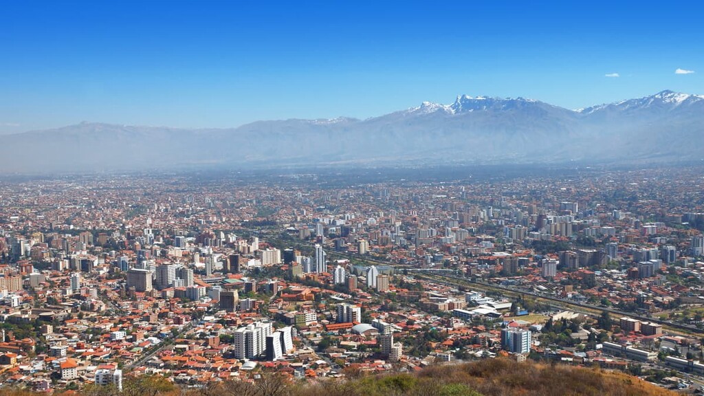
While it’s over a 10-hour drive away, Cochabamba is the closest major city to Llica National Park. It’s the fourth largest city in Bolivia and it is home to about one million people. If you’re making your way from La Paz towards Uyuni, Cochabamba is worth a stop.
Cochabamba has a reputation as a laid-back, friendly city with some of the best restaurants and dining in Bolivia. It’s also located on the border of Tunari National Park, at the base of some of the tallest mountains in central Bolivia.