
Scan the QR code and open PeakVisor on your phone
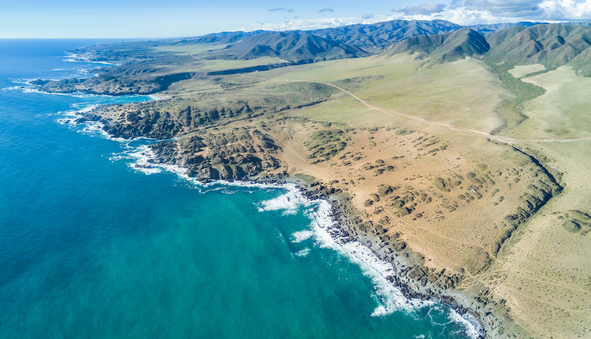
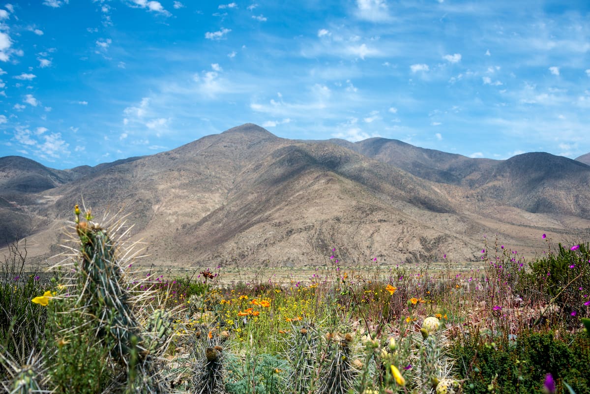
On the southern coast of Chile’s Región de Atacama lies the Parque Nacional Llanos de Challe, a premiere site to observe Atacama’s desert bloom. Amid the dryness of the desert, the mist of the Pacific Ocean allows for Llanos de Challe to sprout lush green hills and a diverse array of flora and fauna.
There is discrepancy as to what the actual tallest peak in the park is, as there are some peaks that aren’t very widely or officially recognized, such as the Cerro El Toro at around 1,014m/3,327ft above sea level.
Cerro Chuchampe is also one of the tallest and most prominent peaks, at an elevation of 924m/3,031ft with a prominence of 584m/1,916ft. The shorter Cerro Negro, however, at 774m/2,539ft above sea level, is perhaps the most popular mountain at the park, due to its excursions and vistas.
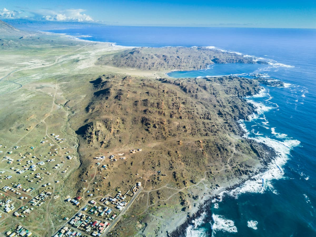
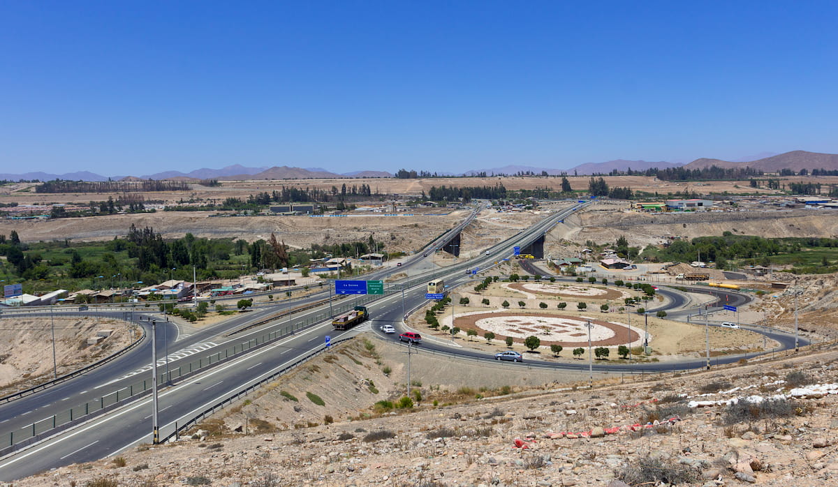
The Parque Nacional Llanos de Challe rests on 45,708 hectares of land in southern Atacama, specifically within the province of Huasco, one of the Región de Atacama’s three provinces. The park is located directly above the province’s eponymous city of Huasco and about 74km/46mi from the province’s capital of vallenar, as well as 119km/74mi southwest of Copiapó.
The landscape of the Parque Nacional Llanos de Challe is largely mountainous outside of the coast. On the western portion, where Cerro Negro lies, the hills make up a coastal mountain range, part of the Cordillera de la Costa, with humidity influenced by the rolling fog of the Pacific.
The park’s landscape is part of a sedimentary deposit from the Cenozoic era, lying upon a foundation of basal rock. The park is also affected by the Canto del Agua, a geological formation of the Región de Atacama consisting of layers of limestone, sandstone, shales, mudstone, marine sediments, and others.
The Llanos de Challe area is also blanketed by clastic sediments with little stratification or consolidation, mainly consisting of breccia and clasts of granitoids and quartzites.
Like many of the coastal parks in Atacama, Llanos de Challe provides a mixture of coastal desert with the arid inland. The coastal desert is made lush and humid by the Pacific fogs that roll into its hills, with these specific moist, misty hill ecosystems referred to as lomas.
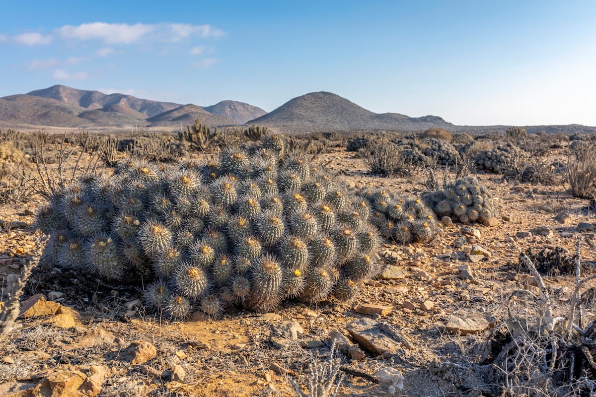
This climate contributes to a total flora count of over 220 distinct species. Given Atacama’s unique climate, 206 of the species are native to Chile, with 14 of them specifically endemic to Atacama.
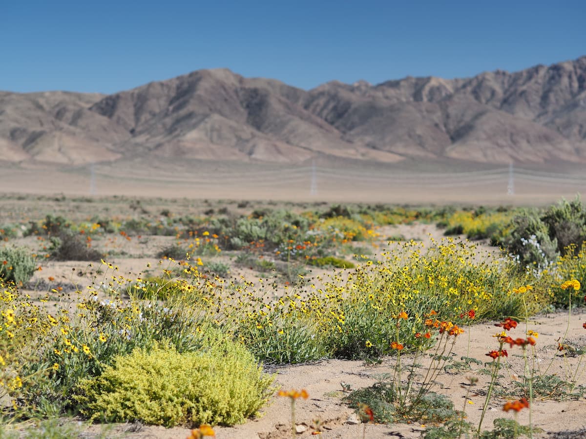
Many of these species are cacti, of which the Atacama Desert is known for having a wide variety, as well as geophytes, plants with an underground storage organ that allows them to conserve necessary resources.
The park also does important conservation work, protecting plant species in danger of extinction, such as the garra de león and the napina, as well as 14 species categorized as vulnerable.
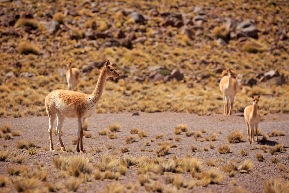
As for fauna, Llanos de Challe is considered one of the optimal locations to observe guanacos, a llama-like animal that is prolific within Atacama. The park also houses chilla and culpeo foxes, alongside common desert and scrubland birds such as condors, canasteros, and the endemic Moustached turca, and even peregrine falcons.
In especially moist El Niño years, the park may undergo a beautiful desert bloom from September to November, setting the desert alight in the colors of its flowers. Wonderfully vibrant añañucas, malvillas, and lilies are some of the most notable flowers during these events.
The province of Huasco, where the Parque Nacional Llanos de Challe is located, has a rich history of mining, beginning with pre-Hispanic indigenous groups and continuing throughout Spanish colonization and eventual independence.
From around 1000-1400 AD, the Huasco coast was populated by peoples of the Copiapó culture. During the Incan reign of much of the Atacama Desert, the Copiapós merged with the Diaguita peoples of the area. There may have also been folks from the Chango culture who used the Huasco shoreline for fishing, perhaps around the 1500s, though they did not seem to remain in the specific area very long.
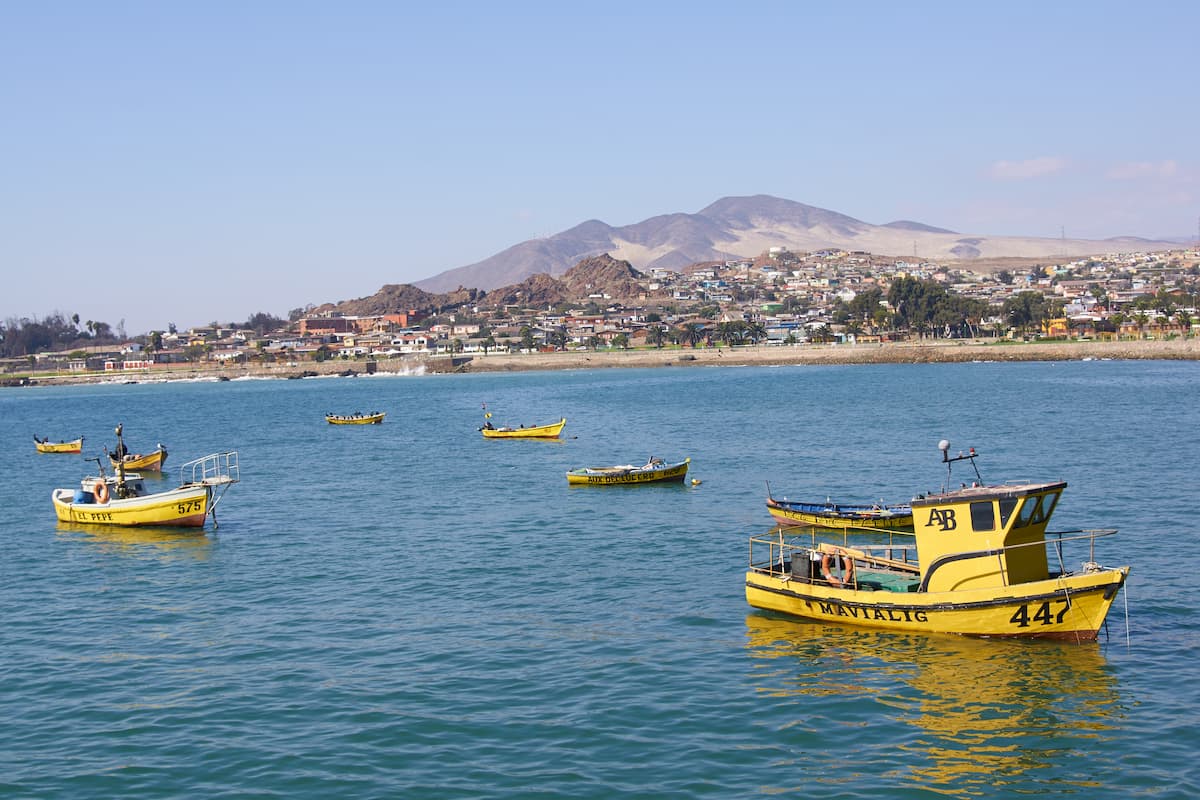
When Spanish colonization efforts began in the 1500s, the area soon became known for its large copper deposits, especially in Vallenar. The province’s ports also became important, having been used in prehispanic times for fishing and travel. In the 1800s, the Huasco port became a site of much movement as copper exploitation and exportation increased.
The area’s location has made it a prime site for numerous powerful earthquakes and tsunamis, including one of a magnitude of 8.39 in 1922, resulting in the death of 14 people, and most recently, a 6.7 magnitude earthquake in 2013, though the epicenter was far enough from Huasco to mainly result in power outages.
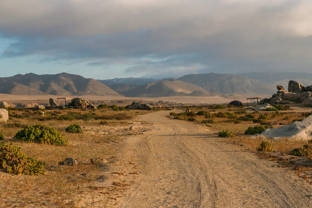
There are two main trails inside the Parque Nacional Llanos de Challe, namely the Sendero Interpretativo Centenario and the Sendero Los Corrales. Outside of the trails, the park also provides picnic areas, opportunities for camping within the coastal sector, and the stunning white sand beach of Playa Blanca.
This is the main trail of the park, a 2.5km/1.5mi circular route that offers sights of the various environments and vegetation that make the Parque Nacional Llanos de Challe so interesting.
The Sendero Los Corrales, a longer round trip of around 6km/3.7mi, starts and ends at the Los Pozos nursery.
There are also various guided excursions available throughout the park, such as a 3km/1.9mi trek up Cerro Negro, boasting amazing panoramic views of the park and of the camanchaca ecosystem.
Other excursions include:
The Parque Nacional Llanos de Challe is in proximity to several cities of the Región de Atacama, many of which are not very populated, but nonetheless provide great opportunities for day trips and getting to know the Atacama Desert’s rich culture and history.
Huasco is the closest city to the Parque Llanos de Challe, and perhaps an ideal lodging location for those looking to venture to the park. Despite having a population of only around 10,000 people, the city provides all the essential infrastructure for tourism, with hotels, clubs, and clean beaches outfitted with kayak rentals or horseback riding opportunities.
The city holds numerous festivals throughout the year with a wide variety of themes, from visual art to music to history to religion and more. Huasco is also home to many architectural attractions, like the Iglesia de San Pedro Apóstol, a church shaped like a ship’s bow, as well as forts, a lighthouse, sculptures, and more.
Near the city are numerous interesting locations, such as the Huasco Bajo, an ancient town known for its old and unique olive trees, and the Huasco River estuary wetland, hosting a biodiverse ecosystem known for its variety of birds. Along the coast, one can find a variety of marine life as well, with large numbers of sea lions occasionally present.
Surprisingly, the capital of the Provincia de Huasco is not Huasco itself, but Vallenar, a city of around 52,000 people just an hour east. Vallenar is famous for its mining sector, but also hosts many attractions, including museums, parks, commercial centers and plazas, clubs and hotels, and the stunning San Ambrosio Church.
About two hours northeast of the park is Copiapó, the capital of the Región de Atacama with about 158,000 people and the site of much development in tourism and hospitality in recent years. The city’s rich history and many national and indigenous monuments, as well as its museums, parks, casinos, and commercial centers, make it an attractive place to stay or visit.


