
Scan the QR code and open PeakVisor on your phone
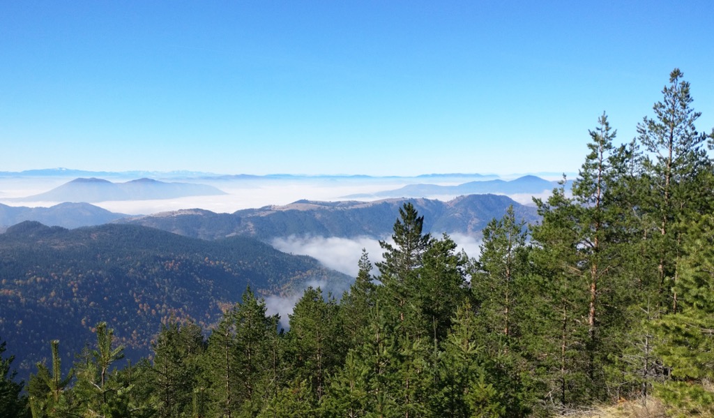
The Nature Park Šargan - Mokra Gora straddles the border between Serbia and Bosnia and Herzegovina, protecting dense forests, numerous waterfalls, and historical sites. Located amidst the Dinaric Alps, there are 46 named peaks in the park; the highest and most prominent is Zborište (1,546 m / 5,072 ft).
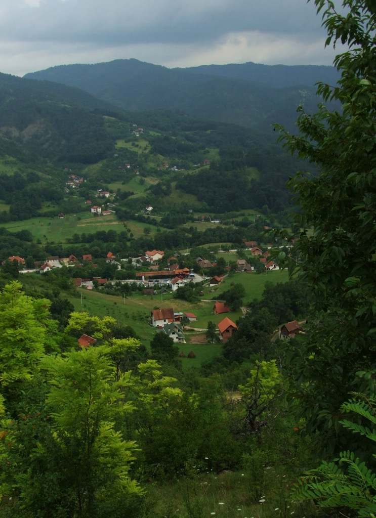
The Nature Park Šargan - Mokra Gora is in southwestern Serbia and is encompassed by the Dinaric Alps, specifically in the Starovlaško-raška highlands region. The park spans 10,813 ha (26,726 ar) and includes parts of the municipalities of Mokra Gora and Kremna within the Užice city area.
The park encompasses the Mokra Gora basin, a portion of the Kremanska Kotlina basin, the southeast area of Tara Mountain, and the northwest branches of Zlatibor, including the Šargan Pass. Thanks to its unique geographical position, the pass has historically been a significant crossroads for various nations, cultures, and religions.
Today, the highway passes through the park, connecting southeastern and western Europe as it traverses Serbia, Bosnia and Herzegovina, and Croatia. Within the park, the highest peak is Zborišta, reaching an elevation of 1,546 m (5,072 ft).
The park is 255 km (158 mi) from Belgrade, 51 km (32 mi) from Užice, and 23 km (14 mi) from Višegrad. The Kotorman border crossing with Bosnia and Herzegovina is located at the park's boundary, connecting Užice to Višegrad.
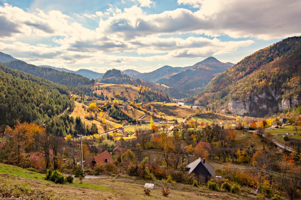
The Mokra Gora is defined by the interactions between the carbonate mass of Tara Mountain's karstic plateau and the peridotite massive ridge of nearby Zlatibor Mountain.
The oldest rocks, consisting of sandstone, aerolite, clay, and limestone, date back to the lower and middle Paleozoic. The constant sinking of the lower erosive base during the withdrawal of the Pannonian Sea resulted in the incision of riverbeds, creating deeply incised gorges and canyons that divide the high plateaus.
Unique wilderness areas include the Suvi Potok Gorge and the canyons of Kamešina and Dubošca. These areas feature cascading streams within narrow riverbeds, surrounded by cliffs, outcrops, and rocky formations.
The limestone hill Vao (1,219 m / 3,999 ft), surrounded by the Timotijevići, Podstenje, Turudići, and Milekići hamlets, is a wilderness oasis rising above the Grubiševac and Suvodol streams. The cliffs of this limestone hill feature numerous caves and pits, the most famous being Hajdučka and Crvena pećina.
The waters of the Mokra Gora basin flow into the Drina, while the waters of the Kremansko basin feed into the Zapadna (West) Morava. The pass Šargan marks the watershed between the two basins.
Predominant black pine and oak forests characterize Mokra Gora's vegetation. Alder and white willow forests exist in the valley's lower parts, and beech forests occupy limestone areas, while black pine grows on both serpentinite and limestone.
Among the 800 flowering plant species and ferns, 7.5% are endemic or sub-endemic, including Balkan endemics like the Yugoslav bellflower and Haynald's athamant. The Red Data Book of Flora of Serbia lists the critically endangered Alpine knapweed - thriving on limestone slopes of Ograđenica - as the park’s only endangered plant species.
Cold, salmon-type waters host various fish species. Amphibians and reptiles include the fire salamander and Aesculapian snake.
The park harbors 90 bird species, including vulnerable and threatened examples like the short-toed eagle and capercaillie. Mammals, totaling 32 species, include the grey wolf, chamois, otter, and brown bear.
Remnants of an ancient Roman cobblestone road on Šargan, metal coins, and tombstones at the Roman or Greek cemetery confirm the existence of a Roman settlement in Mokra Gora, making it the valley's oldest known settlement. The cemetery houses medieval graves with massive or smaller tombstones, each displaying a carved equilateral cross, crescent, or saber. Stećci, enormous stone blocks, are also present.
The medieval Church of the Ascension in Kršanj stands out among sacral buildings. Affiliated initially with Dobrun Monastery, it was burned multiple times. The Church of St. Elias in Mokra Gora, built in 1946, also stands out.
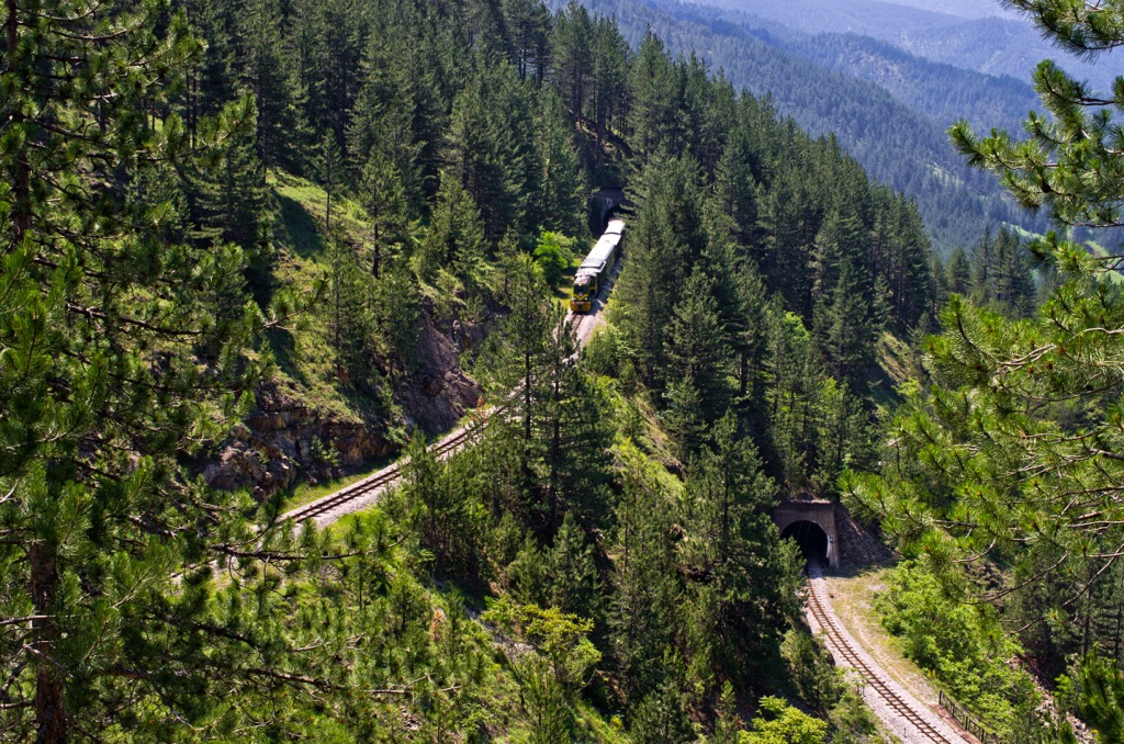
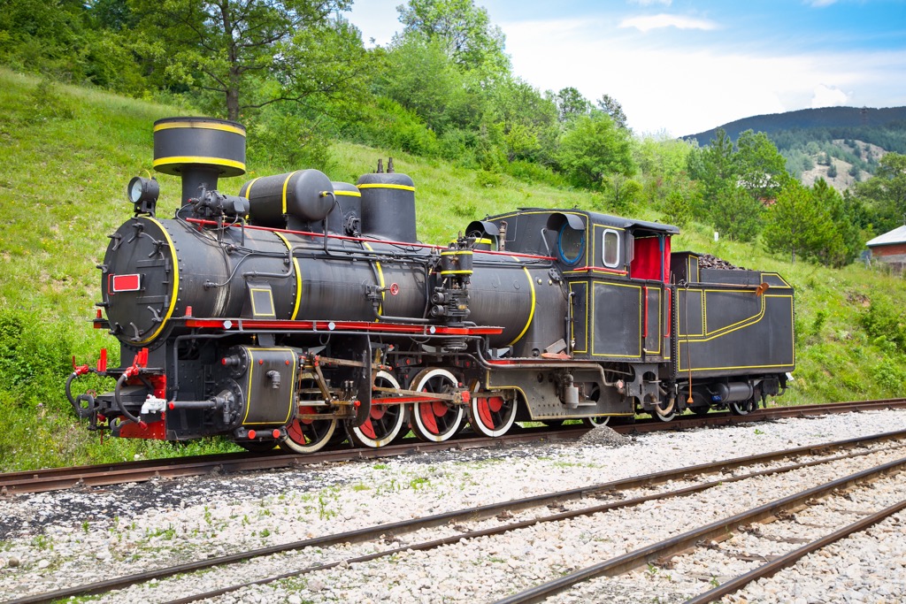
The main tourist attraction, the narrow-gauge "Šargan Eight" railway, quickly conquers a significant elevation difference. The railway passes through tunnels and bridges and covers a 15 km distance from Mokra Gora to Šargan Vitasi. It features old trains and locomotives along the route, creating a unique open-air museum. Kremna, known for the Tarabić family and their prophecies, is also part of Mokra Gora.
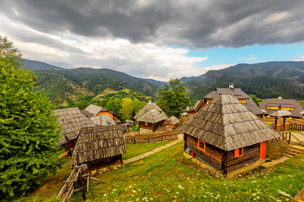
Filmmaker Emir Kusturica established the ethno-village "Drvengrad" on Mećavnik Hill. Drvengrad showcases folk architecture, highlighting the skill of woodworking with stone tools. The village also hosts the Kustendorf Film and Music Festival.
Formerly part of Tara National Park, the Mokra Gora and Šargan area gained recognition as an area of outstanding national importance in 2005.
The trail begins at the Bela Voda picnic area in Mokra Gora and follows the Kamešina River. One can see the beautiful church of St. John the Baptist with a stone bridge. There is also a spring of medicinal water believed to benefit the eyes. After passing the Jatarice site, the trail ascends to the next stage of the journey, following the railway and passing through two tunnels of the "Šargan Eight" (consider the train schedule; it might be best to go when it's not operational).
Subsequently, the trail continues along the Kamešina, leading to the Skakavac waterfall, a 15 m (49 ft) high natural beauty. One can go towards Okruglica (1,033m / 3,389 ft), where the path becomes challenging. Beyond Okruglica, the trail becomes grassy and gentle, leading over Veliki Vis (1,182m) and gradually descending to the village of Šljivovica.
Jovin Grob is the starting point for a circular tour exploring the six waterfalls of the Drugančica River, which originates beneath Veliki Viogor and flows 7 km (4.3 mi) until it joins the Beli Rzav River.
From Jovin Grob, a firm forest path descends northwest to Krsmanski Potok, following it downstream to the first houses. At the intersection, turn right onto a wider gravel road, which leads directly to the center of Mokra Gora.
Embark on a journey from the heart of Mokra Gora to the summit of the nature park's highest peak. With nearly 1,000 m (3,281 ft) of elevation gain, this 20 km (12.4 mi) hike begins with the ascent to Zborište from the main road, turning towards Drvengrad.
The trail follows forest and gravel paths through the Timotijevići hamlet, reaching a junction leading to the Visitor Center and hotel. From the intersection, continue through a forest path to the ski slope's summit, Iver, and then ascend to the peak of Zborište (1,546 m / 5,072 ft). The return journey mostly follows asphalt roads back to the starting point.
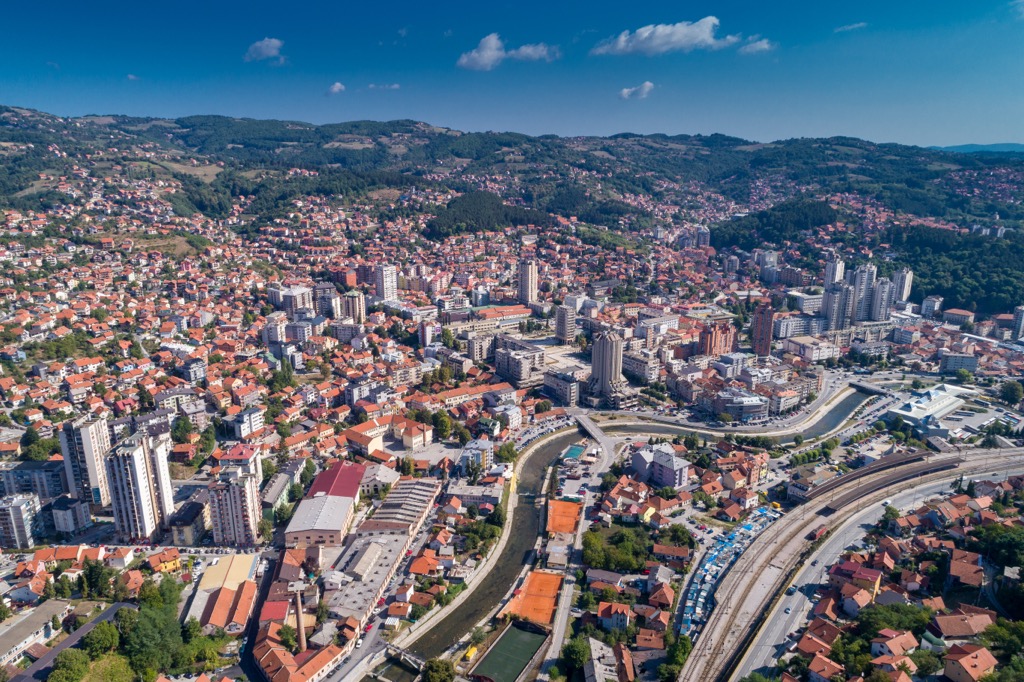
Čačak is a vibrant city located in central Serbia. With a population of around 70,000, it is a significant cultural and economic hub. In addition to the nearby mountainous regions, including Mokra Gora, the Morava River flows through the city and provides recreational value.
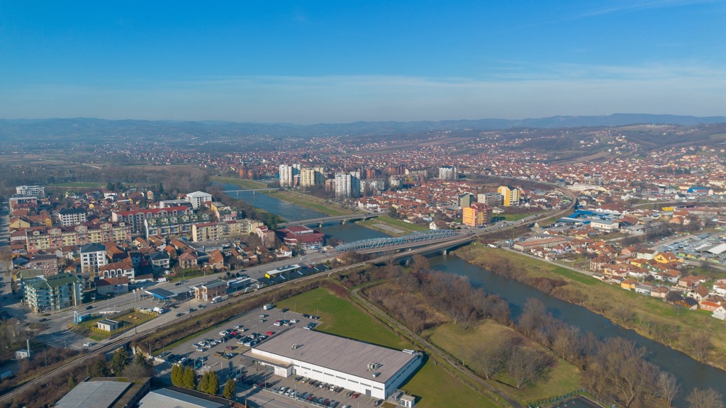
Užice, situated in western Serbia, is a charming city known for its historical significance. With a population of around 50,000, it is surrounded by picturesque mountains and the Đetinja River. Užice is an industrial hub as well as a gateway to the scenic Zlatibor mountain region.
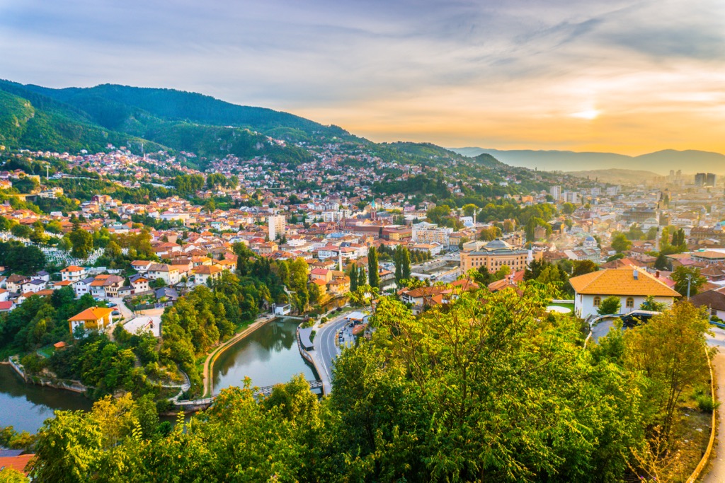
Sarajevo, the capital of Bosnia and Herzegovina, is a unique blend of Eastern and Western influences. Home to around 400,000 people, it is known for hosting the 1984 Winter Olympics and enduring the Bosnian War from 1992 to 1995.


