Scan the QR code and open PeakVisor on your phone
Kopački Rit Nature Park sits on the border between Croatia and Serbia, where the Drava River meets the Danube. The park protects a critical wetland area with lakes, bogs, swamps, and thick Panonian forests.
Kopački Rit is located in northeastern Croatia. The park is one of Europe's most pristine floodplain areas and is cherished for its exceptional natural beauty and biological diversity. Covering a total area of 231 sq. km (89.1 sq. mi), the park also hosts a Special Zoological Reserve spanning 71 sq. km (27 sq. mi).
Kopački Rit represents a valuable natural heritage that has been under protection since 1967 and has gained international recognition. It's a flat area within the region known as Baranja, part of Osijek-Baranja County. The park is situated in the municipalities of Bilje and Kneževi Vinogradi. Kopački Rit is easily accessible thanks to its proximity to Osijek.
The park extends northward from the Drava's confluence with the Danube River and stretches along the Danube's left and right banks up to the former Kazuk port. The national border with Serbia defines the eastern boundary of the nature park.
The park's unspoiled natural beauty, abundant waterways, flora, and fauna attract tourists and researchers alike. Angling and hunting are permitted in specific areas of Kopački Rit with fewer restrictions. Kopački Rit is part of the international bike routes, "Pannonian Peace Route" and "Danube Route," making it Croatia's primary hub for cycling enthusiasts.
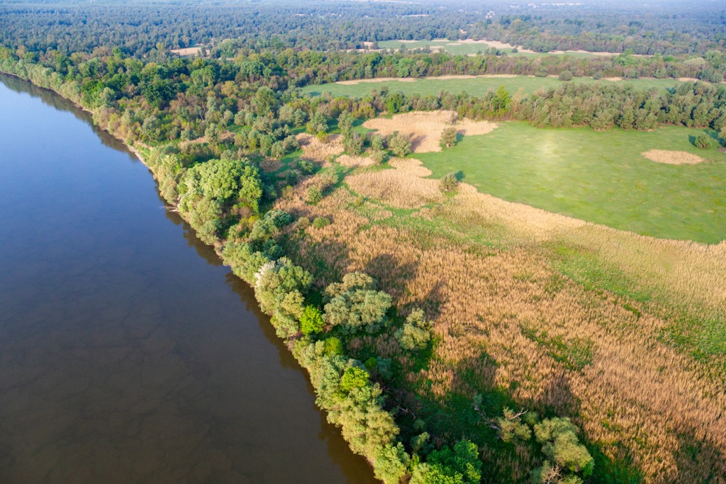
Kopački Rit, formed by the combined influence of the Danube and Drava Rivers, is a floodplain region. In the park's northern, southern, and western surroundings, floodplains extend to Batina in the north, Bijelo Brdo in the south, and Donji Miholjac in the west. The park is one of the largest fluvial lowlands in Europe.
The area undergoes significant transformations throughout the year, primarily in response to the varying flood levels from the Danube and, to a lesser extent, from the Drava. The entire Baranja region doesn't reach elevations exceeding 250 m (820 ft) above sea level, and the Nature Park is situated in its lowest section, with terrain elevations ranging from 78 m (256 ft) (at the base of Kopačko Lake) to 86 m (282 ft).
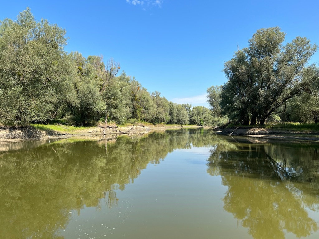
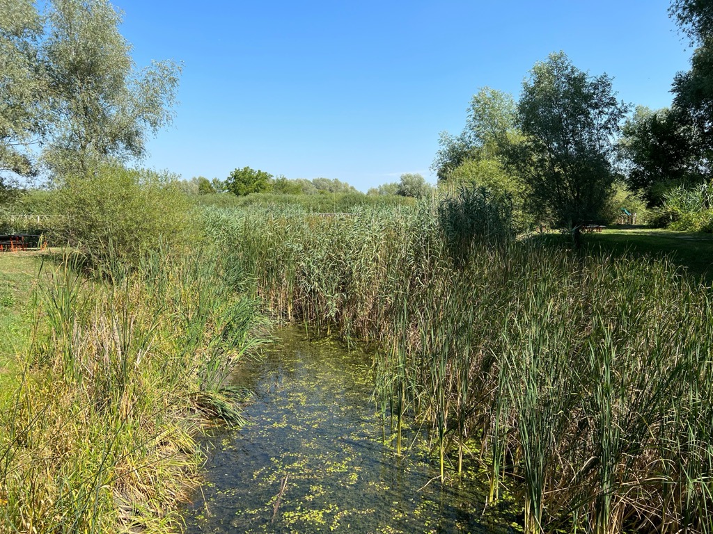
The Kopački Rit landscape encompasses lakes, marshes, wet grasslands, reed beds, riverine forests, channels, oxbow lakes, and fishponds. Seasonal flooding leads to dynamic ecosystems that support a diverse range of plant and animal species.
The rivers carve out sandbars, islands, and distributaries known locally as 'dunavac' or 'Stara Drava.' Conversely, floodwaters deposit sediments in one area while deepening the terrain in another, giving the landscape a distinctive undulating appearance. This process creates parallel depressions (pools) and elevated areas (ridges). The elevation difference between pools and ridges is typically at most 8 m (26 ft).
At their ends, the pools connect through a natural channel called 'foka,' which leads to the Danavac or Danube. Fokovi (pl.) serve the purpose of filling and draining pools and have often been artificially deepened. Additionally, manufactured canals have taken on the role of fokovi.
Kopački Rit is a vital habitat for various wildlife. Its southern part has been designated a Special Zoological Reserve with an impressive array of life: over 522 vascular plants, 300 bird species, 55 mammals, 53 fish species, 12 amphibians, and 12 reptile species.
Moreover, the importance of Kopački Rit as a home for birds led to its inclusion in the List of Important Bird Areas in Europe (IBA) in 1986. In 1993, it was added to the List of Wetlands of International Importance under the Ramsar Convention. Kopački Rit is central to the protected areas network along the Danube, known as DANUBEPARKS, established in 2007. The area plays a crucial role in the Mura-Drava-Danube Biosphere Reserve, declared by UNESCO in 2012.
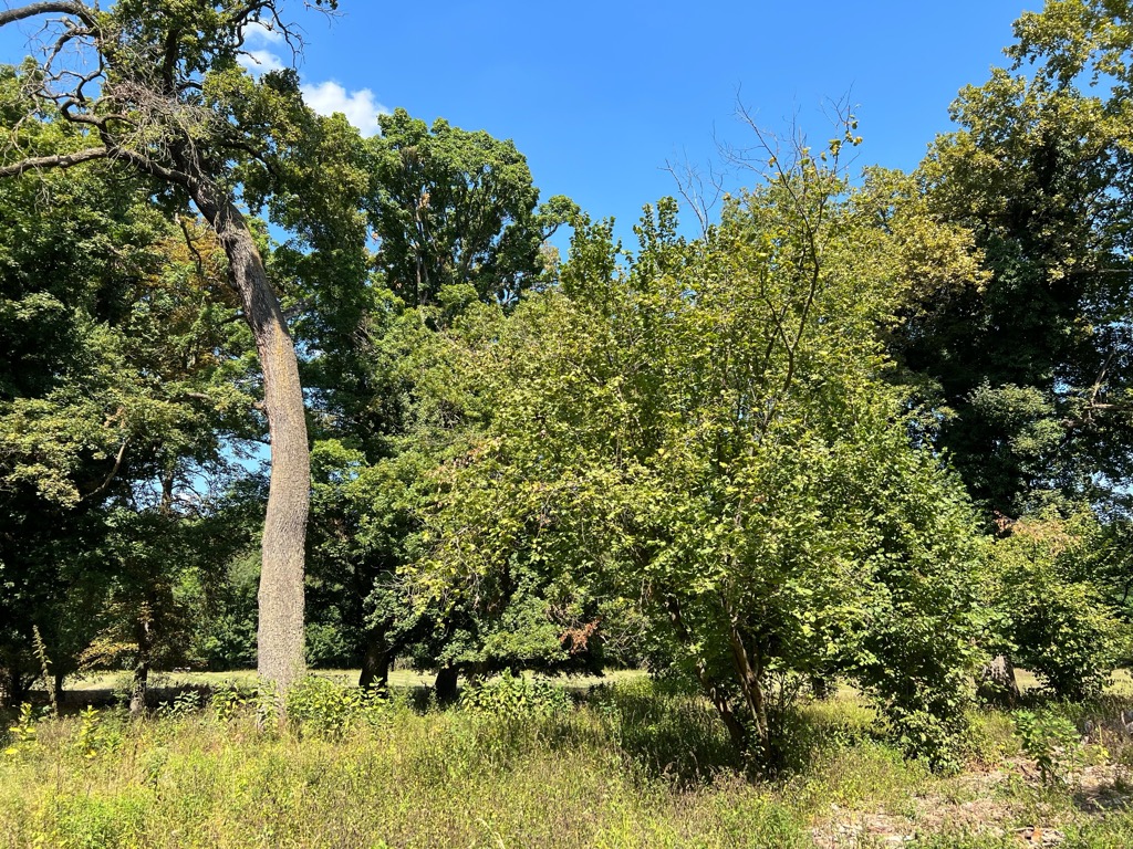
The gently undulating microrelief in Kopački Rit results in a diverse habitat mosaic. The plant communities vary depending on floodwater depth and duration. White willow forests cover most of the floodplain, while slightly higher ground features a mix of white willow and black poplar forests. In the park’s most elevated terrain, you'll find oak forests.
Water surfaces are home to communities of aquatic plants such as water lilies, water chestnuts, and pondweeds. Reed beds and tall sedge communities dominate periodically flooded areas, creating a classic wetland ambiance.
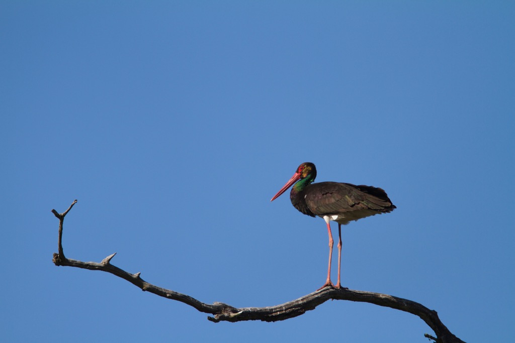
Vast reed beds, wet meadows, and floodplain forests offer optimal living conditions for mammals like red deer, roe deer, wild boar, wildcat, otter, beaver, and badger. Kopački Rit hosts 300 bird species, representing 80% of the bird species recorded in Croatia. More than 140 of these are regular or occasional nesting birds.
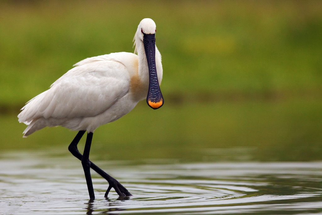
Particularly intriguing are the species that nest in large colonies, such as the grey heron, great egret, cormorant, and river gull. During spring and autumn migrations, Kopački Rit is a crucial resting place for numerous wetland birds. The area also boasts the largest population of the Eurasian spoonbill in the entire Danube basin and is considered a symbol of the Nature Park. The great cormorant is another colonial nesting bird in the area and a devoted fish enthusiast.
Kopački Rit is the most significant spawning ground for fish in this part of the Danube basin. The fish fauna of Kopački Rit comprises more than 50 freshwater species, with the most common including common carp, pike, catfish, and perch.
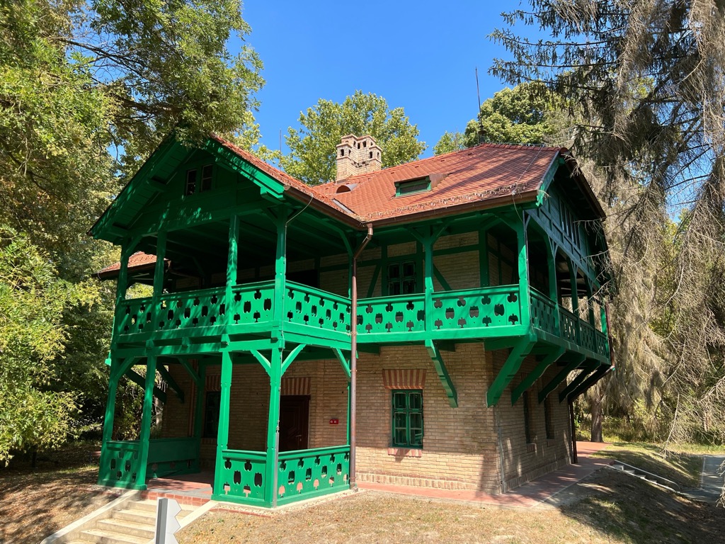
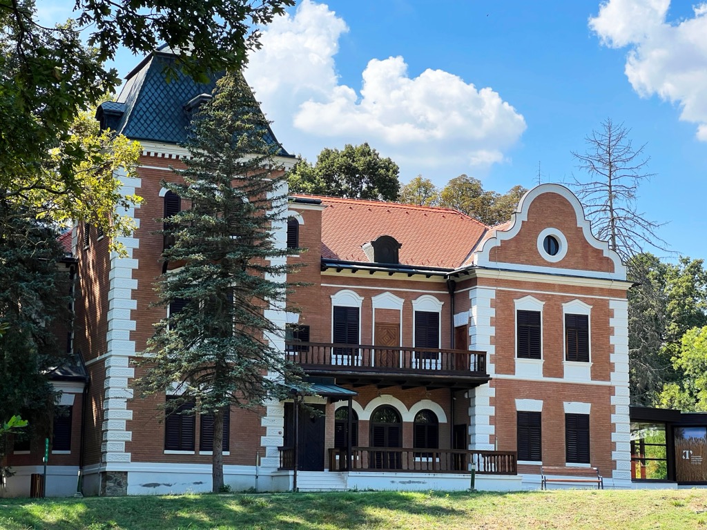
In 1699, King Leopold I of Croatia and Hungary bestowed the Belje estate, which included Kopački Rit, upon Prince and military leader Eugene of Savoy. He constructed a hunting lodge in Bilje.
The Tikveš Castle complex comprises a nineteenth-century residential building amid Baranja's woods, built by members of the Habsburg family's Teschen branch. Throughout history, it served as an exclusive hunting center known throughout Europe and the world, but it was restricted to rulers and the Court's guests.
During the former Yugoslavia, Kopački Rit was managed by Belgrade's "Jelen" hunting and forestry company. Thanks to the efforts of Drago Getz and several eminent naturalists, Kopački Rit became a "Managed Nature Reserve" in 1967 due to its preservation, significant biodiversity, and ecological value. In 1976, the park's core area was declared a Special Zoological Reserve, and the broader region became the "Kopački Rit Nature Park.”
In 1993, Kopački Rit was designated an internationally significant wetland under the Ramsar Convention. Since 1997, the "Kopački Rit Nature Park" has been managed by the Public Institution "Kopački Rit Nature Park." The Croatian Parliament expanded the Nature Park in 1999 to its current size.
The best hikes in Kopački Rit Nature Park include:
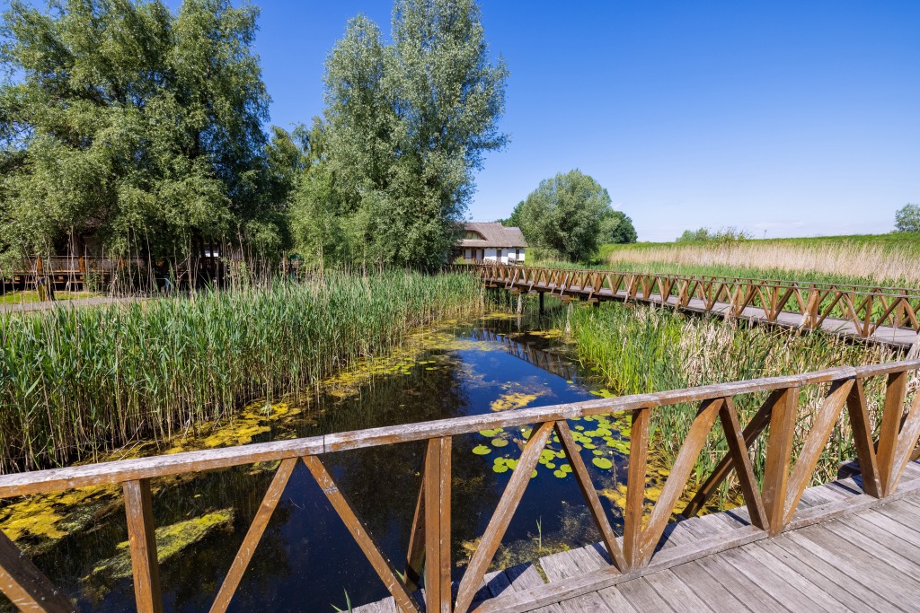
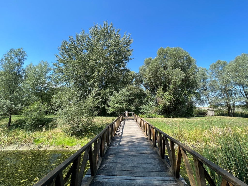
The White Water Lily boardwalk is an excellent starting point for exploring the park. This raised pathway guides you from the Visitors Centre to the shores of Sakadaš Lake. The boardwalk features informative displays on the local flora, fauna, and the various facets of this ecosystem.
Widely recognized as a favorite among birdwatchers, mountain bikers, and cycling enthusiasts, this route also provides tranquil moments during off-peak hours.
The cycling path commences in Bilje and extends towards Kozjak, traversing open fields and cultivated plains. Beyond Kozjak, the trail proceeds through the Fajzaš hunting area, ultimately crossing the Danube River to reach the picturesque village of Kopačevo.
As a segment of an international cycling network, this pathway remains accessible throughout the year. It offers paved terrain, is well-signposted, and passes top-notch lodging dining venues and natural and cultural points of interest.
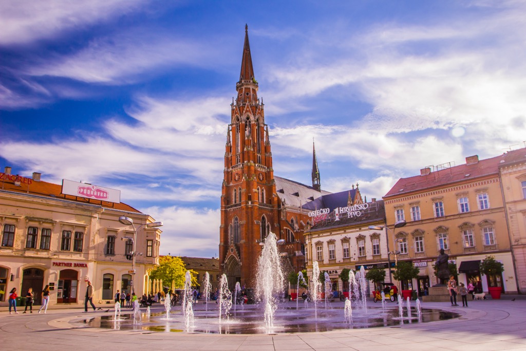
Osijek is a thriving urban center located in the northeastern part of Croatia. As the country’s fourth-largest city, it boasts a population of approximately 100,000. Osijek is a vital hub for various industries, including commerce, manufacturing, transportation, and tourism.
Osijek's architecture displays a fascinating blend of styles, offering a vibrant and distinct visual experience that sets it apart from other metropolitan areas.
It is Croatia's capital and largest city and is a bustling metropolis home to around 800,000 inhabitants. It’s the nation's primary economic, cultural, and political hub.
Zagreb's allure lies in its dynamic and multifaceted character. The city's history reflects various epochs, including the Austro-Hungarian period. The architecture is a fusion of styles, creating a visual landscape that distinguishes Zagreb from other urban centers.

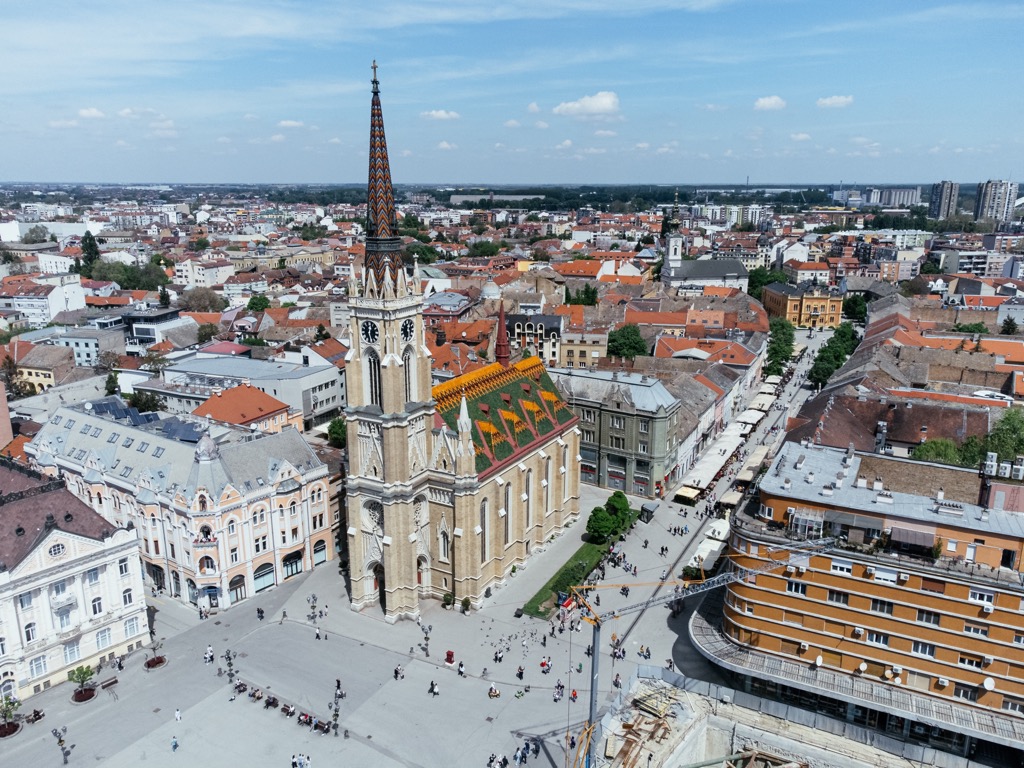
Novi Sad is in northern Serbia and is the country's second-largest city, with a population of roughly 290,000. It plays a pivotal role in Serbia's economy, strongly emphasizing commerce, industry, agriculture, and culture.
Novi Sad boasts a vibrant atmosphere with a blend of cultures and influences from its past. The city's history is intertwined with various rulers and empires.