Scan the QR code and open PeakVisor on your phone
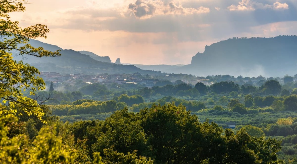
Stroll through sweeping river valleys and climb some of the highest mountains in the Lucanian Apennines when you visit southern Italy’s Appennino Lucano–Val d'Agri–Lagonegrese National Park. There are 195 named mountains in the national park, the highest and most prominent of which is Monte del Papa (2,005 m/6,578 ft).
Appennino Lucano–Val d'Agri–Lagonegrese National Park (Parco Nazionale dell'Appennino Lucano–Val d'Agri–Lagonegrese) is located in the southern Italian province of Potenza in the region of Basilicata. It covers an area of approximately 690 sq. km (266.5 sq. mi) and is one of Italy’s newest national parks, having been established in 2007.
Appennino Lucano–Val d'Agri–Lagonegrese National Park centers around some of the highest summits in the Lucanian Apennines. The Lucanian Apennines are part of the 1,200 km (745 mi) long Apennines range that runs down the spine of the Italian Peninsula.
The park extends from the Monte Volturino (1,835 m/6,020 ft) and Monte Pierfaone (1,735 m/5,692 ft) massifs in the north to the Sirino Massif (Massiccio del Sirino) in the south. Between these two rugged ranges is the gentler, fan-shaped Maddalena Mountains (Monti della Maddalena).
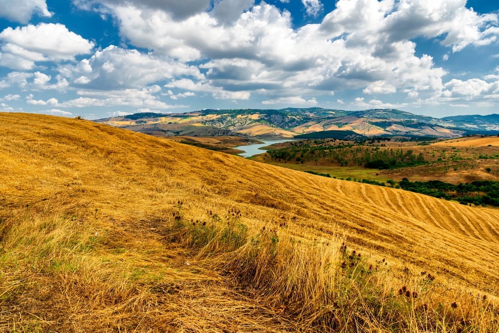
Another key feature of Appennino Lucano–Val d'Agri–Lagonegrese National Park is the Agri Valley (Val d'Agri), the largest intermontane basin in the southern Apennines. The Maddalena Mountains and Viggiano Mountains (Montagna di Viggiano) encircle Val d’Agri.
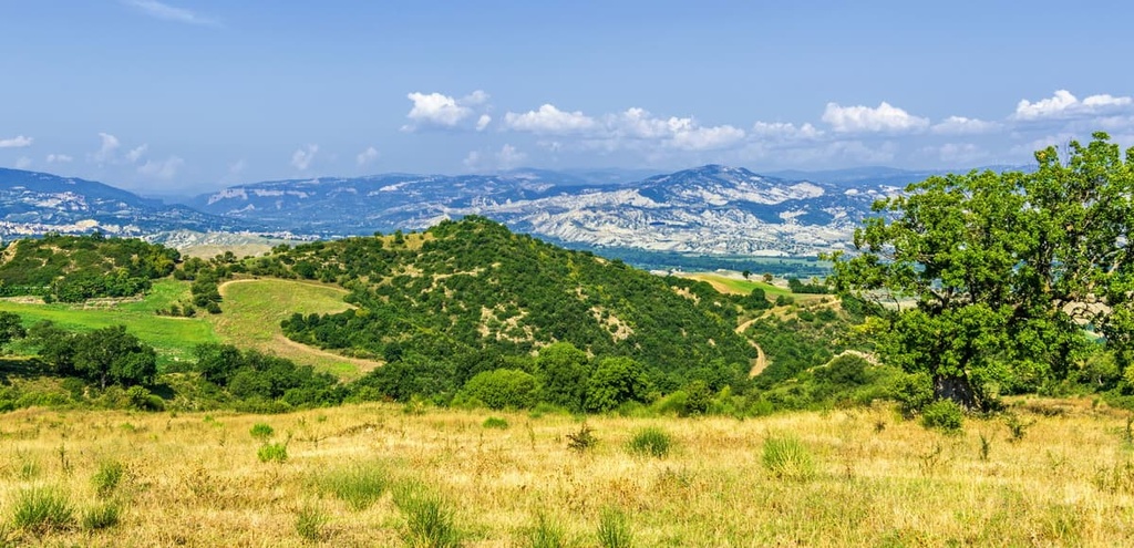
The landscape of Appennino Lucano–Val d'Agri–Lagonegrese National Park is verdant, and it consists primarily of thick oak or beech forests interspersed with meadows and pastures.
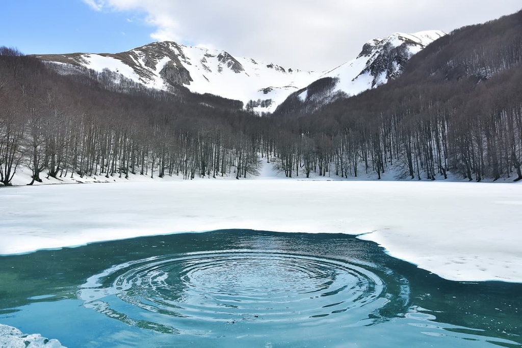
Several significant rivers and lakes flow through Appennino Lucano–Val d'Agri–Lagonegrese National Park. The Bianco River (Fiume Bianco) stretches along the park's northern boundary before joining the 92 km (57 mi) long River Tanagro (Fiume Tanagro). The Torrente Nocito, which runs along the park's southern edge, is a tributary of the Agri River (Fiume Agri).
The park's largest body of water is Pietra del Pertusillo Lake (Lago del Pertusillo), a 7.5 sq km (2.9 sq mi) artificial lake created by the Diga del Pertusillo, a dam that was built across the Agri River.
Appennino Lucano–Val d'Agri–Lagonegrese National Park borders two other national parks: Cilento and Vallo di Diano National Park (Parco Nazionale Cilento, Vallo di Diano e Alburni) to the west and Pollino National Park (Parco Nazionale del Pollino) to the south.
Gallipoli Cognato Small Lucanian Dolomites Regional Park (Parco Regionale di Gallipoli Cognato Piccole Dolomiti Lucane) borders Appennino Lucano–Val d'Agri–Lagonegrese National Park to the east.
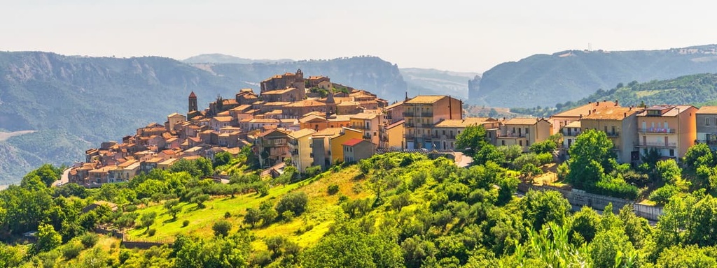
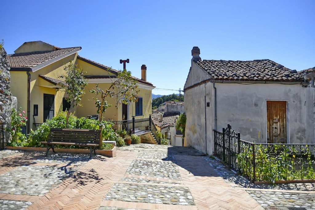
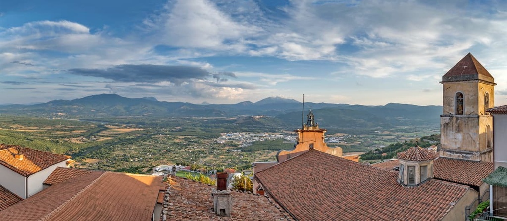
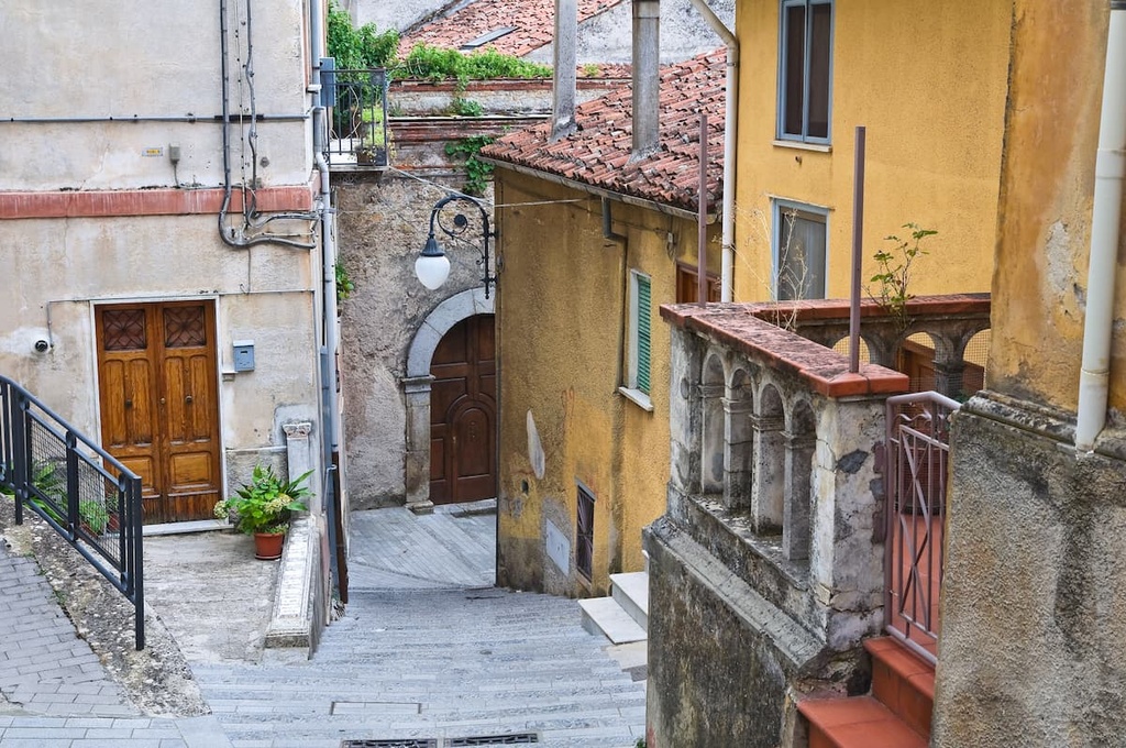
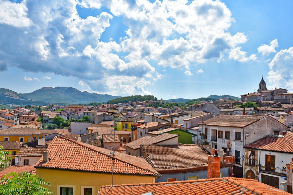
There's more human activity in Appennino Lucano–Val d'Agri–Lagonegrese National Park than most other national parks in Italy, meaning there are a few relatively sizable towns and villages within the protected area. Notable settlements include Viggiano, Moliterno, Marsicovetere, and Grumento Nova.
Potenza, the regional capital of Basilicata, is located approximately 10 km (6 mi) to the north of the park's boundary.
The southern Apennines, especially the Lucanian Apennines, are one of the most geologically interesting and complex regions of southern Italy. The Lucanian Apennines are composed of sedimentary rocks, mainly limestone, but various mountain groups in the range have slightly different geological formations.
The western section of the Upper Val d’Agri consists of carbonate massifs, while to the east in the Lagonegrese region, calcareous and siliceous deep-sea soils are prominent. Clays, sands, and flysch deposits are common further to the east.
The Lucanian Apennines formed during the Apennine orogeny, a mountain-building event that began in the Cenozoic Era around 65 million years ago. The orogeny reached its peak activity between the Miocene and Pliocene epochs, about 20 million to 2.6 million years ago.
The sedimentary rocks of the Apennines were created by sediment from dead sea creatures deposited on the seafloor of the now-closed ancient Tethys Sea.
The Tethys Sea separated the African and European tectonic plates. The collision of the African and European plates and the closure of the Tethys Sea were two of the many events that were responsible for the start of the Apennine orogeny.
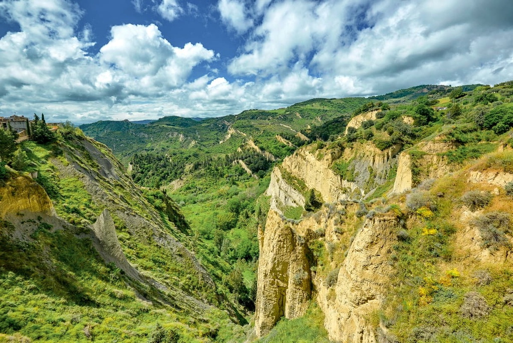
The limestone bedrock of Appennino Lucano–Val d'Agri–Lagonegrese National Park has allowed for a number of karst features to form in the region. In particular, there are numerous extensive cave systems that run under the park.
One such cave, the Grotta di Castel di Lepre in Marsico Nuovo, stretches for 2 km (1.2 mi) and has a 15 m (49 ft) drop at the entrance. Other notable caves include Grotta della Transhumanza and Grotta di Sant'Angelo al Monte Raparo.
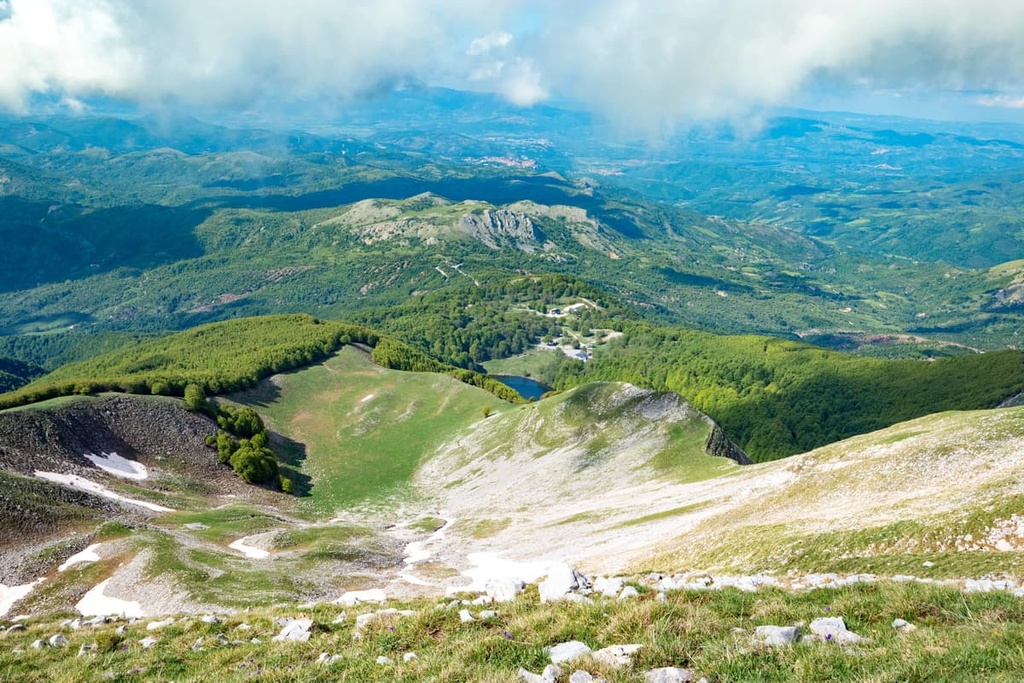
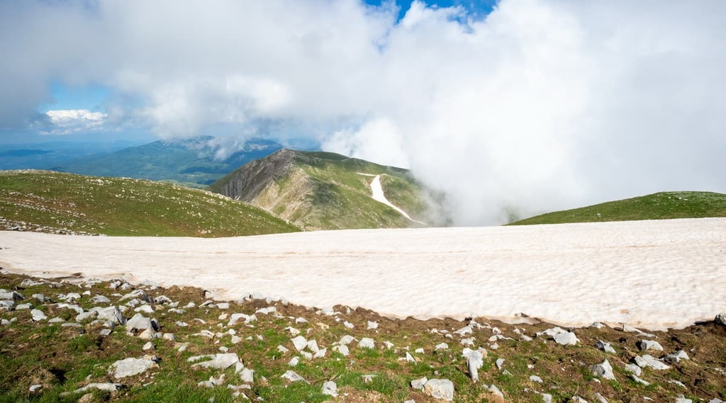
The modern-day Appennino Lucano–Val d'Agri–Lagonegrese National Park contains a mixture of jagged mountains and rolling hills as well as over 25 summits that exceed 1,500 m (4,921 ft) in elevation.
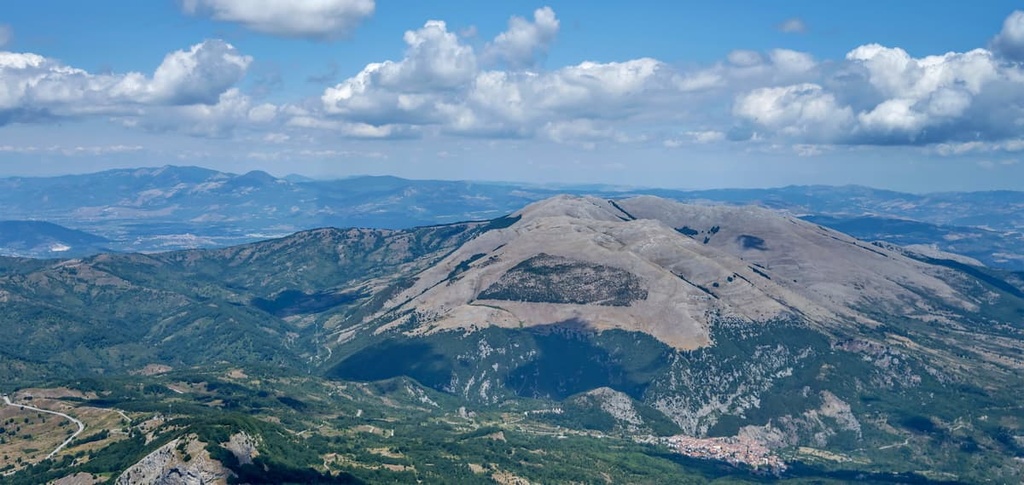
In the northern and eastern parts of the park, notable peaks include Monte Volturino (1,835 m/6,020 ft), Monte Arioso (1,709 m/5,607 ft), and Monte Calvelluzzo (1,699 m/5,574 ft). To the south and west, notable peaks include the park's highest mountain, Monte del Papa (2,005 m/6,578 ft), as well as Monte Sirino (1,909 m/6,263 ft) and Monte Raparo (1,764 m/5,787 ft).
The ecologically rich basin of the River Agri, which features dense forests and verdant meadows, makes Appennino Lucano–Val d'Agri–Lagonegrese National Park an excellent place to observe some of the southern Apennines' fascinating wildlife.
Appennino Lucano–Val d'Agri–Lagonegrese National Park is home to several elusive predatory mammals, chiefly polecats, European wildcats, and wolves. Wolves sit atop the food chain in the region, and their favorite prey is wild boar. Other common mammals include foxes, beech martens, and European hares.
The lakes and rivers of Appennino Lucano–Val d'Agri–Lagonegrese National Park are the park's lifeblood and are inhabited by various animals.

Otters are a particularly common sight at the park’s Pietra del Pertusillo Lake. Shrimps, crabs, chubs, and roaches are just a few of the other aquatic creatures found in the park's waters.
Amphibians and reptiles commonly spotted in the park include yellow-bellied toads, Italian newts, and spectacled salamanders. Several snake species are also present in the region, such as four-lined snakes, Italian Aesculapian snakes, and vipers.
A wide variety of both resident and migratory bird species can be found in Appennino Lucano–Val d'Agri–Lagonegrese National Park. Many of these species, like white storks, black storks, and great white herons, come to the park to visit its waterways.
High up in the mountains of the park, visitors might be lucky enough to spot golden eagles, red kites, and imperial ravens.
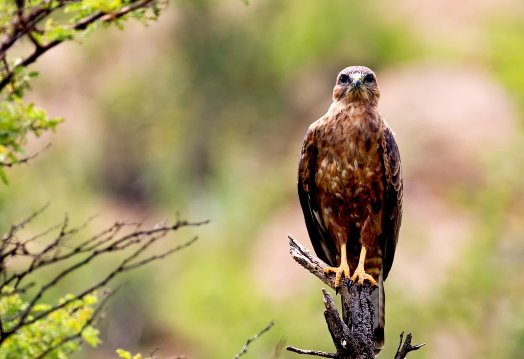
A famous avian resident of the park is the Egyptian vulture, which is one of the only bird species that uses tools to build its nests. The middle spotted woodpecker, which is extremely rare in Italy, is widespread across Basilicata thanks to the region’s well-preserved woodlands.
Noteworthy insects that inhabit Appennino Lucano–Val d'Agri–Lagonegrese National Park include rosalia longicorns, stag beetles, and great capricorn beetles.
Thanks to its elevation range of over 1,700 m (5,577 ft), Appennino Lucano–Val d'Agri–Lagonegrese National Park's flora is extremely diverse. Many of the park's most interesting plants are located in areas above 1,000 m (3,280 ft) in elevation.
At this elevation, beech forests dominate the landscape, along with more unusual tree specimens, such as Lobel's maples, oriental hornbeams, and field maples. Turkey oaks, hazels, and black hornbeams may also be present in the northern parts of the park.
The park's Abetina di Laurenzana Regional Nature Reserve (Riserva Regionale Abetina di Laurenzana) is ecologically notable as it protects the largest silver fir forest in the southern Apennines.
Herbaceous plants are common across Appennino Lucano–Val d'Agri–Lagonegrese National Park, including heath speedwell, deadly nightshade, and Lucanian yarrow. The latter of these plants is endemic to the Calabrian-Lucanian Apennines.
Botanists have discovered several endemic species within Appennino Lucano–Val d'Agri–Lagonegrese National Park. One example is Hippocrepis glauca, which can only be found around the Volturino massif. Other plants that live in the region but are rarely found anywhere else in Italy include ashy cranesbill, perennial knawel, and broadleaf speedwell.
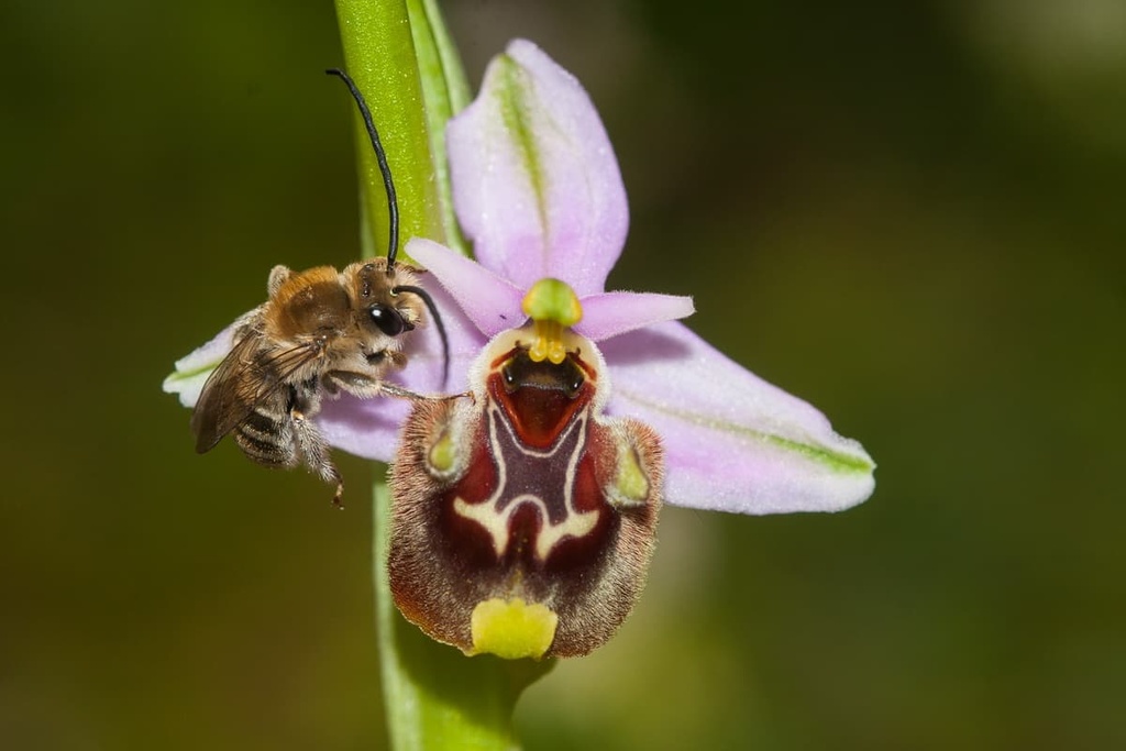
Italy is home to over 100 orchid species, and many fascinating specimens grow within Appennino Lucano–Val d'Agri–Lagonegrese National Park. Examples include bee orchids, monkey orchids, and early spider orchids.
Humans have been inhabiting the region of Basilicata since the Paleolithic age, as is evidenced by the discovery of Homo erectus remains in the region.
One of the first civilizations to inhabit the area was the Lucanians, an Oscan-speaking Italic tribe that dates back to around the sixth century BCE.
During the third century BCE, Romans conquered Basilicata and named it Lucania. During this time, the Romans founded Grumentum, an ancient city that was built near modern-day Grumento Nova during the Samnite Wars.
Val d’Agri and Grumentum were the sites of important battles during the Second Punic War in the third century BCE. These skirmishes are well-known to this day as they brought the famed Carthaginian general Hannibal within touching distance of Grumentum.
Today, Grumentum is considered one of the finest Roman archeological sites in Italy, along with Pompeii, Herculaneum, and Ostia.
Grumentum contains the ruins of an amphitheater, the only one of its type of Basilicata. Other features of Grumentum include Roman baths, temples, and an aqueduct. The Romans abandoned Grumentum by the fifth century CE. It's now one of the park's most popular attractions.
From the eleventh century, the Province of Potenza was part of the Duchy of Apulia, which was under Norman rule. Then, from the thirteenth century, Potenza became part of the Kingdom of Naples. In 1861, Potenza was unified with the rest of Italy.
The Appennino Lucano–Val d'Agri–Lagonegrese National Park was established in 2007 to protect the area's biodiversity, rich culture, and archeological history.
Appennino Lucano - Val d'Agri - Lagonegrese National Park has an extensive trail system that snakes its way across the entirety of the park.
The park's mountain passes can be dangerous, so hikers should come well-prepared with topographic maps, GPS tracking units, appropriate clothing, and plenty of food and water. The park's trail system follows the CAI (Italian Alpine Club) Hiking Difficulty Scale.
Trails in the park are subject to closure due to landslides and poor weather. Before setting off, the park authority recommends contacting the visitor center in Montemurro.
You can also download a brochure on the park's trails from the official website. Consider hiring an official guide if you are unfamiliar with Appennino Lucano–Val d'Agri–Lagonegrese National Park. The contact details for official guides in the region are located on the park's website.
Read on to find out more about some of the best mountain hikes in Appennino Lucano–Val d'Agri–Lagonegrese National Park.
Located on the southern boundary of Appennino Lucano–Val d'Agri–Lagonegrese National Park is the Sirino Massif (Massiccio del Sirino).
As the park's highest and most rugged area, the Sirino Massif contains several of the park's tallest mountains, including Monte del Papa (2,005 m/6,578 ft) and its neighbor, Monte Sirino (1,909 m/6,263 ft).
It's possible to scale both mountains on the S12 trail starting from the Church of the Madonna del Brusco (Chiesa della Madonna del Brusco), which is located to the west of the massif. The path is also used by pilgrims who carry a statue of the Madonna della Neve twice a year to the summit of Monte Sirino.
This walk is 7.2 km (4.5 mi) in length and takes approximately 4 hours to complete. The S12 trail is rated E and is considered intermediate in difficulty.
Near the chapel, there's a place where you can fill up water bottles. The trail leads steadily uphill through woodlands before offering a panorama of the town of Lagonegro. You'll first reach the summit of Monte Sirino, where you can see many of the park's highest summits and the Tyrrhenian Sea.
The path then continues along an exposed panoramic ridge to the summit of Monte del Papa. Hikers who want to avoid the ridge can take a detour along a dirt road through woodlands that runs almost parallel to the main path.
Providing hikers with a rewarding climb and stunning views of the Val d’Agri, Monte Volturino (1,835 m/6,020 ft) is one of the park's most popular summits.
One of the best ways to scale Monte Volturino is via the N8 trail from the Sorgente del Copone spring, which is located just outside Marsicovetere. The N8 trail is 11.5 km (7.1 mi) in length and it takes approximately 6 hours to complete. It's rated E and is considered intermediate in difficulty.
The first 3 km (1.8 mi) of this walk are perfect for birdwatchers, as they cross fields where kestrels, red kites, and buzzards are often spotted.
At around 6.5 km (4 mi), after passing through a beech forest, you'll find the Romanelli spring (Sorgente Romanelli), where you can refill water bottles. The spring is located just a few hundred meters away from the rifugio Romanelli (1,246 m/4,088 ft).
The final leg of the N8 trail leads through forests to the summit of Monte Volturino. The views from the summit are incredible as they feature everything from the Viggiano Mountains and Sirino Massif to the Pollino Massif (Massiccio del Pollino) and Val d’Agri.
This short yet pleasurable stroll up Monte Pierfaone (1,735 m/5,692 ft) is ideal for hikers not looking to exert themselves on one of the park's harder peaks. Monte Pierfaone is also very popular with tourists thanks to its namesake ski resort.
The best way to scale Monte Pierfaone is on the N4 trail starting from the parking area outside the old Hotel La Maddalena, which is located on the Contrada Pierfaone to the south of the mountain. The N4 trail is 4.7 km (3 mi) in length and takes approximately 2 hours to complete. It's rated E and is considered easy in difficulty.
On this trail, you’ll start by following the dirt path through woodlands and along a stream. Further down the track, there's a place where you can fill up water bottles. Around 3 km (1.8 mi) from the start of the trail, you'll reach a clearing where your first stop, Monte Arioso (1,709 m/5,607 ft), is visible in the distance.
The summit of Monte Arioso offers excellent views of Pollino National Park (Parco Nazionale del Pollino) and Cilento, Vallo di Diano and Alburni National Park (Parco Nazionale del Cilento, Vallo di Diano e Alburni). Plus, Monte Vulture (1,326 m/4,350 ft) is visible to the north from the top of Monte Arioso.
From the summit of Monte Arioso, you’ll follow the obvious path through beech forests and across ski slopes to the summit of Monte Pierfaone. A large television frequency tower marks the summit.
Situated at the heart of the park, the Raparo Massif (Massiccio del Raparo) boasts several rewarding hiking trails for visitors to enjoy.
While the S4 trail from Sarconi meanders for 15 km (9.3 mi) across beautiful countryside, the S5 trail is one of the Lucanian Apennines' classic itineraries.
Known as the Croce di Raparo, or Raparo Cross, the S5 trail takes hikers from north to south, crossing the best of the massif. The walk is 5.9 km (3.6 mi) in length and takes approximately 3 hours to complete. It's rated E and is considered easy in difficulty.
You can pick up this trail from the Sorgente pisciolo spring, which is located to the north of the Raparo Massif. After filling up your water bottles and admiring the view of the Agri Valley, follow the dirt path to the south through a beech forest.
One of the highlights of the walk is when the beech forest opens up into a vast clearing, where the views of the Sirino Massif and Monte Alpi (1,906 m/6,253 ft) are breathtaking.
The path then zigzags steadily up the mountainside until you reach the summit pastures. From here, it's a short walk to the highest summit in the massif: Monte Raparo (1,764 m/5,787 ft). The views from the summit are extensive and stretch as far as the Tyrrhenian Sea.
However, the walk doesn't stop here as it continues onto one of the massif's secondary peaks, Verro Croce (1,672 m/5,486 ft). The summit marks the end of the trail and affords excellent views of the Racanello Valley (Valle di Racannello) and the ancient town of San Chirico Raparo.
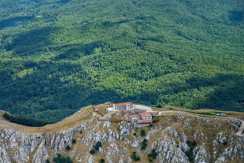
The principal summit of the Viggiano Mountains, the Sacred Mountain of Viggiano (Sacro Monte di Viggiano) is one of Potenza's most culturally significant peaks. Known locally as il Monte, it's the site of a popular ski resort and the destination point for an important religious pilgrimage route.
The Pilgrimage to the Shrine of the Black Madonna involves a procession from Viggiano where pilgrims carry a statue of the Virgin Mary to the Sanctuary of the Madonna of the Sacred Mountain (Santuario Madonna del Sacro Monte) atop il Monte.
The procession takes the statue up to the summit on the first Sunday of May. There’s a second procession that brings the statue back down on the first Sunday of September. Before entering the sanctuary, pilgrims lap the building three times while praying as a sign of respect.
There are several paths up il Monte, but arguably the best route starts from north of the mountain massif. The N10 trail is 7.5 km (4.6 mi) in length and takes around 3 hours to complete. It's rated E and is considered easy in difficulty.
You can pick up the trail from the parking lot outside the Sanctuary of the Madonna del Monte Saraceno of Calvello (Santuario di Maria Santissima del Monte Saraceno) on Monte Saraceno (1,604 m/5,262 ft). This sanctuary is also the site of a similar pilgrimage from Calvello.
The trail starts by leading through dense beech forests before opening out onto a clearing called the Quadrivio di Tuppo delle Seti. Then, as you head for the town of the Viggiano, you’ll carefully follow an ancient sheep track.
Next, you'll reach the La Laura Valley (Valle detta La Laura), which is characterized by sinkholes and depressions that are typical of the region’s karst topography. From here, the path leads onto a ridge, which you follow to the summit of il Monte. The final stop on this walk is the Piana Bonocore.
Whether you're looking to ski, hike, or simply relax in nature and unwind, Appennino Lucano–Val d'Agri–Lagonegrese National Park is an ideal destination for an outdoor getaway. Read on to learn about some of the best towns in Appennino Lucano–Val d'Agri–Lagonegrese National Park.
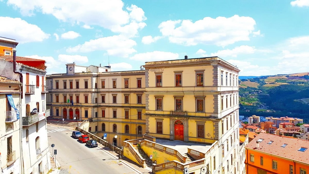
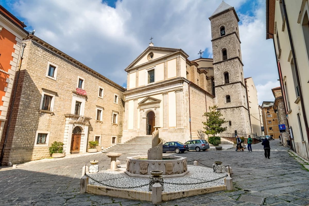
The regional capital of Basilicata, Potenza is the best place to stay if you enjoy the hustle and bustle of big city life. As the highest regional capital in Italy, Potenza sits at an elevation of 819 m (2,687 ft).
Potenza is home to some cultural wonders that are well worth visiting, like the eighteenth-century Potenza Cathedral and the National Archaeological Museum of Basilicata.
Despite Potenza's large size, it’s located within 15 km (9.3 mi) of several remote hiking areas, including Monte Pierfaone (1,735 m/5,692 ft). Popular hotels in Potenza include the Grande Albergo Potenza and Park Hotel Centro Congressi.
Located in the southwestern area of the Upper Val d’Agri is Viggiano. The town is famous for its harp-making industry and for its status as the starting point of the Pilgrimage to the Shrine of the Black Madonna. Located approximately 10 km (6.2 mi) from Viggiano is a popular ski resort called the Montagna Grande di Viggiano.
Viggiano is a vibrant and picturesque town that offers easy access to hiking areas such as the Viggiano Mountains (Montagna Viggiano) and Monte Calvelluzzo (1,699 m/5,574 ft). Popular hotels in Viggiano include Hotel Dell' Arpa and Hotel Theotokos.
Consider staying in Moliterno if you want to uncover the ancient history of Appennino Lucano–Val d'Agri–Lagonegrese National Park. Locals built Moliterno in the ninth century after the Saracens destroyed the Roman city of Grumentum.
Moliterno is situated approximately 10 km (6 mi) from Grumento Nova, which is home to Grumentum's ruins and the National Archaeological Museum of the Alta Val d'Agri. The neighboring town of Sarconi is famous for its Bean Festival, which draws in thousands of tourists every August.
During your stay in Moliterno, don't miss out on visiting the Medieval Castle of Moliterno (Castello Medioevale di Moliterno). Popular accommodation options in Moliterno include B&B Sogni D'Oro and B&B Fronte al Museo.
Located at the heart of Appennino Lucano–Val d'Agri–Lagonegrese National Park in the Val d’Agri is the municipality of Marsicovetere. The municipality includes the communities of Villa d'Agri and Barricelle, both of which are located on the valley floor, as well as a historic town center, which sits on a mountainside at 1,037 m (3,402 ft) in elevation.
During your stay, ensure that you take in the view from Marsicovetere's historic center and explore its winding cobblestone streets. Marsicovetere is located close to several popular mountains, including Monte Volturino (1,734 m/5,689 ft). Popular hotels in Marsicovetere include Hotel Sirio and B&B Addò Mast Giuann.
The vibrant town of Satriano di Lucania is located to the northwest of Appennino Lucano–Val d'Agri–Lagonegrese National Park and is a popular destination for tourists. The Satriano Valley (Valle delle Satriano) is nicknamed the "most painted valley in Italy" due to the over 400 murals that adorn Satriano di Lucania's town center.
Consider visiting Satriano di Lucania in February to catch the town's annual carnival. You'll also want to tour the Satrianum archeological site, which was home to a former Norman stronghold. Popular hotels in Satriano di Lucania include B&B Rifugio della Luna and B&B Villa Rosina.
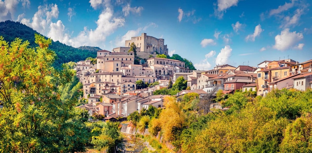
Sat on the northwestern edge of Appennino Lucano–Val d'Agri–Lagonegrese National Park is the town of Brienza. This historic settlement dates back to the seventh century when it was founded by the Lombards.
Brienza is a popular tourist destination partly because it is home to the fifteenth-century Caracciolo Castle (Castello Caracciolo), which sits on a rocky spur overlooking the Pergola River. The town is also famed for its production of Caciocavallo Podolico cheese. Popular hotels in Brienza include Hotel Imperial and B&B La Voce del Fiume.